Photo: Wikipedia
Strategic Assessment of Wilson County
Meaningful friction. Expect exposure to either population pressure, blast zones, or natural disaster risk. Consider buying a retreat property.
What does the Strategic Assessment tell us?
Our Strategic Assessment grades tactical survivability of an area. Major population centers, military targets, fallout zones, natural disasters, and border exposure all drive risk — lower exposure means a more defensible position in a crisis.
This is heavily inspired by Joel Skousen's Strategic Relocation book. Highly recommended you checkout the book ($)What does this tell us?
Our Strategic Assessment grades tactical survivability of an area. Major population centers, military targets, fallout zones, natural disasters, and border exposure all drive risk — lower exposure means a more defensible position in a crisis.
This is heavily inspired by Joel Skousen's Strategic Relocation book. Highly recommended you checkout the book ($)Strategic Pillars

Key Distances
Strategic Assessment Analysis
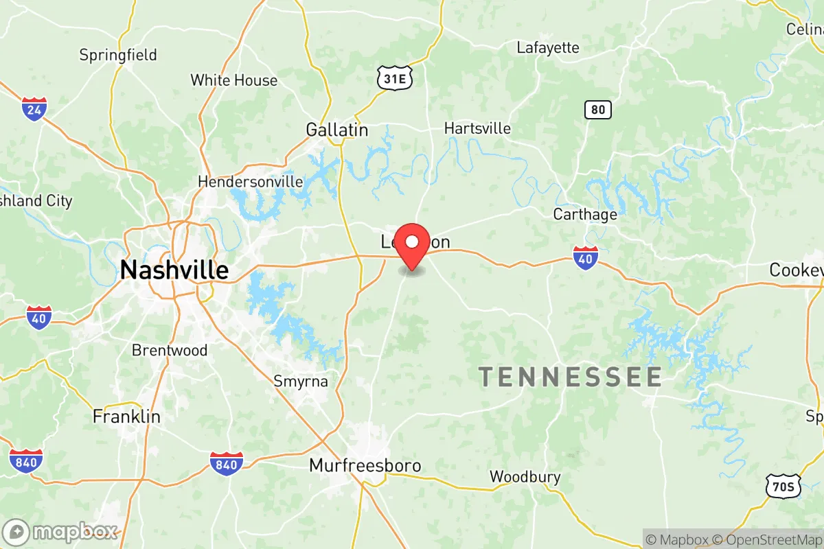
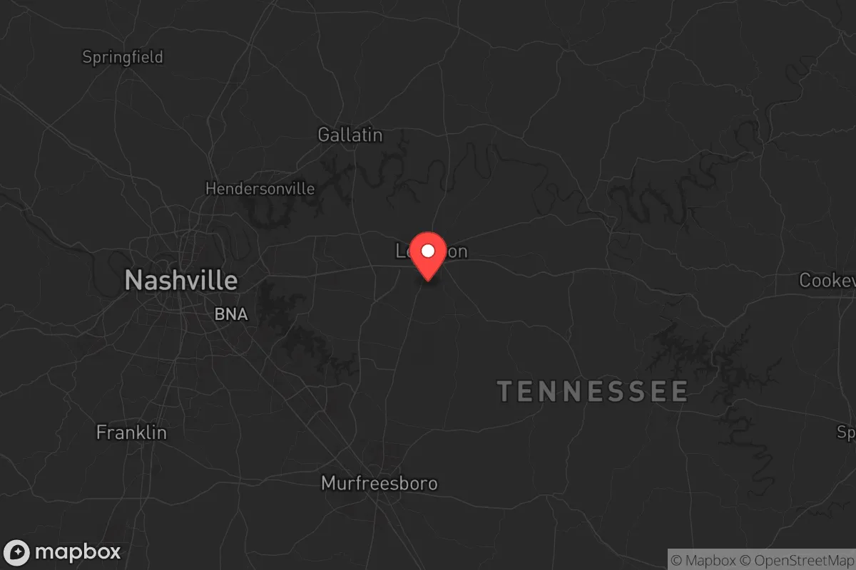
Wilson County, Tennessee, offers a strategic balance of rural resilience and practical access that appeals to those prioritizing self-sufficiency and security in an uncertain national landscape. Located about 30 miles east of Nashville, the county avoids the direct fallout risks of a major metropolitan target while remaining close enough to leverage its infrastructure when needed. The area’s geography—rolling hills, the Cumberland River, and a network of smaller waterways—provides natural defensibility and resource potential that make it a serious contender for relocation-minded individuals and families who value preparedness over proximity to urban chaos.
Geographic position and natural advantages for long-term security
Wilson County sits in a sweet spot of Middle Tennessee, bordered by the Cumberland River to the north and the rolling hills of the Highland Rim to the south. The county seat, Lebanon, is the primary population hub, but smaller communities like Watertown, Mt. Juliet, and the unincorporated areas around Statesville offer lower-density living with better escape routes. The terrain is not mountainous, but the gentle ridges and valleys provide natural cover and line-of-sight advantages for those thinking about defensible property. The Cumberland River, which flows through the northern part of the county near the town of Carthage (just over the line in Smith County), offers a reliable water source for irrigation, livestock, and emergency supply—though it’s not navigable for large vessels, which actually reduces the risk of unwanted river traffic during unrest. The area’s karst topography, with its limestone bedrock and numerous springs, means groundwater is generally accessible for well drilling, a critical factor for off-grid water security. The climate is temperate, with four distinct seasons and no extreme weather patterns like hurricanes or wildfires, though tornadoes are a periodic concern—something to factor into any property’s storm shelter planning.
Risks, exposures, and proximity to fallout-relevant landmarks
The primary risk for Wilson County is its proximity to Nashville, a major metropolitan area that would be a high-priority target in any large-scale conflict or civil unrest scenario. Nashville’s interstates (I-40, I-24, I-65) and its status as a regional transportation hub mean that any disruption there could send waves of refugees or supply chain failures into surrounding counties. The city’s airport, Nashville International (BNA), and its role as a healthcare and logistics center make it a likely target for anything from EMP attacks to conventional strikes. Wilson County is also within 50 miles of the Tennessee Valley Authority’s (TVA) Cumberland Fossil Plant in nearby Stewart County, a major power generation site that could be a secondary target. On the plus side, there are no major military bases, refineries, or nuclear facilities within the county itself—Fort Campbell is about 70 miles northwest, and the Oak Ridge National Laboratory is about 100 miles east, both far enough to avoid direct fallout but close enough to feel secondary effects. The county’s main vulnerability is its reliance on I-40 for east-west travel; a major event on that corridor could choke off supply routes. For those considering relocation, properties on the eastern side of the county, near the Smith County line or along the more rural Highway 70 corridor, offer better buffer from Nashville’s immediate chaos.
Practical resilience for a relocator: food, water, energy, and defensibility
Wilson County’s agricultural base is a strong point for food security. The county has a mix of row crops (corn, soybeans, hay) and livestock operations, with local farms and farmers’ markets in Lebanon and Watertown providing direct access to fresh produce and meat. The soil is generally fertile in the river bottoms, and many properties come with acreage suitable for small-scale farming or gardening. Water is the bigger concern: while the Cumberland River is a major resource, municipal water systems in Lebanon and Mt. Juliet are tied to the same grid that could fail during a crisis. Well water is the gold standard here, and most rural properties have it, but buyers should verify well depth and yield—some areas near the karst formations can have inconsistent water tables. Energy resilience is mixed. The county is served by the Lebanon Electric Department and Middle Tennessee Electric, both of which have decent reliability records, but the grid is still vulnerable to weather events and potential cyberattacks. Solar is viable given the region’s average 200+ sunny days per year, and many rural homes already have propane tanks for backup heating. Defensibility varies by location: properties with tree cover, natural ridges, and limited road access (like those off Highway 231 north of Lebanon or near the Cedars of Lebanon State Park) offer better tactical advantages than subdivisions in Mt. Juliet, which are too close to Nashville’s sprawl. The county’s gun culture is strong, with multiple shooting ranges and a pro-Second Amendment community, which aligns with a preparedness mindset. Local law enforcement in Wilson County is generally responsive, but during a widespread event, you’ll be relying on yourself and your neighbors—so vetting the local community is as important as vetting the land.
The overall strategic picture for Wilson County is one of calculated risk. It’s not a remote bunker location—it’s a buffer zone that gives you access to Nashville’s resources (hospitals, supply chains, job markets) while maintaining enough distance to avoid the worst of any urban collapse. The county’s real strength is its balance: good water access, decent agricultural potential, a conservative-leaning population that values self-reliance, and a geography that offers natural defensibility without being isolated. For a single individual or family looking to relocate with a prepper mindset, Wilson County is a solid middle-ground option—not the safest place in a total collapse scenario, but one of the better bets for weathering the kind of slow-burn instability that seems increasingly likely. The key is to buy land east of I-40, get a well-tested property with good water, and build relationships with the local farming community before you need them. That’s the real edge here: the people are the resource, and in Wilson County, they’re mostly the kind who’ll share a cup of sugar—or a box of ammo—when things get tight.
* Values derived from national, state, county, city and local statistics and may differ in a specific area. Last updated: 2026-05-12T07:34:08.000Z
Narrative content on this page is AI-generated and may contain mistakes. Verify any details that matter before acting on them.
ReloMaps may earn a commission from affiliate links at no extra cost to you.