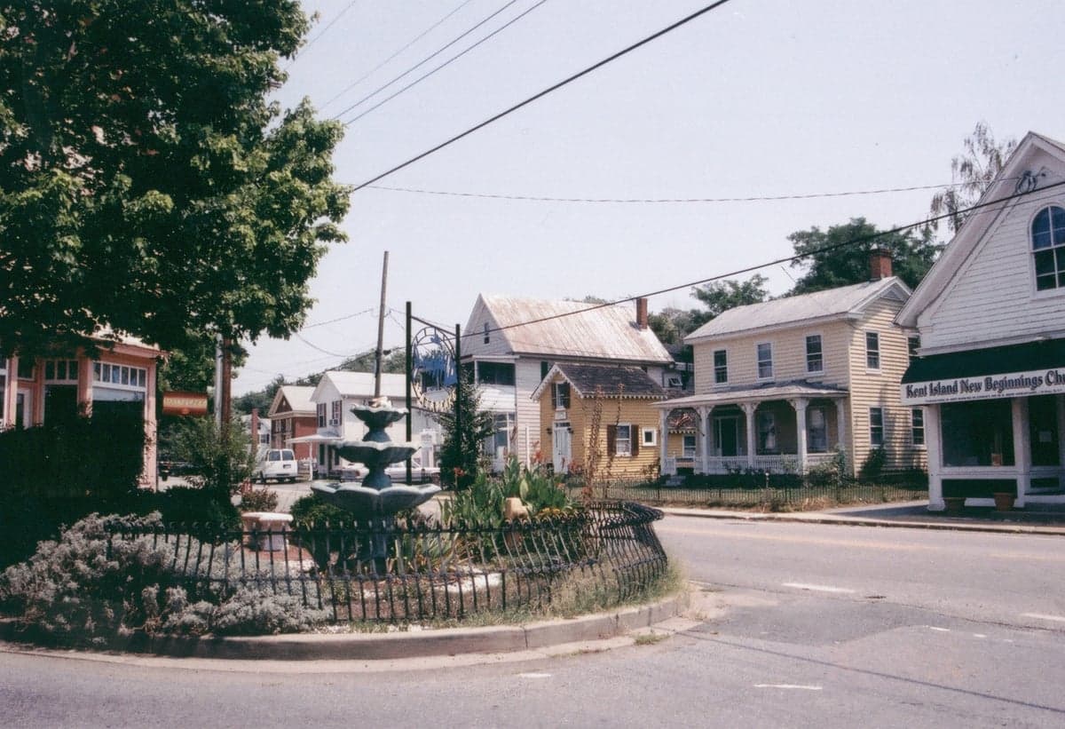
Photo: Wikipedia
Strategic Assessment of Stevensville, MD
Workable tactical position. Some exposure to population density or targets, but generally defensible in a crisis.
What does the Strategic Assessment tell us?
Our Strategic Assessment grades tactical survivability of an area. Major population centers, military targets, fallout zones, natural disasters, and border exposure all drive risk — lower exposure means a more defensible position in a crisis.
This is heavily inspired by Joel Skousen's Strategic Relocation book. Highly recommended you checkout the book ($)What does this tell us?
Our Strategic Assessment grades tactical survivability of an area. Major population centers, military targets, fallout zones, natural disasters, and border exposure all drive risk — lower exposure means a more defensible position in a crisis.
This is heavily inspired by Joel Skousen's Strategic Relocation book. Highly recommended you checkout the book ($)Strategic Pillars

Key Distances
Regional Safe Places
Below is our recommended "safe zones" in Maryland and the surrounding area based on our strategic heuristics. For most people, it's unrealistic to live in a “safe zone” full-time due to work, family or other personal reasons. They tend to be more rural. However, many of these areas are perfect for second homes and retreat properties that double as a vacation home or even a short-term rental.




Important Note: For informational purposes only. This does not mean nothing bad ever happens in the green zones. Please use common sense. This is based on public data and modeled with AI. We tried to take a conservative approach but mistakes happen. We update this regularly as new information becomes available.
Solar Generator Recommendations
Backup power matters more here than in safer locations. We've picked three solar generators across budgets and capacity tiers — start with the budget unit if you only need a few essentials, or step up if you want to run a fridge and HVAC for days at a time.

Jackery Portable Power Station Explorer 300
Budget OptionPower on the Go: Weighing only 11 lbs, it's convenient to set up and store with book-sized foldable solar panels

BLUETTI Portable Power Station AC180
Designed for both indoor and outdoor scenarios, AC180 is highly capable as it has a robost capacity and continuous output power.

EF ECOFLOW DELTA Pro Ultra Power Station
Upgraded PickEcoFlow DELTA Pro Ultra is a whole-home energy system designed to grow with your family. Integrated with the Smart Home Panel 2, it scales to meet your evolving energy needs — keeping your home powered, intelligent, and secure through every stage of life.
We earn a commission, at no additional cost to you.
Strategic Assessment Analysis
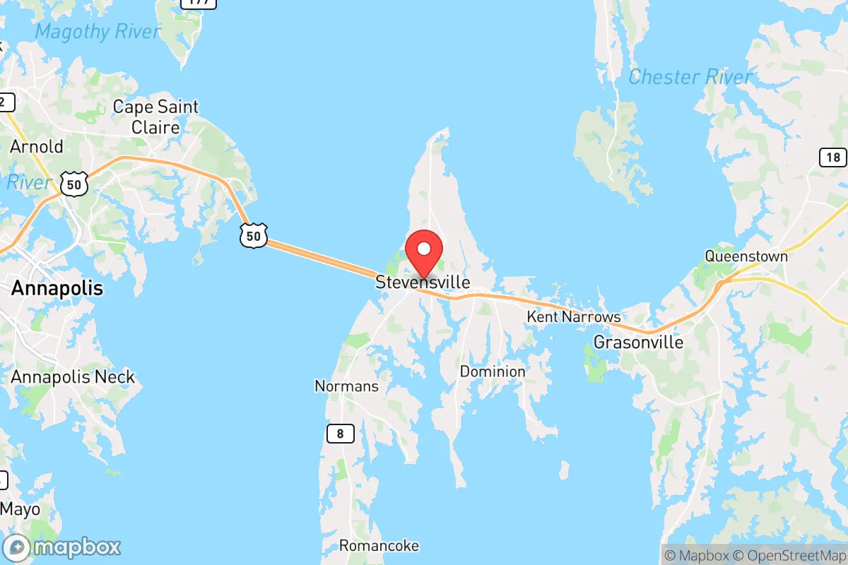
Stevensville, Maryland, offers a strategic blend of rural accessibility and Chesapeake Bay geography that makes it a serious contender for relocation-minded individuals and families who prioritize resilience and self-sufficiency. Situated on Kent Island, the town sits just across the Chesapeake Bay Bridge from Annapolis and roughly 30 miles from Baltimore and 45 miles from Washington, D.C., placing it within striking distance of major metropolitan resources while maintaining a distinctly separate, lower-density character. For a reader weighing disaster readiness, Stevensville's position on an island—connected to the mainland by a single major bridge—creates both a natural buffer and a critical vulnerability that demands careful consideration.
Geographic position and natural advantages for self-sufficiency
Stevensville's location on Kent Island provides several inherent geographic advantages for those focused on resilience. The island's position in the Chesapeake Bay means it benefits from a moderated microclimate, with slightly cooler summers and warmer winters than inland areas, which can reduce energy demands and extend growing seasons for food production. The surrounding waters offer abundant fishing, crabbing, and foraging opportunities—blue crabs, rockfish, and oysters are locally harvestable resources that can supplement food stores in a disruption scenario. The area's relatively low population density compared to the nearby D.C.-Baltimore corridor means less competition for local resources during a crisis. Kent Island's flat to gently rolling terrain also simplifies gardening, rainwater catchment, and solar panel placement, making it more practical for self-sufficient setups than steeper, forested regions. The island's position also places it outside the immediate blast and fallout zones of major urban targets, though proximity to those cities introduces other risks discussed below.
Risks, exposures, and proximity to fallout-relevant landmarks
The most significant risk for Stevensville is its dependence on the Chesapeake Bay Bridge (U.S. Route 50/301) as the sole road connection to the western shore and the mainland. In any large-scale evacuation or crisis scenario, this bridge could become a choke point or be rendered impassable—whether by accident, infrastructure failure, or deliberate disruption. Residents should plan for the possibility of being effectively stranded on the island for extended periods. Additionally, the island's proximity to Annapolis (home to the U.S. Naval Academy) and the broader National Capital Region means that a major event targeting D.C. or military installations could produce fallout patterns that affect Kent Island, depending on wind direction. The presence of the Naval Air Station Patuxent River roughly 50 miles south, as well as Aberdeen Proving Ground to the north, adds to the region's profile as a potential secondary target area. Flooding from storm surge is a real concern for low-lying coastal portions of the island, particularly with hurricanes and nor'easters. The area's flat topography offers little natural shielding from fallout, so a basement or reinforced safe room would be a prudent investment for any relocator serious about preparedness.
Practical resilience for a relocator: food, water, energy, and defensibility
For a family or individual looking to establish a resilient homestead, Stevensville presents a mixed picture. The island's agricultural history means that good soil is available in many areas, and local zoning generally permits backyard gardens, small livestock, and even hobby farms on appropriately zoned parcels. The Chesapeake Bay and its tributaries provide a reliable water source, though groundwater wells are common and should be tested for saltwater intrusion in coastal areas. Municipal water is available in denser parts of Stevensville, but a well with a hand pump or a rainwater catchment system offers greater independence. Solar energy is viable here—the region receives roughly 4.5 peak sun hours per day on average—and net metering policies in Maryland support grid-tied systems, though battery storage is recommended for true off-grid capability. Heating degree days are moderate, meaning wood or pellet stoves can serve as effective backup heat sources without requiring massive fuel storage. Defensibility is a relative weakness: the island's flat, open terrain and single egress point make it difficult to secure against organized threats, but the low crime rate and tight-knit community character of Stevensville itself offer a degree of social resilience. Neighbors tend to know each other, and local networks can be invaluable in a crisis. The Queen Anne's County government maintains a reasonably active emergency management office, and the area is served by a volunteer fire department and a county sheriff's office, though response times to more remote parts of the island can be longer than in suburban settings.
Overall, Stevensville offers a credible base for a resilience-minded relocator who understands its trade-offs. The island's geographic separation from the urban core provides a meaningful buffer against the immediate effects of a major event, while its access to bay resources and agricultural land supports a more self-sufficient lifestyle. The critical vulnerability remains the bridge dependency and the potential for fallout from nearby military and government targets. For a family willing to invest in backup power, water independence, and a well-stocked pantry, Stevensville can serve as a strategic foothold—close enough to metropolitan resources to be practical for daily life, yet far enough to offer genuine separation when it matters most. The key is to treat the island not as a fortress, but as a well-connected outpost with clear strengths and acknowledged weaknesses that can be managed with deliberate planning.

* Values derived from national, state, county, city and local statistics and may differ in a specific area. Last updated: 2026-07-21T20:15:42.000Z
Narrative content on this page is AI-generated and may contain mistakes. Verify any details that matter before acting on them.
ReloMaps may earn a commission from affiliate links at no extra cost to you.

