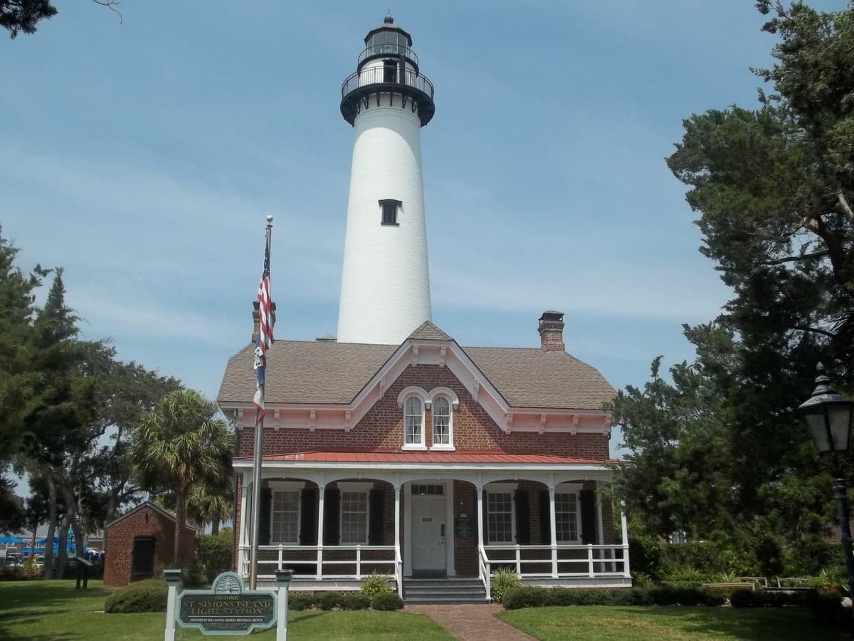
Photo: Wikipedia
Strategic Assessment of St. Simons Island, GA
Multiple tactical vulnerabilities. Population density, target proximity, or disaster risk are likely compounding. A retreat property and exit planning is required.
What does the Strategic Assessment tell us?
Our Strategic Assessment grades tactical survivability of an area. Major population centers, military targets, fallout zones, natural disasters, and border exposure all drive risk — lower exposure means a more defensible position in a crisis.
This is heavily inspired by Joel Skousen's Strategic Relocation book. Highly recommended you checkout the book ($)What does this tell us?
Our Strategic Assessment grades tactical survivability of an area. Major population centers, military targets, fallout zones, natural disasters, and border exposure all drive risk — lower exposure means a more defensible position in a crisis.
This is heavily inspired by Joel Skousen's Strategic Relocation book. Highly recommended you checkout the book ($)Strategic Pillars

Key Distances
Regional Safe Places
Below is our recommended "safe zones" in Georgia and the surrounding area based on our strategic heuristics. For most people, it's unrealistic to live in a “safe zone” full-time due to work, family or other personal reasons. They tend to be more rural. However, many of these areas are perfect for second homes and retreat properties that double as a vacation home or even a short-term rental.
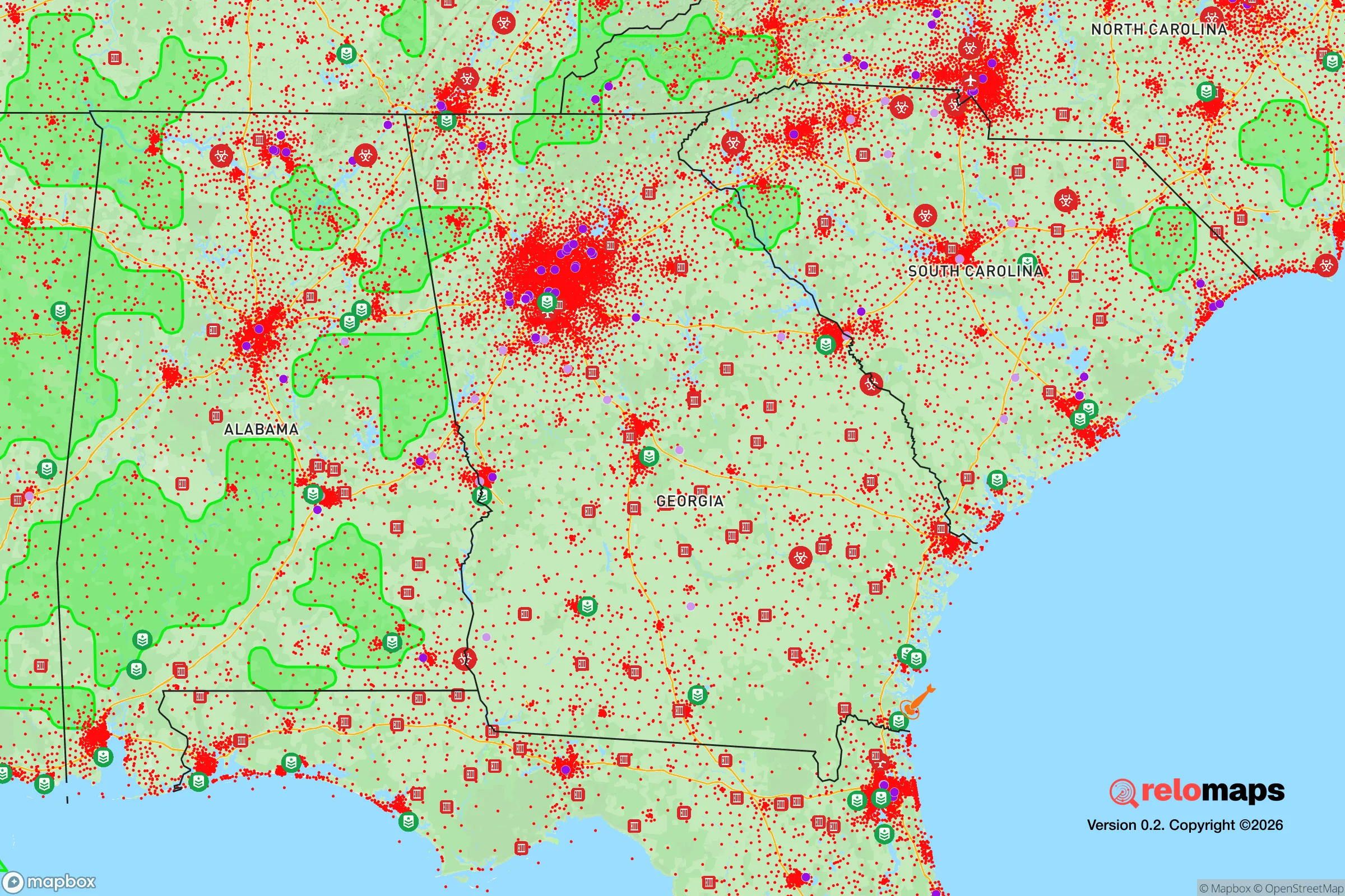
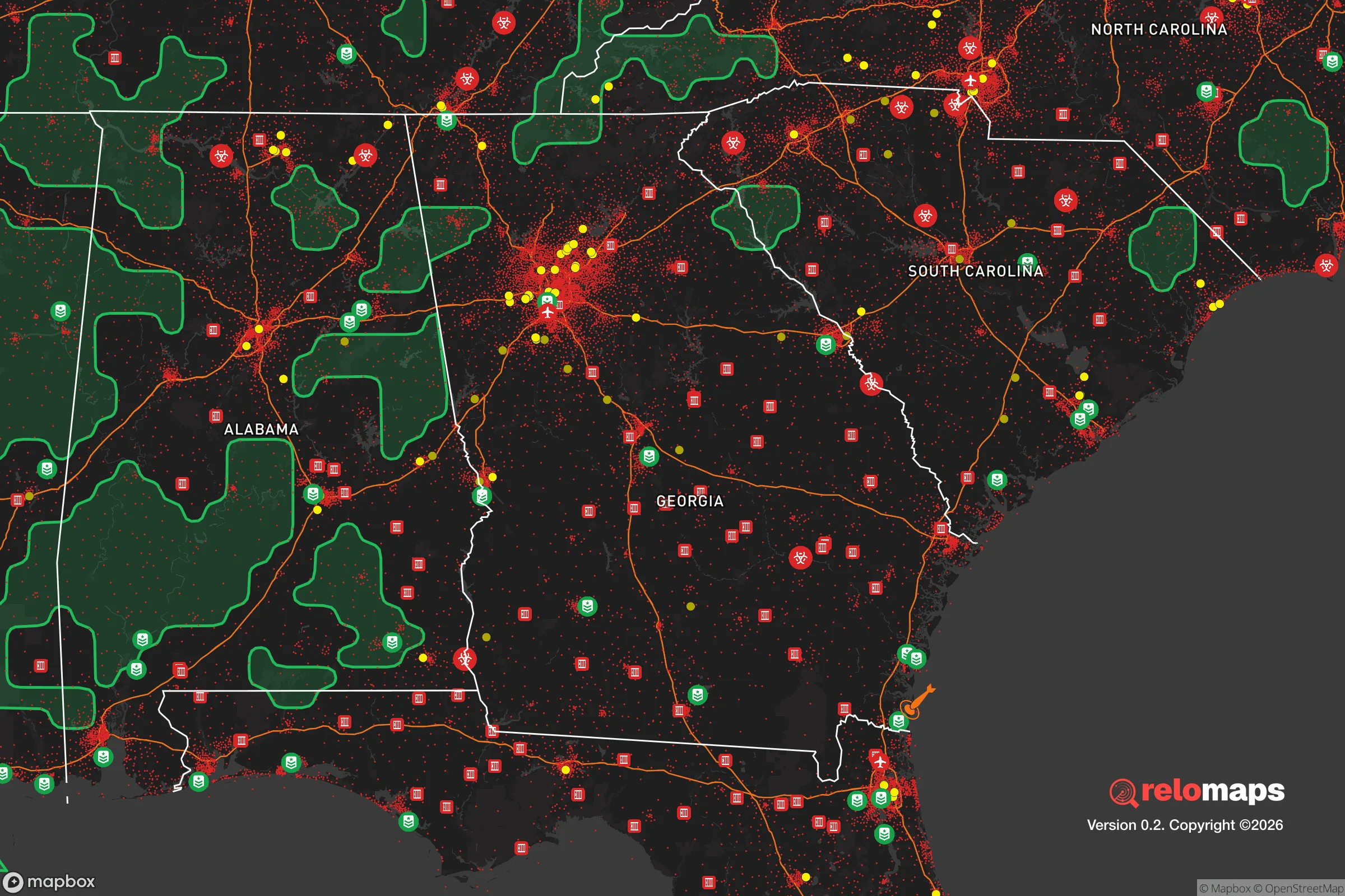


Important Note: For informational purposes only. This does not mean nothing bad ever happens in the green zones. Please use common sense. This is based on public data and modeled with AI. We tried to take a conservative approach but mistakes happen. We update this regularly as new information becomes available.
Solar Generator Recommendations
Backup power matters more here than in safer locations. We've picked three solar generators across budgets and capacity tiers — start with the budget unit if you only need a few essentials, or step up if you want to run a fridge and HVAC for days at a time.

Jackery Portable Power Station Explorer 300
Budget OptionPower on the Go: Weighing only 11 lbs, it's convenient to set up and store with book-sized foldable solar panels

BLUETTI Portable Power Station AC180
Designed for both indoor and outdoor scenarios, AC180 is highly capable as it has a robost capacity and continuous output power.

EF ECOFLOW DELTA Pro Ultra Power Station
Upgraded PickEcoFlow DELTA Pro Ultra is a whole-home energy system designed to grow with your family. Integrated with the Smart Home Panel 2, it scales to meet your evolving energy needs — keeping your home powered, intelligent, and secure through every stage of life.
We earn a commission, at no additional cost to you.
Strategic Assessment Analysis
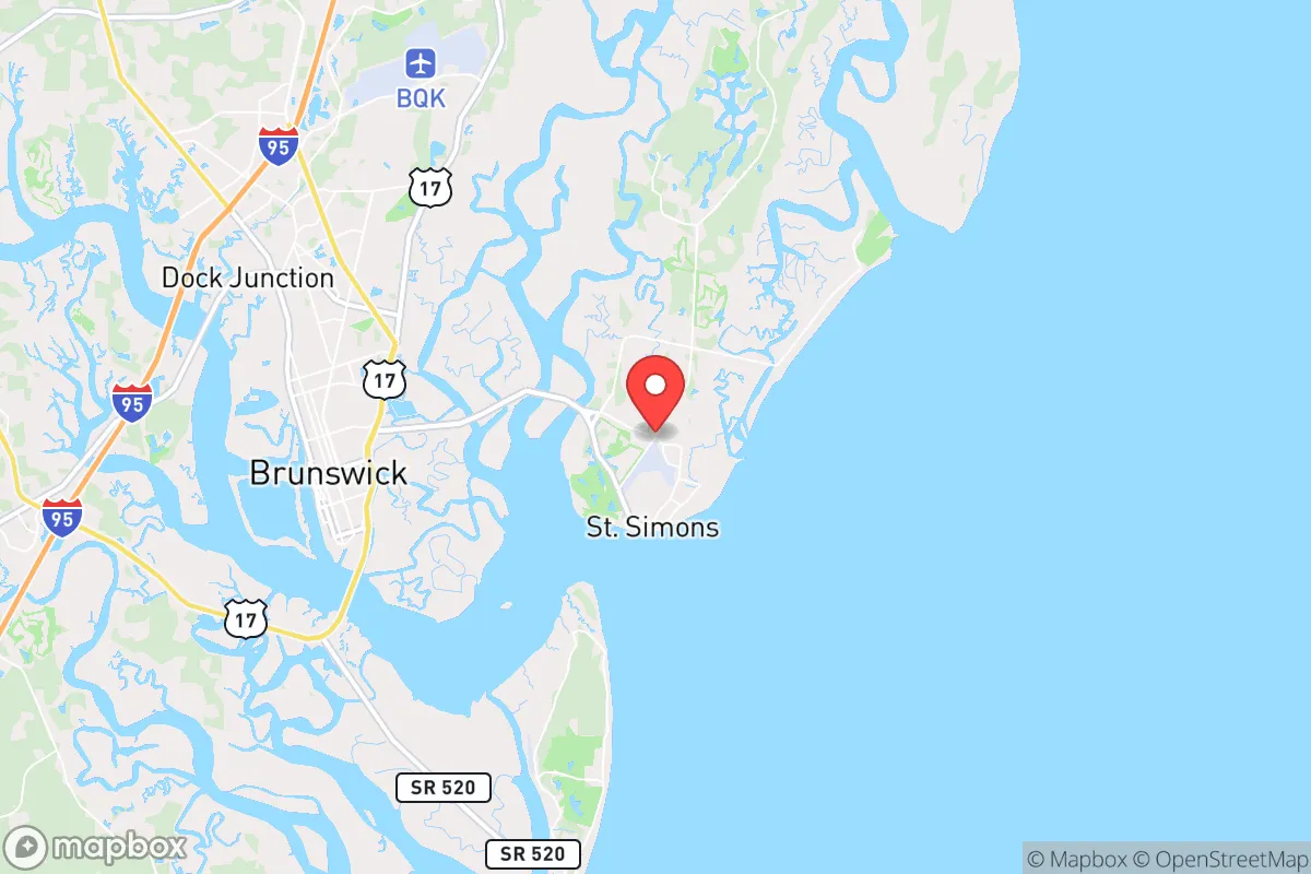
St. Simons Island, Georgia, presents a complex strategic picture for the relocation-minded reader prioritizing disaster readiness and self-sufficiency. Its primary advantage is geographic insulation—a barrier island with limited access points—but this same feature creates significant vulnerabilities in a crisis. The island’s location roughly 70 miles south of Savannah and 80 miles north of Jacksonville places it within the extended shadow of major population centers, which is a net negative for those seeking to avoid fallout from man-made or cascading infrastructure failures. For the conservative-leaning individual or family weighing long-term security, St. Simons offers a mixed bag: strong natural defenses against certain threats, but pronounced exposure to others that demand serious pre-planning.
Geographic position and natural advantages for security-minded relocators
St. Simons sits on Georgia’s Golden Isles, a chain of barrier islands shielded from the open Atlantic by a series of salt marshes and tidal creeks. This positioning provides a natural buffer against storm surge from the east, though it is by no means a guarantee of safety. The island’s primary access is via the F.J. Torras Causeway, a single road connecting to the mainland at Brunswick. This chokepoint is both a defensive asset and a critical liability: in a grid-down scenario, controlling that single bridge would effectively seal the island, but it also means any evacuation or supply movement depends entirely on one corridor. The surrounding marshlands and dense maritime forests offer limited cover and no agricultural utility, meaning the island’s natural advantages are more about isolation than resource abundance. For a relocator, the key takeaway is that St. Simons is defensible by geography, but that defense comes at the cost of mobility and self-sufficiency.
Risks, exposures, and proximity to fallout-relevant landmarks
The island’s most acute natural risk is hurricane landfall. St. Simons lies in a zone that has historically seen direct hits from major storms—Hurricane Irma in 2017 caused widespread flooding and power outages lasting days, and the 1898 Sea Islands hurricane devastated the area. Storm surge from a Category 3 or higher event could inundate large portions of the island, particularly the low-lying south end near East Beach and the golf course communities. Flood insurance is mandatory for most properties, and the Federal Emergency Management Agency (FEMA) maps show significant portions of the island in Special Flood Hazard Areas. Beyond weather, the island’s proximity to the Port of Brunswick—one of the busiest automobile ports in the United States—and the Kings Bay Naval Submarine Base (home to the U.S. Navy’s Atlantic Fleet ballistic missile submarines) roughly 30 miles south introduces man-made risk. These are high-value strategic targets in any conflict scenario, and St. Simons sits within the likely fallout zone of a kinetic or electromagnetic event aimed at those facilities. The island’s reliance on the mainland for power, water, and fuel means that any disruption to the causeway or the Brunswick infrastructure grid would cascade rapidly. For the disaster-conscious relocator, this is the single most important negative factor: you are living next to a military installation and a major port, both of which elevate your risk profile significantly.
Practical resilience for a relocator: food, water, energy, and defensibility
St. Simons is not a place where self-sufficiency comes easily. The island has no significant agricultural land—the soil is sandy and salt-affected, and the growing season, while long, is limited by humidity and pest pressure. Fresh water comes entirely from the mainland via the Brunswick-Glynn County water system, which draws from the Floridan Aquifer. A prolonged power outage or contamination event would leave residents dependent on bottled water deliveries or private wells, which are rare on the island. Most homes rely on electric pumps for well water, compounding the vulnerability. Energy infrastructure is similarly centralized: Georgia Power runs the grid, and while some residents have installed solar panels and battery backups, the island has no community-level microgrid or backup generation. Natural gas is available in parts of the island, but propane delivery is the norm for cooking and heating in many homes. For food storage, the island has two major grocery stores (Publix and Winn-Dixie) plus a handful of specialty markets, but supply chains are vulnerable to bridge closure or storm disruption. Defensibility is the island’s strongest card: the single causeway, the marsh barriers, and the limited road network mean that a small, organized group could effectively control access. However, that same geography makes escape difficult if the situation deteriorates. For a family, the practical resilience picture is one of moderate preparedness potential—you can stockpile, install solar, and dig a well—but you are fundamentally dependent on mainland infrastructure for daily survival. The island’s small permanent population (roughly 15,000) and strong community networks are a plus for mutual aid, but the seasonal influx of tourists (which can swell the population to 50,000+ in summer) creates a resource strain that could turn critical in a crisis.
The overall strategic picture for St. Simons Island is one of calculated trade-offs. It offers genuine geographic isolation and a defensible layout that appeals to those prioritizing security from civil unrest or localized threats. The natural beauty, low crime rate, and tight-knit community are real advantages for family life. But the island’s exposure to hurricane risk, its proximity to high-value military and industrial targets, and its near-total dependence on a single causeway for supplies and evacuation make it a poor choice for anyone seeking true self-sufficiency or long-term resilience against large-scale disasters. For the conservative relocator who values community and natural setting over hardcore preparedness, St. Simons can work—provided you invest seriously in backup power, water storage, and a solid evacuation plan for the hurricane season. For those whose primary concern is fallout, grid collapse, or societal disruption, the island’s liabilities likely outweigh its assets. It is a beautiful place to live, but not a fortress.

* Values derived from national, state, county, city and local statistics and may differ in a specific area. Last updated: 2026-09-01T10:05:22.000Z
Narrative content on this page is AI-generated and may contain mistakes. Verify any details that matter before acting on them.
ReloMaps may earn a commission from affiliate links at no extra cost to you.

