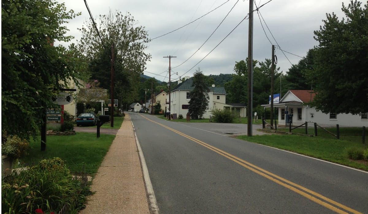
Photo: Wikipedia
Strategic Assessment of Sperryville, VA
Workable tactical position. Some exposure to population density or targets, but generally defensible in a crisis.
What does the Strategic Assessment tell us?
Our Strategic Assessment grades tactical survivability of an area. Major population centers, military targets, fallout zones, natural disasters, and border exposure all drive risk — lower exposure means a more defensible position in a crisis.
This is heavily inspired by Joel Skousen's Strategic Relocation book. Highly recommended you checkout the book ($)What does this tell us?
Our Strategic Assessment grades tactical survivability of an area. Major population centers, military targets, fallout zones, natural disasters, and border exposure all drive risk — lower exposure means a more defensible position in a crisis.
This is heavily inspired by Joel Skousen's Strategic Relocation book. Highly recommended you checkout the book ($)Strategic Pillars

Key Distances
Regional Safe Places
Below is our recommended "safe zones" in Virginia and the surrounding area based on our strategic heuristics. For most people, it's unrealistic to live in a “safe zone” full-time due to work, family or other personal reasons. They tend to be more rural. However, many of these areas are perfect for second homes and retreat properties that double as a vacation home or even a short-term rental.




Important Note: For informational purposes only. This does not mean nothing bad ever happens in the green zones. Please use common sense. This is based on public data and modeled with AI. We tried to take a conservative approach but mistakes happen. We update this regularly as new information becomes available.
Solar Generator Recommendations
Backup power matters more here than in safer locations. We've picked three solar generators across budgets and capacity tiers — start with the budget unit if you only need a few essentials, or step up if you want to run a fridge and HVAC for days at a time.

Jackery Portable Power Station Explorer 300
Budget OptionPower on the Go: Weighing only 11 lbs, it's convenient to set up and store with book-sized foldable solar panels

BLUETTI Portable Power Station AC180
Designed for both indoor and outdoor scenarios, AC180 is highly capable as it has a robost capacity and continuous output power.

EF ECOFLOW DELTA Pro Ultra Power Station
Upgraded PickEcoFlow DELTA Pro Ultra is a whole-home energy system designed to grow with your family. Integrated with the Smart Home Panel 2, it scales to meet your evolving energy needs — keeping your home powered, intelligent, and secure through every stage of life.
We earn a commission, at no additional cost to you.
Strategic Assessment Analysis
Sperryville, Virginia, offers a strategic resilience profile that punches well above its weight for a town of roughly 350 residents. Nestled at the eastern foot of the Blue Ridge Mountains in Rappahannock County, it combines the defensive advantages of rugged terrain with a location that is far enough from major metropolitan targets to matter, yet close enough to markets for practical self-sufficiency. For a relocator weighing disaster readiness, Sperryville’s core value lies in its position as a hard-to-reach, low-profile haven with strong local food infrastructure, though its single-road access and proximity to the I-66 corridor demand honest scrutiny.
Geographic position and natural defensive advantages
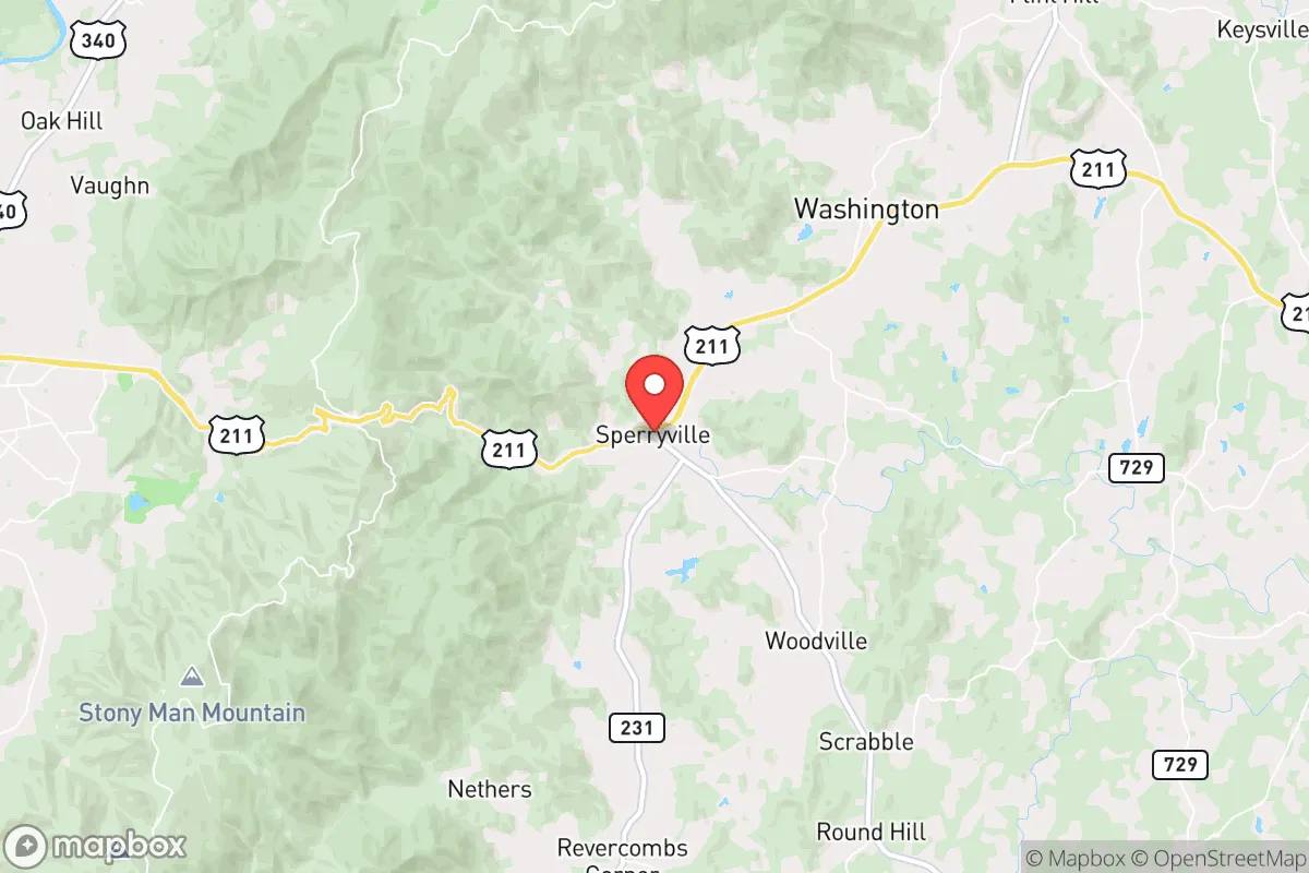
Sperryville sits at the confluence of the Thornton River and the eastern slope of the Blue Ridge, roughly 70 miles west of Washington, D.C., and about 35 miles from the nearest substantial city, Front Royal. That distance is a genuine asset in a resilience analysis: it places the town outside the immediate blast and fallout zones of a major metropolitan strike, while still being within a day’s drive of supply chains when conditions are normal. The town is framed by Shenandoah National Park to the west and the Rappahannock County countryside to the east, creating a natural buffer of protected federal land that limits dense development and preserves a working agricultural landscape.
The terrain itself is a defensive feature. The Blue Ridge escarpment rises sharply west of town, with passes like Thornton Gap (U.S. Route 211) providing chokepoints that are easy to monitor and, in a worst-case scenario, relatively easy to control. The eastern approach is gentler but still rolling and wooded, offering natural cover and multiple small valleys that break up sightlines. Elevation ranges from about 600 feet in the village to over 3,000 feet on the nearby ridges, which means cooler summers, reliable spring water, and a landscape that is inherently difficult for large-scale mechanized movement. For a family or small group, the area offers dozens of discreet hollows and secondary roads that are not on any main thoroughfare.
Risks, exposures, and proximity to fallout-relevant landmarks
The most significant risk factor for Sperryville is not the town itself but its relationship to the Washington, D.C. metropolitan area. While 70 miles provides substantial standoff distance, prevailing winds from the west-northwest in a fallout scenario would carry particulate matter toward the coast, not toward the Blue Ridge—a favorable detail. However, the I-66 corridor, which connects Front Royal to D.C., runs about 20 miles north of Sperryville. In a mass evacuation event, that highway would be a funnel for millions of people, and Sperryville’s own Route 211 connects directly to that corridor. The town could see significant transient traffic from urban refugees, which is a security and resource concern, not a fallout one.
Natural risks are comparatively mild. The region is not in a major earthquake zone, though the 2011 Mineral, Virginia, quake (magnitude 5.8) was felt strongly here and caused minor chimney damage. Tornado risk is low but not zero; the Blue Ridge tends to break up supercell thunderstorms. The larger natural threat is winter weather: Sperryville averages about 25 inches of snow annually, and the mountain passes can become impassable for days during ice storms. Flash flooding along the Thornton River is a real but localized hazard, particularly for properties in the floodplain near the village center. Wildfire risk is moderate, with dry autumn conditions and dense forest, though the area has no recent history of major fires.
On man-made risks, the area is notably quiet. There are no nuclear power plants within 50 miles—the nearest is North Anna, about 60 miles southeast—and no major military installations or industrial chemical facilities in the immediate vicinity. The primary man-made exposure is indirect: if the D.C. grid or its data infrastructure fails, Sperryville’s dependence on regional power and communications networks becomes apparent. Cell coverage is spotty in the hollows, and fiber internet is limited, which is a resilience negative for remote work but a positive for low-profile living.
Practical resilience for a relocator: food, water, energy, and defensibility
For a relocator serious about self-sufficiency, Sperryville’s practical resilience is anchored in its agricultural base. Rappahannock County has over 40 working farms, including several that supply the town’s year-round farmers market and the well-regarded Rappahannock County Farm-to-Table network. The local soil is productive, and the growing season runs roughly 170 days, suitable for vegetables, small grains, and orchard fruit. Water is a genuine strength: the Blue Ridge captures significant orographic rainfall (40–50 inches annually), and the town’s historic reliance on springs and wells means most rural properties have independent water sources. A drilled well in this area typically yields 5–15 gallons per minute, which is ample for household use and small-scale irrigation.
Energy resilience is more challenging. The grid is served by Rappahannock Electric Cooperative, and outages are common during winter storms, often lasting 12–48 hours. Solar potential is good—the region averages 4.5 peak sun hours per day—and a growing number of properties in the county have installed off-grid or hybrid solar systems. Wood heat is a practical and culturally normal option here; firewood is abundant and inexpensive, and most older homes have working fireplaces or wood stoves. Propane delivery is reliable in normal times, but a relocator should plan for a minimum of 500 gallons of on-site storage for heating and cooking.
Defensibility is a mixed picture. The town’s compact layout—a few blocks of stores, a post office, and a handful of restaurants—means that a small, organized group could secure the immediate village center if needed. The surrounding terrain offers excellent natural choke points, particularly on Route 211 west of town and on the secondary roads leading to the national park. However, the town is not a fortress: it has multiple unguarded entry points via farm roads, and the local sheriff’s office covers a large, thinly populated county with limited personnel. The realistic defensive posture is not to hold a perimeter but to be invisible—choose a property set back from main roads, with a long driveway and natural tree cover, and maintain a low profile in the community.
Food storage and medical access round out the picture. The nearest full-service hospital is in Front Royal (Warren Memorial Hospital, about 35 minutes away), with a small clinic in nearby Washington, Virginia, for routine care. The town has one grocery store, Sperryville Grocery, which is well-stocked but small; a serious relocator should plan for 30–60 days of stored food and essential medications. The local community is tight-knit and historically self-reliant, with a strong culture of barter and mutual aid among farmers and long-time residents—an intangible but critical resilience asset that cannot be bought.
Overall, Sperryville presents a strong strategic picture for the disaster-conscious relocator. Its geographic isolation, abundant water, productive farmland, and low-profile character make it one of the better-positioned small towns in the mid-Atlantic for weathering both natural and man-made disruptions. The weaknesses—single-road access, winter storm vulnerability, and proximity to the D.C. evacuation funnel—are manageable with planning and property selection. For a single individual or family willing to invest in solar, wood heat, and a well, Sperryville offers a defensible, self-sufficient base that is neither so remote as to be impractical nor so connected as to be a target. It is not a bug-out bunker; it is a working rural community that already lives closer to the land than most, and that is precisely its value.

* Values derived from national, state, county, city and local statistics and may differ in a specific area. Last updated: 2026-09-14T21:51:44.000Z
Narrative content on this page is AI-generated and may contain mistakes. Verify any details that matter before acting on them.
ReloMaps may earn a commission from affiliate links at no extra cost to you.

