Photo: Wikipedia
Strategic Assessment of Dorchester County
Meaningful friction. Expect exposure to either population pressure, blast zones, or natural disaster risk. Consider buying a retreat property.
What does the Strategic Assessment tell us?
Our Strategic Assessment grades tactical survivability of an area. Major population centers, military targets, fallout zones, natural disasters, and border exposure all drive risk — lower exposure means a more defensible position in a crisis.
This is heavily inspired by Joel Skousen's Strategic Relocation book. Highly recommended you checkout the book ($)What does this tell us?
Our Strategic Assessment grades tactical survivability of an area. Major population centers, military targets, fallout zones, natural disasters, and border exposure all drive risk — lower exposure means a more defensible position in a crisis.
This is heavily inspired by Joel Skousen's Strategic Relocation book. Highly recommended you checkout the book ($)Strategic Pillars

Key Distances
Strategic Assessment Analysis
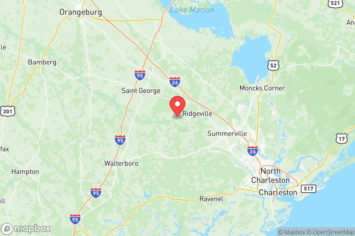
Dorchester County, South Carolina, sits in a strategic sweet spot for relocators who want coastal access without the direct exposure of beachfront living. The county’s geography—wedged between the port city of Charleston and the rural interior—offers a mix of economic opportunity and buffer from the most intense hurricane surge zones. For a family or individual weighing disaster readiness and long-term self-sufficiency, the inland towns like St. George, Harleyville, and Ridgeville provide a quieter, more defensible footprint than the crowded suburbs around Summerville, yet still lie within an hour of major medical and supply hubs. This assessment lays out the specific geographic advantages, man-made risks, and practical resilience factors that matter most for a prepared relocator.
Geographic position and natural advantages in the Lowcountry
Dorchester County covers about 580 square miles of the Atlantic Coastal Plain, with a flat to gently rolling terrain that drains into the Edisto River and the Ashley River. The county’s location roughly 25 miles inland from the Atlantic gives it a notable edge in hurricane scenarios: storm surge rarely penetrates past the barrier islands and salt marshes of Charleston and Beaufort counties. Summerville, the largest town, sits on a natural rise that historically sheds floodwater more efficiently than low-lying areas like downtown Charleston. The Edisto River, one of the longest free-flowing blackwater rivers in the eastern U.S., provides a reliable water source and a natural barrier for properties along its banks. The county’s rural western half—particularly around St. George—offers a mix of hardwood forest and agricultural land that can support small-scale farming, hunting, and timber. Interstate 26 cuts diagonally through the county, linking it to Columbia in under 90 minutes and providing a primary evacuation route inland. The absence of major mountains or dense forests means visibility and open lines of communication are generally good, which aids both everyday living and emergency response.
Risks, exposures, and proximity to fallout-relevant landmarks
The same proximity that gives Dorchester County economic vitality also introduces real risks. The county is part of the Charleston metropolitan statistical area, meaning it sits within the blast-and-fallout shadow of several high-value targets. Joint Base Charleston, which includes the Charleston Air Force Base and the Naval Weapons Station in neighboring Goose Creek (Berkeley County), is roughly 15 miles east of Summerville. The Port of Charleston—one of the busiest container ports on the East Coast—lies about 20 miles southeast. Both are logical adversary targets and would generate significant electromagnetic pulse (EMP) and fallout effects across Dorchester County if struck. Additionally, the Savannah River Site, a nuclear weapons tritium production facility, sits about 70 miles west in Aiken County. While far enough to avoid direct blast damage, prevailing weather patterns could bring airborne contamination from a Savannah River incident. On the natural-hazard side, the county is rated as high risk for inland flooding from tropical systems; even weak hurricanes like 2015’s Joaquin dropped 15–20 inches of rain, causing the Edisto and Ashley to flood large swaths of agricultural land. Tornadoes are a secondary but annual risk, especially during spring thunderstorms. The combination of federal, military, and industrial infrastructure within 30 miles means that a relocator choosing the more populated eastern corridor (Summerville, Ridgeville) must account for a denser fallout exposure zone than those selecting the far western towns like Harleyville or St. George.
Practical resilience: food, water, energy, and defensibility for relocators
For the seriously prepared relocator, Dorchester County scores moderately well on the raw ingredients of self-reliance. Water is the biggest plus: the county sits atop the Coastal Plain aquifer and has the Edisto and Ashley Rivers as surface sources. Many rural properties already have well water, and the county’s relatively high water table means new wells are affordable (typically $3,000–$6,000). Food production is viable—the county has a heritage of row crops (corn, soybeans, peanuts) and livestock, especially in the western half. The St. George and Harleyville areas still have active farms and small-town farmers’ markets; for long-term resilience, square-foot gardening and chicken-keeping are practical on parcels as small as two acres. Energy reliability is a mixed picture: the grid is served by Dominion Energy and Berkeley Electric Cooperative, both of which have hardened systems after recent hurricanes, but outages from tree damage can last days in rural areas. Solar with battery backup is allowed by county ordinance and is increasingly common. Defensibility varies by location—eastern subdivisions offer good services but poor OODA-loop (observe, orient, decide, act) conditions due to close neighbors and road chokepoints. The western towns like Harleyville (population ~800) and St. George (population ~2,000) are small enough that a family can establish a perimeter, store supplies, and maintain good sightlines. Nearby National Forest land (the Francis Marion National Forest lies just east in Berkeley County) offers additional foraging and hunting options but also attracts part-time recreational traffic that could complicate long-term security. Overall, the county provides the space and water access for a serious off-grid setup, but requires deliberate property selection—avoiding designated flood zones and staying at least 10 miles from major transportation corridors like I-26 to reduce refugee flow during a crisis.
The strategic picture for Dorchester County is one of trade-offs. It offers a temperate climate, ample water, and a position that is close enough to Charleston’s economy for normal life but far enough from the most explosive targets for a moderate risk profile. The county’s biggest liabilities are its proximity to Joint Base Charleston and the Port of Charleston—both are magnets for strategic strikes—and its vulnerability to inland flooding from strong tropical systems. For a relocator who prioritizes self-sufficiency and is willing to choose a property in the western half (Harleyville or St. George), Dorchester County provides a solid starting point with room to build food, water, and energy independence while maintaining access to regional hospitals and supply routes. It will not serve the hardcore prepper seeking total isolation (for that, look farther west to the Upstate or the mountains), but for the family wanting a realistic mix of convenience and preparedness, it ranks as one of the more balanced options in the coastal Southeast.

* Values derived from national, state, county, city and local statistics and may differ in a specific area. Last updated: 2026-06-25T07:12:34.000Z
Narrative content on this page is AI-generated and may contain mistakes. Verify any details that matter before acting on them.
ReloMaps may earn a commission from affiliate links at no extra cost to you.

