
Photo: Wikipedia
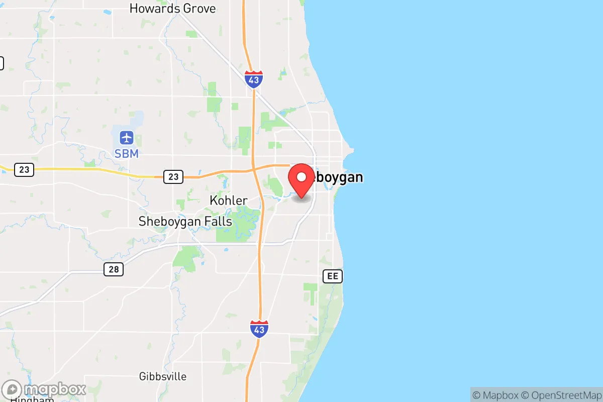
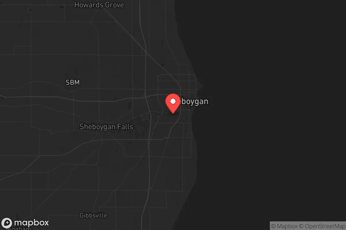
Strategic Assessment of Sheboygan, WI
Meaningful friction. Expect exposure to either population pressure, blast zones, or natural disaster risk. Consider buying a retreat property.
What does the Strategic Assessment tell us?
Our Strategic Assessment grades tactical survivability of an area. Major population centers, military targets, fallout zones, natural disasters, and border exposure all drive risk — lower exposure means a more defensible position in a crisis.
This is heavily inspired by Joel Skousen's Strategic Relocation book. Highly recommended you checkout the book ($)What does this tell us?
Our Strategic Assessment grades tactical survivability of an area. Major population centers, military targets, fallout zones, natural disasters, and border exposure all drive risk — lower exposure means a more defensible position in a crisis.
This is heavily inspired by Joel Skousen's Strategic Relocation book. Highly recommended you checkout the book ($)Strategic Pillars

Key Distances
Regional Safe Places
Below is our recommended "safe zones" in Wisconsin and the surrounding area based on our strategic heuristics. For most people, it's unrealistic to live in a “safe zone” full-time due to work, family or other personal reasons. They tend to be more rural. However, many of these areas are perfect for second homes and retreat properties that double as a vacation home or even a short-term rental.
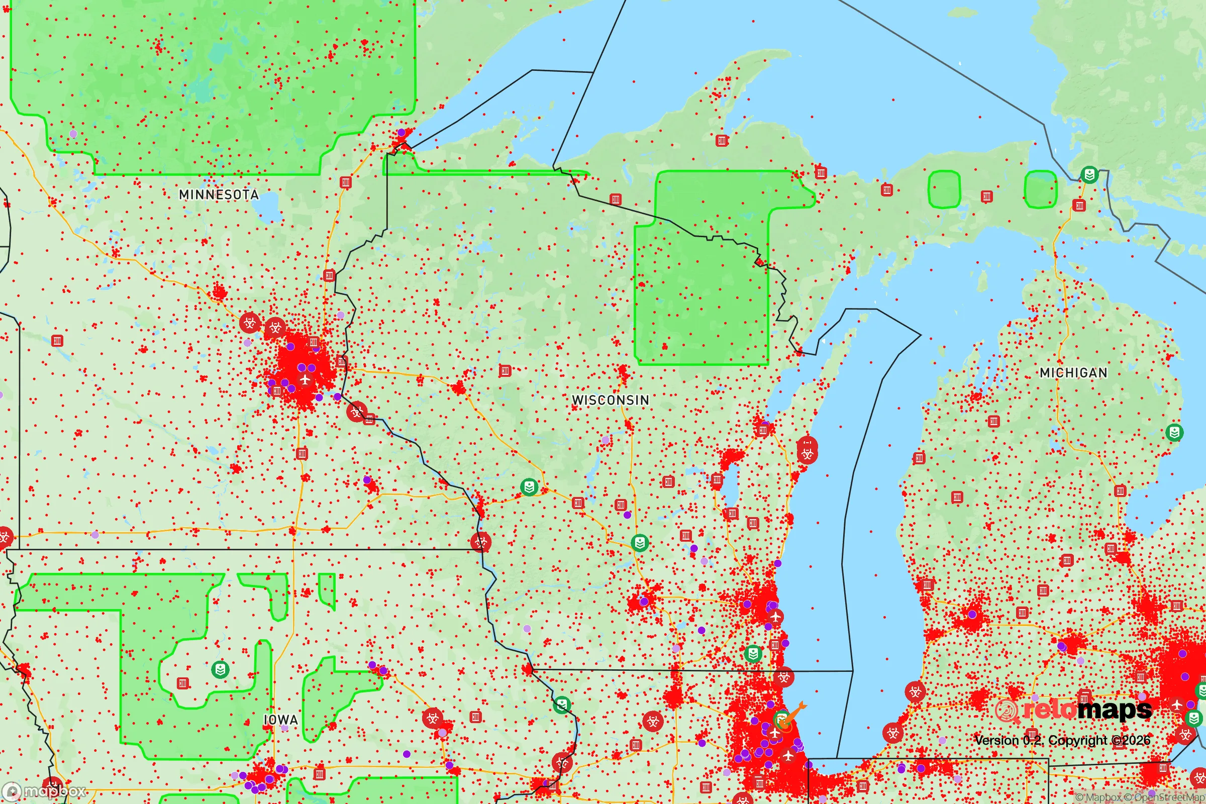
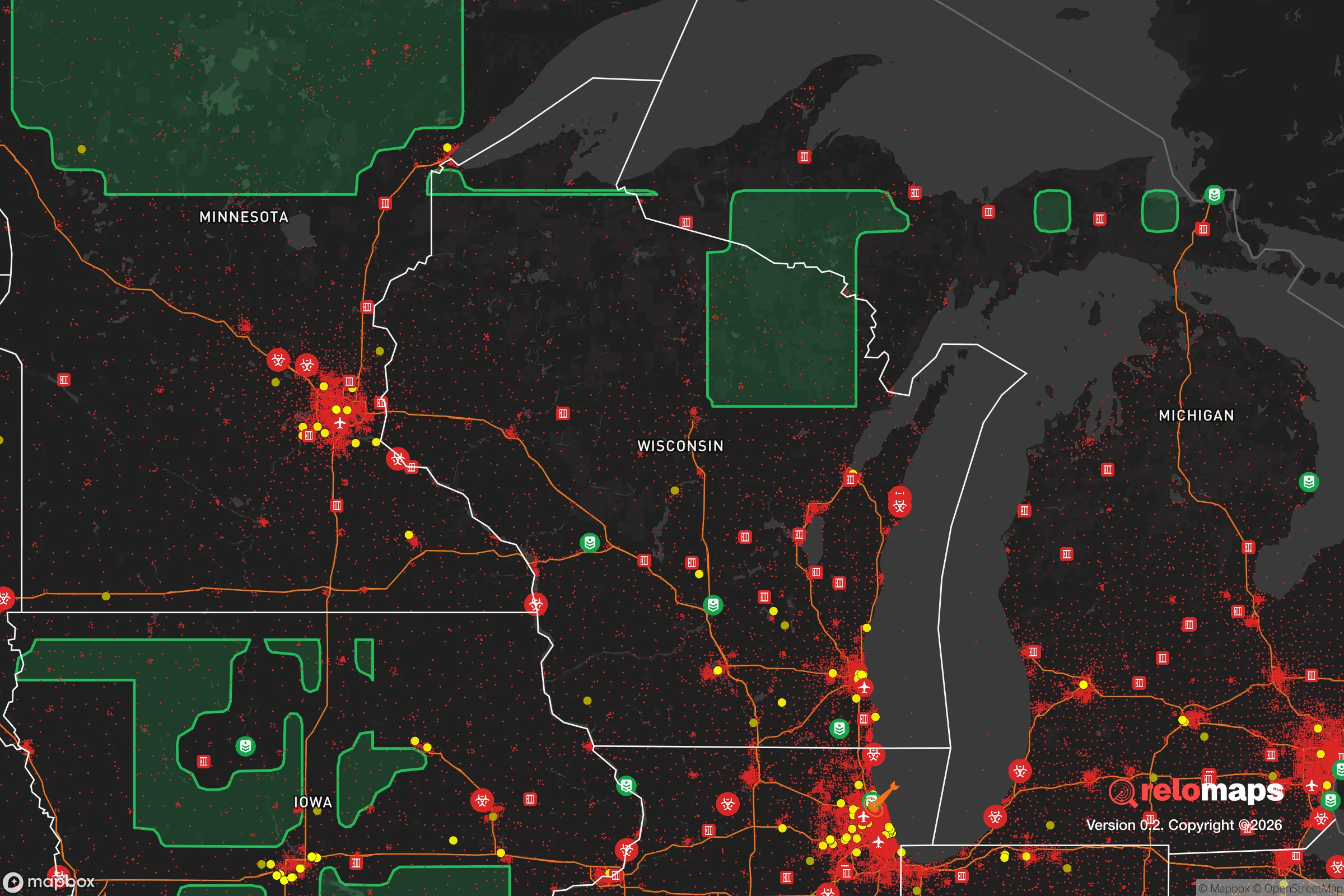
Important Note: For informational purposes only. This does not mean nothing bad ever happens in the green zones. Please use common sense. This is based on public data and modeled with AI. We tried to take a conservative approach but mistakes happen. We update this regularly as new information becomes available.
Solar Generator Recommendations
Backup power matters more here than in safer locations. We've picked three solar generators across budgets and capacity tiers — start with the budget unit if you only need a few essentials, or step up if you want to run a fridge and HVAC for days at a time.

Jackery Portable Power Station Explorer 300
Budget OptionPower on the Go: Weighing only 11 lbs, it's convenient to set up and store with book-sized foldable solar panels

BLUETTI Portable Power Station AC180
Designed for both indoor and outdoor scenarios, AC180 is highly capable as it has a robost capacity and continuous output power.

EF ECOFLOW DELTA Pro Ultra Power Station
Upgraded PickEcoFlow DELTA Pro Ultra is a whole-home energy system designed to grow with your family. Integrated with the Smart Home Panel 2, it scales to meet your evolving energy needs — keeping your home powered, intelligent, and secure through every stage of life.
We earn a commission, at no additional cost to you.
Strategic Assessment Analysis
Sheboygan, Wisconsin, sits in a strategic sweet spot that few Midwestern towns can claim: close enough to major resources to be practical, far enough from the chaos of large cities to offer genuine resilience. Located on the western shore of Lake Michigan, roughly 50 miles north of Milwaukee and 60 miles south of Green Bay, this city of about 48,000 people benefits from a strong industrial base, a deep-water port, and a community that still remembers how to work with its hands. For someone thinking long-term about security, self-sufficiency, and stability, Sheboygan presents a compelling case — but like any location, it comes with trade-offs that demand a clear-eyed look.
Geographic position and natural advantages for long-term security
Sheboygan’s primary strategic asset is its position on Lake Michigan, one of the largest freshwater bodies on the planet. In a world where water scarcity is becoming a real concern, having access to an essentially unlimited supply of fresh water is a massive advantage. The city draws its municipal water directly from the lake, and for those with private wells, the water table is reliable. The lake also moderates the climate, keeping winters slightly milder and summers cooler than inland areas — a small but meaningful buffer against extreme weather events. The surrounding landscape is a mix of rolling farmland, hardwood forests, and the Kettle Moraine State Forest to the west, which provides both a natural barrier and a source of game, timber, and forage. The terrain is not mountainous, but it offers enough cover and defensible positions for those who know how to use them. The city itself is compact, with a grid layout that makes it easy to secure key intersections and choke points if needed. The port, while not massive, is functional and could serve as a resupply or evacuation point in a crisis — something few inland towns can offer.
Risks, exposures, and proximity to fallout-relevant landmarks
No location is without vulnerabilities, and Sheboygan has a few that deserve attention. The most obvious is its proximity to Milwaukee, a major urban center with over 1.5 million people in the metro area. In a scenario involving civil unrest, mass migration from cities, or a major disaster, Milwaukee could become a source of instability. The I-43 corridor connecting Sheboygan to Milwaukee is a direct line of approach, and while it can be monitored and potentially blocked, it also means that anyone fleeing the city will likely head north along that route. Sheboygan is also within 100 miles of the Point Beach Nuclear Plant, located about 15 miles north in Two Rivers. While the plant has a solid safety record, any nuclear incident — whether accident or sabotage — would put Sheboygan in the potential fallout zone, depending on wind direction. The city itself has some industrial infrastructure, including a large Kohler manufacturing plant and several food processing facilities, which could be targets in a coordinated attack or become hazards if operations fail. On the plus side, Sheboygan is far enough from major military installations, strategic ports, and political centers that it is unlikely to be a primary target in a conflict. The risk profile is moderate, not extreme, but it requires a plan for both urban refugees and potential industrial accidents.
Practical resilience for a relocator: food, water, energy, and defensibility
For someone serious about self-reliance, Sheboygan offers a strong foundation. The surrounding farmland is some of the most productive in the country, with dairy, corn, soybeans, and vegetables grown in abundance. Local farmers markets and CSAs are common, and the soil is good enough that a determined individual could establish a productive garden or small homestead within a 20-minute drive of downtown. The lake provides fish — perch, trout, salmon — and the inland rivers and streams offer additional protein sources. Water, as noted, is not a problem, but filtration and storage should still be part of any plan, especially if municipal systems are compromised. Energy is a mixed bag. The grid is reasonably stable, but winter storms can knock out power for days. Solar is viable, though the region gets only about 160 sunny days per year, so battery storage and backup generation are essential. Natural gas is widely available, and wood heat is a practical option for those with property in the surrounding woods. Defensibility is decent but not fortress-level. The city itself is open, with many older homes built close together, but the surrounding rural areas offer plenty of options for a more secure setup. The local population is generally conservative, self-reliant, and armed — Wisconsin has a strong gun culture and relatively permissive carry laws. That means you’re less likely to be the only prepared person in the area, which is both a comfort and a consideration. Community ties matter here; being known as a reliable neighbor will go further than any stockpile.
Overall, Sheboygan presents a balanced strategic picture for the relocator who values resilience over isolation. It is not a remote bunker location, nor is it a high-risk urban center. It is a working-class city with a functional economy, a strong sense of place, and access to the resources that matter most: water, food, and a community that still believes in self-reliance. The risks are real — proximity to Milwaukee, a nuclear plant within fallout range, and the potential for industrial accidents — but they are manageable with planning and situational awareness. For the conservative-minded individual or family looking to put down roots in a place that can weather the storms ahead, Sheboygan deserves a serious look. It won’t be the safest place in every scenario, but it is one of the most practical for those who want to be prepared without living off the grid entirely.
* Values derived from national, state, county, city and local statistics and may differ in a specific area. Last updated: 2026-04-21T10:33:21.000Z
Narrative content on this page is AI-generated and may contain mistakes. Verify any details that matter before acting on them.
ReloMaps may earn a commission from affiliate links at no extra cost to you.