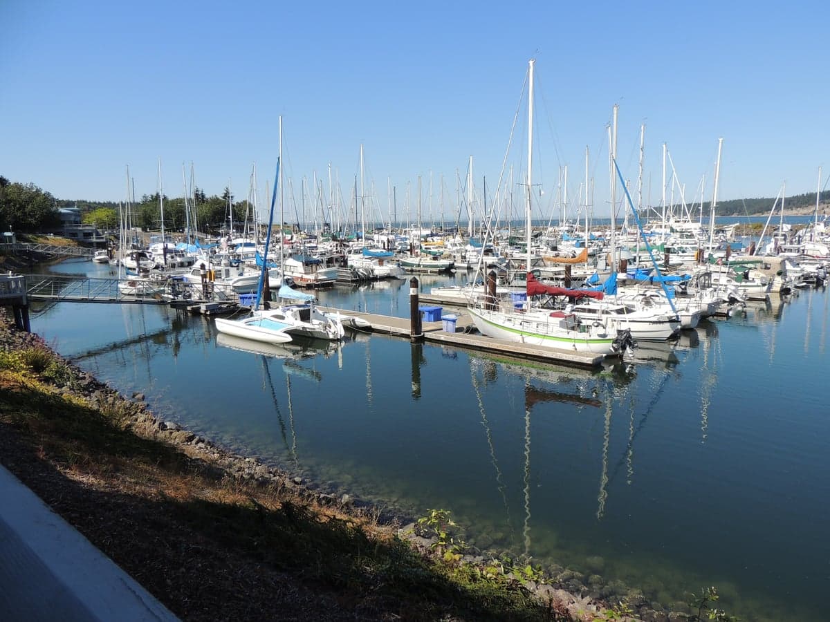
Photo: Wikipedia
Strategic Assessment of Sequim, WA
Meaningful friction. Expect exposure to either population pressure, blast zones, or natural disaster risk. Consider buying a retreat property.
What does the Strategic Assessment tell us?
Our Strategic Assessment grades tactical survivability of an area. Major population centers, military targets, fallout zones, natural disasters, and border exposure all drive risk — lower exposure means a more defensible position in a crisis.
This is heavily inspired by Joel Skousen's Strategic Relocation book. Highly recommended you checkout the book ($)What does this tell us?
Our Strategic Assessment grades tactical survivability of an area. Major population centers, military targets, fallout zones, natural disasters, and border exposure all drive risk — lower exposure means a more defensible position in a crisis.
This is heavily inspired by Joel Skousen's Strategic Relocation book. Highly recommended you checkout the book ($)Strategic Pillars

Key Distances
Regional Safe Places
Below is our recommended "safe zones" in Washington and the surrounding area based on our strategic heuristics. For most people, it's unrealistic to live in a “safe zone” full-time due to work, family or other personal reasons. They tend to be more rural. However, many of these areas are perfect for second homes and retreat properties that double as a vacation home or even a short-term rental.
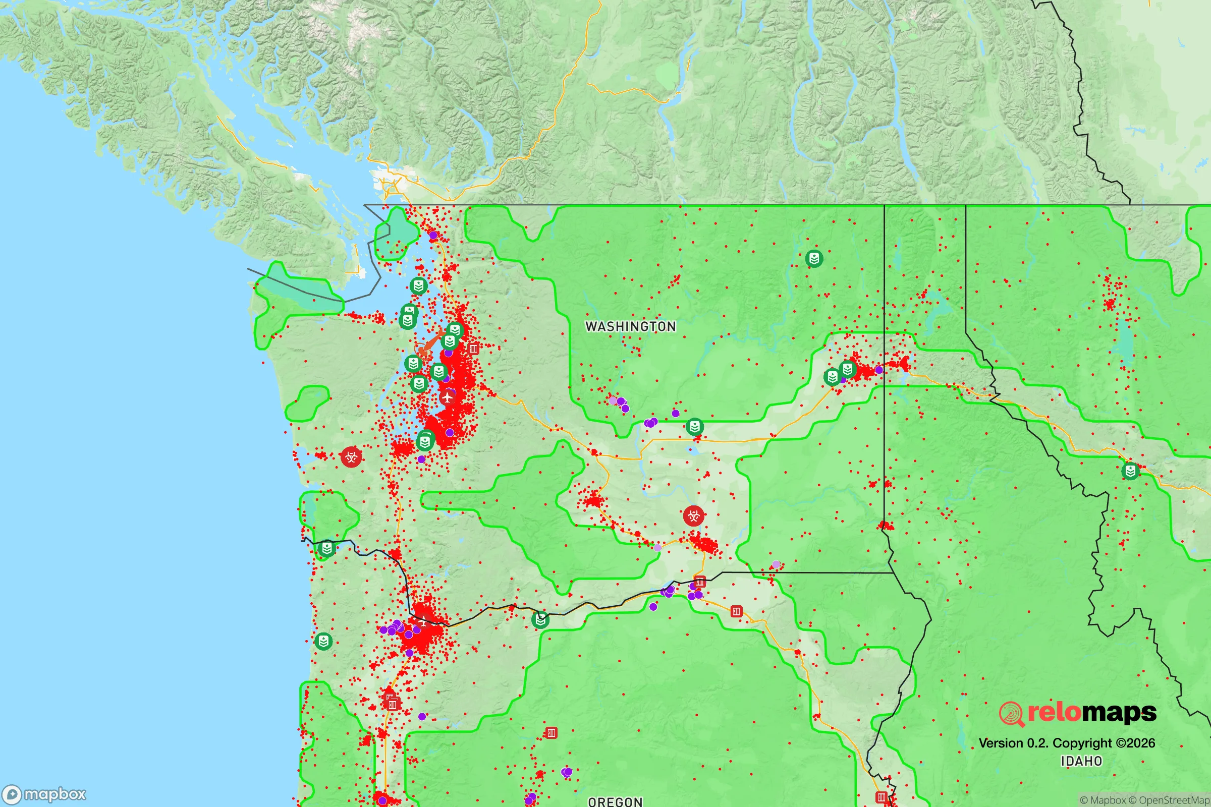
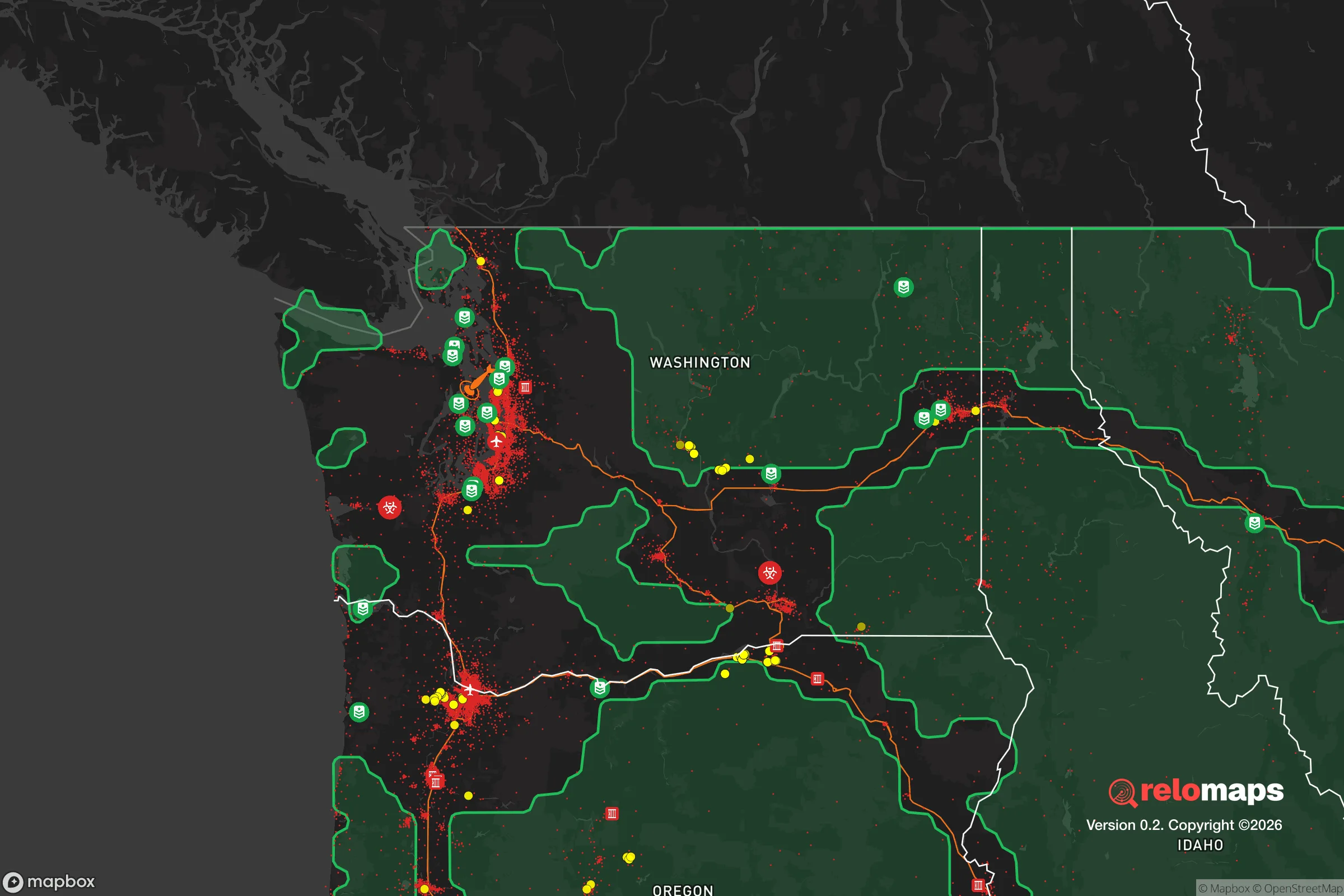


Important Note: For informational purposes only. This does not mean nothing bad ever happens in the green zones. Please use common sense. This is based on public data and modeled with AI. We tried to take a conservative approach but mistakes happen. We update this regularly as new information becomes available.
Solar Generator Recommendations
Backup power matters more here than in safer locations. We've picked three solar generators across budgets and capacity tiers — start with the budget unit if you only need a few essentials, or step up if you want to run a fridge and HVAC for days at a time.

Jackery Portable Power Station Explorer 300
Budget OptionPower on the Go: Weighing only 11 lbs, it's convenient to set up and store with book-sized foldable solar panels

BLUETTI Portable Power Station AC180
Designed for both indoor and outdoor scenarios, AC180 is highly capable as it has a robost capacity and continuous output power.

EF ECOFLOW DELTA Pro Ultra Power Station
Upgraded PickEcoFlow DELTA Pro Ultra is a whole-home energy system designed to grow with your family. Integrated with the Smart Home Panel 2, it scales to meet your evolving energy needs — keeping your home powered, intelligent, and secure through every stage of life.
We earn a commission, at no additional cost to you.
Strategic Assessment Analysis
Sequim, Washington occupies a distinctive strategic position on the Olympic Peninsula that combines genuine geographic isolation with practical access to critical infrastructure, making it a location worth serious consideration for those prioritizing disaster readiness and long-term self-sufficiency. The area’s rain shadow effect, limited population density, and distance from major metropolitan centers create a resilience profile that is rare in the Pacific Northwest, though not without its own vulnerabilities. For a relocator thinking in terms of decades rather than years, Sequim offers a foundation that can be built upon, provided the specific risks and logistical realities are understood and planned for.
Geographic position and natural advantages for long-term security
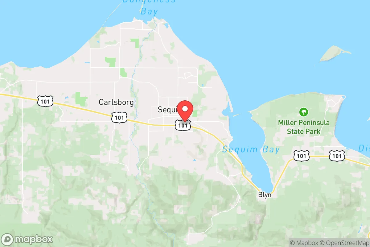
Sequim sits in the rain shadow of the Olympic Mountains, receiving roughly 15-18 inches of precipitation annually—comparable to Los Angeles—while areas just 20 miles west receive over 100 inches. This microclimate is a critical advantage for anyone pursuing food self-sufficiency, as it allows for reliable gardening, orchard establishment, and livestock management without the constant moisture challenges that plague much of western Washington. The area’s location on the northern edge of the Olympic Peninsula places it roughly 60 miles from the Seattle metropolitan area as the crow flies, but the actual travel time via the Hood Canal Bridge and I-5 is closer to 90 minutes under normal conditions—and significantly longer if that bridge becomes impassable. The Olympic Peninsula itself functions as a natural redoubt, bounded by the Strait of Juan de Fuca to the north, the Pacific Ocean to the west, and the Hood Canal and Puget Sound to the east. The only practical road access to the rest of Washington is via US-101 south through Olympia or the Hood Canal Bridge, both of which are chokepoints that could be controlled or compromised. For a relocator, this isolation is a double-edged sword: it provides natural defensibility and reduces exposure to cascading failures from urban centers, but it also means that supply chains, medical evacuation, and outside assistance are all contingent on those same narrow corridors. The Olympic Mountains to the south and west offer additional buffer from seismic and tsunami risks that affect the outer coast, though Sequim itself is not immune to earthquake hazards.
Risks, exposures, and proximity to fallout-relevant landmarks
The most significant risk for Sequim is seismic. The Cascadia Subduction Zone, capable of producing a magnitude 9.0+ earthquake, lies approximately 100 miles offshore. A full-rupture event would generate strong shaking across the Olympic Peninsula, with liquefaction risks in low-lying areas near the Dungeness River and Sequim Bay. The tsunami threat is minimal for Sequim proper—the Strait of Juan de Fuca and the Olympic Mountains provide substantial protection—but coastal communities like Port Angeles and Neah Bay would be directly impacted. More immediately relevant to a strategic assessment is the area’s proximity to the Puget Sound Naval Shipyard in Bremerton, approximately 50 miles southeast. This facility is a primary maintenance and refit location for nuclear-powered aircraft carriers and submarines, making it a potential target in any conflict involving strategic assets. The Bangor Naval Base, home to the US Navy’s West Coast Trident submarine fleet, is roughly 60 miles east near Silverdale. While Sequim is far enough from these installations to avoid direct blast effects, fallout patterns from a nuclear event at either facility—or from a broader conflict—would depend entirely on prevailing winds, which in this region are predominantly from the southwest. That means fallout from Bremerton or Bangor would likely be carried northeast, away from Sequim, but a detonation farther west or a change in wind direction could change that calculus. The Hanford Nuclear Reservation, 200 miles southeast, is another consideration, though its distance and the prevailing wind patterns make it a lower-probability concern. For the relocator, the key takeaway is that Sequim’s isolation from major military and industrial targets is a genuine advantage, but it is not absolute, and any serious preparedness plan must account for the possibility of regional contamination events.
Practical resilience for a relocator: food, water, energy, and defensibility
Sequim’s practical resilience is where the area truly distinguishes itself. The rain shadow climate means that solar energy is viable year-round, with the region receiving roughly 2,500 hours of sunlight annually—comparable to Portland and better than Seattle. This makes off-grid solar power a realistic option, particularly when paired with battery storage and a backup generator for the extended overcast periods common in winter. Water availability is excellent: the Dungeness River and its aquifer provide abundant freshwater, and the area’s annual precipitation, while low for western Washington, still averages 15-18 inches, enough to support rainwater catchment systems for non-potable uses. The local agricultural scene is robust, with the Dungeness Valley producing hay, lavender, berries, and livestock. The Sequim-Dungeness Valley is one of the few places in western Washington where dryland farming is practical, and the growing season is long enough for most temperate crops. For those serious about food self-sufficiency, the area supports orchards (apples, pears, plums, cherries), vineyards, and small-scale grain production. The local food infrastructure includes the Sequim Farmers Market, several U-pick operations, and a growing network of small farms that sell directly to consumers. Defensibility is a mixed picture. The natural chokepoints—the Hood Canal Bridge and US-101 south—provide strategic depth, but they also mean that any determined adversary could effectively isolate the peninsula. Within Sequim itself, the terrain is relatively flat and open, with limited natural cover. The population of roughly 8,000 in the city proper, and about 30,000 in the greater Sequim-Dungeness area, is small enough to avoid the resource competition of a major metro but large enough to have a functioning local economy and medical infrastructure. The Olympic Medical Center in Port Angeles, 15 miles west, provides emergency and surgical care, though major trauma would require evacuation to Seattle or Tacoma—a trip that could become impossible in a crisis.
The overall strategic picture for Sequim is one of genuine but conditional resilience. The area offers a rare combination of favorable climate for self-sufficiency, abundant natural resources, and geographic isolation from the most obvious threats facing the Pacific Northwest. The rain shadow, the Olympic Mountains, and the distance from major military and industrial targets create a buffer that few other locations in the region can match. However, that same isolation becomes a liability if the Hood Canal Bridge fails—whether from an earthquake, a deliberate act, or simple age—or if a regional event contaminates the Dungeness River watershed. For the relocator who is willing to invest in redundant systems—solar with battery backup, a well or rainwater catchment, a year’s supply of stored food, and a community network of like-minded neighbors—Sequim provides a foundation that can be built into a genuinely resilient long-term home. It is not a bunker, and it is not immune to the risks that face the entire Pacific Northwest. But for someone looking for a place that balances access to modern amenities with the capacity for genuine self-reliance, Sequim deserves a serious look. The key is to go in with eyes open, plan for the specific vulnerabilities, and build the relationships and infrastructure that turn a good location into a secure one.

* Values derived from national, state, county, city and local statistics and may differ in a specific area. Last updated: 2026-10-29T04:34:41.000Z
Narrative content on this page is AI-generated and may contain mistakes. Verify any details that matter before acting on them.
ReloMaps may earn a commission from affiliate links at no extra cost to you.

