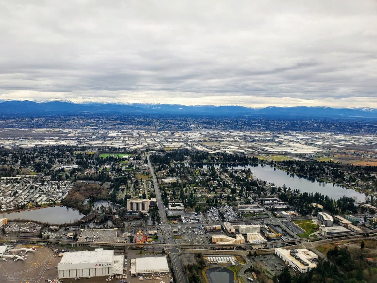
Photo: Wikipedia
Strategic Assessment of Seatac, WA
High tactical risk. This location is likely close to major population centers, strategic targets, or sits in a high-disaster corridor. A retreat property and careful exit planning is required.
What does the Strategic Assessment tell us?
Our Strategic Assessment grades tactical survivability of an area. Major population centers, military targets, fallout zones, natural disasters, and border exposure all drive risk — lower exposure means a more defensible position in a crisis.
This is heavily inspired by Joel Skousen's Strategic Relocation book. Highly recommended you checkout the book ($)What does this tell us?
Our Strategic Assessment grades tactical survivability of an area. Major population centers, military targets, fallout zones, natural disasters, and border exposure all drive risk — lower exposure means a more defensible position in a crisis.
This is heavily inspired by Joel Skousen's Strategic Relocation book. Highly recommended you checkout the book ($)Strategic Pillars

Key Distances
Regional Safe Places
Below is our recommended "safe zones" in Washington and the surrounding area based on our strategic heuristics. For most people, it's unrealistic to live in a “safe zone” full-time due to work, family or other personal reasons. They tend to be more rural. However, many of these areas are perfect for second homes and retreat properties that double as a vacation home or even a short-term rental.
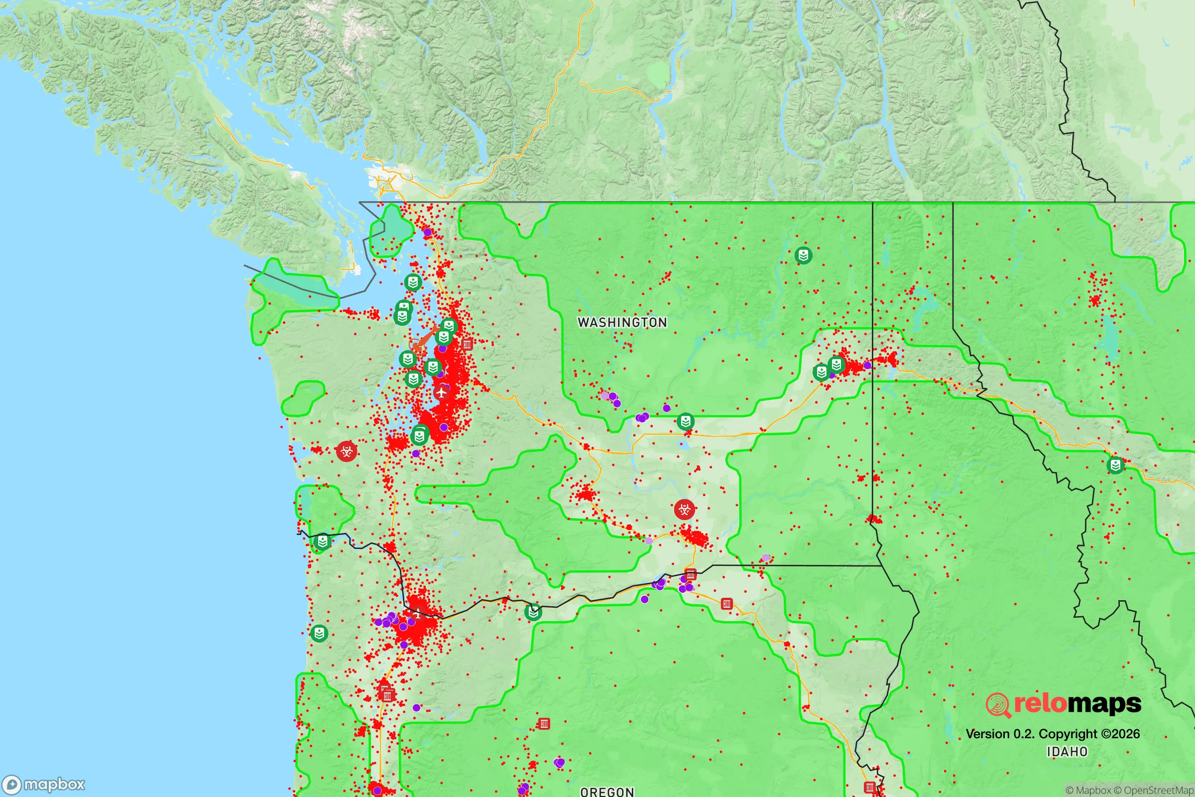
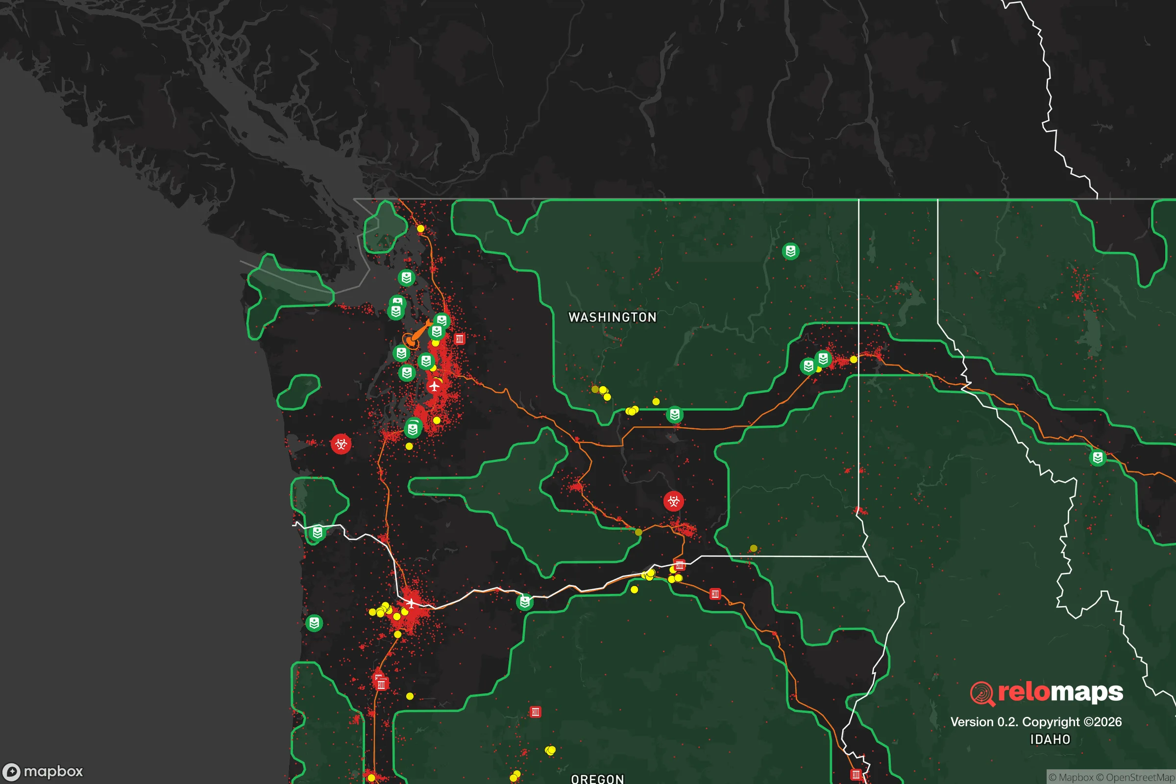


Important Note: For informational purposes only. This does not mean nothing bad ever happens in the green zones. Please use common sense. This is based on public data and modeled with AI. We tried to take a conservative approach but mistakes happen. We update this regularly as new information becomes available.
Solar Generator Recommendations
Backup power matters more here than in safer locations. We've picked three solar generators across budgets and capacity tiers — start with the budget unit if you only need a few essentials, or step up if you want to run a fridge and HVAC for days at a time.

Jackery Portable Power Station Explorer 300
Budget OptionPower on the Go: Weighing only 11 lbs, it's convenient to set up and store with book-sized foldable solar panels

BLUETTI Portable Power Station AC180
Designed for both indoor and outdoor scenarios, AC180 is highly capable as it has a robost capacity and continuous output power.

EF ECOFLOW DELTA Pro Ultra Power Station
Upgraded PickEcoFlow DELTA Pro Ultra is a whole-home energy system designed to grow with your family. Integrated with the Smart Home Panel 2, it scales to meet your evolving energy needs — keeping your home powered, intelligent, and secure through every stage of life.
We earn a commission, at no additional cost to you.
Strategic Assessment Analysis
SeaTac, Washington, sits in a precarious strategic position that demands a hard-nosed assessment for anyone serious about long-term preparedness. While its location offers undeniable logistical advantages for mobility and supply access, the city’s proximity to Seattle, a major international airport, and critical infrastructure makes it a high-risk zone for anyone prioritizing resilience against civic unrest, mass casualty events, or large-scale disasters. For the conservative prepper or survivalist, SeaTac is a hub of convenience that comes with a heavy price tag in terms of vulnerability.
Geographic position and natural advantages for a prepper
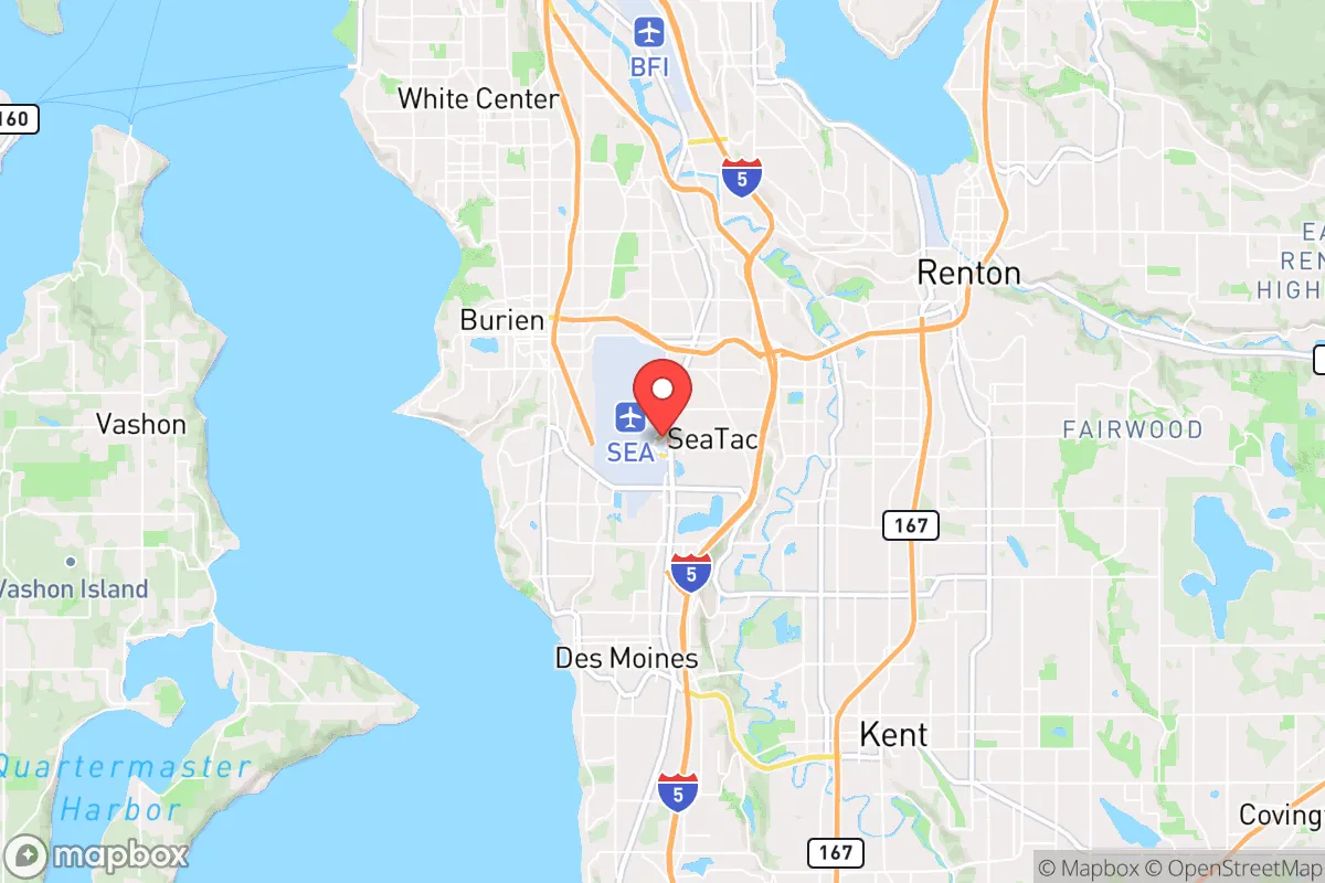
SeaTac’s primary strategic asset is its location at the intersection of major transportation corridors. It sits directly on Interstate 5, the spine of the West Coast, and is home to Seattle-Tacoma International Airport (SEA), one of the busiest airports in the country. For a relocator, this means rapid egress by air or road if you have the means and timing right. The city also lies within a short drive of the Port of Tacoma and the Port of Seattle, giving access to maritime supply chains. On the natural side, the area benefits from the Puget Sound’s temperate maritime climate—mild winters and moderate summers reduce the risk of extreme temperature-related survival challenges. Fresh water is abundant from the nearby Green River and numerous lakes, including Angle Lake and Des Moines Creek. However, the region’s volcanic and seismic activity is a major wildcard. Mount Rainier, a stratovolcano visible from SeaTac, poses a lahar (volcanic mudflow) threat that could devastate the valleys leading to the Puget Sound lowlands. The Cascadia Subduction Zone also looms, capable of generating a magnitude 9.0 earthquake and a subsequent tsunami that would hammer the coast and disrupt all infrastructure inland. For a prepper, these natural hazards are not abstract—they are recurring, predictable threats that demand serious mitigation planning.
Risks, exposures, and proximity to fallout-relevant landmarks
The most glaring vulnerability for SeaTac is its proximity to high-value, high-risk targets. SeaTac is effectively a suburb of Seattle, a major population center with a dense urban core, tech headquarters (Amazon, Microsoft), and a politically charged environment that has seen significant civil unrest in recent years. In a scenario of widespread civic breakdown, SeaTac would be a primary chokepoint for people fleeing Seattle, making it a likely zone for looting, roadblocks, and conflict over resources. The airport itself is a double-edged sword: it’s a potential evacuation point, but it’s also a prime target for terrorism, mass casualty events, or a government-directed quarantine zone during a pandemic or biological incident. The city is also ringed by military and industrial infrastructure. Joint Base Lewis-McChord (JBLM) is about 30 miles south, a major Army and Air Force installation that could become a focal point for federal mobilization or, in a worst-case scenario, a contested asset. The Boeing Renton Factory, which produces commercial aircraft, is just north, and the Puget Sound Naval Shipyard in Bremerton is a strategic naval asset. Any major conflict or national emergency would make these sites magnets for attack or occupation. For the survivalist, living within a 10-mile radius of these landmarks means being in the blast radius—literally or figuratively—of any coordinated disruption.
Practical resilience for a relocator: food, water, energy, and defensibility
When you break down the practicalities of daily survival in SeaTac, the picture is mixed. Water is not a problem—the region gets over 37 inches of rain annually, and you can collect rainwater easily, though you’ll need filtration for pathogens. The public water supply comes from the Cedar River and Tolt River watersheds, which are well-managed but vulnerable to earthquake disruption. A backup well or a high-capacity rain catchment system is a must. Food security is a challenge because SeaTac is urbanized with limited agricultural land. The best bet is to establish relationships with farms in the Snoqualmie Valley or the Skagit Valley to the north, but those are a 45-minute to 2-hour drive in normal conditions. In a collapse, that supply line would be cut. Community gardens exist, but they’re small and not defensible. Energy is a weak point. The grid is served by Puget Sound Energy, which relies on hydroelectric dams (like the Columbia River dams) and natural gas. A major earthquake could knock out both for weeks. Solar is viable but limited by cloud cover—you’ll need a robust battery system and possibly a backup generator with stored fuel. Defensibility is poor for a single family or small group. SeaTac is a dense, flat suburban area with a mix of single-family homes, apartments, and commercial strips. There are no natural chokepoints or high ground to control. Your best bet is a home on a cul-de-sac with a fenced yard and reinforced doors, but you’re still surrounded by neighbors who may not share your preparedness mindset. The city’s police force is part of the King County Sheriff’s Office contract, and response times in a crisis would be measured in hours, not minutes. For a relocator, the practical takeaway is that SeaTac is a logistics hub, not a redoubt. You can live here if you’re willing to invest heavily in on-site supplies, fortification, and a rapid evacuation plan to a more defensible rural property east of the Cascades or in the Olympic Peninsula.
Overall, SeaTac presents a strategic paradox for the conservative prepper. It offers unmatched access to transportation and supply chains, but that same connectivity makes it a target-rich environment for any large-scale disruption. The natural risks from earthquakes and volcanoes are real and recurring, while the man-made risks from civil unrest and proximity to critical infrastructure are amplified by the city’s density and political climate. If your goal is to ride out a crisis in place, SeaTac is a poor choice—you’re too close to too many things that can go wrong. If your strategy is mobility and you have the resources to bug out quickly by air or road, it could serve as a temporary staging point. But for long-term resilience, look further south toward more rural areas of Pierce or Thurston counties, or better yet, across the mountains into eastern Washington. SeaTac is a place to pass through, not to dig in.

* Values derived from national, state, county, city and local statistics and may differ in a specific area. Last updated: 2026-04-21T11:15:05.000Z
Narrative content on this page is AI-generated and may contain mistakes. Verify any details that matter before acting on them.
ReloMaps may earn a commission from affiliate links at no extra cost to you.

