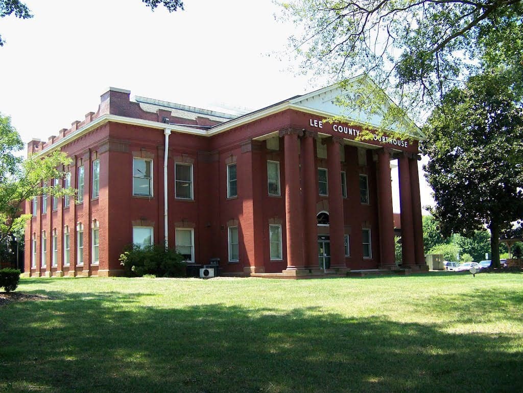
Photo: Wikipedia
Strategic Assessment of Sanford, NC
Meaningful friction. Expect exposure to either population pressure, blast zones, or natural disaster risk. Consider buying a retreat property.
What does the Strategic Assessment tell us?
Our Strategic Assessment grades tactical survivability of an area. Major population centers, military targets, fallout zones, natural disasters, and border exposure all drive risk — lower exposure means a more defensible position in a crisis.
This is heavily inspired by Joel Skousen's Strategic Relocation book. Highly recommended you checkout the book ($)What does this tell us?
Our Strategic Assessment grades tactical survivability of an area. Major population centers, military targets, fallout zones, natural disasters, and border exposure all drive risk — lower exposure means a more defensible position in a crisis.
This is heavily inspired by Joel Skousen's Strategic Relocation book. Highly recommended you checkout the book ($)Strategic Pillars

Key Distances
Regional Safe Places
Below is our recommended "safe zones" in North Carolina and the surrounding area based on our strategic heuristics. For most people, it's unrealistic to live in a “safe zone” full-time due to work, family or other personal reasons. They tend to be more rural. However, many of these areas are perfect for second homes and retreat properties that double as a vacation home or even a short-term rental.


Important Note: For informational purposes only. This does not mean nothing bad ever happens in the green zones. Please use common sense. This is based on public data and modeled with AI. We tried to take a conservative approach but mistakes happen. We update this regularly as new information becomes available.
Solar Generator Recommendations
Backup power matters more here than in safer locations. We've picked three solar generators across budgets and capacity tiers — start with the budget unit if you only need a few essentials, or step up if you want to run a fridge and HVAC for days at a time.

Jackery Portable Power Station Explorer 300
Budget OptionPower on the Go: Weighing only 11 lbs, it's convenient to set up and store with book-sized foldable solar panels

BLUETTI Portable Power Station AC180
Designed for both indoor and outdoor scenarios, AC180 is highly capable as it has a robost capacity and continuous output power.

EF ECOFLOW DELTA Pro Ultra Power Station
Upgraded PickEcoFlow DELTA Pro Ultra is a whole-home energy system designed to grow with your family. Integrated with the Smart Home Panel 2, it scales to meet your evolving energy needs — keeping your home powered, intelligent, and secure through every stage of life.
We earn a commission, at no additional cost to you.
Strategic Assessment Analysis
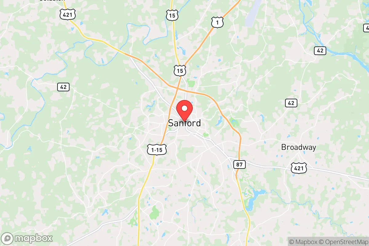
Sanford, North Carolina, sits in a strategic sweet spot that resilience-minded relocators should take seriously: far enough from the major metropolitan blast zones to offer genuine buffer, yet close enough to access critical infrastructure when needed. Located in Lee County, roughly 40 miles southwest of Raleigh and 30 miles northwest of Fayetteville, Sanford occupies the Sandhills region—a geological zone of sandy soil, pine forests, and rolling terrain that historically resisted the sprawl of the Triangle. For someone weighing relocation with an eye toward civic unrest, mass casualty events, or long-term grid-down scenarios, Sanford presents a mixed but workable picture: decent natural advantages, moderate exposure to fallout-relevant targets, and a community that still retains a rural-industrial character rather than a purely suburban bedroom-commuter identity.
Geographic position and natural advantages for long-term stability
Sanford’s location in the Sandhills gives it a few underappreciated physical advantages. The sandy, well-drained soil means flooding is far less of a concern than in the Piedmont clay zones to the west or the coastal plain to the east—important for anyone thinking about road passability after heavy rain or hurricane remnants. The region sits at an elevation of roughly 350–400 feet, which is high enough to avoid storm surge from hurricanes that push up the Cape Fear River basin, but low enough to have reliable groundwater access. The surrounding terrain is a mix of loblolly pine stands, small farms, and creeks that feed into the Deep River, a tributary of the Cape Fear. That river system provides a natural water source, though it’s not a major navigable waterway—meaning it’s less likely to be a target for disruption than the Neuse or the Roanoke. For a relocator thinking about defensibility, the pine forests offer decent cover and firewood, but the sandy soil makes digging fighting positions or bunkers relatively easy compared to clay-heavy areas. The climate is humid subtropical, with hot summers and mild winters—no deep freeze to worry about for water pipes or livestock, but enough seasonal variation to require a solid wood stove or backup heat plan.
Risks, exposures, and proximity to fallout-relevant landmarks
Sanford’s biggest strategic weakness is its proximity to two major military installations: Fort Liberty (formerly Fort Bragg) to the southwest and Pope Army Airfield, both about 30–35 miles away. In a mass casualty event or large-scale conflict scenario, those bases are high-value targets for kinetic or cyber attack, and the fallout—literal or figurative—could ripple into Lee County. Additionally, the Raleigh-Durham metropolitan area, with its Research Triangle Park, major hospitals, and state government infrastructure, lies 40 miles northeast. That’s close enough that a major event in the Triangle—whether a dirty bomb, a pandemic surge, or civil unrest—could send refugees streaming down US-1 and NC-87 into Sanford. The town itself has no obvious high-value targets: no nuclear power plants (the closest is Harris Nuclear Plant near New Hill, about 25 miles north), no major military depots, and no large-scale chemical facilities. The railroad line running through Sanford (the Aberdeen, Carolina and Western Railway) is a secondary freight route, not a major hazmat corridor. For a prepper, the calculus is that Sanford is close enough to danger to be affected, but far enough that you have time to react—provided you have a plan and a vehicle with a full tank. The biggest natural risk is hurricane-spawned tornadoes and the occasional ice storm, both of which can knock out power for days. The sandy soil also means well water can be finicky; many older homes rely on shallow wells that can go dry in a prolonged drought.
Practical resilience for a relocator: food, water, energy, and defensibility
For someone serious about self-sufficiency, Sanford offers a workable baseline but requires deliberate investment. The agricultural land in Lee County is mostly row crops (corn, soybeans, tobacco) and some pasture, but the sandy soil isn’t the richest in the state—you’ll need to amend heavily for a productive garden. That said, the growing season is long (roughly April to October), and there are several local farms and a farmers’ market that could serve as supply lines in a partial grid-down scenario. Water is the bigger concern: municipal water comes from the Deep River and is treated at the Sanford Water Treatment Plant, which is a single-point-of-failure vulnerability. A well is strongly recommended for any relocator, but drilling depths vary—expect 100–200 feet in most of the Sandhills, with yields that can be marginal. Rainwater catchment is viable given the 45–50 inches of annual precipitation, but you’ll need storage capacity. For energy, the grid is served by Duke Energy Progress, and outages are common during storms. Solar is feasible—the region gets about 210 sunny days per year—but tree cover in the pine forests can limit roof exposure. Propane is widely available for backup generation. Defensibility is moderate: Sanford is a small city (population roughly 30,000) with a downtown grid layout, but the outskirts offer rural acreage with good sightlines and limited road access. The main highways (US-1, US-421, NC-87) are choke points that could be monitored or blocked, but they also mean you’re not trapped. The local population skews older and more conservative than the Triangle, which in a crisis scenario could mean stronger community cohesion—but also less willingness to share resources with newcomers. Building relationships before a crisis is essential.
The overall strategic picture for Sanford is one of cautious viability for the resilience-minded relocator. It’s not a hardened redoubt like the Appalachian highlands, nor a remote off-grid paradise in the mountains. What it offers is a middle-ground position: close enough to urban resources to stock up and maintain a professional income, but far enough from the highest-risk targets to buy you time and options. The Sandhills terrain provides decent natural cover and water access, the climate is manageable, and the local economy—anchored by manufacturing (Caterpillar, Pfizer, and several metal fabrication shops) and agriculture—means there’s a working-class ethos rather than a purely service-sector dependence. The downsides are real: proximity to Fort Liberty and the Triangle, a single-source municipal water system, and soil that requires work for food production. For a single individual or a family willing to drill a well, install solar, and build a network of like-minded neighbors, Sanford can work as a long-term base. But it demands active preparation, not passive hope. If you’re looking for a place that balances access with buffer, and you’re willing to put in the sweat equity, Sanford deserves a serious look—just don’t expect it to save you without your own effort.
* Values derived from national, state, county, city and local statistics and may differ in a specific area. Last updated: 2026-05-03T20:26:32.000Z
Narrative content on this page is AI-generated and may contain mistakes. Verify any details that matter before acting on them.
ReloMaps may earn a commission from affiliate links at no extra cost to you.