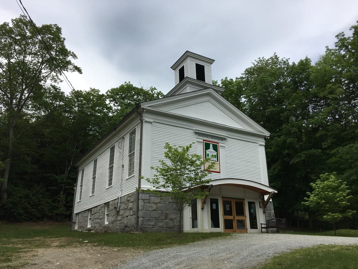
Photo: Wikipedia
Strategic Assessment of Sandisfield, MA
Meaningful friction. Expect exposure to either population pressure, blast zones, or natural disaster risk. Consider buying a retreat property.
What does the Strategic Assessment tell us?
Our Strategic Assessment grades tactical survivability of an area. Major population centers, military targets, fallout zones, natural disasters, and border exposure all drive risk — lower exposure means a more defensible position in a crisis.
This is heavily inspired by Joel Skousen's Strategic Relocation book. Highly recommended you checkout the book ($)What does this tell us?
Our Strategic Assessment grades tactical survivability of an area. Major population centers, military targets, fallout zones, natural disasters, and border exposure all drive risk — lower exposure means a more defensible position in a crisis.
This is heavily inspired by Joel Skousen's Strategic Relocation book. Highly recommended you checkout the book ($)Strategic Pillars

Key Distances
Regional Safe Places
Below is our recommended "safe zones" in Massachusetts and the surrounding area based on our strategic heuristics. For most people, it's unrealistic to live in a “safe zone” full-time due to work, family or other personal reasons. They tend to be more rural. However, many of these areas are perfect for second homes and retreat properties that double as a vacation home or even a short-term rental.
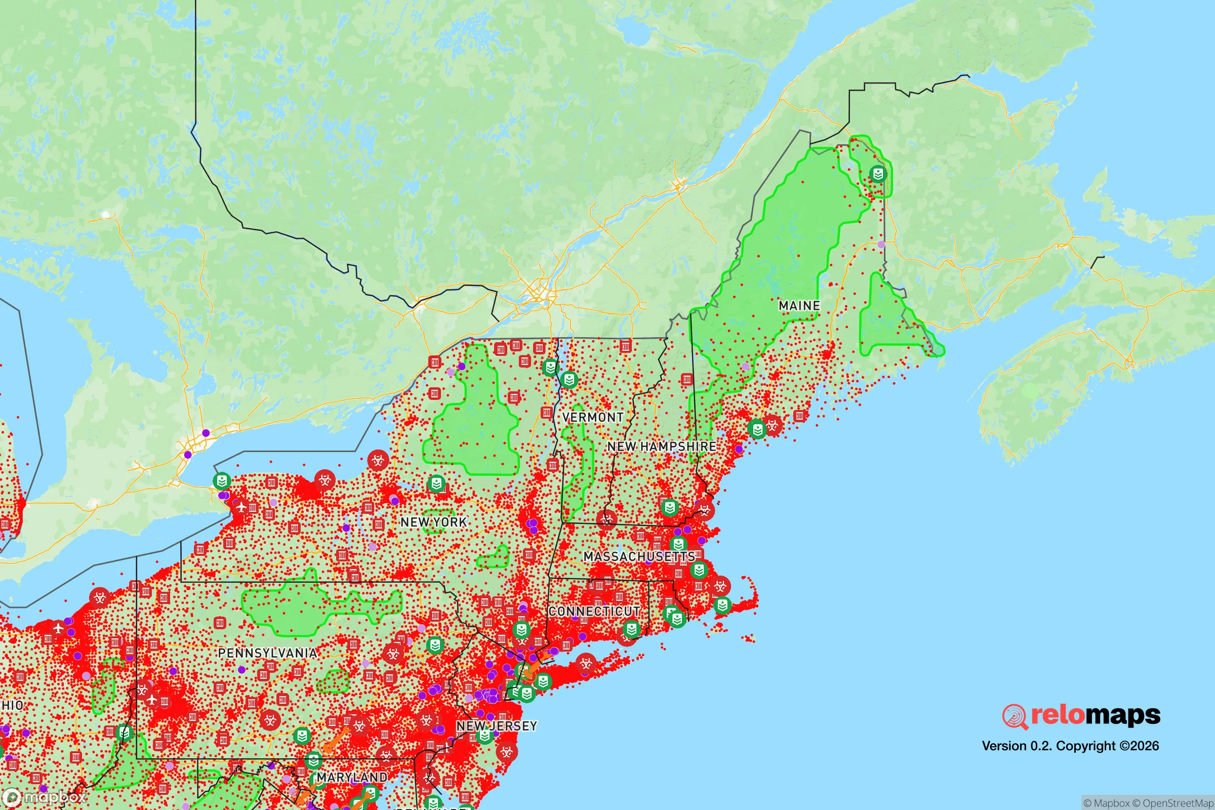
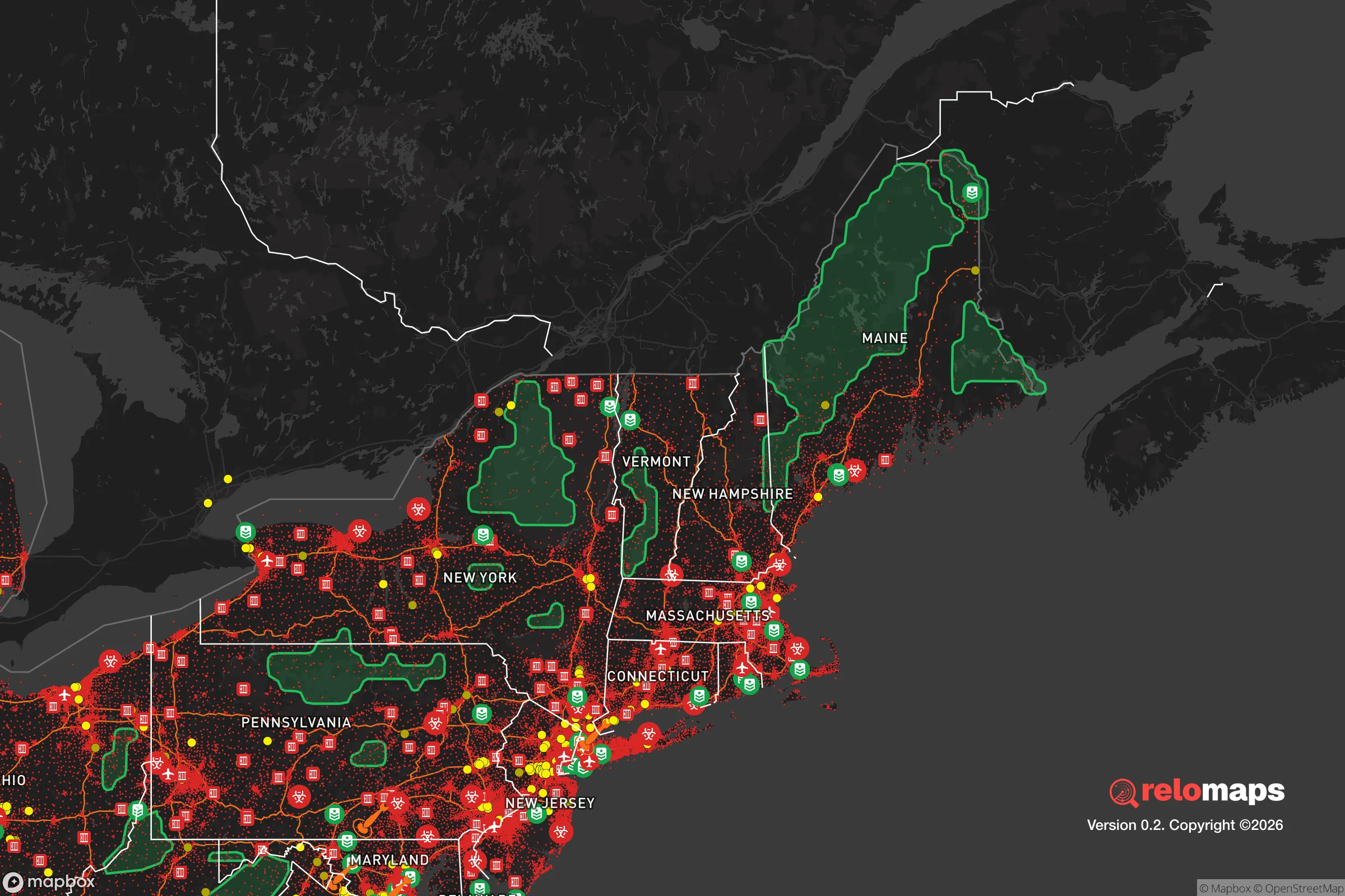


Important Note: For informational purposes only. This does not mean nothing bad ever happens in the green zones. Please use common sense. This is based on public data and modeled with AI. We tried to take a conservative approach but mistakes happen. We update this regularly as new information becomes available.
Solar Generator Recommendations
Backup power matters more here than in safer locations. We've picked three solar generators across budgets and capacity tiers — start with the budget unit if you only need a few essentials, or step up if you want to run a fridge and HVAC for days at a time.

Jackery Portable Power Station Explorer 300
Budget OptionPower on the Go: Weighing only 11 lbs, it's convenient to set up and store with book-sized foldable solar panels

BLUETTI Portable Power Station AC180
Designed for both indoor and outdoor scenarios, AC180 is highly capable as it has a robost capacity and continuous output power.

EF ECOFLOW DELTA Pro Ultra Power Station
Upgraded PickEcoFlow DELTA Pro Ultra is a whole-home energy system designed to grow with your family. Integrated with the Smart Home Panel 2, it scales to meet your evolving energy needs — keeping your home powered, intelligent, and secure through every stage of life.
We earn a commission, at no additional cost to you.
Strategic Assessment Analysis
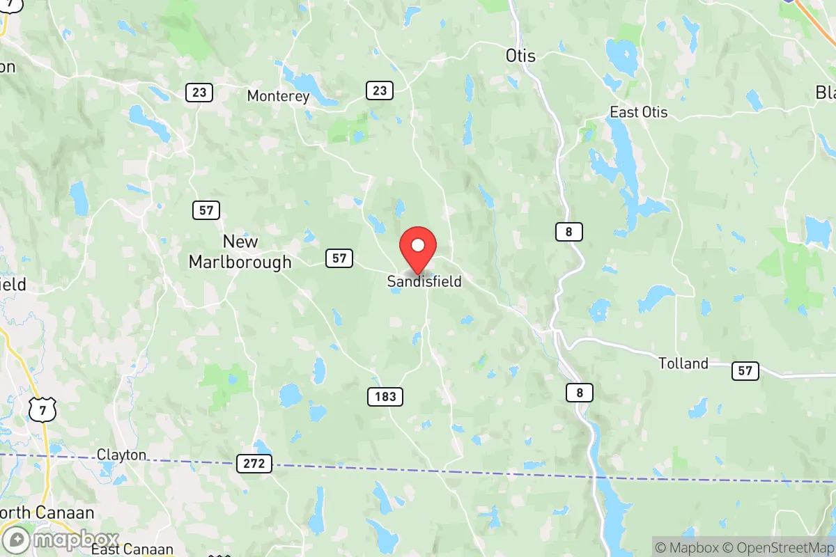
Sandisfield, Massachusetts, offers a compelling strategic profile for the relocation-minded reader prioritizing resilience and self-sufficiency, largely due to its position in the remote, forested hills of the Berkshires. This town of roughly 900 residents sits at a deliberate distance from major population centers—about 30 miles from Springfield, 50 from Hartford, and 120 from Boston—placing it outside the immediate blast and fallout zones of any high-value target while still being within a day's drive of essential supply chains. Its elevation, rugged terrain, and low population density create a natural buffer against the cascading failures that would overwhelm suburban and urban areas, making it a location worth serious consideration for those who value preparedness over convenience.
Geographic position and natural advantages for long-term security
Sandisfield's location in the southern Berkshires provides several structural advantages that are difficult to replicate. The town sits atop the Taconic Range, with elevations ranging from 1,000 to over 2,000 feet, which offers natural drainage, cooler summer temperatures, and a degree of isolation from floodplains and coastal storm surges. The surrounding landscape is dominated by the 10,000-acre Sandisfield State Forest and the Tolland State Forest, creating a contiguous block of undeveloped woodland that acts as a physical and visual buffer. This forest cover also provides a renewable source of firewood, building materials, and game, all critical for a post-disruption scenario. The area's numerous small streams and ponds—including the headwaters of the Farmington River—offer reliable freshwater sources that are less likely to be contaminated by industrial runoff or agricultural chemicals than those in the Connecticut River Valley. For a relocator, the key takeaway is that Sandisfield's geography inherently limits the speed and scale of any external threat, whether natural or man-made, by forcing it to traverse difficult terrain and sparse road networks.
Risk exposure, fallout proximity, and man-made threat assessment
While Sandisfield avoids the worst of coastal hurricane impacts and is not in a designated flood zone, it is not without risks. The primary natural hazard is winter storms, which can drop 60-80 inches of snow annually and create prolonged power outages—a scenario that tests any off-grid setup. The town sits in a moderate seismic zone, but the risk of a damaging earthquake is low compared to the West Coast. The more significant concern for the strategic relocator is proximity to man-made threats. Sandisfield lies roughly 40 miles west of the Springfield Armory and the Bradley Air National Guard Base, and about 50 miles from the Hartford-New Haven corridor, which includes the Millstone Nuclear Power Station in Connecticut. In a major conflict or terrorist event, these are plausible targets for conventional or nuclear strikes. However, the prevailing winds in western Massachusetts blow from the west and northwest, meaning that fallout from a strike on Springfield or Hartford would likely be carried east and northeast, away from Sandisfield. The town is also far from the major interstate highways (I-90 is 20 miles north, I-84 is 25 miles south), reducing the risk of refugee flows or military convoys passing through. The nearest rail line is the Housatonic Railroad, a freight-only line that runs through Great Barrington, 12 miles west. Overall, the risk profile is moderate: the area is not a direct target, but it is within the outer ring of potential fallout zones from regional infrastructure.
Practical resilience for a relocator: food, water, energy, and defensibility
For a family or individual serious about self-sufficiency, Sandisfield's practical resilience is a mixed bag that requires active preparation. The town has no municipal water system; nearly all homes rely on private wells, which is a major advantage for water security, provided the well is deep enough (100+ feet) and has a hand pump or solar-powered backup. The local soil is rocky and acidic, typical of New England, meaning large-scale gardening is challenging without raised beds and soil amendments. However, the surrounding forests are rich in edible mushrooms, berries, and maple syrup potential, and deer hunting is excellent—the Massachusetts Division of Fisheries and Wildlife estimates deer densities of 15-20 per square mile in the region. For energy, the area has good solar potential despite the tree cover, with about 4.5 peak sun hours per day on average. Wood heat is the dominant backup heating source, and most older homes have functioning fireplaces or wood stoves. The town's road network is sparse—only two main paved roads (Routes 8 and 57) and a handful of gravel roads—which makes it naturally defensible. A single downed tree or washed-out culvert can block access for hours, which is a nuisance in normal times but a strategic asset in a crisis. The nearest hospital is Fairview Hospital in Great Barrington (20 minutes), but for serious trauma, the closest Level 1 trauma center is Baystate Medical Center in Springfield (45 minutes). The local police force is a single officer, and the fire department is volunteer, so emergency response times can be long. For a relocator, the practical takeaway is that Sandisfield offers excellent raw materials for resilience—water, wood, isolation—but requires significant upfront investment in well backup, food storage, and alternative energy to be truly self-sufficient.
The overall strategic picture for Sandisfield is that of a high-potential but high-effort location. It offers genuine geographic protection from the most immediate threats facing the Northeast—coastal flooding, urban unrest, and direct nuclear strikes—while providing the natural resources needed for long-term survival. However, the town's remoteness also means limited access to medical care, supply chains, and community support networks, all of which must be built or stockpiled in advance. For the conservative-leaning relocator who values independence and is willing to invest in infrastructure, Sandisfield represents a solid, if not exceptional, choice. It is not a bug-out location for a weekend; it is a place to build a life that is already prepared for disruption. The key is to treat the move not as an escape, but as a deliberate transition to a more resilient baseline—one that requires work, but offers a genuine return on that investment in security and peace of mind.

* Values derived from national, state, county, city and local statistics and may differ in a specific area. Last updated: 2026-10-20T07:51:46.000Z
Narrative content on this page is AI-generated and may contain mistakes. Verify any details that matter before acting on them.
ReloMaps may earn a commission from affiliate links at no extra cost to you.

