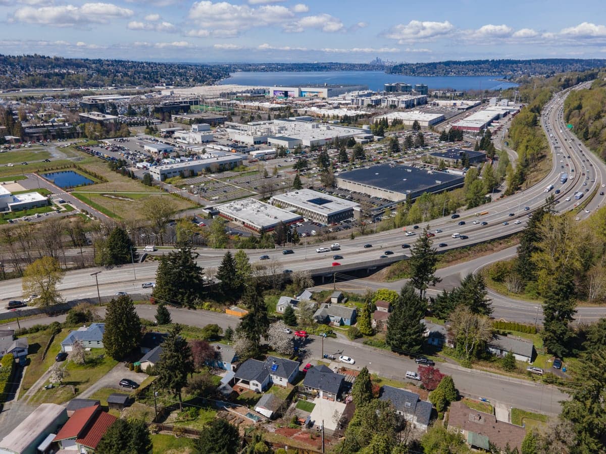
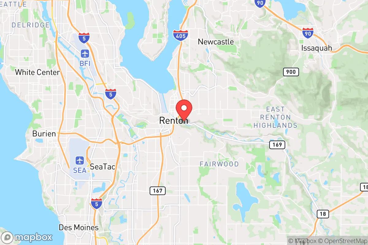
Photo: Wikipedia
Strategic Assessment of Renton, WA
High tactical risk. This location is likely close to major population centers, strategic targets, or sits in a high-disaster corridor. A retreat property and careful exit planning is required.
What does the Strategic Assessment tell us?
Our Strategic Assessment grades tactical survivability of an area. Major population centers, military targets, fallout zones, natural disasters, and border exposure all drive risk — lower exposure means a more defensible position in a crisis.
This is heavily inspired by Joel Skousen's Strategic Relocation book. Highly recommended you checkout the book ($)What does this tell us?
Our Strategic Assessment grades tactical survivability of an area. Major population centers, military targets, fallout zones, natural disasters, and border exposure all drive risk — lower exposure means a more defensible position in a crisis.
This is heavily inspired by Joel Skousen's Strategic Relocation book. Highly recommended you checkout the book ($)Strategic Pillars

Key Distances
Regional Safe Places
Below is our recommended "safe zones" in Washington and the surrounding area based on our strategic heuristics. For most people, it's unrealistic to live in a “safe zone” full-time due to work, family or other personal reasons. They tend to be more rural. However, many of these areas are perfect for second homes and retreat properties that double as a vacation home or even a short-term rental.
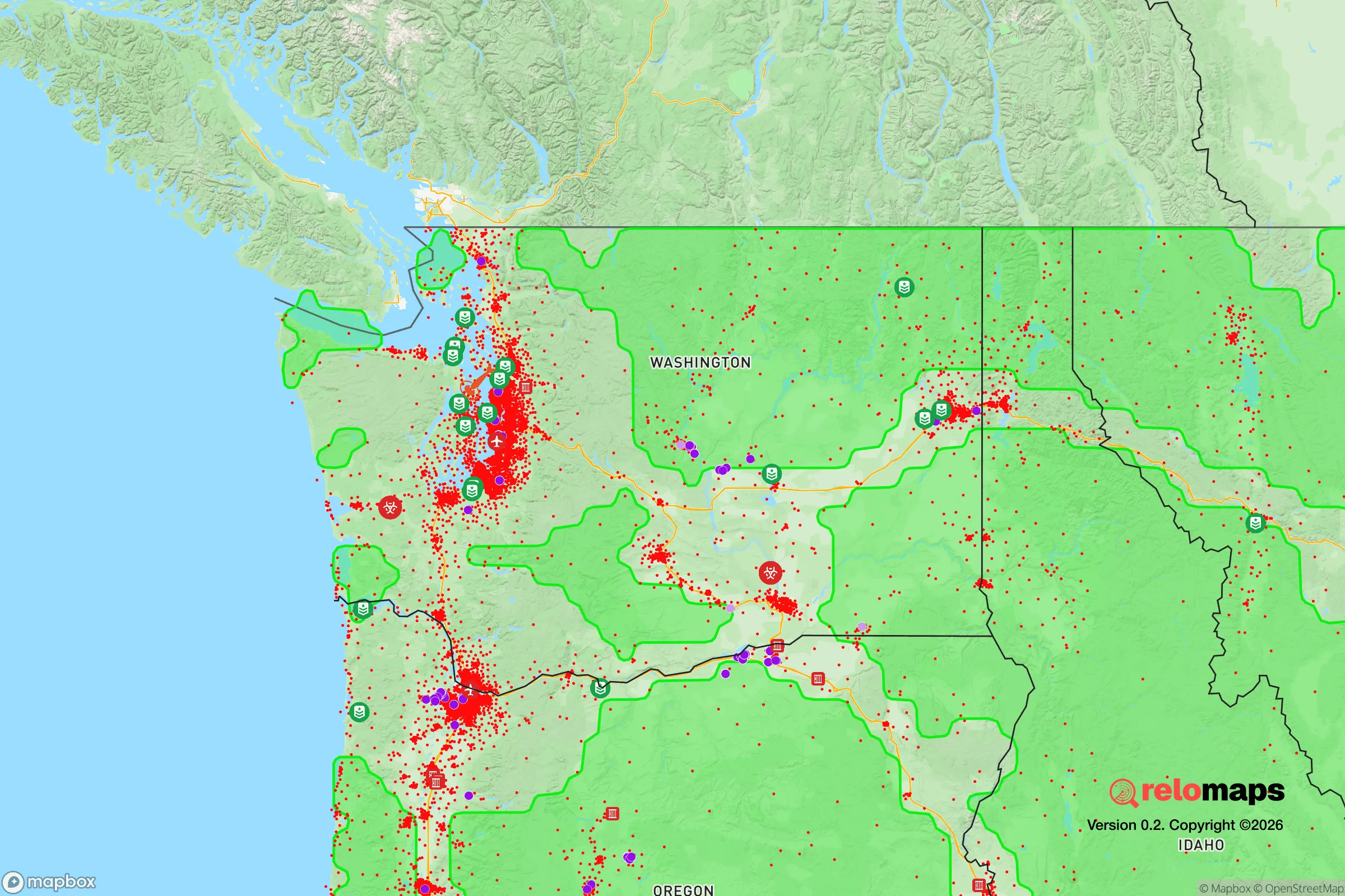
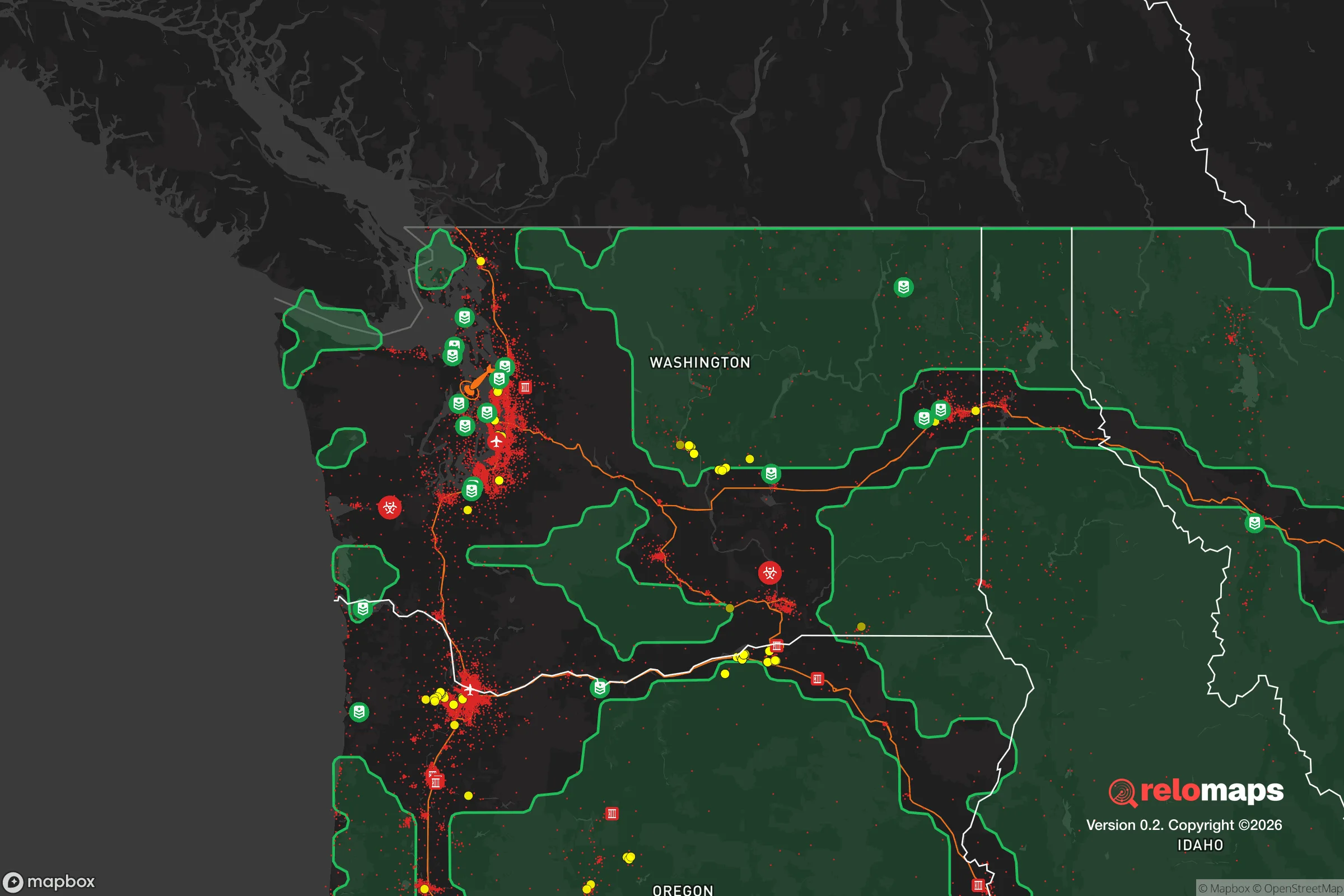


Important Note: For informational purposes only. This does not mean nothing bad ever happens in the green zones. Please use common sense. This is based on public data and modeled with AI. We tried to take a conservative approach but mistakes happen. We update this regularly as new information becomes available.
Solar Generator Recommendations
Backup power matters more here than in safer locations. We've picked three solar generators across budgets and capacity tiers — start with the budget unit if you only need a few essentials, or step up if you want to run a fridge and HVAC for days at a time.

Jackery Portable Power Station Explorer 300
Budget OptionPower on the Go: Weighing only 11 lbs, it's convenient to set up and store with book-sized foldable solar panels

BLUETTI Portable Power Station AC180
Designed for both indoor and outdoor scenarios, AC180 is highly capable as it has a robost capacity and continuous output power.

EF ECOFLOW DELTA Pro Ultra Power Station
Upgraded PickEcoFlow DELTA Pro Ultra is a whole-home energy system designed to grow with your family. Integrated with the Smart Home Panel 2, it scales to meet your evolving energy needs — keeping your home powered, intelligent, and secure through every stage of life.
We earn a commission, at no additional cost to you.
Strategic Assessment Analysis
Renton, Washington, sits in a precarious strategic pocket—close enough to Seattle to feel the shockwaves of any major civic or economic collapse, yet far enough to offer a buffer that many Puget Sound locations lack. Its position on the southeast shore of Lake Washington, combined with direct access to I-405 and I-5, makes it a natural chokepoint for movement in and out of the region. For a relocator thinking in terms of resilience, Renton presents a mixed bag: genuine geographic advantages for supply and escape routes, but also significant exposure to the fallout of a major metropolitan collapse.
Geographic position and natural advantages for long-term stability
Renton’s location is defined by its relationship to water and terrain. The city sits at the southern tip of Lake Washington, with the Cedar River running through its core. This gives it a reliable freshwater source—critical for any long-term self-sufficiency scenario. The surrounding topography includes the Cascade foothills to the east and the Issaquah Alps, which provide natural barriers and potential retreat zones. To the west, the Duwamish River valley offers a lowland corridor, but also a floodplain that could complicate movement during a disaster. The key advantage here is that Renton is not a coastal city—it’s inland enough to avoid direct tsunami or storm surge risks, yet still connected to the Pacific via the Lake Washington Ship Canal and the Duwamish Waterway. For a prepper, this means you have a viable waterborne escape route if roadways become impassable. The city’s elevation ranges from about 30 feet near the lake to over 400 feet in the surrounding hills, offering defensible high ground in the southern and eastern neighborhoods. The Cedar River watershed is also a major plus—it’s a protected source that feeds into the region’s drinking water, and its proximity means you’re not entirely dependent on distant reservoirs or pipelines.
Risks, exposures, and proximity to fallout-relevant landmarks
The biggest strategic liability for Renton is its proximity to Seattle and the broader Puget Sound urban corridor. Renton is roughly 12 miles from downtown Seattle, and within a 20-mile radius of Boeing Field, Sea-Tac Airport, and the Port of Seattle—all high-value targets in any major conflict or terrorist scenario. The Boeing Renton Factory, which produces the 737 and 737 MAX, is itself a massive industrial complex that could become a target or a source of secondary hazards (chemical spills, structural collapse). The city also sits near the I-405/I-5 interchange, a critical transportation node that would likely become a chokepoint or a target during civil unrest. For a conservative-minded relocator, the risk of mass casualty events tied to political violence, supply chain disruptions, or infrastructure sabotage is real. Renton’s population density—around 4,500 people per square mile—means that any localized disaster could quickly cascade into a humanitarian crisis. The city is also in a seismically active zone; the Seattle Fault runs just north of Renton, and a major earthquake could sever roads, bridges, and utilities for weeks. The potential for a Cascadia Subduction Zone event, while less immediate, would devastate the entire region, and Renton’s low-lying areas near the Cedar River and Lake Washington would face liquefaction and flooding. In short, Renton is not a bug-out location—it’s a forward operating base with significant exposure to the region’s vulnerabilities.
Practical resilience for a relocator: food, water, energy, and defensibility
For someone serious about self-sufficiency, Renton offers a few concrete advantages, but they require deliberate planning. The Cedar River provides a year-round surface water source, but it’s also a public water supply that could be contaminated or shut off during a crisis. A prepper would need to invest in a good filtration system (e.g., Berkey or Sawyer) and have a plan for rainwater catchment. The city’s water utility, while generally reliable, is vulnerable to power outages and seismic damage. Food security is a challenge: Renton is urban, with limited agricultural land. The nearest farmland is in the Snoqualmie Valley to the east or the Puyallup Valley to the south, both about 20-30 minutes by car. For long-term food storage, you’d need to rely on stockpiling or community gardening—there are a few community gardens in the city, but they’re small. Energy resilience is mixed. Puget Sound Energy serves the area, and power outages are common during windstorms (especially in the fall and winter). Solar is viable, but the region’s cloud cover reduces efficiency; a backup generator with a propane or natural gas hookup is a better bet. Defensibility is where Renton struggles. The city is flat in the core, with a grid-like street pattern that offers few natural chokepoints. The hills to the south and east (e.g., the Kennydale and Highlands neighborhoods) provide better terrain for a perimeter, but they’re still within easy walking distance of the urban center. For a single individual or family, the best strategy is to secure a property on the eastern edge, near the Cougar Mountain Regional Wildland Park, which offers forested escape routes and limited road access. The presence of a Boeing facility also means a large workforce that could become a liability during a collapse—thousands of people would be displaced and looking for resources.
The overall strategic picture for Renton is one of calculated risk. It’s not a fortress, and it’s not a remote homestead. It’s a mid-sized city with genuine geographic advantages—water, terrain, and transportation links—but also with significant exposure to the region’s political and seismic instability. For a conservative relocator who values preparedness, Renton works best as a base of operations with a clear exit plan. The eastern hills and the Cascade foothills offer a viable retreat corridor, and the Cedar River provides a water source that can be secured with the right gear. But the city’s proximity to Seattle, its industrial targets, and its dense population mean that any major event—whether a terrorist attack, an earthquake, or civil unrest—would likely overwhelm local resources within hours. If you’re looking for a place to ride out the storm, Renton is a decent option only if you’re willing to invest in hardening your property, building a community network, and maintaining a low profile. Otherwise, it’s a place to pass through on your way to more defensible ground in the Cascades or eastern Washington.

* Values derived from national, state, county, city and local statistics and may differ in a specific area. Last updated: 2026-04-21T11:12:22.000Z
Narrative content on this page is AI-generated and may contain mistakes. Verify any details that matter before acting on them.
ReloMaps may earn a commission from affiliate links at no extra cost to you.

