Photo: Wikipedia
Strategic Assessment of Purcell, OK
Meaningful friction. Expect exposure to either population pressure, blast zones, or natural disaster risk. Consider buying a retreat property.
What does the Strategic Assessment tell us?
Our Strategic Assessment grades tactical survivability of an area. Major population centers, military targets, fallout zones, natural disasters, and border exposure all drive risk — lower exposure means a more defensible position in a crisis.
This is heavily inspired by Joel Skousen's Strategic Relocation book. Highly recommended you checkout the book ($)What does this tell us?
Our Strategic Assessment grades tactical survivability of an area. Major population centers, military targets, fallout zones, natural disasters, and border exposure all drive risk — lower exposure means a more defensible position in a crisis.
This is heavily inspired by Joel Skousen's Strategic Relocation book. Highly recommended you checkout the book ($)Strategic Pillars

Key Distances
Regional Safe Places
Below is our recommended "safe zones" in Oklahoma and the surrounding area based on our strategic heuristics. For most people, it's unrealistic to live in a “safe zone” full-time due to work, family or other personal reasons. They tend to be more rural. However, many of these areas are perfect for second homes and retreat properties that double as a vacation home or even a short-term rental.
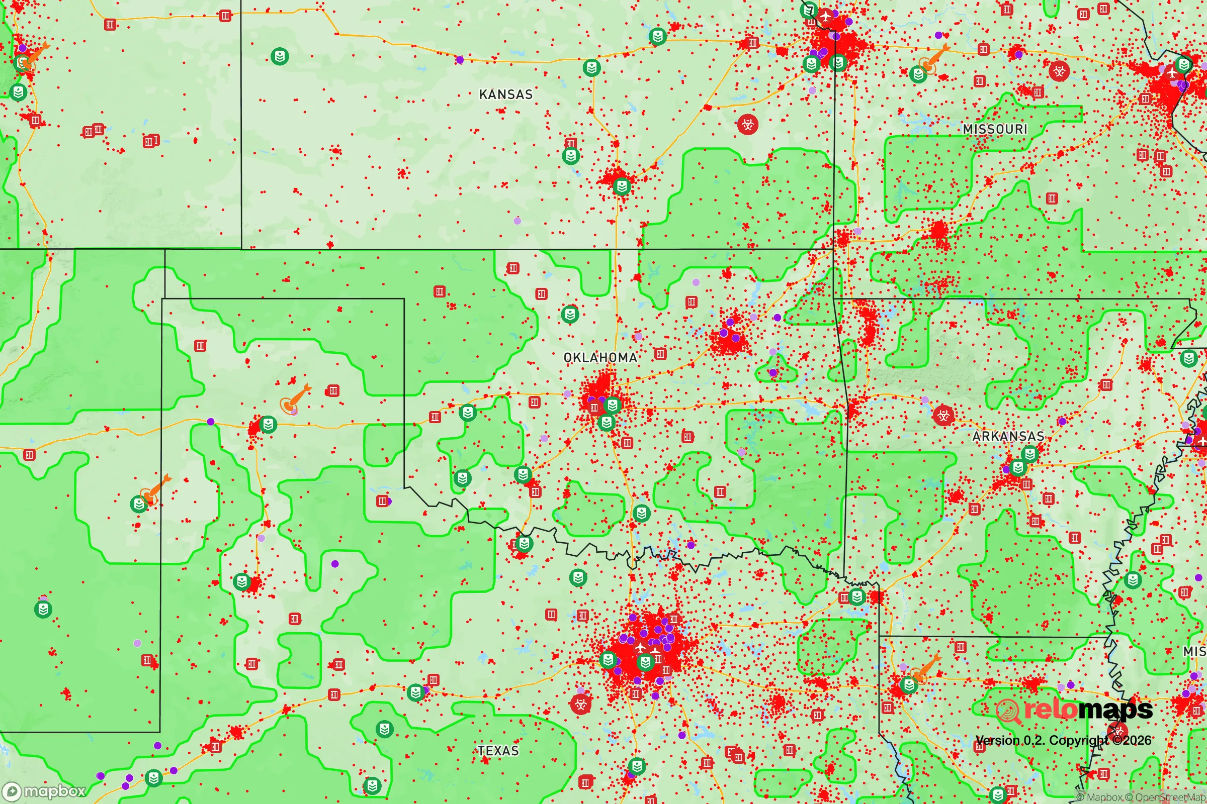
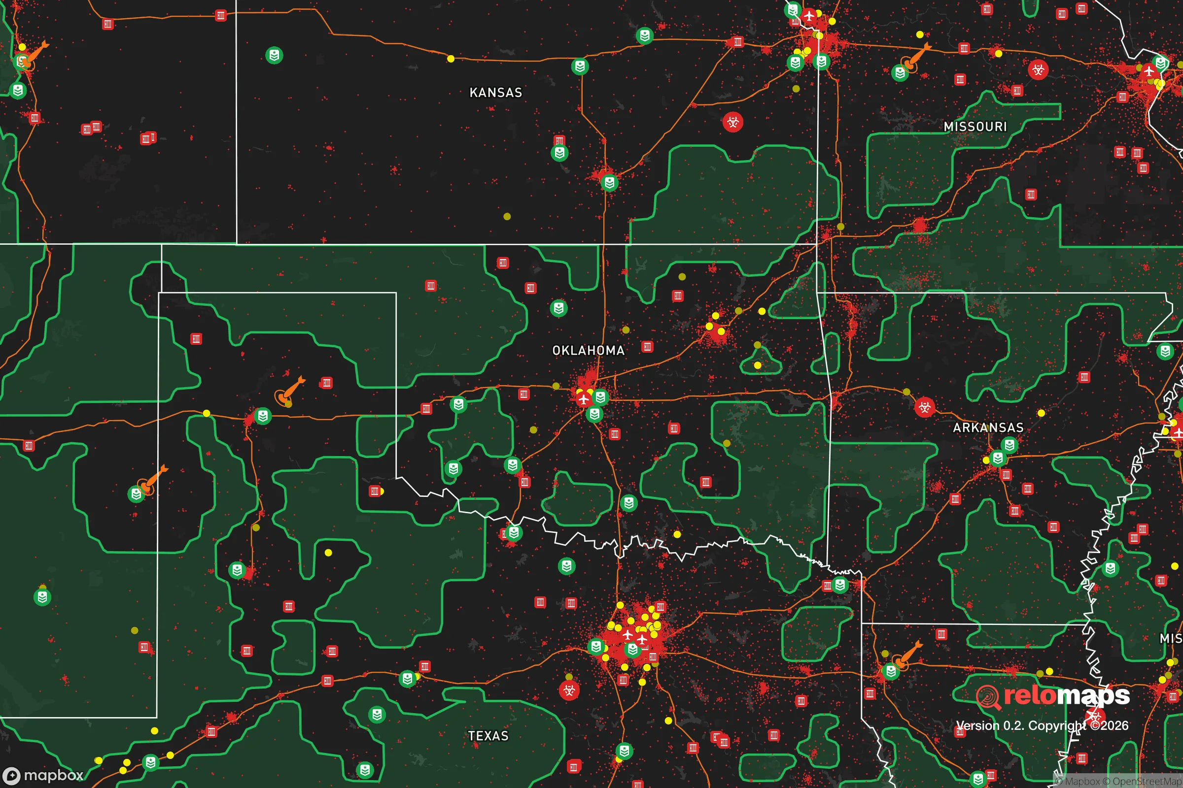


Important Note: For informational purposes only. This does not mean nothing bad ever happens in the green zones. Please use common sense. This is based on public data and modeled with AI. We tried to take a conservative approach but mistakes happen. We update this regularly as new information becomes available.
Solar Generator Recommendations
Backup power matters more here than in safer locations. We've picked three solar generators across budgets and capacity tiers — start with the budget unit if you only need a few essentials, or step up if you want to run a fridge and HVAC for days at a time.

Jackery Portable Power Station Explorer 300
Budget OptionPower on the Go: Weighing only 11 lbs, it's convenient to set up and store with book-sized foldable solar panels

BLUETTI Portable Power Station AC180
Designed for both indoor and outdoor scenarios, AC180 is highly capable as it has a robost capacity and continuous output power.

EF ECOFLOW DELTA Pro Ultra Power Station
Upgraded PickEcoFlow DELTA Pro Ultra is a whole-home energy system designed to grow with your family. Integrated with the Smart Home Panel 2, it scales to meet your evolving energy needs — keeping your home powered, intelligent, and secure through every stage of life.
We earn a commission, at no additional cost to you.
Strategic Assessment Analysis
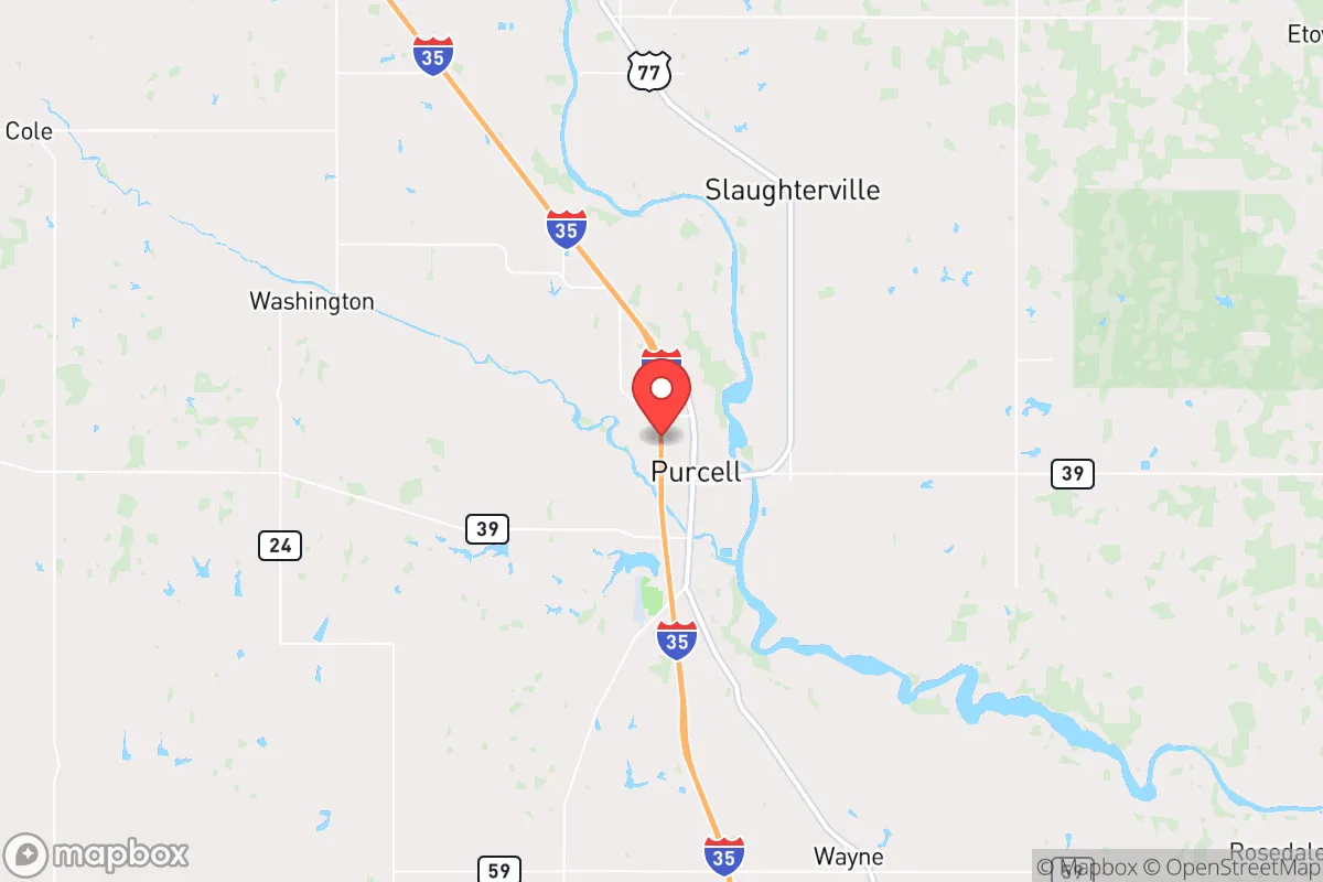
Purcell, Oklahoma, offers a compelling mix of strategic depth and everyday practicality for those prioritizing resilience and self-sufficiency. Its position roughly 40 miles south of Oklahoma City and 30 miles north of the Red River places it in a sweet spot: close enough to urban resources for supply runs and medical care, yet far enough to avoid the immediate chaos of a major metropolitan collapse. The town’s historical role as a railroad and agricultural hub gives it a built-in infrastructure for logistics and food production, making it a location that rewards careful planning without requiring a bunker mentality.
Geographic position and natural advantages for long-term stability
Purcell sits in the heart of the South Canadian River valley, a region defined by rolling plains, mixed-grass prairies, and a climate that supports both row crops and livestock. The area’s elevation—around 1,100 feet—keeps it above the worst of the floodplain risks that plague communities directly on the river, though low-lying pockets near the Canadian can see standing water after heavy spring rains. The underlying geology is primarily sandstone and shale, which means decent groundwater recharge in normal years, though wells in the area typically need to be drilled 100 to 300 feet deep to reach reliable aquifers. For a relocator, this means surface water from the river and local creeks is a viable backup, but it requires treatment for sediment and potential agricultural runoff. The climate is firmly continental: hot, humid summers with occasional drought, and cold winters with periodic ice storms. This variability is actually a resilience asset—it forces residents to plan for both heat and cold, and the local building stock is generally adapted to these extremes. The lack of major seismic activity, hurricane risk, or wildfire corridors (outside of grass fires in dry years) means Purcell avoids the catastrophic natural disaster profiles that plague coastal or mountain regions.
Risk exposure and proximity to fallout-relevant landmarks
The primary man-made risk for Purcell is its proximity to the Oklahoma City metropolitan area, which includes Tinker Air Force Base, a major strategic asset for the U.S. military. In a conflict scenario involving nuclear exchange, Tinker would be a high-priority target, and Purcell lies within the moderate fallout zone for a ground burst at that facility. Prevailing winds in the region are from the south and southwest, which would carry fallout north and east of the city—meaning Purcell is actually in a relatively favorable position for a Tinker strike, as the fallout plume would likely miss the town. However, a strike on the Will Rogers World Airport or the Oklahoma City urban core could produce a more diffuse risk. The Interstate 35 corridor, which runs directly through Purcell, is a double-edged sword: it provides excellent evacuation routes north to Kansas or south to Texas, but it also makes the town a potential chokepoint for refugees fleeing the metro area. In a grid-down scenario, the highway could become a liability, drawing crowds and creating security concerns. The nearby McClain County Energy Center (a natural gas plant) and the numerous oil and gas wells in the county present a lower-order risk—pipeline ruptures or wellhead fires are possible but localized. Overall, Purcell’s risk profile is moderate: it’s not a primary target, but it’s close enough to one to require a serious fallout shelter plan and a strategy for managing an influx of evacuees.
Practical resilience for a relocator: food, water, energy, and defensibility
Purcell’s agricultural heritage is its strongest resilience card. The surrounding McClain County is a major producer of wheat, hay, cattle, and poultry, and the town itself hosts a grain elevator and several feed stores. For a relocator looking to grow food, the growing season runs roughly April through October, with sandy loam soils that drain well but require amendment for heavy vegetable production. Local farmers’ markets and co-ops exist but are small; serious self-sufficiency will require a home garden, a few fruit trees (peach, pear, and apple do well here), and possibly a small flock of chickens or goats. Water is the weak link. The municipal supply comes from Lake Thunderbird and the Canadian River, but in a prolonged drought or infrastructure failure, those sources could be compromised. A well is the gold standard for resilience here, but drilling costs run $15–$30 per foot, and water quality varies—some wells in the area have high mineral content or trace nitrates from fertilizer. Rainwater catchment is feasible, with average annual precipitation around 36 inches, but storage is the bottleneck. Energy is a bright spot. Oklahoma is a wind energy powerhouse, and Purcell sits in a region with consistent 10–15 mph winds, making small-scale wind turbines a viable supplement to solar. Net metering is available through the local electric cooperative, but a battery backup system is recommended for grid-down scenarios. Defensibility is mixed. The town’s layout is a classic small-town grid, with a few natural chokepoints (the railroad bridge over the Canadian, the I-35 interchange) that could be monitored. The surrounding countryside offers numerous rural properties with good sightlines and limited access, but the flat terrain means there’s little natural cover. A relocator should prioritize a property with a well, a septic system, and a perimeter that can be observed from the house. The local sheriff’s office is responsive but small; in a crisis, residents will largely be on their own.
The overall strategic picture for Purcell is one of cautious optimism. It’s not a hardened redoubt or a remote homestead, but it’s a functional, working-class town with the bones of a resilient community: local food production, a moderate climate, and a location that balances access with separation. The biggest vulnerabilities are water security and the proximity to a major metro area that could become a liability in a crisis. For a relocator willing to invest in a well, a solar-plus-battery system, and a solid fallout shelter, Purcell offers a realistic path to self-sufficiency without the isolation of a mountain cabin. It’s a place where you can buy a modest acreage, raise a garden, and still drive to a Home Depot or a hospital in 40 minutes—which, in the world of strategic relocation, is a rare and valuable combination.

* Values derived from national, state, county, city and local statistics and may differ in a specific area. Last updated: 2026-07-13T01:05:56.000Z
Narrative content on this page is AI-generated and may contain mistakes. Verify any details that matter before acting on them.
ReloMaps may earn a commission from affiliate links at no extra cost to you.

