Photo: Wikipedia
Strategic Assessment of Portage Lakes, OH
Workable tactical position. Some exposure to population density or targets, but generally defensible in a crisis.
What does the Strategic Assessment tell us?
Our Strategic Assessment grades tactical survivability of an area. Major population centers, military targets, fallout zones, natural disasters, and border exposure all drive risk — lower exposure means a more defensible position in a crisis.
This is heavily inspired by Joel Skousen's Strategic Relocation book. Highly recommended you checkout the book ($)What does this tell us?
Our Strategic Assessment grades tactical survivability of an area. Major population centers, military targets, fallout zones, natural disasters, and border exposure all drive risk — lower exposure means a more defensible position in a crisis.
This is heavily inspired by Joel Skousen's Strategic Relocation book. Highly recommended you checkout the book ($)Strategic Pillars

Key Distances
Regional Safe Places
Below is our recommended "safe zones" in Ohio and the surrounding area based on our strategic heuristics. For most people, it's unrealistic to live in a “safe zone” full-time due to work, family or other personal reasons. They tend to be more rural. However, many of these areas are perfect for second homes and retreat properties that double as a vacation home or even a short-term rental.

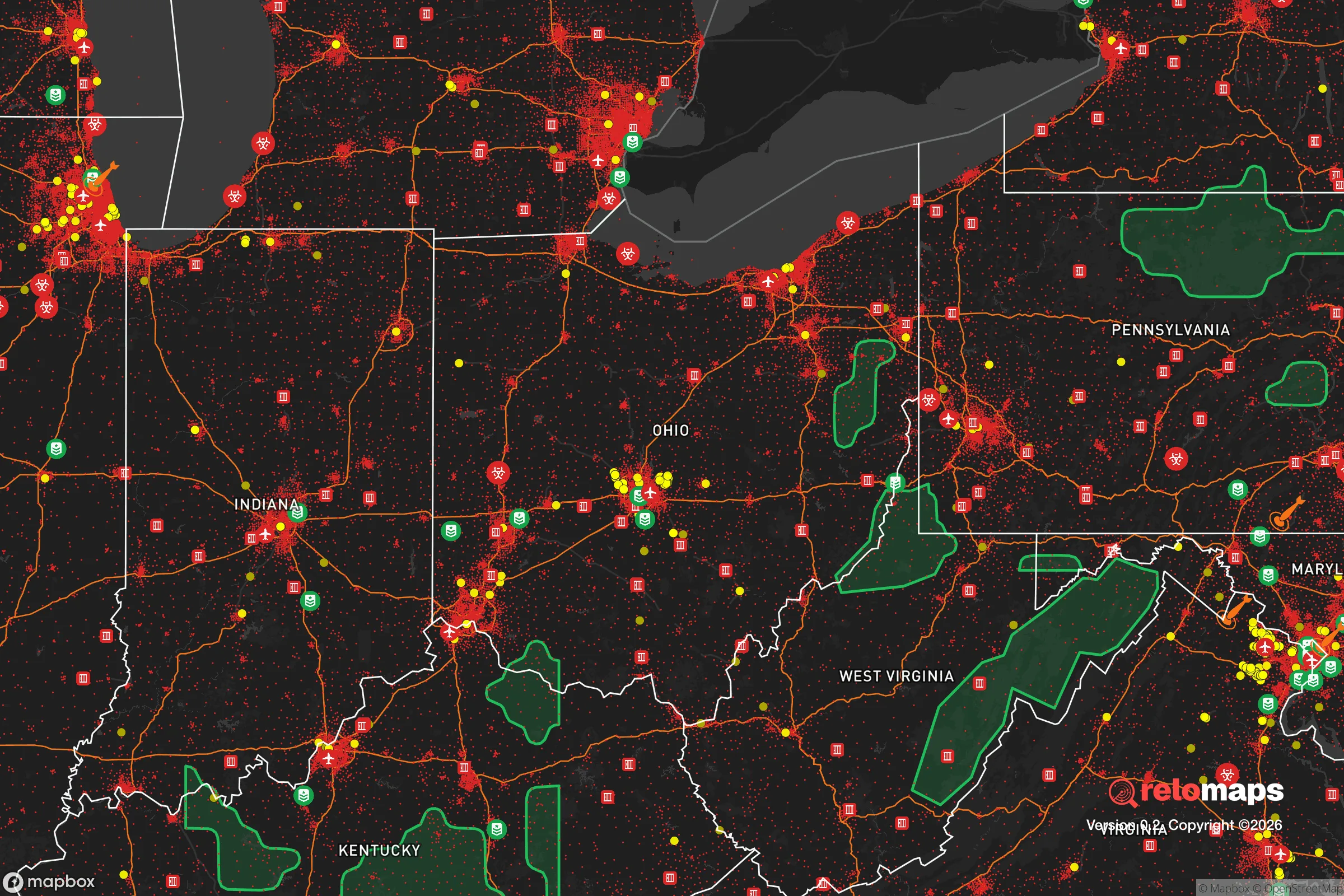


Important Note: For informational purposes only. This does not mean nothing bad ever happens in the green zones. Please use common sense. This is based on public data and modeled with AI. We tried to take a conservative approach but mistakes happen. We update this regularly as new information becomes available.
Solar Generator Recommendations
Backup power matters more here than in safer locations. We've picked three solar generators across budgets and capacity tiers — start with the budget unit if you only need a few essentials, or step up if you want to run a fridge and HVAC for days at a time.

Jackery Portable Power Station Explorer 300
Budget OptionPower on the Go: Weighing only 11 lbs, it's convenient to set up and store with book-sized foldable solar panels

BLUETTI Portable Power Station AC180
Designed for both indoor and outdoor scenarios, AC180 is highly capable as it has a robost capacity and continuous output power.

EF ECOFLOW DELTA Pro Ultra Power Station
Upgraded PickEcoFlow DELTA Pro Ultra is a whole-home energy system designed to grow with your family. Integrated with the Smart Home Panel 2, it scales to meet your evolving energy needs — keeping your home powered, intelligent, and secure through every stage of life.
We earn a commission, at no additional cost to you.
Strategic Assessment Analysis
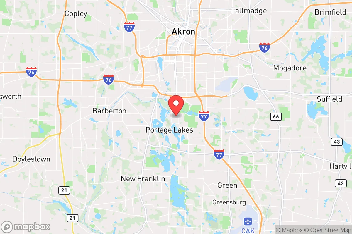
Portage Lakes, Ohio, occupies a strategic niche that balances proximity to regional infrastructure with a degree of natural insulation, making it a location worth serious consideration for those prioritizing resilience and self-sufficiency. Situated in Summit County, roughly 10 miles south of Akron and 40 miles south of Cleveland, the area benefits from access to major highways (I-77, I-76, and the Ohio Turnpike) without being directly in the blast zone of a major metropolitan center. Its defining feature—a chain of 11 interconnected glacial lakes covering over 2,000 acres—provides a built-in water resource and a natural buffer against urban sprawl, though it also introduces specific vulnerabilities that a relocator must weigh carefully.
Geographic position and natural advantages for long-term stability
The Portage Lakes area sits within the Glaciated Allegheny Plateau, a region characterized by rolling hills, mixed hardwood forests, and abundant surface water. This topography offers several resilience benefits. The lakes themselves—including Turkeyfoot Lake, Rex Lake, and Long Lake—form a natural hydrological network that can support off-grid water collection, irrigation, and small-scale aquaculture. The surrounding watershed, part of the Tuscarawas River basin, is relatively clean and fed by consistent Midwestern rainfall (averaging 38 inches annually), reducing the risk of prolonged drought compared to western states. The area's elevation, ranging from 1,000 to 1,200 feet above sea level, places it above the flood-prone river valleys of the Cuyahoga and Tuscarawas, though localized flooding near lakefront properties remains a concern during heavy spring rains. For a relocator, the key advantage is reliable freshwater access from multiple natural sources, combined with a temperate climate that supports year-round gardening and livestock—a significant plus for food security. The dense tree cover also provides natural camouflage and windbreaks, though it increases wildfire fuel load during dry spells, a risk that is low but not zero in this region.
Risks, exposures, and proximity to fallout-relevant landmarks
The primary strategic weakness of Portage Lakes is its position within the broader Northeast Ohio industrial and logistical corridor. While not a primary target itself, the area lies within 50 miles of several high-value infrastructure nodes that could become secondary or collateral targets in a major conflict or terrorist event. Akron-Canton Airport (CAK), 15 miles southeast, is a regional cargo hub and a potential staging point for military or emergency logistics. The Port of Cleveland, 45 miles north, handles bulk cargo and is a Great Lakes chokepoint. More concerning for a resilience-minded reader: the Davis-Besse Nuclear Power Station, located 80 miles west near Toledo, and the Perry Nuclear Plant, 60 miles northeast, are both within the 100-mile fallout plume radius for prevailing westerly winds. A catastrophic failure at either—whether from accident or attack—could deposit radioactive material across the Portage Lakes area within hours. The region also sits near the Marcellus and Utica shale gas fields, with numerous natural gas compressor stations and pipelines (including the Rover Pipeline) running through Summit and Stark counties. A pipeline rupture or intentional sabotage could cause localized contamination or fire risk. On the natural disaster front, the area is low-risk for hurricanes, earthquakes (seismic zone 1), and wildfires, but severe thunderstorms, tornadoes (EF-2 or EF-3 are possible), and ice storms are annual realities. The 2020 Akron-area derecho caused widespread power outages lasting 5-7 days, a pattern that could repeat. For a relocator, the calculus is: low direct-target risk, moderate secondary-risk from nearby infrastructure, and moderate-to-high weather-related disruption risk.
Practical resilience for a relocator: food, water, energy, and defensibility
For someone serious about self-sufficiency, Portage Lakes offers a mixed but workable baseline. Water is the strongest asset: the lake chain provides a year-round surface water source that can be filtered (via sand or ceramic filters) for drinking, and the water table is high enough that a shallow well (30-60 feet) is feasible on most properties not directly on the lakes. The Summit County Soil and Water Conservation District offers free well-water testing, a practical resource for new landowners. Food production is viable but requires effort. The growing season runs from mid-April to mid-October (USDA Zone 6a), with fertile silt-loam soils that support vegetables, apples, and small grains. Local ordinances in Coventry Township and New Franklin (the two main municipalities covering the lakes) generally allow backyard chickens and small livestock, though pigs and cattle may require acreage variances. The area has a strong network of farmers' markets (the Portage Lakes Farmers Market runs June-October) and bulk food co-ops (Mustard Seed Market in Akron), providing supply-chain redundancy. Energy resilience is a weaker point. The grid is served by FirstEnergy (Ohio Edison), which has a mixed reliability record—average outage duration in Summit County is 120-180 minutes per event, but major storms can extend that to days. Solar potential is moderate (4.0-4.5 peak sun hours per day), and net metering is available, but homeowners associations (HOAs) in some lakefront communities may restrict panel placement. Natural gas is widely available for heating, a plus for winter resilience (average January low of 18°F). Defensibility is moderate. The lake chain creates natural chokepoints—only a few roads (Portage Lakes Drive, Manchester Road, and S. Main Street) provide access to the interior, which could be monitored or blocked. However, the area is not a natural fortress; the terrain is gentle, and the dense tree cover provides concealment but also limits sightlines. Property crime in the Portage Lakes area is slightly above the national average (Summit County reports 2.5 property crimes per 1,000 residents vs. 1.9 nationally), so physical security—fencing, lighting, a safe room—is a practical investment, not paranoia. The local sheriff's office (Summit County Sheriff) has a substation in New Franklin, with response times averaging 8-12 minutes in the lakes area.
The overall strategic picture for Portage Lakes is that of a moderate-resilience location with strong water security and manageable risk exposure. It is not a remote bug-out location—you are 20 minutes from Akron's hospitals and big-box stores, and 45 minutes from Cleveland's urban core. That proximity is a double-edged sword: it provides supply-chain access and community resources, but it also ties you to regional vulnerabilities (grid failures, pipeline incidents, nuclear fallout corridors). For a family or individual who wants a defensible home base with good water, decent growing conditions, and a low probability of being a direct target, Portage Lakes is a solid choice—provided you invest in backup power, water filtration, and a realistic plan for the 2-3 day grid outages that will happen annually. The lakes themselves are the ace in the hole: a renewable water source that most inland locations lack. Just don't mistake "near the city" for "safe from the city's risks." If you can tolerate the trade-off, this area offers a livable, sustainable foundation for long-term preparedness.

* Values derived from national, state, county, city and local statistics and may differ in a specific area. Last updated: 2026-09-29T01:28:16.000Z
Narrative content on this page is AI-generated and may contain mistakes. Verify any details that matter before acting on them.
ReloMaps may earn a commission from affiliate links at no extra cost to you.

