
Photo: Wikipedia
Strategic Assessment of Mckean County
Meaningful friction. Expect exposure to either population pressure, blast zones, or natural disaster risk. Consider buying a retreat property.
What does the Strategic Assessment tell us?
Our Strategic Assessment grades tactical survivability of an area. Major population centers, military targets, fallout zones, natural disasters, and border exposure all drive risk — lower exposure means a more defensible position in a crisis.
This is heavily inspired by Joel Skousen's Strategic Relocation book. Highly recommended you checkout the book ($)What does this tell us?
Our Strategic Assessment grades tactical survivability of an area. Major population centers, military targets, fallout zones, natural disasters, and border exposure all drive risk — lower exposure means a more defensible position in a crisis.
This is heavily inspired by Joel Skousen's Strategic Relocation book. Highly recommended you checkout the book ($)Strategic Pillars

Key Distances
Strategic Assessment Analysis
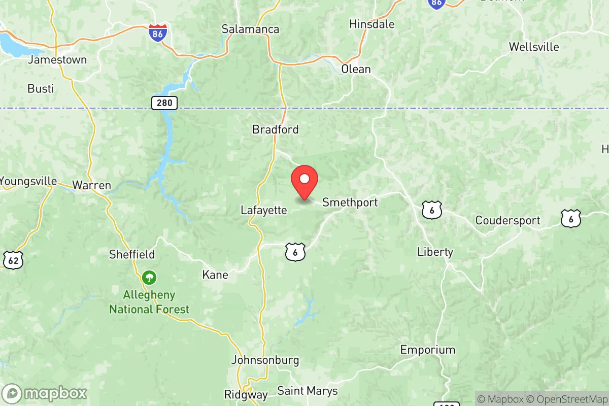
McKean County, Pennsylvania, offers a compelling strategic profile for relocators prioritizing resilience and self-sufficiency, anchored by its position in the sparsely populated Allegheny Plateau. The county seat, Smethport, along with the larger towns of Bradford and Kane, sit within a region defined by rugged terrain, dense hardwood forests, and a low population density of roughly 40 people per square mile—a natural buffer against the cascading failures that can plague dense urban corridors. This area’s key advantage is its distance from major metropolitan targets and critical infrastructure choke points, making it a viable long-term holding ground for those serious about disaster preparedness.
Geographic position and natural advantages for long-term security
McKean County’s location in north-central Pennsylvania, roughly 100 miles south of the New York state line and 80 miles east of the Ohio border, places it well outside the immediate fallout zones of major East Coast population centers like New York City, Philadelphia, or Pittsburgh. The county is part of the Appalachian Plateau, with elevations ranging from 1,200 to over 2,400 feet, which provides natural defensibility through steep valleys and limited road access—a key consideration for anyone evaluating retreat security. The Allegheny National Forest covers a significant portion of the county’s western half, offering a vast, managed wilderness that can support foraging, timber, and water sourcing. The Kinzua Dam and Allegheny Reservoir, located just west of the county line in Warren County, provide a massive, reliable freshwater source that could sustain a regional population during infrastructure disruptions. Unlike flatter agricultural regions, McKean’s topography makes large-scale movement difficult, which is a double-edged sword: it slows both threats and resupply, but for a prepared relocator, it favors those who know the terrain.
Risks, exposures, and proximity to fallout-relevant landmarks
While McKean County is far from the highest-risk targets, it is not immune to man-made and natural hazards. The county sits within 50 miles of the Bradford Refinery (actually located in Warren County, near the McKean line), a major crude oil processing facility that could be a secondary target or a source of hazardous material release during a conflict. Additionally, the Kinzua Dam itself, while a water asset, is a high-value infrastructure target; its failure would send a catastrophic flood wave down the Allegheny River valley, affecting low-lying areas in the county’s western edge, though most of McKean’s population centers sit at higher elevations. The Pennsylvania Grand Canyon (Pine Creek Gorge) lies just to the southeast in Tioga County, but its tourism draw means seasonal population surges that could strain local resources. Natural risks are moderate: the region experiences cold, snowy winters (average 80+ inches annually in higher elevations), which can isolate communities for days, and the steep terrain increases landslide risk during heavy rains. There are no nuclear power plants within 100 miles, and the nearest major military installation—Fort Drum in New York—is over 150 miles north, reducing the likelihood of direct kinetic effects. The primary man-made risk is the county’s own oil and gas infrastructure, with numerous wells and pipelines that could become ignition sources or contamination points during a seismic event or grid failure.
Practical resilience for a relocator: food, water, energy, and defensibility
For a relocator focused on self-sufficiency, McKean County offers a mixed but generally favorable picture. Water availability is excellent: the county is laced with perennial streams, including the Allegheny River headwaters and Tunungwant Creek, and groundwater is accessible via shallow wells in most valleys. The average annual precipitation of 40-45 inches supports rain catchment systems, though winter freezing requires proper insulation. Food production is limited by a short growing season (Zone 5b, roughly 120 frost-free days) and acidic, rocky soils—large-scale agriculture is not viable, but small gardens, cold frames, and greenhouse use can yield potatoes, root vegetables, and hardy greens. The county’s vast forests provide wild game (deer, turkey, bear) and forage (ramps, berries, mushrooms), but over-reliance on hunting could deplete local populations quickly in a crisis. Energy resilience is a challenge: the grid is rural and prone to outages from ice storms and wind; however, the region’s steep creeks offer micro-hydro potential for properties with year-round flow, and solar panels perform adequately despite cloud cover (roughly 4.0 peak sun hours per day). Wood heating is the dominant backup, with abundant fuel available on private and state forest land—a critical advantage over regions reliant on natural gas or heating oil. Defensibility is strong: the county’s low population density (roughly 40,000 total residents) and limited through-roads (primarily US-6 and PA-219) create natural chokepoints. The small towns of Smethport (county seat, population ~1,500) and Kane (population ~3,500) are compact and easily monitored, while more remote hamlets like Rew or Mount Jewett offer near-total isolation. The local culture is self-reliant, with a strong hunting and firearms tradition, and the county’s emergency services are volunteer-based, meaning community cohesion is a practical necessity rather than an abstraction.
The overall strategic picture for McKean County is one of a solid, if unglamorous, resilience hub for the serious relocator. It lacks the agricultural bounty of the Midwest or the mild climate of the South, but its combination of low target value, abundant water, forest resources, and natural defensibility makes it a strong candidate for those prioritizing long-term survival over comfort. The key trade-offs are clear: you trade away easy access to supply chains and medical infrastructure for a position that is unlikely to be a primary or secondary target in a major conflict. For a family willing to invest in cold-weather preparedness, wood heat, and a greenhouse, McKean County offers a defensible, low-profile base of operations in a region that history and geography have largely passed by—and that, in a crisis, is exactly the point.

* Values derived from national, state, county, city and local statistics and may differ in a specific area. Last updated: 2026-09-12T06:11:52.000Z
Narrative content on this page is AI-generated and may contain mistakes. Verify any details that matter before acting on them.
ReloMaps may earn a commission from affiliate links at no extra cost to you.

