
Photo: Wikipedia
Strategic Assessment of Blair County
Meaningful friction. Expect exposure to either population pressure, blast zones, or natural disaster risk. Consider buying a retreat property.
What does the Strategic Assessment tell us?
Our Strategic Assessment grades tactical survivability of an area. Major population centers, military targets, fallout zones, natural disasters, and border exposure all drive risk — lower exposure means a more defensible position in a crisis.
This is heavily inspired by Joel Skousen's Strategic Relocation book. Highly recommended you checkout the book ($)What does this tell us?
Our Strategic Assessment grades tactical survivability of an area. Major population centers, military targets, fallout zones, natural disasters, and border exposure all drive risk — lower exposure means a more defensible position in a crisis.
This is heavily inspired by Joel Skousen's Strategic Relocation book. Highly recommended you checkout the book ($)Strategic Pillars

Key Distances
Strategic Assessment Analysis
Blair County, Pennsylvania, occupies a strategic middle ground in the resilience landscape—far enough from major metropolitan blast zones to avoid the worst of a nuclear exchange, yet close enough to critical infrastructure that its self-sufficiency calculus demands careful attention. Anchored by the city of Altoona and the boroughs of Hollidaysburg and Tyrone, the county sits at the eastern edge of the Allegheny Plateau, a region historically valued for its rail corridors and industrial output. For a relocator weighing disaster readiness and long-term sustainability, Blair County offers a mix of genuine geographic advantages and notable exposure risks that require honest assessment.
Geographic position and natural advantages for long-term survival
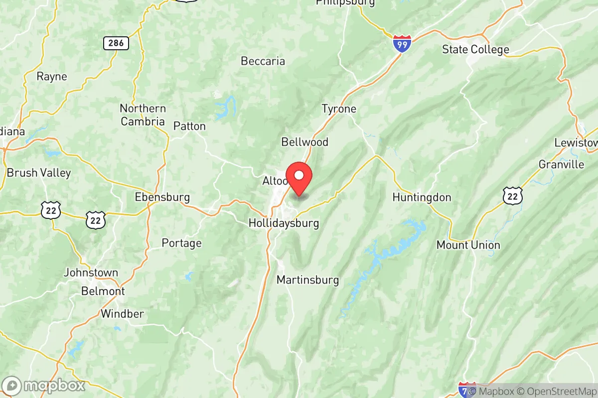
Blair County’s topography is its first and most durable asset. The county lies within the Ridge-and-Valley province of the Appalachian Mountains, with the Allegheny Front rising to the west and the Tussey Mountain ridge forming a natural barrier to the east. This rugged terrain provides significant natural defensibility—approaches into the county are funneled through a handful of passes and river gaps, making movement into the area slow and predictable. The elevation, averaging over 1,200 feet in Altoona and climbing to nearly 2,600 feet along the western ridges, places the county above the inversion layers that trap particulate fallout in lower-lying regions. Prevailing westerly winds tend to sweep airborne contaminants eastward, meaning that a detonation in the Pittsburgh or Harrisburg corridors would likely deposit fallout away from Blair County’s core population centers. The county’s position roughly 90 miles east of Pittsburgh and 80 miles west of Harrisburg puts it outside the immediate blast and thermal radii of those cities’ likely targets, while still being within a day’s travel of secondary resources. The Little Juniata River and the Frankstown Branch of the Juniata River provide reliable surface water sources, and the surrounding state game lands—including Rothrock State Forest to the south—offer extensive areas for foraging, hunting, and dispersed settlement.
Risks, exposures, and proximity to fallout-relevant landmarks
The same geography that provides defensibility also concentrates risk. Blair County is bisected by the Norfolk Southern Pittsburgh Line, one of the busiest freight rail corridors in the eastern United States, which carries hazardous materials—including chlorine, anhydrous ammonia, and crude oil—through the heart of Altoona and Hollidaysburg daily. A derailment or intentional release in the Horseshoe Curve area, a famous rail landmark just west of Altoona, could contaminate the Little Juniata watershed for miles downstream. The county also hosts the Altoona Energy Center, a natural gas-fired power plant that, while not a nuclear target, is a potential secondary target for grid disruption. More critically, Blair County lies within 150 miles of two major nuclear-related sites: the Three Mile Island decommissioning site near Harrisburg (roughly 80 miles east) and the Beaver Valley Nuclear Power Station near Shippingport (about 110 miles west). While neither is an active reactor in the traditional sense—Three Mile Island is in decommissioning, and Beaver Valley’s Unit 1 is permanently shut down—the spent fuel pools at both sites remain potential targets for sabotage or accident. The county’s proximity to Fort Indiantown Gap (about 70 miles east), a major military training center and potential mobilization hub, means that any conflict drawing in the Pennsylvania National Guard could see convoys and air traffic passing through the county’s narrow valleys, creating both a security buffer and a potential target vector. For a relocator, the key takeaway is that Blair County is not a remote wilderness—it is a transportation corridor with industrial infrastructure that carries inherent risk.
Practical resilience for a relocator: food, water, energy, and defensibility
On the practical side, Blair County offers a mixed but workable foundation for self-sufficiency. The county’s agricultural base is modest but real: roughly 30% of the land is in farmland, with a strong concentration of dairy operations, beef cattle, and hay production in the Morrison Cove region (the valley between Tussey and Dunning Mountains) and the Canoe Creek valley south of Hollidaysburg. These areas are within a 20-minute drive of Altoona but feel distinctly rural, with scattered farmsteads, spring-fed ponds, and limited road access. Water availability is above average for the region: the county sits atop the Lock Haven Formation, a sandstone aquifer that yields reliable groundwater at depths of 50 to 200 feet, and the numerous streams draining the Allegheny Front provide year-round surface flow. However, the county’s water infrastructure is aging—Altoona’s water system, which draws from the Mill Run Reservoir and the Blair Gap Run, has faced repeated boil-water advisories and maintenance backlogs. A relocator should plan for independent water storage and filtration regardless of location. Energy resilience is a bright spot: the county has strong solar potential (averaging 4.2 peak sun hours per day), and the hilly terrain allows for micro-hydro installations on the steeper streams. Wood heating is practical, with abundant hardwood forests in the state game lands and private woodlots. Defensibility is best in the outlying townships—Woodbury Township and Greenfield Township offer low population density, limited through-traffic, and natural chokepoints at the few road crossings of the ridges. Altoona itself, with its dense row-house neighborhoods and rail yards, would be difficult to secure and should be considered a supply hub rather than a long-term residence in a crisis scenario.
The overall strategic picture for Blair County is one of cautious viability. It is not a fallout-proof sanctuary—no place east of the Mississippi truly is—but it offers a defensible terrain, adequate water and agricultural resources, and a position that avoids the worst of the blast zones while still being connected enough to access supplies and information. The county’s greatest weakness is its reliance on the rail corridor and the associated industrial risks; its greatest strength is the rugged, dispersed settlement pattern that allows a prepared relocator to live quietly in the ridges and valleys, out of sight and out of the main lines of movement. For a family or individual willing to invest in independent water, energy, and food systems, and to choose a location in the outer townships rather than the valley floor, Blair County represents a solid, unglamorous option in the mid-Atlantic resilience landscape. It will not be the first place to recover after a major event, but it is unlikely to be the last place standing either—and for many, that middle ground is exactly the right balance.

* Values derived from national, state, county, city and local statistics and may differ in a specific area. Last updated: 2026-07-27T07:52:59.000Z
Narrative content on this page is AI-generated and may contain mistakes. Verify any details that matter before acting on them.
ReloMaps may earn a commission from affiliate links at no extra cost to you.

