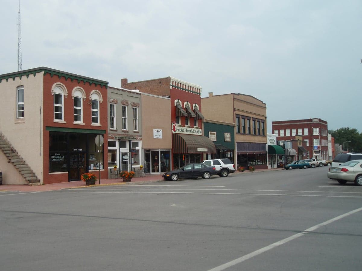
Photo: Wikipedia
Strategic Assessment of Paola, KS
Workable tactical position. Some exposure to population density or targets, but generally defensible in a crisis.
What does the Strategic Assessment tell us?
Our Strategic Assessment grades tactical survivability of an area. Major population centers, military targets, fallout zones, natural disasters, and border exposure all drive risk — lower exposure means a more defensible position in a crisis.
This is heavily inspired by Joel Skousen's Strategic Relocation book. Highly recommended you checkout the book ($)What does this tell us?
Our Strategic Assessment grades tactical survivability of an area. Major population centers, military targets, fallout zones, natural disasters, and border exposure all drive risk — lower exposure means a more defensible position in a crisis.
This is heavily inspired by Joel Skousen's Strategic Relocation book. Highly recommended you checkout the book ($)Strategic Pillars

Key Distances
Regional Safe Places
Below is our recommended "safe zones" in Kansas and the surrounding area based on our strategic heuristics. For most people, it's unrealistic to live in a “safe zone” full-time due to work, family or other personal reasons. They tend to be more rural. However, many of these areas are perfect for second homes and retreat properties that double as a vacation home or even a short-term rental.
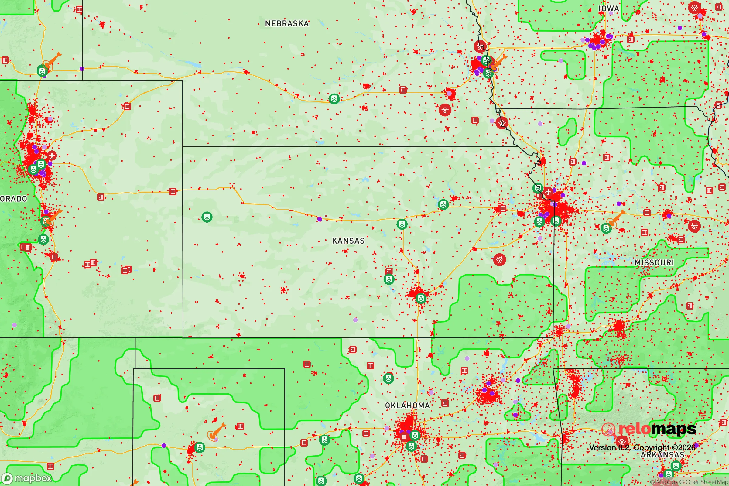
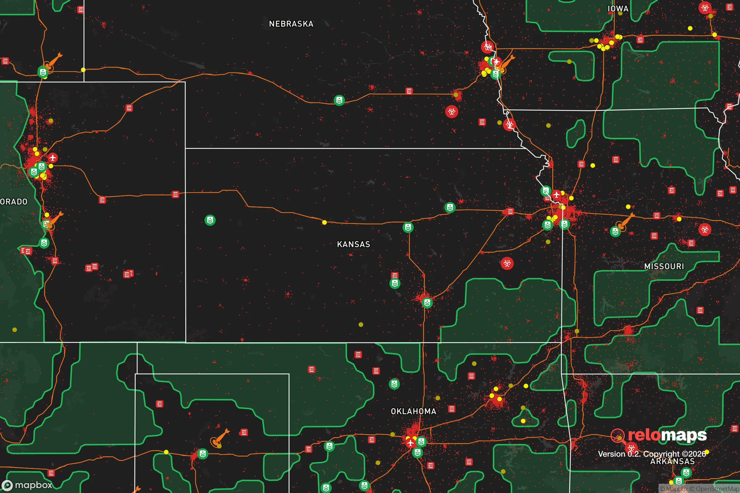


Important Note: For informational purposes only. This does not mean nothing bad ever happens in the green zones. Please use common sense. This is based on public data and modeled with AI. We tried to take a conservative approach but mistakes happen. We update this regularly as new information becomes available.
Solar Generator Recommendations
Backup power matters more here than in safer locations. We've picked three solar generators across budgets and capacity tiers — start with the budget unit if you only need a few essentials, or step up if you want to run a fridge and HVAC for days at a time.

Jackery Portable Power Station Explorer 300
Budget OptionPower on the Go: Weighing only 11 lbs, it's convenient to set up and store with book-sized foldable solar panels

BLUETTI Portable Power Station AC180
Designed for both indoor and outdoor scenarios, AC180 is highly capable as it has a robost capacity and continuous output power.

EF ECOFLOW DELTA Pro Ultra Power Station
Upgraded PickEcoFlow DELTA Pro Ultra is a whole-home energy system designed to grow with your family. Integrated with the Smart Home Panel 2, it scales to meet your evolving energy needs — keeping your home powered, intelligent, and secure through every stage of life.
We earn a commission, at no additional cost to you.
Strategic Assessment Analysis
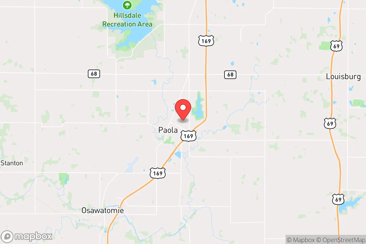
Paola, Kansas, offers a compelling balance of rural self-sufficiency and strategic access, making it a noteworthy option for those prioritizing disaster readiness and long-term resilience. Located in Miami County roughly 40 miles southwest of Kansas City, the town sits far enough from major metropolitan centers to reduce exposure to civil unrest and fallout risks, yet close enough to leverage regional resources when conditions are stable. Its position within the rolling Osage Cuestas region provides natural defensibility, while the local economy and infrastructure support a quieter, more self-reliant lifestyle that aligns with conservative values of preparedness and community.
Geographic position and natural advantages for long-term stability
Paola’s geography is a quiet asset. The town lies in the Marais des Cygnes River valley, which provides fertile soil and reliable water access—critical for any long-term self-sufficiency plan. The surrounding terrain is characterized by low, wooded hills and open farmland, offering both cover and agricultural potential. Unlike flatter, more exposed parts of the Great Plains, this undulating landscape creates natural chokepoints and defensible positions, particularly along the river corridors and ridgelines. The area sits outside the primary tornado alley’s most active zone, though severe weather remains a seasonal reality. More importantly, Paola is far from active fault lines, coastal storm surge zones, and major wildfire corridors, reducing the likelihood of catastrophic natural disasters that could force evacuation. The local climate supports a growing season of roughly 180 days, allowing for diversified food production—a key factor for anyone serious about reducing dependence on fragile supply chains.
Risk exposure and proximity to fallout-relevant landmarks
While Paola avoids many natural hazards, its proximity to the Kansas City metropolitan area introduces specific man-made risks. The city is roughly 35 miles from the Kansas City International Airport and within 50 miles of several major rail yards and industrial facilities that could become secondary targets in a conflict scenario. The nearby Wolf Creek Generating Station, a nuclear power plant located about 60 miles to the southwest in Burlington, Kansas, is a notable concern. Though not close enough to be in the immediate blast or thermal zone, prevailing winds from the southwest could carry fallout toward Paola in the event of a major incident. Additionally, the area lies within the broader reach of the nation’s central missile fields and strategic transportation corridors, which could elevate risk during a large-scale conflict. However, compared to suburbs directly adjacent to Kansas City or Wichita, Paola’s distance and rural buffer significantly reduce the likelihood of direct exposure to ground zero effects. The town’s small population (roughly 5,800) and low-density development also mean fewer high-value targets and less civil chaos during a crisis.
Practical resilience for a relocator: food, water, energy, and defensibility
For someone serious about self-sufficiency, Paola offers a workable baseline. The local water supply comes from the Marais des Cygnes River and groundwater wells, with the city maintaining a treatment plant that serves the immediate area. For off-grid setups, the water table in Miami County is generally accessible at depths of 30 to 100 feet, making private wells feasible for most rural properties. The region’s agricultural heritage means that farmland and pasture are still affordable relative to national averages, with many parcels available for purchase outside city limits. Local farmers’ markets and co-ops provide a buffer against supply chain disruptions, and the county’s strong 4-H and FFA presence indicates a culture that values practical skills. Energy resilience is more mixed: the grid is served by Evergy, which has faced reliability issues during extreme weather (notably the 2021 winter storm), but the area’s moderate climate reduces heating and cooling demands compared to more extreme regions. Solar potential is good, with roughly 4.5 peak sun hours per day, and local zoning is generally permissive for small-scale renewable installations. Defensibility is aided by the town’s layout—compact downtown with residential spread along tree-lined roads—and the surrounding rural landscape offers multiple escape routes via state highways 7 and 68. The local law enforcement presence is modest but community-oriented, and the county’s low crime rate (violent crime roughly 60% below national average) suggests a stable social environment even in normal times.
The overall strategic picture for Paola is one of moderate resilience with manageable trade-offs. It is not a remote bunker location, nor is it a high-risk urban center. For a relocator who values community, agricultural potential, and a conservative cultural framework, Paola provides a solid foundation for building a prepared lifestyle. The key vulnerabilities—proximity to Kansas City’s infrastructure and the Wolf Creek plant—are real but can be mitigated through careful property selection (e.g., choosing land east or north of town to avoid prevailing fallout patterns) and by building local networks. The area’s affordability, access to water, and agricultural capacity make it a practical choice for those who want to be ready without living in isolation. In a world where resilience increasingly means balancing access with distance, Paola holds its ground as a sensible, grounded option.

* Values derived from national, state, county, city and local statistics and may differ in a specific area. Last updated: 2026-10-03T18:49:00.000Z
Narrative content on this page is AI-generated and may contain mistakes. Verify any details that matter before acting on them.
ReloMaps may earn a commission from affiliate links at no extra cost to you.

