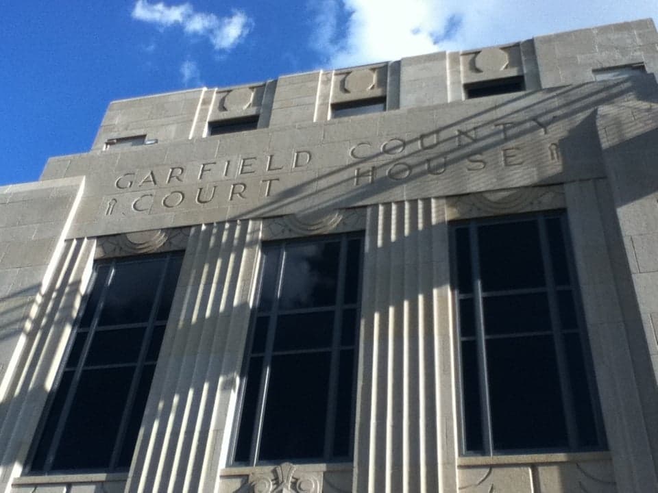
Photo: Wikipedia
Strategic Assessment of Garfield County
Workable tactical position. Some exposure to population density or targets, but generally defensible in a crisis.
What does the Strategic Assessment tell us?
Our Strategic Assessment grades tactical survivability of an area. Major population centers, military targets, fallout zones, natural disasters, and border exposure all drive risk — lower exposure means a more defensible position in a crisis.
This is heavily inspired by Joel Skousen's Strategic Relocation book. Highly recommended you checkout the book ($)What does this tell us?
Our Strategic Assessment grades tactical survivability of an area. Major population centers, military targets, fallout zones, natural disasters, and border exposure all drive risk — lower exposure means a more defensible position in a crisis.
This is heavily inspired by Joel Skousen's Strategic Relocation book. Highly recommended you checkout the book ($)Strategic Pillars

Key Distances
Strategic Assessment Analysis
Garfield County, anchored by the city of Enid, presents a compelling strategic option for relocation-minded readers prioritizing resilience and self-sufficiency, largely due to its position in north-central Oklahoma—far from the hurricane-prone Gulf Coast, the seismic risks of the New Madrid zone, and the dense population corridors of the I-35 and I-44 axes. The county’s economy, historically rooted in agriculture and energy (wheat, cattle, and oil and gas extraction), provides a baseline of practical industry that supports local food production and energy independence, while its location roughly 90 miles north of Oklahoma City and 60 miles south of the Kansas border places it in a sweet spot of rural accessibility without isolation. For a conservative-leaning audience weighing disaster readiness, Garfield County offers a blend of low population density (roughly 62,000 residents across 1,060 square miles), a strong local governance structure, and a climate that avoids the extremes of tornado alley’s most active zones, though it is not without its own exposures.
Geographic position and natural advantages for long-term stability
Garfield County sits on the southern edge of the Great Plains, a region defined by flat to gently rolling terrain that offers excellent visibility and defensibility—a practical advantage for anyone assessing security or situational awareness. The county is bisected by U.S. Highway 81 and State Highway 412, providing reliable ground routes north to Kansas and south to the Oklahoma City metro, but it avoids the choke points and congestion of major interstate corridors like I-35, which runs 30 miles east through neighboring Noble County. The area’s natural resources include the Cimarron River, which forms the county’s southern border and offers a perennial water source, though its flow is seasonal and often silty, requiring filtration for potable use. The county’s position in the Central Flyway also means abundant wildlife—deer, turkey, and waterfowl—for those considering hunting as a food-security measure. Enid’s Vance Air Force Base, a major training hub for the U.S. Air Force’s T-6 Texan II and T-1 Jayhawk aircraft, is a double-edged asset: it provides a stable economic anchor and military infrastructure, but also makes the county a potential target in a conflict scenario. The base’s presence, however, also means a robust local emergency response network and a population accustomed to security protocols, which can be a net positive for preparedness-minded relocators.
Risks, exposures, and proximity to fallout-relevant landmarks
While Garfield County avoids the worst of tornado alley’s core (which lies further east and south into central Oklahoma and north Texas), it still sits in a region that experiences an average of 5-7 tornado warnings per year, with the peak season from April to June. The county’s flat terrain offers little natural shielding from severe weather, meaning a dedicated storm shelter or reinforced safe room is a non-negotiable for any serious preparedness plan. Beyond weather, the county’s proximity to several fallout-relevant landmarks warrants attention: Vance Air Force Base is the most obvious, but the county also lies within 150 miles of the Cushing oil storage hub (the largest commercial crude oil storage facility in North America, located in Payne County to the southeast) and the Ponca City refinery complex (roughly 30 miles east in Kay County). These industrial sites, while not within Garfield County itself, represent potential secondary targets or accident zones that could affect air quality or ground transport routes in a crisis. Enid’s own industrial base includes grain elevators, fertilizer plants, and oilfield supply depots, which, while not high-value military targets, could pose localized hazards from chemical spills or fires. The county’s distance from major population centers—Oklahoma City is 90 miles south, Wichita is 100 miles north—reduces the risk of being caught in a mass evacuation or refugee flow, but the I-35 corridor to the east could become a bottleneck if regional events trigger south-to-north movement.
Practical resilience for a relocator: food, water, energy, and defensibility
For a relocator focused on self-sufficiency, Garfield County’s agricultural base is its strongest asset. The county is a top producer of hard red winter wheat in Oklahoma, with thousands of acres of cropland and a network of local grain elevators and co-ops that support direct-to-consumer grain purchases. Local farmers’ markets in Enid and smaller towns like Waukomis and Covington provide seasonal access to fresh produce, eggs, and meat, while the county’s ranching culture means beef and pork are available through direct farm sales or local processors. Water access is more nuanced: the Cimarron River is a surface source, but its water quality is poor due to high silt and mineral content, requiring robust filtration (e.g., ceramic or reverse osmosis systems). Groundwater from the Ogallala Aquifer is accessible via private wells in the western part of the county, but the aquifer is declining regionally, so well depth and yield should be verified before purchase. Energy resilience is favorable: the county is served by Oklahoma Gas and Electric (OG&E) and several rural electric cooperatives, but natural gas is abundant (the county sits atop the Anadarko Basin), and many rural properties already have propane tanks or access to natural gas lines. Solar potential is good, with an average of 230 sunny days per year, making off-grid solar-plus-battery systems viable for supplementing grid power. Defensibility is aided by the county’s low population density and open terrain—a rural property with a long driveway and clear sightlines offers natural security—but the lack of natural cover (forests, hills) means that a determined group could approach from any direction. The county’s law enforcement presence is concentrated in Enid (Garfield County Sheriff’s Office and Enid Police Department), with rural areas relying on county deputies and state troopers, so response times in a crisis could be 20-30 minutes or more.
Overall, Garfield County presents a balanced strategic picture for the disaster-ready relocator: it offers genuine advantages in food production, energy access, and geographic positioning away from major urban and industrial fallout zones, but it demands proactive investment in water filtration, storm sheltering, and security planning to mitigate its specific risks. The presence of Vance Air Force Base is the most significant variable—it brings economic stability and emergency infrastructure, but also introduces a target profile that a relocator must weigh against the county’s otherwise low-key profile. For a family or individual willing to drill a well, install solar, and build a storm shelter, Garfield County provides a defensible, resource-rich base of operations in a region that is often overlooked by those fixated on the Ozarks or the Rockies. The key takeaway: this is a solid B+ location for resilience—not a fortress, but a practical, livable option with room to grow your own food and keep your own lights on.

* Values derived from national, state, county, city and local statistics and may differ in a specific area. Last updated: 2026-07-15T04:45:26.000Z
Narrative content on this page is AI-generated and may contain mistakes. Verify any details that matter before acting on them.
ReloMaps may earn a commission from affiliate links at no extra cost to you.

