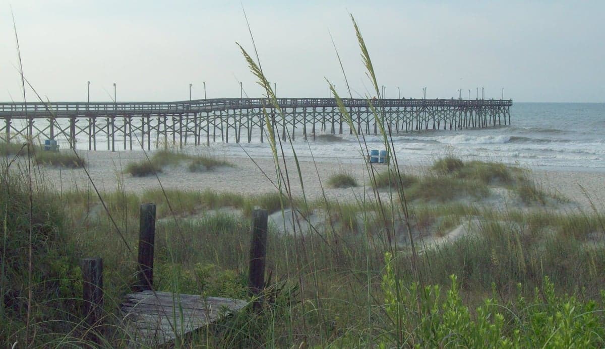
Photo: Wikipedia
Strategic Assessment of Ocean Isle Beach, NC
Meaningful friction. Expect exposure to either population pressure, blast zones, or natural disaster risk. Consider buying a retreat property.
What does the Strategic Assessment tell us?
Our Strategic Assessment grades tactical survivability of an area. Major population centers, military targets, fallout zones, natural disasters, and border exposure all drive risk — lower exposure means a more defensible position in a crisis.
This is heavily inspired by Joel Skousen's Strategic Relocation book. Highly recommended you checkout the book ($)What does this tell us?
Our Strategic Assessment grades tactical survivability of an area. Major population centers, military targets, fallout zones, natural disasters, and border exposure all drive risk — lower exposure means a more defensible position in a crisis.
This is heavily inspired by Joel Skousen's Strategic Relocation book. Highly recommended you checkout the book ($)Strategic Pillars

Key Distances
Regional Safe Places
Below is our recommended "safe zones" in North Carolina and the surrounding area based on our strategic heuristics. For most people, it's unrealistic to live in a “safe zone” full-time due to work, family or other personal reasons. They tend to be more rural. However, many of these areas are perfect for second homes and retreat properties that double as a vacation home or even a short-term rental.

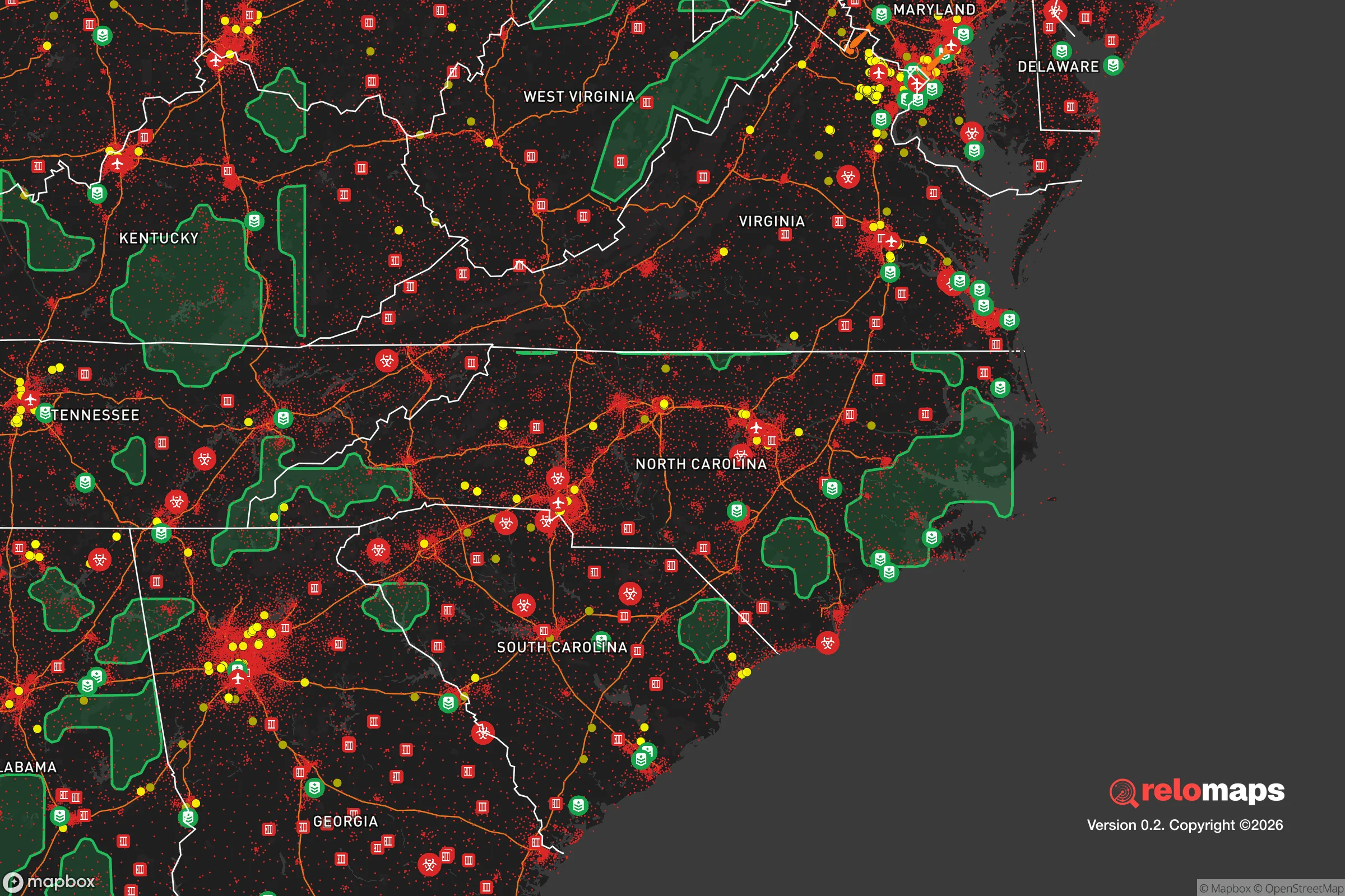


Important Note: For informational purposes only. This does not mean nothing bad ever happens in the green zones. Please use common sense. This is based on public data and modeled with AI. We tried to take a conservative approach but mistakes happen. We update this regularly as new information becomes available.
Solar Generator Recommendations
Backup power matters more here than in safer locations. We've picked three solar generators across budgets and capacity tiers — start with the budget unit if you only need a few essentials, or step up if you want to run a fridge and HVAC for days at a time.

Jackery Portable Power Station Explorer 300
Budget OptionPower on the Go: Weighing only 11 lbs, it's convenient to set up and store with book-sized foldable solar panels

BLUETTI Portable Power Station AC180
Designed for both indoor and outdoor scenarios, AC180 is highly capable as it has a robost capacity and continuous output power.

EF ECOFLOW DELTA Pro Ultra Power Station
Upgraded PickEcoFlow DELTA Pro Ultra is a whole-home energy system designed to grow with your family. Integrated with the Smart Home Panel 2, it scales to meet your evolving energy needs — keeping your home powered, intelligent, and secure through every stage of life.
We earn a commission, at no additional cost to you.
Strategic Assessment Analysis
Ocean Isle Beach, North Carolina, offers a strategic relocation option for those prioritizing disaster readiness and self-sufficiency, though its strengths are tightly coupled with its coastal identity. The town's position on a barrier island provides natural isolation from mainland population centers, while its location roughly 35 miles from the Myrtle Beach metro area and 50 miles from Wilmington places it within a useful buffer zone—close enough for supply runs and medical access, but far enough to avoid the immediate fallout of a major urban disruption. The area's resilience is defined by its low population density (approximately 550 year-round residents), limited bridge access, and a geography that demands serious preparation for hurricane threats and storm surge.
Geographic position and natural advantages for self-sufficiency
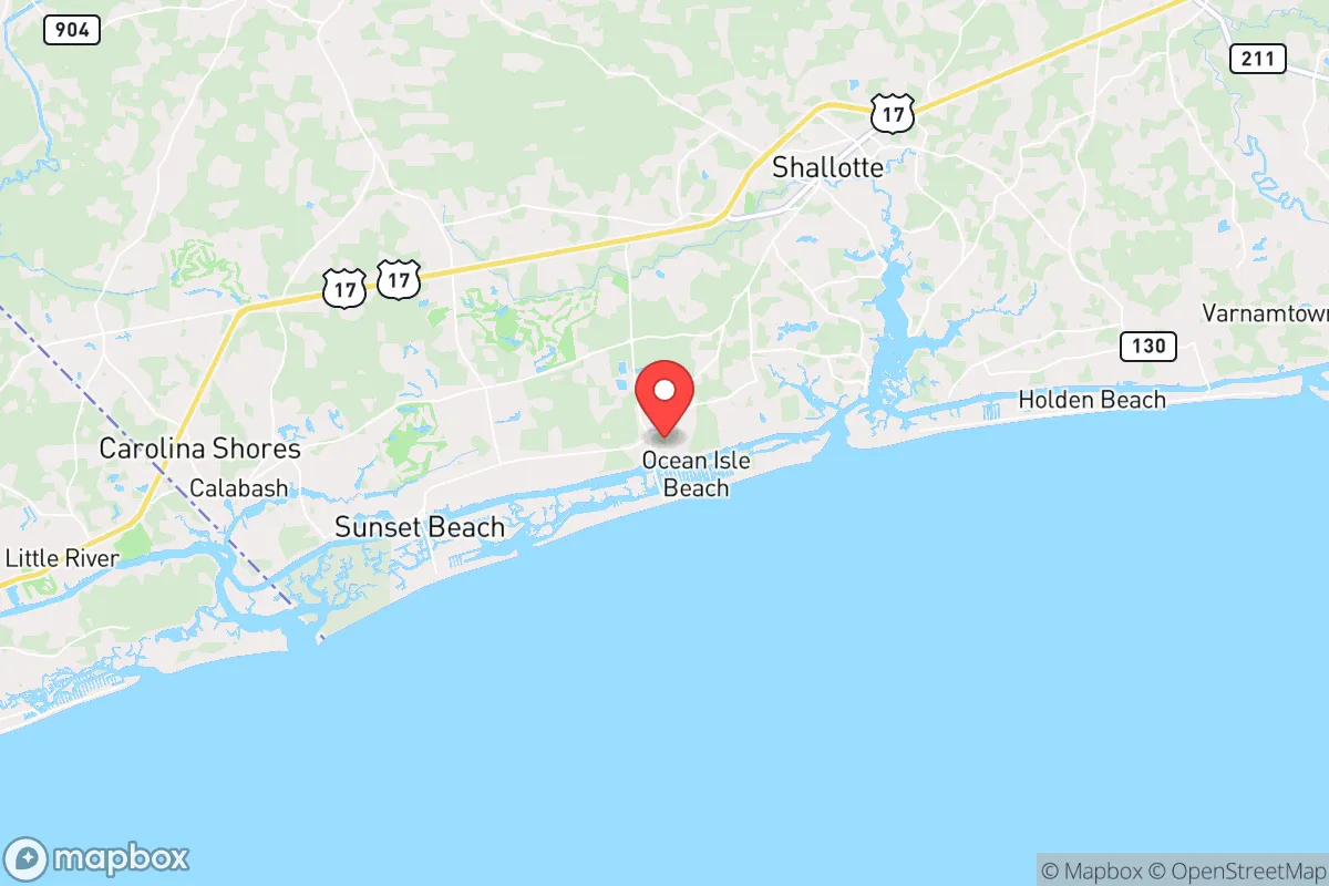
Ocean Isle Beach sits on a 7-mile-long barrier island, bordered by the Atlantic Ocean to the south and the Intracoastal Waterway to the north. This configuration offers a natural moat effect: the only vehicular access is via the Ocean Isle Beach Bridge on NC 904, a single two-lane span that can be controlled or monitored in a crisis. The island's narrow width—typically less than half a mile—means most homes are within a 5- to 10-minute walk of the ocean, which is a double-edged sword for resilience. The surrounding Brunswick County is heavily forested with pine and live oak, providing ample cover and natural resources, while the nearby Green Swamp Preserve (15 miles northwest) offers a vast, undeveloped buffer zone for retreat or foraging. The area's proximity to the Cape Fear River (20 miles north) and the Waccamaw River (25 miles west) provides freshwater sources, though both are tidal and require treatment. The local topography is flat, with elevations rarely exceeding 20 feet, which limits defensible high-ground options but simplifies overland travel and gardening.
Risks, exposures, and proximity to fallout-relevant landmarks
The most significant risk for Ocean Isle Beach is hurricane storm surge. The island sits in a Zone A evacuation area, meaning it is the first to be ordered out during a tropical event. The National Hurricane Center's historical data shows that a Category 2 storm can produce 6-8 feet of surge here, enough to inundate most ground-floor structures. The single bridge access creates a chokepoint: during a mandatory evacuation, the 15-mile drive to the mainland via NC 904 can become gridlocked, especially when combined with traffic from nearby Sunset Beach and Holden Beach. Beyond weather, the area's proximity to Duke Energy's Brunswick Nuclear Plant (25 miles northeast, near Southport) is a concern. While the plant has robust containment, a major incident could place Ocean Isle Beach within the 10-mile plume exposure pathway, requiring evacuation or sheltering. The nearby Sunny Point Military Ocean Terminal (30 miles northeast), a key ammunition shipping port, is another potential target. On the positive side, the island's isolation from major highways (I-40 is 45 miles north, I-95 is 70 miles west) reduces the risk of being caught in mass refugee flows or secondary attacks on infrastructure corridors. The closest major city, Myrtle Beach, is a tourism hub with a population of 35,000, but its sprawling suburban footprint and dependence on tourism make it a potential liability for resource competition during a crisis.
Practical resilience for a relocator: food, water, energy, and defensibility
For a relocator focused on self-sufficiency, Ocean Isle Beach presents a mixed picture. Food security is achievable but requires planning. The island has no commercial agriculture, but the surrounding Brunswick County is rich in farmland—corn, soybeans, and livestock operations are common within a 10-mile radius. The Intracoastal Waterway and Atlantic offer year-round fishing (flounder, red drum, shrimp, and blue crab), and the area's mild climate (average winter lows of 35°F) allows for extended growing seasons for vegetables like tomatoes, peppers, and greens. However, the sandy, salty soil on the island itself is poor for gardening; raised beds with imported soil or hydroponics are necessary. Water security is a critical vulnerability. The island relies on a municipal water system drawing from the Lower Cape Fear Aquifer, which is vulnerable to saltwater intrusion during storms and power outages. A private well is not feasible on the island due to shallow, brackish groundwater. Relocators should plan for rainwater catchment (average annual rainfall is 55 inches) and storage of at least 2-3 gallons per person per day for two weeks. Energy resilience is favorable: the area has strong solar potential (4.5-5.0 peak sun hours per day), and many homes already have backup generators due to frequent hurricane-related outages. Duke Energy's grid is reliable under normal conditions, but the island's single power line from the mainland is a single point of failure. Defensibility is a key advantage. The island's limited access points—one bridge and the beach itself—make it naturally chokepoint-friendly. The year-round population is small and tight-knit, which fosters community cooperation but also means that newcomers should invest in building relationships before a crisis. The nearest law enforcement is the Brunswick County Sheriff's Office (15 miles away in Shallotte), with response times of 15-30 minutes in normal conditions. For long-term self-sufficiency, the mainland areas around Shallotte (population 3,600) offer more space for homesteading, with larger lots, better soil, and access to the Waccamaw River for water and transport.
The overall strategic picture for Ocean Isle Beach is one of calculated trade-offs. Its coastal location provides natural isolation and abundant marine resources, but it comes with a hard ceiling on survivability during a major hurricane—evacuation is not optional, and the single bridge is a vulnerability. For a relocator who is serious about disaster readiness, the island works best as a seasonal or secondary retreat rather than a year-round fortress. The mainland areas of Brunswick County—particularly around Supply, Ash, and Longwood—offer better long-term resilience with higher ground, deeper freshwater aquifers, and more agricultural land, while still being within 20-30 minutes of the coast for fishing and recreation. If you choose Ocean Isle Beach itself, invest heavily in storm hardening, a robust generator system, and a pre-planned evacuation route to a secondary property inland. The area's low crime rate (violent crime is roughly 60% below the national average) and quiet, family-oriented culture make it a safe bet for normal times, but its resilience in a prolonged crisis depends entirely on how well you prepare for the island's inherent limitations.

* Values derived from national, state, county, city and local statistics and may differ in a specific area. Last updated: 2026-09-20T21:58:55.000Z
Narrative content on this page is AI-generated and may contain mistakes. Verify any details that matter before acting on them.
ReloMaps may earn a commission from affiliate links at no extra cost to you.

