Photo: Wikipedia
Strategic Assessment of Northlake, TX
Meaningful friction. Expect exposure to either population pressure, blast zones, or natural disaster risk. Consider buying a retreat property.
What does the Strategic Assessment tell us?
Our Strategic Assessment grades tactical survivability of an area. Major population centers, military targets, fallout zones, natural disasters, and border exposure all drive risk — lower exposure means a more defensible position in a crisis.
This is heavily inspired by Joel Skousen's Strategic Relocation book. Highly recommended you checkout the book ($)What does this tell us?
Our Strategic Assessment grades tactical survivability of an area. Major population centers, military targets, fallout zones, natural disasters, and border exposure all drive risk — lower exposure means a more defensible position in a crisis.
This is heavily inspired by Joel Skousen's Strategic Relocation book. Highly recommended you checkout the book ($)Strategic Pillars

Key Distances
Regional Safe Places
Below is our recommended "safe zones" in Texas and the surrounding area based on our strategic heuristics. For most people, it's unrealistic to live in a “safe zone” full-time due to work, family or other personal reasons. They tend to be more rural. However, many of these areas are perfect for second homes and retreat properties that double as a vacation home or even a short-term rental.

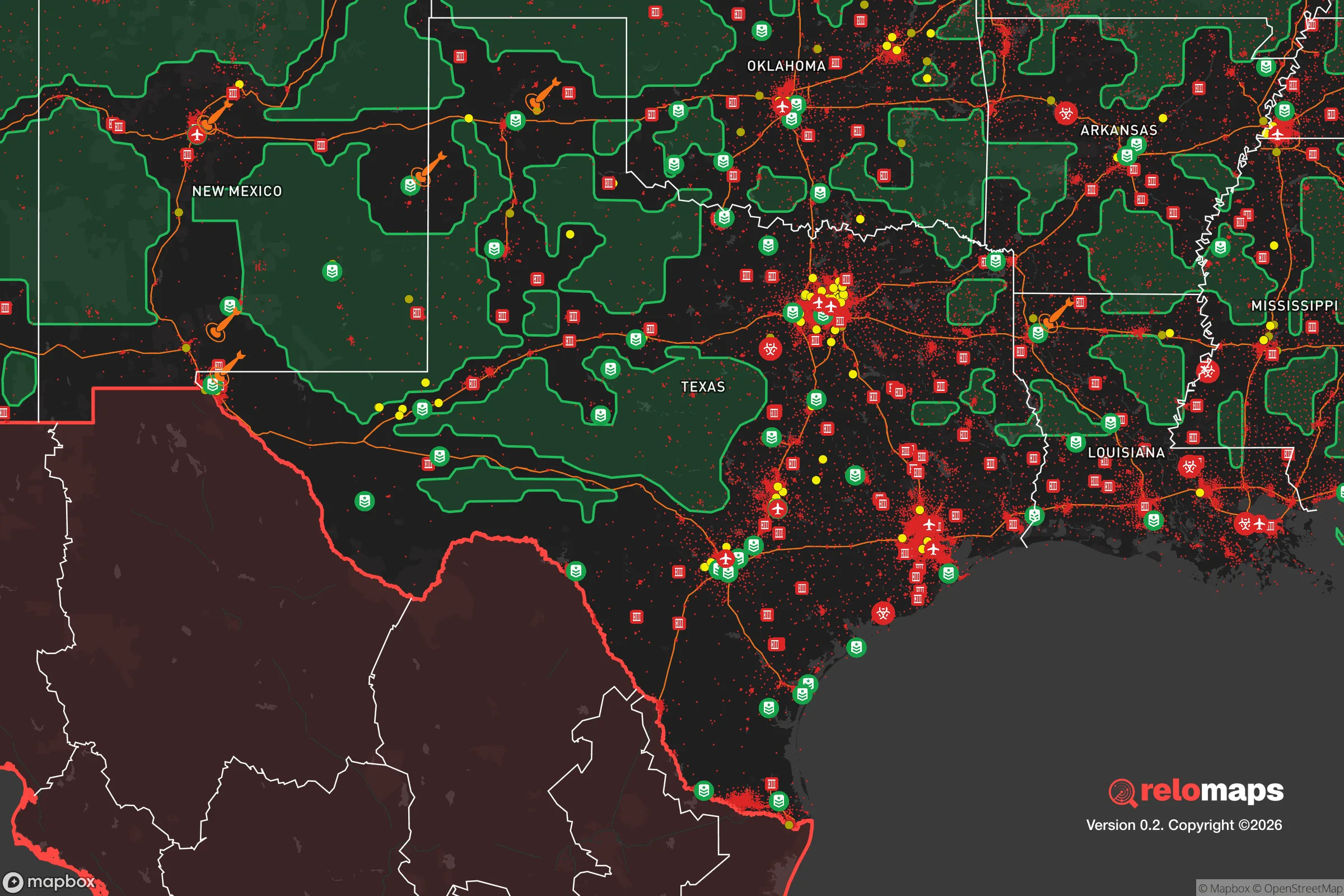


Important Note: For informational purposes only. This does not mean nothing bad ever happens in the green zones. Please use common sense. This is based on public data and modeled with AI. We tried to take a conservative approach but mistakes happen. We update this regularly as new information becomes available.
Solar Generator Recommendations
Backup power matters more here than in safer locations. We've picked three solar generators across budgets and capacity tiers — start with the budget unit if you only need a few essentials, or step up if you want to run a fridge and HVAC for days at a time.

Jackery Portable Power Station Explorer 300
Budget OptionPower on the Go: Weighing only 11 lbs, it's convenient to set up and store with book-sized foldable solar panels

BLUETTI Portable Power Station AC180
Designed for both indoor and outdoor scenarios, AC180 is highly capable as it has a robost capacity and continuous output power.

EF ECOFLOW DELTA Pro Ultra Power Station
Upgraded PickEcoFlow DELTA Pro Ultra is a whole-home energy system designed to grow with your family. Integrated with the Smart Home Panel 2, it scales to meet your evolving energy needs — keeping your home powered, intelligent, and secure through every stage of life.
We earn a commission, at no additional cost to you.
Strategic Assessment Analysis
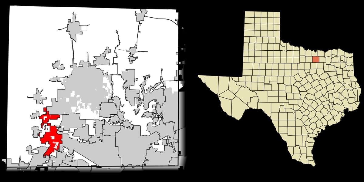
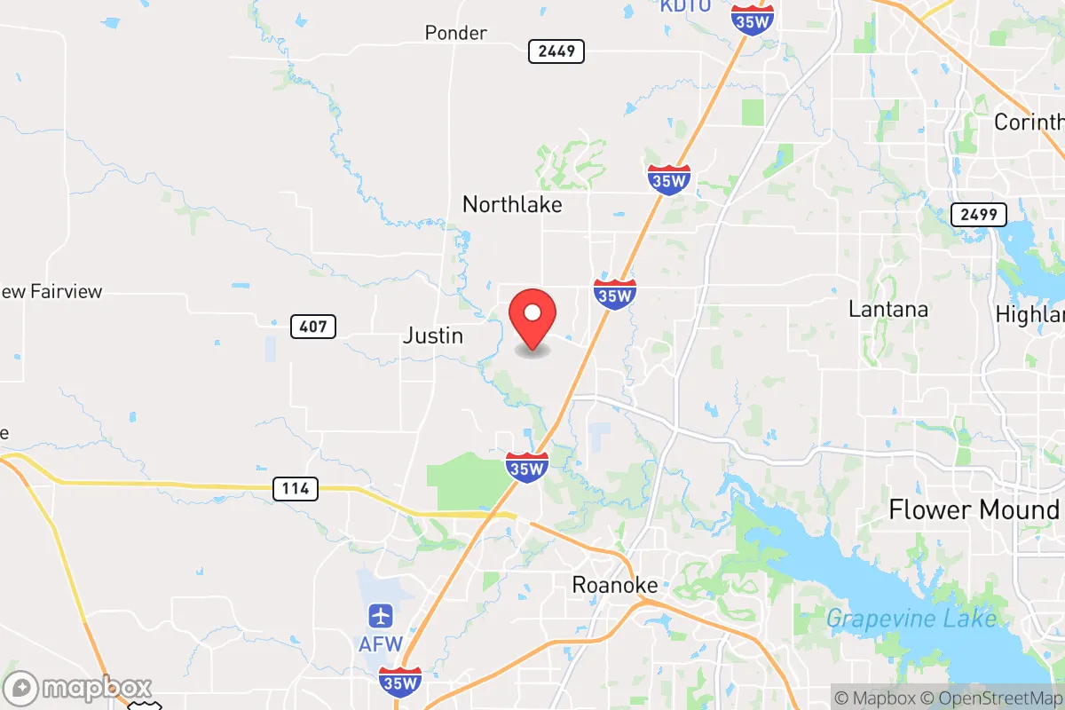
Northlake, Texas, offers a compelling strategic position for relocation-minded individuals and families who prioritize disaster readiness and self-sufficiency, balancing proximity to the Dallas-Fort Worth metroplex with a distinctly rural buffer. Located in Denton County, roughly 35 miles northwest of downtown Dallas, the town sits at the intersection of Interstate 35W and U.S. 380, providing rapid access to major urban resources while maintaining a low-density, semi-rural character. This geographic sweet spot gives Northlake a resilience advantage: it is close enough to tap into the DFW region's economic and logistical infrastructure, yet far enough from the densest population centers to reduce exposure to cascading urban failures, civil unrest, or targeted attacks on high-value infrastructure. The area's recent growth—from fewer than 1,000 residents in 2010 to over 5,000 by 2025—reflects a deliberate expansion tied to master-planned communities and industrial development, but the town's zoning and limited annexation history have preserved significant open space and agricultural land, which are critical assets for long-term self-sufficiency.
Geographic position and natural advantages for disaster readiness
Northlake's location on the eastern edge of the Cross Timbers ecoregion provides a natural buffer against some of Texas's more extreme weather patterns. The area sits atop the Barnett Shale formation, which means the underlying geology is predominantly limestone and clay, offering stable building foundations and minimal seismic risk—earthquakes in this region are rare and typically below magnitude 3.0. The terrain is gently rolling, with elevations around 700 feet, which reduces flood risk compared to areas closer to the Trinity River or its major tributaries. Northlake is not in a designated floodplain, though localized flash flooding can occur during heavy rain events, particularly along the small creeks that drain into the Elm Fork of the Trinity River. The town's position in Denton County places it in USDA Hardiness Zone 8a, with an average annual rainfall of about 36 inches, which is sufficient for rain-fed gardening and small-scale agriculture without requiring extensive irrigation. The growing season spans roughly 230 days, from late March to early November, allowing for diverse crop production. Prevailing winds from the south-southeast mean that airborne contaminants from industrial sources or potential fallout from a distant event would typically be carried away from Northlake, though this is a general pattern and not a guarantee.
Risks, exposures, and proximity to fallout-relevant landmarks
The most significant risk factor for Northlake is its proximity to several high-value targets and potential cascading hazards within a 50-mile radius. The town lies roughly 15 miles east of the AllianceTexas development in Fort Worth, a major logistics hub that includes the Fort Worth Alliance Airport, a FedEx sorting hub, and numerous defense contractors. This concentration of transportation and military-adjacent infrastructure makes the area a plausible target for a precision strike or sabotage in a conflict scenario. Additionally, Northlake is about 25 miles from the Dallas-Fort Worth International Airport (DFW), one of the busiest in the world, and 30 miles from the Dallas CBD, which contains multiple Fortune 500 headquarters and federal buildings. In a nuclear or radiological event, fallout patterns would depend heavily on wind direction, but prevailing winds from the south-southeast would carry contamination away from Northlake toward the north-northwest, potentially sparing the town from the worst of a ground-level release from a DFW-area detonation. However, a ground burst at Alliance or DFW could still produce significant fallout if winds shifted. The town is also within 40 miles of the Comanche Peak Nuclear Power Plant in Glen Rose, a pressurized water reactor that has operated safely since 1990 but remains a low-probability, high-consequence risk. Natural hazards are more mundane: severe thunderstorms, hail, and occasional tornadoes are the primary weather threats. Denton County averages about 5 tornado warnings per year, with most being weak (EF0-EF1) and short-lived. The area is not prone to hurricanes, wildfires (due to low fuel loads), or drought-driven water shortages, as the region's water supply is managed by the Upper Trinity Regional Water District and draws from multiple reservoirs.
Practical resilience for a relocator: food, water, energy, and defensibility
For a relocator focused on self-sufficiency, Northlake offers a mixed but generally favorable picture. Water access is the strongest asset: the town sits atop the Trinity Aquifer, which provides groundwater at depths of 200-400 feet, and private wells are permitted on parcels of one acre or more in unincorporated areas. Municipal water comes from the Upper Trinity Regional Water District, which draws from Lake Lewisville and Lake Ray Roberts, both of which have maintained reliable supplies even during the 2011 and 2022 droughts. Rainwater harvesting is legal and encouraged, with no state-level restrictions. Food production potential is high: the sandy loam soils are well-suited for raised-bed gardening, and the long growing season supports vegetables, fruits, and small livestock. Denton County has a robust agricultural extension office and a growing network of farmers' markets, though Northlake itself has limited retail grocery options—the nearest full-service supermarket is about 10 miles away in Roanoke or Justin. For long-term food storage, the area's low humidity (average 65%) is favorable for dry goods, but summer heat (average July high of 95°F) requires climate-controlled storage. Energy resilience is moderate: the town is served by Denton Municipal Electric and CoServ Electric, both of which have invested in grid hardening and backup generation. However, the Texas grid (ERCOT) remains vulnerable to extreme weather events, as demonstrated by the 2021 winter storm. Solar panel installation is viable, with an average of 220 sunny days per year, and net metering is available through some providers. Natural gas is widely available for heating and cooking, which provides a backup option if electricity fails. Defensibility is a key advantage: Northlake's low population density (roughly 200 people per square mile) and dispersed housing patterns make it difficult for a large-scale threat to concentrate. The town has its own police department, and Denton County Sheriff's Office provides additional coverage. The nearest major hospital is Texas Health Presbyterian Hospital in Flower Mound, about 15 miles south, which is a Level III trauma center. For a family or individual, the ability to retreat to a rural property with a well, solar panels, and a garden is realistic here, though zoning restrictions in newer subdivisions may limit some self-sufficiency practices.
The overall strategic picture for Northlake is one of calculated trade-offs. It offers a rare combination of rural buffer, groundwater access, and agricultural potential within a short drive of the DFW metroplex's economic engine. The primary vulnerabilities are man-made: proximity to logistics hubs, airports, and the nuclear plant, which elevate the risk profile in a major conflict or terrorist scenario. Natural hazards are manageable and typical for North Texas. For a relocator who values self-sufficiency and is willing to invest in well drilling, solar panels, and food storage, Northlake provides a defensible base with room to grow. The town's rapid development is a double-edged sword—it brings infrastructure improvements but also densification that could erode the very advantages that make it attractive. Those considering a move should prioritize properties with existing water rights, acreage, and minimal HOA restrictions on livestock and gardening. In a region where most suburbs are trading resilience for convenience, Northlake remains a standout option for the prepared-minded household.

* Values derived from national, state, county, city and local statistics and may differ in a specific area. Last updated: 2026-10-29T12:48:37.000Z
Narrative content on this page is AI-generated and may contain mistakes. Verify any details that matter before acting on them.
ReloMaps may earn a commission from affiliate links at no extra cost to you.

