Photo: Wikipedia
Strategic Assessment of Gaston County
Meaningful friction. Expect exposure to either population pressure, blast zones, or natural disaster risk. Consider buying a retreat property.
What does the Strategic Assessment tell us?
Our Strategic Assessment grades tactical survivability of an area. Major population centers, military targets, fallout zones, natural disasters, and border exposure all drive risk — lower exposure means a more defensible position in a crisis.
This is heavily inspired by Joel Skousen's Strategic Relocation book. Highly recommended you checkout the book ($)What does this tell us?
Our Strategic Assessment grades tactical survivability of an area. Major population centers, military targets, fallout zones, natural disasters, and border exposure all drive risk — lower exposure means a more defensible position in a crisis.
This is heavily inspired by Joel Skousen's Strategic Relocation book. Highly recommended you checkout the book ($)Strategic Pillars

Key Distances
Strategic Assessment Analysis
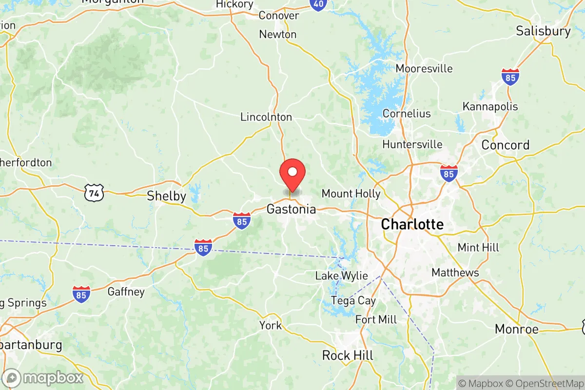
Gaston County, North Carolina, sits in a precarious but potentially strategic pocket of the Piedmont region, offering a mix of geographic buffers and hard-to-ignore exposure risks for anyone serious about long-term resilience. Its position roughly 20 miles west of Charlotte places it within the blast-and-fallout shadow of a major financial and transportation hub, yet its own topography—rolling hills, the Catawba River corridor, and a scattering of small towns like Belmont, Mount Holly, and Cherryville—provides natural chokepoints and defensible terrain that larger metro areas lack. For a relocator weighing civic unrest, supply chain disruptions, or mass casualty events, Gaston County is neither a fortress nor a death trap; it is a calculated middle ground where proximity to resources must be weighed against proximity to risk.
Geographic position and natural advantages for long-term stability
Gaston County’s primary strategic asset is its location along the Catawba River, which runs through the county’s eastern edge and feeds Lake Wylie, a major reservoir that also touches South Carolina. This water source is not infinite—drought cycles have dropped lake levels before—but it provides a reliable surface-water option for filtration and small-scale agriculture that many inland counties lack. The terrain is gently rolling, with elevations ranging from about 600 to 1,000 feet, which offers decent line-of-sight for communications and defensive positioning without the extreme isolation of mountain counties. The county’s road network is anchored by I-85, which runs east-west through the heart of Gastonia, and US 321, which cuts north-south toward Hickory and the High Country. In a grid-down scenario, these highways become liabilities—chokepoints for refugee flow—but the secondary road network (NC 274, NC 279, and numerous farm-to-market roads) offers multiple egress routes toward the less-dense counties of Lincoln and Cleveland to the west and north. The presence of Gaston County Municipal Airport in Cherryville provides a general aviation option for resupply or evacuation that does not depend on Charlotte Douglas International, which would be a primary target in any conflict involving infrastructure strikes.
Risks, exposures, and proximity to fallout-relevant landmarks
The single biggest vulnerability for Gaston County is its proximity to Charlotte, a city of nearly 900,000 people that hosts a major Federal Reserve bank, a hub for Bank of America and Wells Fargo operations, and a sprawling intermodal freight network tied to the Port of Charleston. In a mass casualty event—whether economic collapse, civil unrest, or a coordinated attack—Charlotte would become a humanitarian disaster zone, and Gaston County sits directly in the path of any westward exodus along I-85. The county also lies within 30 miles of McGuire Nuclear Station in neighboring Mecklenburg County, a two-reactor facility that, while well-regulated, represents a fixed target for sabotage or accident. A plume from McGuire would push east or northeast under prevailing winds, but a secondary release scenario could affect the Catawba River watershed that Gaston County depends on. On the industrial side, Gaston County itself hosts several chemical and textile plants, particularly around Mount Holly and Bessemer City, that handle solvents, dyes, and industrial gases. These are not on the scale of Houston’s refinery corridor, but a fire or explosion at one of these facilities during a period of reduced emergency response capacity could create localized contamination zones. The county’s Gaston County Police and Sheriff’s Office is professional and well-funded by rural standards, but in a widespread breakdown, a force of roughly 400 sworn officers cannot secure 90 miles of border against a determined population movement from Charlotte.
Practical resilience for a relocator: food, water, energy, and defensibility
For a single individual or family looking to establish a sustainable foothold, Gaston County offers a mixed bag. The Catawba River and Lake Wylie provide the most obvious water source, but access is not universal—much of the shoreline is privately owned or part of regulated parks. A property with a well is the gold standard here, and the county’s groundwater is generally good, though shallow wells in the eastern part of the county near the river can be vulnerable to surface contamination during floods. Agricultural land is still available in the western half of the county, particularly around Dallas and Cherryville, where small farms and hobby homesteads are common. The growing season runs roughly April through October, and the soil, while clay-heavy in spots, can support corn, beans, squash, and root vegetables with proper amendment. For energy, grid-tied solar with battery backup is viable—the county gets about 210 sunny days per year, slightly below the national average but adequate for a modest off-grid setup. Natural gas is widely piped in the Gastonia and Belmont areas, but rural properties west of US 321 often rely on propane or heating oil, which become supply-chain risks in a crisis. Defensibility is best in the South Point Township area near the Catawba, where winding roads and river bends create natural funnels, and in the Tryon area (technically just over the line in Polk County, but accessible from western Gaston) where elevation changes offer observation points. The county’s gun culture is strong—there are multiple shooting ranges and a high rate of concealed-carry permits—which means a relocator who is prepared to integrate into the local community will find neighbors who take security seriously. However, the county’s population density of roughly 500 people per square mile in the Gastonia area means that a determined group of looters or refugees could overwhelm a single homestead if it is not positioned with good standoff distance and multiple avenues of escape.
Overall, Gaston County presents a workable but not ideal strategic picture for the conservative prepper. Its strengths—reliable water, decent agricultural potential, a network of secondary roads, and a population that is not hostile to self-reliance—are real. Its weaknesses—proximity to a primary target city, a nuclear plant within fallout range, and a road network that funnels crisis traffic directly through the county—are equally real. The smart play here is not to buy a house in Gastonia proper or along the I-85 corridor, but to look at the western and northern fringes: Cherryville, the rural parts of Dallas, or the area around High Shoals where the county meets Lincoln and Cleveland. Those locations give you access to the county’s resources while putting enough distance between you and Charlotte to buy time in a collapse scenario. Gaston County is not a bug-out location; it is a live-in location that requires constant situational awareness and a plan for the day when the interstate goes silent and the sirens start. If you are willing to put in the work—dig a well, stockpile seed, and get to know your neighbors before the crisis hits—it can hold. If you are looking for a place to ride out the storm without effort, keep looking west.
* Values derived from national, state, county, city and local statistics and may differ in a specific area. Last updated: 2026-05-11T22:26:52.000Z
Narrative content on this page is AI-generated and may contain mistakes. Verify any details that matter before acting on them.
ReloMaps may earn a commission from affiliate links at no extra cost to you.