Photo: Wikipedia
Strategic Assessment of Clark County
Multiple tactical vulnerabilities. Population density, target proximity, or disaster risk are likely compounding. A retreat property and exit planning is required.
What does the Strategic Assessment tell us?
Our Strategic Assessment grades tactical survivability of an area. Major population centers, military targets, fallout zones, natural disasters, and border exposure all drive risk — lower exposure means a more defensible position in a crisis.
This is heavily inspired by Joel Skousen's Strategic Relocation book. Highly recommended you checkout the book ($)What does this tell us?
Our Strategic Assessment grades tactical survivability of an area. Major population centers, military targets, fallout zones, natural disasters, and border exposure all drive risk — lower exposure means a more defensible position in a crisis.
This is heavily inspired by Joel Skousen's Strategic Relocation book. Highly recommended you checkout the book ($)Strategic Pillars

Key Distances
Strategic Assessment Analysis
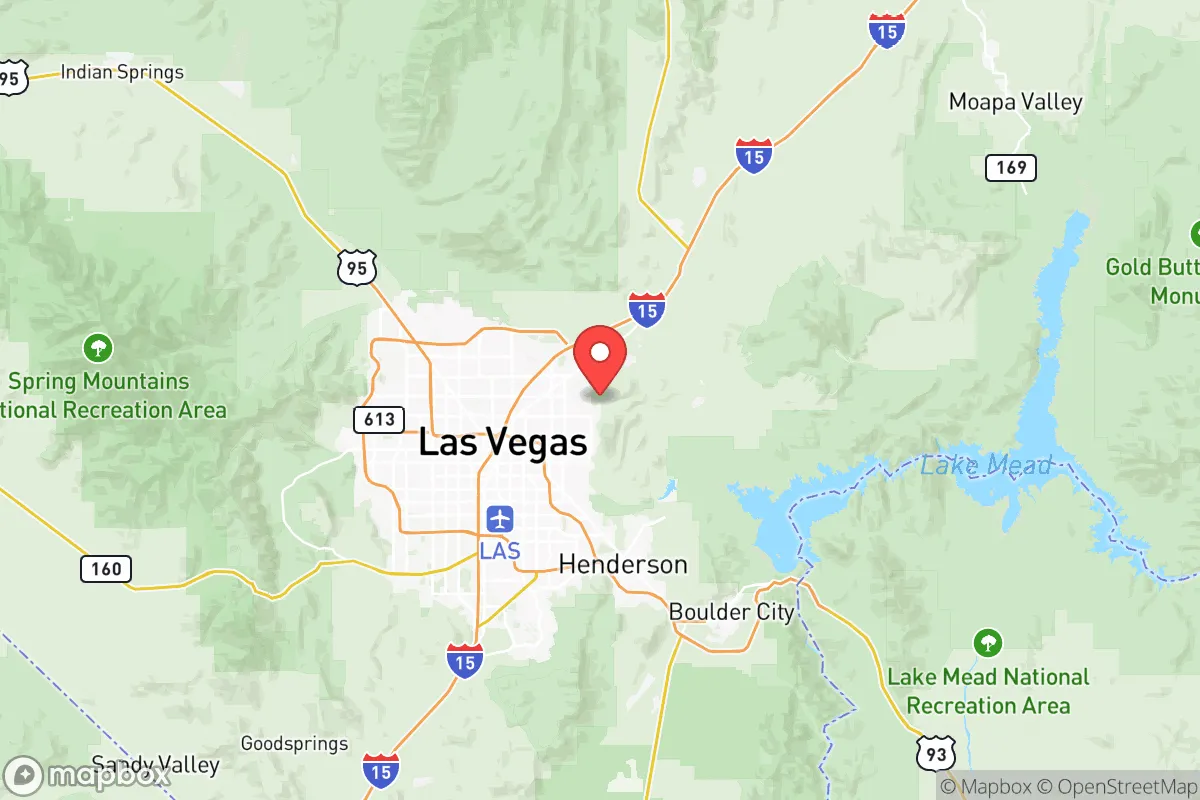
Clark County, Nevada, presents a complex strategic picture for the conservative prepper or survivalist. Its core resilience lies in its geographic isolation and the sheer economic inertia of Las Vegas, but that same isolation creates critical vulnerabilities. For a relocator weighing long-term stability against catastrophic risk, the county offers a unique mix of desert defensibility and urban exposure that demands a hard-eyed assessment.
Geographic position and natural advantages for long-term survival
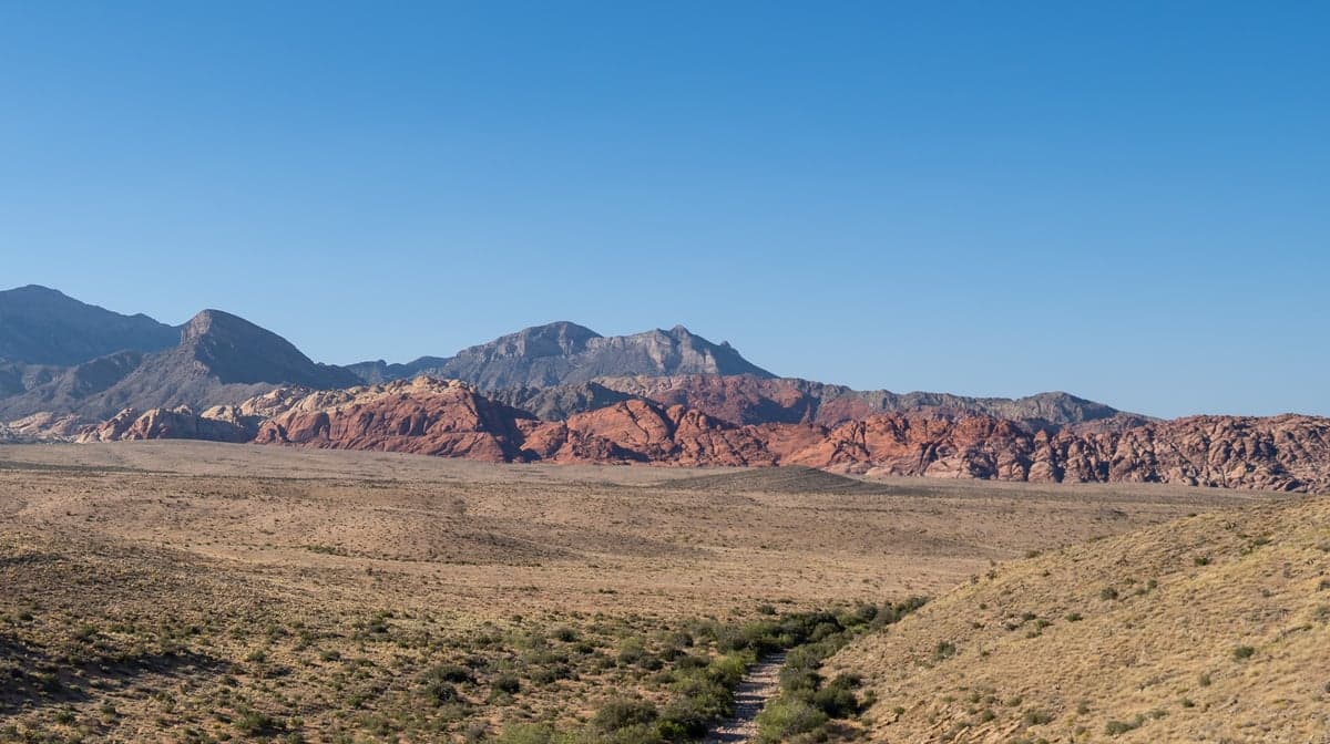
Clark County’s primary strategic asset is its location in the Mojave Desert, far from the major population corridors of the coasts and the Rust Belt. The county sits roughly 250 miles from Los Angeles and 300 miles from Phoenix, placing it outside the immediate blast and fallout zones of those high-value targets. The surrounding terrain—the Spring Mountains to the west, the Sheep Range to the north, and the Eldorado Valley to the southeast—provides natural barriers that slow movement and create defensible pockets. The Mojave Desert’s low humidity and sparse vegetation reduce the risk of wildfire spread compared to forested regions, and the lack of major rivers or floodplains means flash flooding is localized and predictable. For a relocator, the area around Pahrump (Nye County, just west of Clark) and the rural stretches near Searchlight offer the kind of low-population buffer that urban preppers dream of—but you’re still within a two-hour drive of Las Vegas’s resources if needed.
Risks, exposures, and proximity to fallout-relevant landmarks
The flip side is that Clark County contains one of the highest-value targets in the American West: the Las Vegas Strip and the associated tourism infrastructure. A single nuclear or EMP event over the Strip would collapse the regional economy instantly, and the fallout plume from a ground burst at Nellis Air Force Base (home to the Nevada Test and Training Range) or the Nevada National Security Site (formerly the Nevada Test Site, 65 miles northwest of Las Vegas) would blanket large portions of the county. The Hoover Dam at the southeastern edge of the county is a critical infrastructure node—a conventional or cyber attack on its transformers could cut power to 1.3 million people and cripple water pumping for the entire Southwest. The I-15 corridor through the Virgin River Gorge is a chokepoint for any evacuation north or south; a single bridge failure would trap residents in the Las Vegas Valley. For the prepper, the risk isn’t just the blast—it’s the cascading failure of a city that imports 90% of its food and nearly all its fuel, with no natural water source beyond the Colorado River.
Practical resilience for a relocator: food, water, energy, and defensibility
Water is the single biggest vulnerability in Clark County. The region relies almost entirely on the Colorado River via Lake Mead, which has been in a structural deficit for two decades. A multi-year drought or upstream diversion would make Las Vegas uninhabitable for anyone without a private well—and deep wells in the desert are expensive and unpredictable. For a relocator, the practical solution is to locate in the Red Rock Canyon or Mount Charleston areas, where seasonal springs and higher elevation offer better groundwater access, but you’ll need to drill 300-500 feet and install solar pumping. Food resilience is equally challenging: the growing season is short (March to October) and soil is alkaline, so you’re looking at raised beds with imported soil, hydroponics, or greenhouse systems. The Pahrump Valley has a few working farms and a local farmers’ market, but don’t expect to subsist on local produce. Energy is a bright spot—Clark County averages 300+ sunny days per year, making solar with battery storage a reliable off-grid option. The county’s building codes are lax in unincorporated areas, so you can set up a defensible compound with minimal permitting. Defensibility is mixed: the open desert offers clear sightlines but limited cover, and the proximity to Las Vegas means you’re within a day’s walk of desperate populations. A rural property near Laughlin or Mesquite (both on the county’s periphery) gives you a better chance of holding ground than anything inside the I-215 beltway.
Overall strategic picture for the conservative relocator
Clark County is a high-risk, high-reward proposition for the survivalist. It offers the isolation and climate that make long-term off-grid living feasible, but it’s tethered to a city that would collapse catastrophically in any major event. The smart play is to treat the county as a staging area—buy land in the rural periphery (Pahrump, Searchlight, or the Moapa Valley), maintain a low profile, and keep a vehicle capable of a 500-mile bug-out to the Utah or Arizona high country. The county’s political climate leans blue in Las Vegas proper, but the outlying areas are deeply conservative and self-reliant. If you can secure water and energy independence, Clark County gives you the space to ride out the storm—but only if you’re prepared to leave the Strip to its fate.
* Values derived from national, state, county, city and local statistics and may differ in a specific area. Last updated: 2026-05-13T08:06:17.000Z
Narrative content on this page is AI-generated and may contain mistakes. Verify any details that matter before acting on them.
ReloMaps may earn a commission from affiliate links at no extra cost to you.