
Photo by Matthew Lancaster on Unsplash
Strategic Assessment of Mt Jackson, VA
Meaningful friction. Expect exposure to either population pressure, blast zones, or natural disaster risk. Consider buying a retreat property.
What does the Strategic Assessment tell us?
Our Strategic Assessment grades tactical survivability of an area. Major population centers, military targets, fallout zones, natural disasters, and border exposure all drive risk — lower exposure means a more defensible position in a crisis.
This is heavily inspired by Joel Skousen's Strategic Relocation book. Highly recommended you checkout the book ($)What does this tell us?
Our Strategic Assessment grades tactical survivability of an area. Major population centers, military targets, fallout zones, natural disasters, and border exposure all drive risk — lower exposure means a more defensible position in a crisis.
This is heavily inspired by Joel Skousen's Strategic Relocation book. Highly recommended you checkout the book ($)Strategic Pillars

Key Distances
Regional Safe Places
Below is our recommended "safe zones" in Virginia and the surrounding area based on our strategic heuristics. For most people, it's unrealistic to live in a “safe zone” full-time due to work, family or other personal reasons. They tend to be more rural. However, many of these areas are perfect for second homes and retreat properties that double as a vacation home or even a short-term rental.




Important Note: For informational purposes only. This does not mean nothing bad ever happens in the green zones. Please use common sense. This is based on public data and modeled with AI. We tried to take a conservative approach but mistakes happen. We update this regularly as new information becomes available.
Solar Generator Recommendations
Backup power matters more here than in safer locations. We've picked three solar generators across budgets and capacity tiers — start with the budget unit if you only need a few essentials, or step up if you want to run a fridge and HVAC for days at a time.

Jackery Portable Power Station Explorer 300
Budget OptionPower on the Go: Weighing only 11 lbs, it's convenient to set up and store with book-sized foldable solar panels

BLUETTI Portable Power Station AC180
Designed for both indoor and outdoor scenarios, AC180 is highly capable as it has a robost capacity and continuous output power.

EF ECOFLOW DELTA Pro Ultra Power Station
Upgraded PickEcoFlow DELTA Pro Ultra is a whole-home energy system designed to grow with your family. Integrated with the Smart Home Panel 2, it scales to meet your evolving energy needs — keeping your home powered, intelligent, and secure through every stage of life.
We earn a commission, at no additional cost to you.
Strategic Assessment Analysis
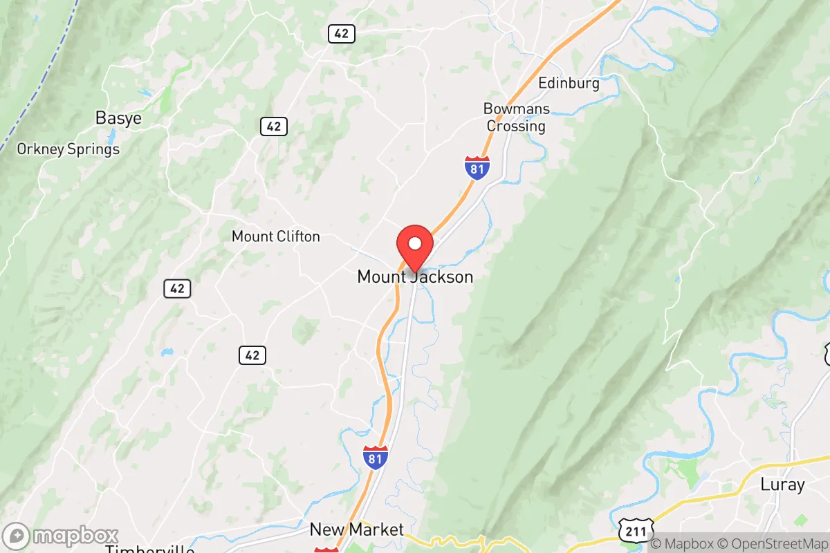
Mount Jackson, Virginia, presents a compelling case for the relocation-minded reader focused on resilience, blending a strategic Shenandoah Valley location with a quiet, agricultural character that supports self-sufficiency. The town sits in a sweet spot—close enough to major infrastructure for supply runs and medical access, yet far enough from the dense populations and high-profile targets of the I-95 corridor to offer genuine breathing room. For someone weighing disaster readiness, Mount Jackson’s position offers a solid foundation, but the full picture requires a clear-eyed look at both its natural advantages and the risks that come with living in a valley with proximity to the nation’s capital.
Geographic position and natural advantages for long-term stability
Mount Jackson’s primary resilience asset is its location in the Shenandoah Valley, a natural corridor that has historically served as a breadbasket and a buffer. The town sits roughly 90 miles west of Washington, D.C., and about 30 miles north of Harrisonburg, placing it outside the immediate blast or fallout zones of a major metropolitan strike while still within a reasonable drive for resupply or medical evacuation. The surrounding landscape is defined by the Massanutten Mountain to the east and the Allegheny Mountains to the west, creating a natural funnel that limits approach routes—a double-edged sword for defensibility but a clear advantage for monitoring movement. The valley floor itself is fertile, with deep, well-drained soils that support agriculture, and the North Fork of the Shenandoah River runs right through town, providing a reliable surface water source. Elevation here averages around 900 feet, which avoids the floodplain risks of lower-lying areas while still benefiting from the valley’s moderate climate—hot summers and cold winters, but rarely extreme enough to cause crop failure or infrastructure collapse. The region’s karst geology, with its limestone bedrock, also means good groundwater potential for wells, though drilling depth and yield vary significantly by parcel.
Risks, exposures, and proximity to fallout-relevant landmarks
The most significant risk for Mount Jackson is its position within the Shenandoah Valley’s “target shadow” relative to Washington, D.C. In a major conflict scenario, the D.C. metro area—home to the Pentagon, Capitol, and numerous government facilities—is a high-priority target. While Mount Jackson is far enough to avoid direct blast effects, prevailing westerly winds would carry fallout eastward, meaning the town is not in the primary downwind plume path from a D.C. strike. However, the valley’s geography can trap particulate matter in certain weather conditions, and the town sits roughly 40 miles from the Blue Ridge Tunnel and other critical transportation chokepoints that could be secondary targets. Natural hazards are more immediate: the area is in a moderate seismic zone (small quakes are felt every few years), and the North Fork of the Shenandoah has a history of flooding, particularly during tropical remnants like Hurricane Camille (1969) and Hurricane Agnes (1972). Ice storms and occasional heavy snow (averaging 25-30 inches annually) can knock out power for days, especially in rural stretches. The nearby Mount Jackson Industrial Park and the town’s position along I-81—a major trucking route—mean that a hazmat spill or transportation accident is a realistic concern, though not a daily one. For the relocator, the key takeaway is that Mount Jackson’s risks are manageable with preparation: flooding is localized and predictable, seismic activity is low, and the fallout risk is real but not acute compared to areas directly east of D.C.
Practical resilience for a relocator: food, water, energy, and defensibility
For someone serious about self-sufficiency, Mount Jackson offers a strong baseline. Food production is the standout advantage: the surrounding Shenandoah County is one of Virginia’s top agricultural producers, with a heavy focus on poultry, cattle, and row crops like corn and hay. The town itself hosts a weekly farmers’ market from May through October, and the nearby Shenandoah Valley Produce Auction in Dayton provides bulk access to local fruits and vegetables. For a relocator with land, the growing season runs roughly 160 days (April to October), and the soil pH is generally favorable for gardens. Water is less straightforward: while the North Fork of the Shenandoah is a reliable surface source, it requires treatment (boiling or filtration) for drinking, and the river’s flow can drop during summer droughts. Wells are common in the area, but drilling costs run $15-$30 per foot, and yields vary—some properties hit good water at 100 feet, others need 300+. The town’s municipal water system draws from the river and is treated, but it’s vulnerable to power outages. Energy resilience is a mixed bag: the grid is served by Shenandoah Valley Electric Cooperative, which has a decent reliability record but is prone to ice-storm outages. Solar potential is good—the valley gets about 200 sunny days per year—but net metering policies in Virginia have been in flux, so check current rules. Wood heating is popular and practical, with abundant firewood from the George Washington National Forest just west of town. Defensibility is the trickiest factor: Mount Jackson’s position in a valley with limited road access (primarily I-81 and US-11) means that in a grid-down scenario, the town could be easily isolated by a single bridge failure or road blockage. The local population is around 2,000, with a county-wide population density of about 60 people per square mile—low enough to avoid crowding but high enough to have a functional community. The Shenandoah County Sheriff’s Office and a small police department provide law enforcement, but response times in rural areas can exceed 20 minutes. For a relocator, the practical play is to secure a property with a well, solar panels, and a wood stove, and to build relationships with local farmers and the Mennonite community (who are skilled in off-grid living and often sell supplies directly).
The overall strategic picture for Mount Jackson is one of a solid, middle-ground option for the resilience-minded relocator. It’s not a hardened bunker location—it’s a working agricultural town with real infrastructure vulnerabilities and a non-zero risk from national-level events. But for someone who wants to be within a few hours of D.C. for work or family while maintaining a credible self-sufficiency setup, it’s one of the better bets in the Mid-Atlantic. The key is to treat it as a base for active preparation, not a passive safe zone: invest in your own water and power, learn the local growing calendar, and understand that the valley’s beauty comes with a trade-off in limited egress routes. For the single individual or family willing to put in the work, Mount Jackson offers a defensible, productive, and community-oriented environment that balances access with distance—a rare combination in a region where most towns are either too close to the target or too far from civilization.

* Values derived from national, state, county, city and local statistics and may differ in a specific area. Last updated: 2026-10-11T03:11:33.000Z
Narrative content on this page is AI-generated and may contain mistakes. Verify any details that matter before acting on them.
ReloMaps may earn a commission from affiliate links at no extra cost to you.

