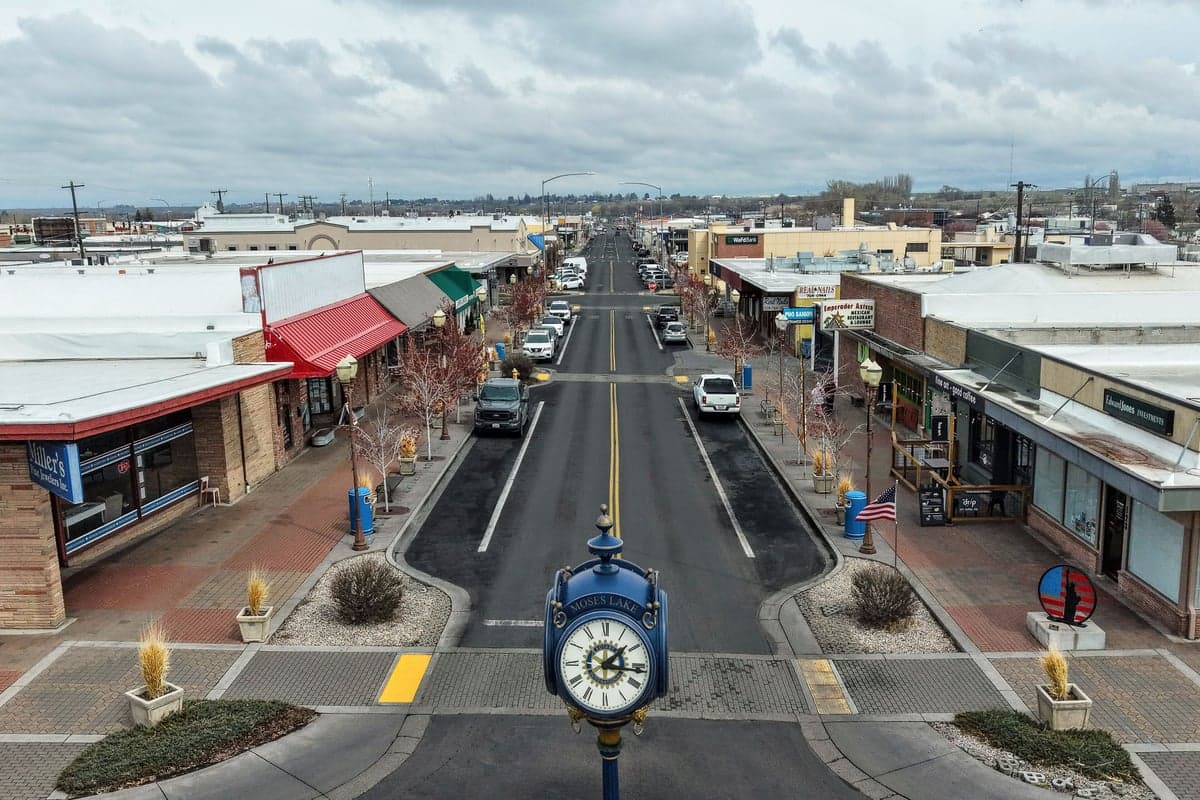
Photo: Wikipedia
Strategic Assessment of Moses Lake, WA
Workable tactical position. Some exposure to population density or targets, but generally defensible in a crisis.
What does the Strategic Assessment tell us?
Our Strategic Assessment grades tactical survivability of an area. Major population centers, military targets, fallout zones, natural disasters, and border exposure all drive risk — lower exposure means a more defensible position in a crisis.
This is heavily inspired by Joel Skousen's Strategic Relocation book. Highly recommended you checkout the book ($)What does this tell us?
Our Strategic Assessment grades tactical survivability of an area. Major population centers, military targets, fallout zones, natural disasters, and border exposure all drive risk — lower exposure means a more defensible position in a crisis.
This is heavily inspired by Joel Skousen's Strategic Relocation book. Highly recommended you checkout the book ($)Strategic Pillars

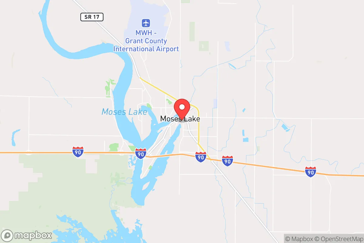
Key Distances
Regional Safe Places
Below is our recommended "safe zones" in Washington and the surrounding area based on our strategic heuristics. For most people, it's unrealistic to live in a “safe zone” full-time due to work, family or other personal reasons. They tend to be more rural. However, many of these areas are perfect for second homes and retreat properties that double as a vacation home or even a short-term rental.
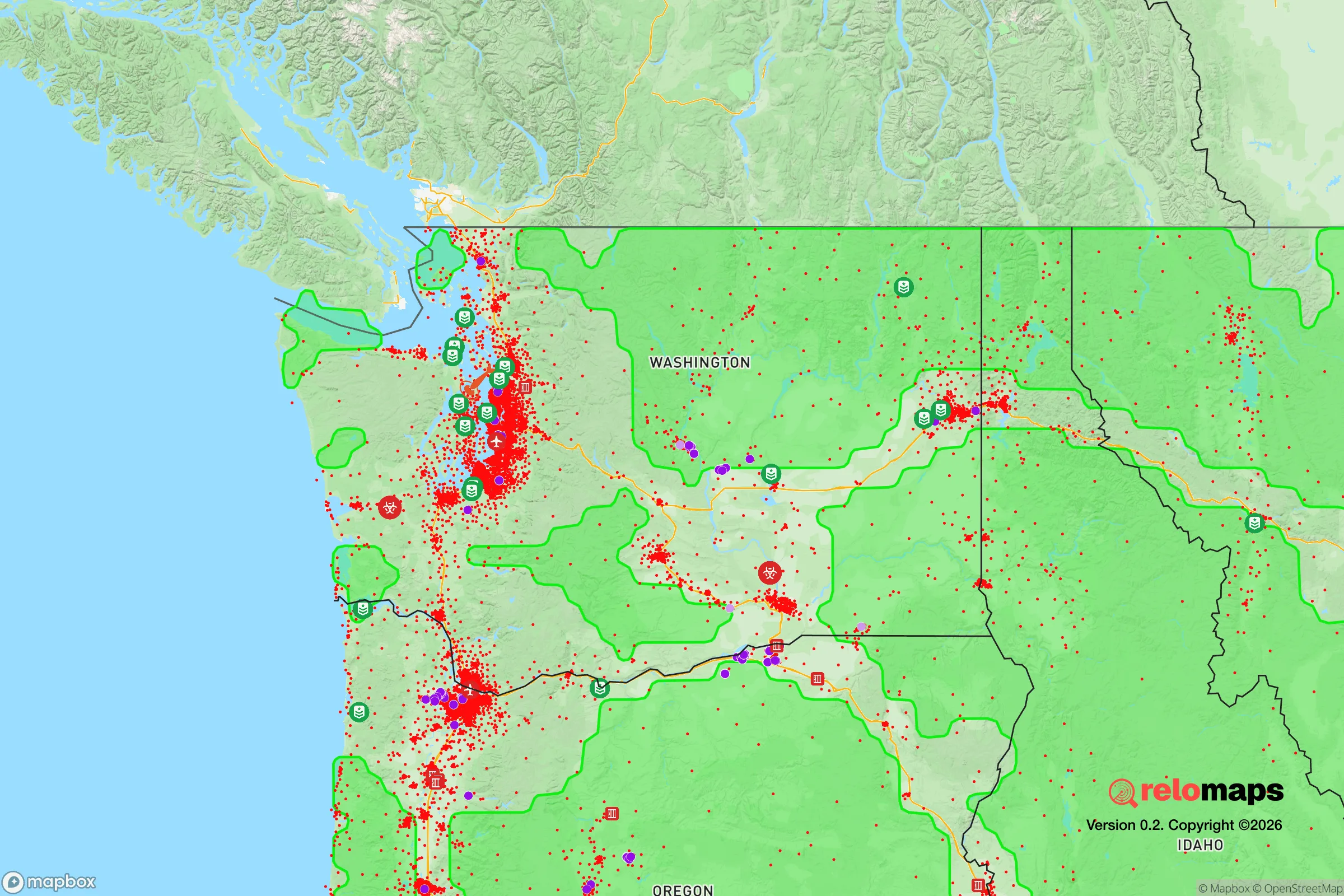
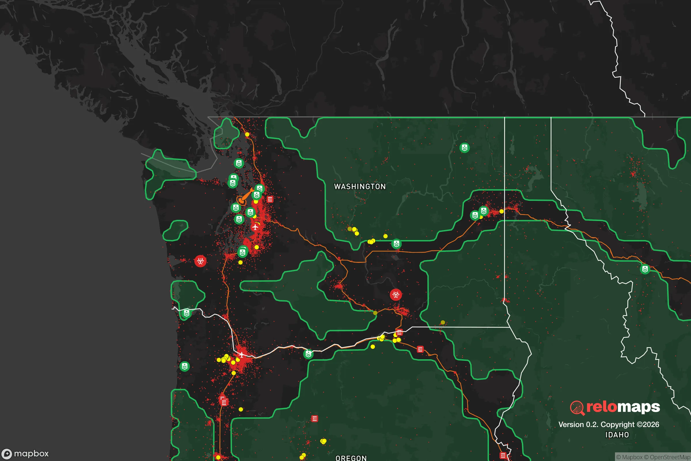


Important Note: For informational purposes only. This does not mean nothing bad ever happens in the green zones. Please use common sense. This is based on public data and modeled with AI. We tried to take a conservative approach but mistakes happen. We update this regularly as new information becomes available.
Solar Generator Recommendations
Backup power matters more here than in safer locations. We've picked three solar generators across budgets and capacity tiers — start with the budget unit if you only need a few essentials, or step up if you want to run a fridge and HVAC for days at a time.

Jackery Portable Power Station Explorer 300
Budget OptionPower on the Go: Weighing only 11 lbs, it's convenient to set up and store with book-sized foldable solar panels

BLUETTI Portable Power Station AC180
Designed for both indoor and outdoor scenarios, AC180 is highly capable as it has a robost capacity and continuous output power.

EF ECOFLOW DELTA Pro Ultra Power Station
Upgraded PickEcoFlow DELTA Pro Ultra is a whole-home energy system designed to grow with your family. Integrated with the Smart Home Panel 2, it scales to meet your evolving energy needs — keeping your home powered, intelligent, and secure through every stage of life.
We earn a commission, at no additional cost to you.
Strategic Assessment Analysis
Moses Lake, Washington, offers a compelling strategic position for relocators prioritizing resilience and self-sufficiency, balancing the region's agricultural abundance with a location that is far enough from major metropolitan targets to reduce fallout risk, yet close enough to access critical infrastructure. Situated in central Washington's Columbia Basin, the city benefits from a semi-arid climate, a robust irrigation system fed by the Columbia River, and a geography that provides natural separation from the densely populated Puget Sound corridor. For a conservative-leaning individual or family assessing long-term stability, Moses Lake presents a grounded, data-backed option that merits serious consideration.
Geographic position and natural advantages for long-term stability
Moses Lake sits at the heart of the Columbia Basin Project, one of the largest irrigation networks in the United States, which transforms the region's dry landscape into a productive agricultural hub. The city's location along Interstate 90 places it roughly 170 miles east of Seattle and 130 miles west of Spokane, providing a buffer from the congestion and vulnerability of those urban centers while still allowing access to their medical and supply chains. The surrounding terrain is largely flat, with the Columbia River and Potholes Reservoir offering substantial freshwater resources. The area's low annual precipitation—around 8 inches per year—reduces risks associated with flooding, mold, and infrastructure degradation that plague wetter regions. Additionally, the region's geology is stable, with minimal seismic activity compared to western Washington, lowering the likelihood of earthquake-related disruptions to utilities and transportation.
Risk exposure, man-made threats, and proximity to critical infrastructure
While Moses Lake avoids many natural disaster risks, it is not without exposure to man-made threats that a resilience-minded relocator should weigh. The most notable concern is the city's proximity to the Columbia Generating Station, Washington's only commercial nuclear power plant, located roughly 30 miles southwest near Richland. Though the plant has a strong safety record, a major incident could affect downwind areas, including Moses Lake, depending on prevailing weather patterns. Additionally, the region hosts several military installations, including Joint Base Lewis-McChord (about 150 miles west) and the Yakima Training Center (about 80 miles southwest), which could become secondary targets or staging areas during a national emergency. The city itself is not a primary target for a strategic strike, but its location along I-90 and near major rail lines means it could experience secondary effects such as refugee flow or supply chain disruptions if Seattle or Spokane were compromised. On the positive side, Moses Lake's distance from major ports, military command centers, and population-dense targets significantly reduces its attractiveness as a primary fallout zone.
Practical resilience for relocators: food, water, energy, and defensibility
For a family or individual serious about self-sufficiency, Moses Lake offers tangible advantages in food and water security. The Columbia Basin's irrigation infrastructure provides reliable access to surface water, and the region's agricultural output—including potatoes, wheat, corn, and alfalfa—means local food production is abundant and diversified. The city's municipal water supply draws from deep aquifers and the Columbia River, offering redundancy that many communities lack. Energy resilience is also strong: the region is served by the Grant County Public Utility District, which derives power from the Wanapum and Priest Rapids dams on the Columbia River, providing a stable, hydroelectric-based grid less vulnerable to fuel supply disruptions. For off-grid or backup energy, the area's high solar insolation—among the best in Washington—makes photovoltaic systems highly effective. Defensibility is a mixed picture: the flat terrain offers limited natural chokepoints, but the surrounding agricultural land provides open sightlines, and the city's relatively low population density (around 25,000 residents) reduces competition for resources in a crisis. The local economy is anchored by agriculture, manufacturing, and the nearby Moses Lake Industrial Center, which includes data centers and aerospace facilities, offering employment stability that supports long-term residency.
Overall, Moses Lake presents a balanced strategic profile for the conservative relocator focused on resilience. Its geographic isolation from major urban targets, combined with abundant water and energy resources, creates a foundation for sustainable living that is rare in the Pacific Northwest. The primary risks—proximity to a nuclear plant and potential secondary effects from regional disruptions—are manageable with basic preparedness measures, such as maintaining a 72-hour kit and understanding local wind patterns. For those willing to trade the amenities of a coastal city for the security of a self-reliant, agriculturally rich community, Moses Lake stands out as a pragmatic choice that aligns with a preparedness-oriented lifestyle.

* Values derived from national, state, county, city and local statistics and may differ in a specific area. Last updated: 2026-10-24T04:31:50.000Z
Narrative content on this page is AI-generated and may contain mistakes. Verify any details that matter before acting on them.
ReloMaps may earn a commission from affiliate links at no extra cost to you.

