
Photo: Wikipedia
Strategic Assessment of Morton Grove, IL
Multiple tactical vulnerabilities. Population density, target proximity, or disaster risk are likely compounding. A retreat property and exit planning is required.
What does the Strategic Assessment tell us?
Our Strategic Assessment grades tactical survivability of an area. Major population centers, military targets, fallout zones, natural disasters, and border exposure all drive risk — lower exposure means a more defensible position in a crisis.
This is heavily inspired by Joel Skousen's Strategic Relocation book. Highly recommended you checkout the book ($)What does this tell us?
Our Strategic Assessment grades tactical survivability of an area. Major population centers, military targets, fallout zones, natural disasters, and border exposure all drive risk — lower exposure means a more defensible position in a crisis.
This is heavily inspired by Joel Skousen's Strategic Relocation book. Highly recommended you checkout the book ($)Strategic Pillars

Key Distances
Regional Safe Places
Below is our recommended "safe zones" in Illinois and the surrounding area based on our strategic heuristics. For most people, it's unrealistic to live in a “safe zone” full-time due to work, family or other personal reasons. They tend to be more rural. However, many of these areas are perfect for second homes and retreat properties that double as a vacation home or even a short-term rental.
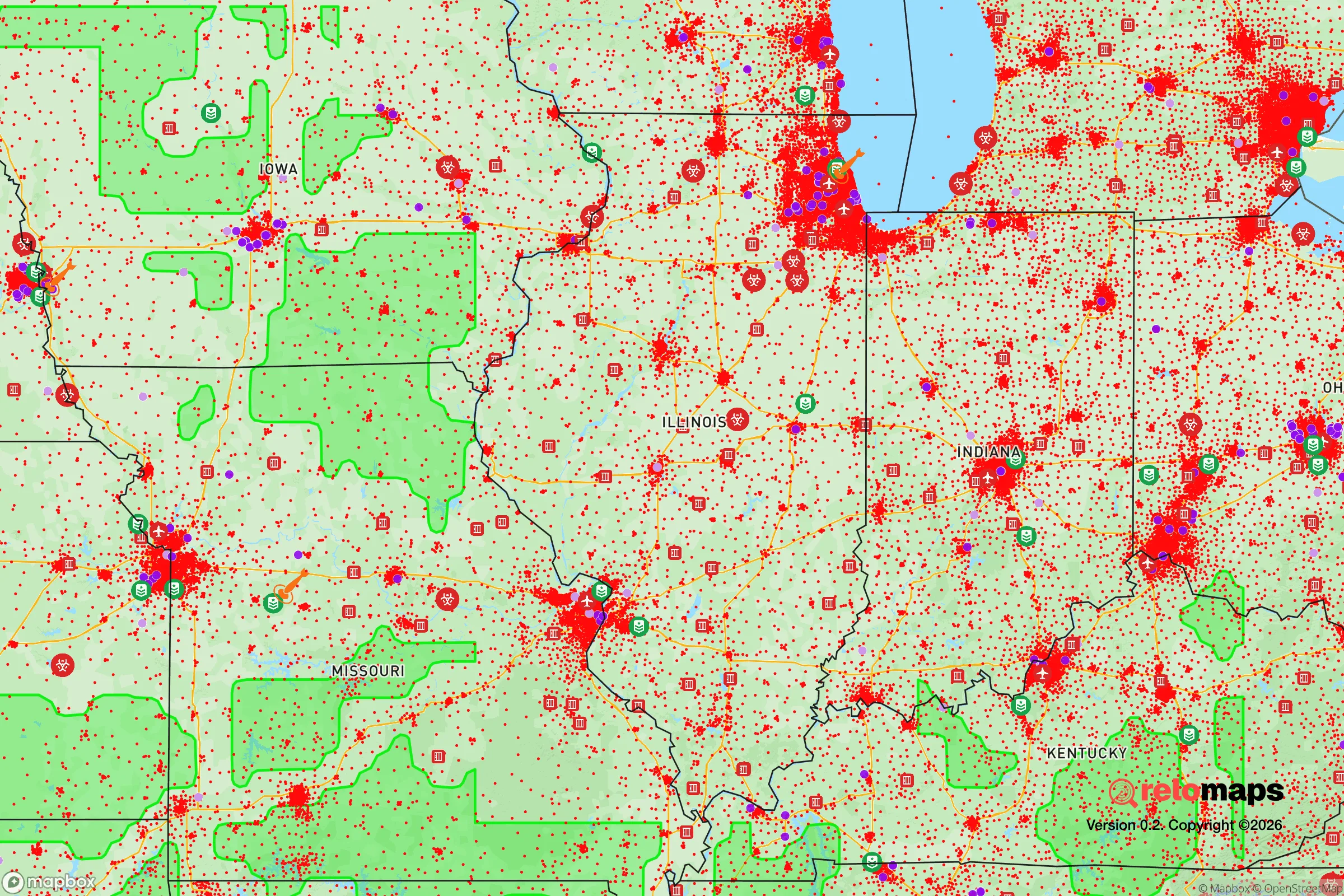
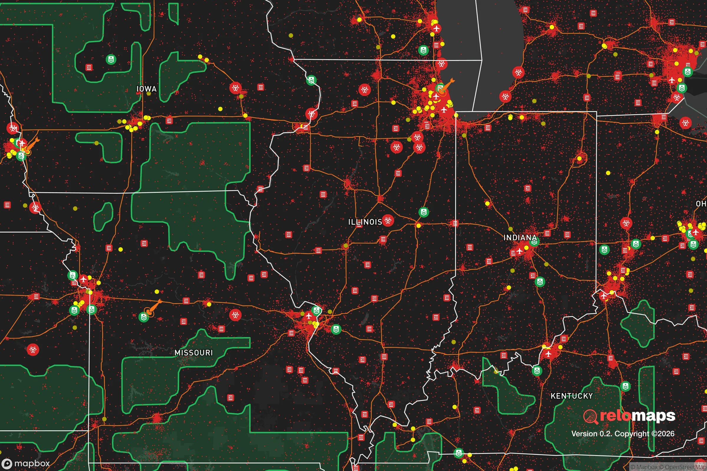


Important Note: For informational purposes only. This does not mean nothing bad ever happens in the green zones. Please use common sense. This is based on public data and modeled with AI. We tried to take a conservative approach but mistakes happen. We update this regularly as new information becomes available.
Solar Generator Recommendations
Backup power matters more here than in safer locations. We've picked three solar generators across budgets and capacity tiers — start with the budget unit if you only need a few essentials, or step up if you want to run a fridge and HVAC for days at a time.

Jackery Portable Power Station Explorer 300
Budget OptionPower on the Go: Weighing only 11 lbs, it's convenient to set up and store with book-sized foldable solar panels

BLUETTI Portable Power Station AC180
Designed for both indoor and outdoor scenarios, AC180 is highly capable as it has a robost capacity and continuous output power.

EF ECOFLOW DELTA Pro Ultra Power Station
Upgraded PickEcoFlow DELTA Pro Ultra is a whole-home energy system designed to grow with your family. Integrated with the Smart Home Panel 2, it scales to meet your evolving energy needs — keeping your home powered, intelligent, and secure through every stage of life.
We earn a commission, at no additional cost to you.
Strategic Assessment Analysis
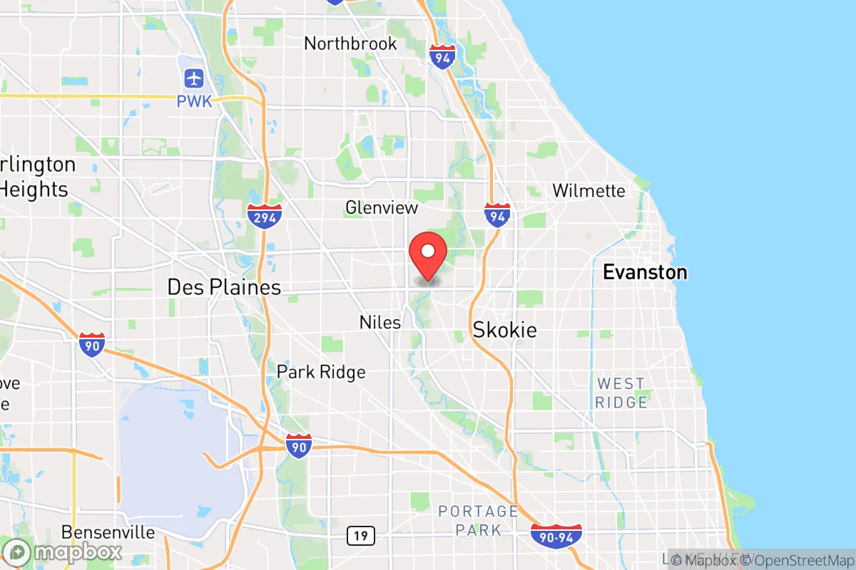
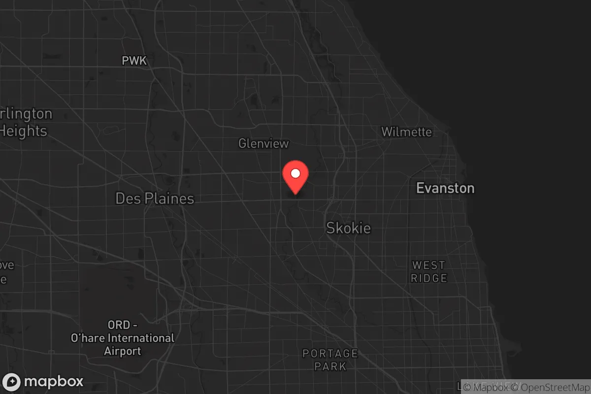
Morton Grove, Illinois, is a solidly built, mature suburb roughly 15 miles northwest of downtown Chicago, and its resilience story is a mixed bag: strong municipal services and a stable housing stock give it a baseline of durability, but its location in the densest metropolitan corridor of the Midwest means it carries significant exposure to regional-scale disruptions. For a relocator thinking seriously about disaster readiness and self-sufficiency, Morton Grove offers the advantages of an established community with deep infrastructure—but it is not a retreat. It is a well-maintained outpost on the edge of a major target zone, and its strategic value depends entirely on how you weigh proximity to resources against proximity to risk.
Geographic position and natural advantages for long-term stability
Morton Grove sits on the flat, glaciated plain of Cook County, roughly 2.5 miles west of the North Branch of the Chicago River and about 5 miles inland from Lake Michigan. The terrain offers no natural defensive features—no hills, no ridges, no significant tree cover beyond residential lots—but that flatness is itself a practical advantage for transportation and utility maintenance. The village is bisected by the Union Pacific/North Line railroad and bracketed by two major north-south arteries, Waukegan Road (IL-43) and Harlem Avenue (IL-43's parallel), with the Edens Expressway (I-94) running along its eastern edge. That grid gives residents multiple redundant routes out of the area, which matters more than topography in a region where the primary threats are weather and infrastructure failure rather than invasion.
The natural risk profile is moderate and well understood. The village sits on a high point relative to the Des Plaines River valley to the west, which means it avoids the chronic floodplain issues that plague neighboring communities like Niles and Park Ridge. The North Branch of the Chicago River, which runs through the eastern edge of town, has a history of flash flooding during intense rain events, but Morton Grove's stormwater management system has been upgraded repeatedly since the 1990s, and the village participates in the Metropolitan Water Reclamation District's tunnel and reservoir plan. Tornado risk is real but statistically low—Cook County averages about two tornado touchdowns per year, and the last direct hit on Morton Grove was an F2 in 1976. Winter is the more consistent adversary: the village averages 36 inches of snow annually, and lake-effect bands off Lake Michigan can drop a foot of snow on the area with less than 12 hours of warning. The municipal snow fleet is well-equipped, but a relocator should treat a week-long power outage during a polar vortex as a realistic planning scenario, not a paranoid fantasy.
Risks, exposures, and proximity to fallout-relevant landmarks
This is where the strategic picture gets serious. Morton Grove is 12 miles from O'Hare International Airport, one of the busiest air hubs in the world, and roughly 15 miles from the downtown Chicago central business district. In a conventional conflict scenario, both are high-value targets, and the prevailing winds in the region blow from the west and northwest—meaning fallout from a strike on O'Hare would drift directly over Morton Grove. The village is also within the immediate disruption zone of the I-94 corridor, which is a primary military logistics route in any mobilization scenario. The presence of the North Shore Gas distribution network and the large above-ground fuel storage facilities near the Skokie Lagoons, about 4 miles east, adds a secondary industrial risk: a fire or explosion at those facilities would produce toxic smoke plumes that could reach the village within an hour.
Beyond the obvious targets, Morton Grove's density works against it in a crisis. The village packs roughly 23,000 residents into 5.2 square miles, giving it a population density of about 4,400 people per square mile—comparable to a small city. That density means that any regional evacuation order would funnel through a limited set of choke points: the Edens, the Tri-State Tollway (I-294) to the west, and Dempster Street (IL-58) running east-west through the center of town. In a real emergency, those roads would gridlock within 30 minutes. The village has no designated public fallout shelters, and the nearest FEMA-certified emergency shelter is at Niles West High School, about 2 miles south. For a family that wants to shelter in place, the housing stock—mostly post-war single-family homes with basements—offers decent below-ground protection, but the basements are typically shallow and not reinforced. A relocator should assume that Morton Grove is not a place to ride out a nuclear event; it is a place to be mobile and have a plan to move west or north within the first hour of a warning.
Practical resilience for a relocator: food, water, energy, and defensibility
On the practical side, Morton Grove's resilience is a function of its suburban maturity. The village is served by the Evanston Water Treatment Plant, which draws from Lake Michigan and has backup diesel generation, so municipal water is relatively reliable—but the distribution system is old, with cast-iron mains in the oldest neighborhoods that are prone to breaks during freeze-thaw cycles. A relocator should not rely on tap water without filtration during a boil order, and a 72-hour supply of bottled water per person is the minimum reasonable baseline. Food security is better than in the city but not self-sufficient: the village has two full-service grocery stores (a Jewel-Osco on Dempster and a Mariano's on Waukegan), but both are within a mile of the I-94 corridor and would be among the first places to empty in a panic-buying event. The village's farmers' market, held on summer Sundays at the Morton Grove Civic Center, is a good local source for produce but operates only from June through October.
Energy resilience is the weakest link. The village is served by ComEd, and the grid is above-average for the region but still vulnerable to the same ice storms and heat waves that cause rolling outages across northern Illinois. Natural gas is the primary heating fuel, and the distribution network is reliable, but a loss of electric power also disables the gas furnaces' blowers and controls. Solar is a viable but constrained option: the village has no zoning restrictions on residential panels, but the older housing stock often has south-facing roofs shaded by mature trees, and the average payback period in Illinois is 8-10 years despite the state's generous net metering. A portable generator with a transfer switch is the most cost-effective investment for a Morton Grove relocator, and the village allows their use without a permit as long as they are not hardwired into the panel. Defensibility is the least of the concerns—crime rates are low, the police department is well-funded, and the village's neighborhood watch program is active—but the open street grid and lack of natural barriers mean that a family's security in a prolonged crisis would depend more on community cohesion than on physical barriers. The village's strong civic organizations, including the Morton Grove Chamber of Commerce and the various faith-based networks, are a genuine asset: in a prolonged emergency, those are the structures that would organize mutual aid and information sharing.
The overall strategic picture for Morton Grove is that of a capable but exposed position. It is not a place for a family seeking true self-sufficiency—the density, the proximity to high-value targets, and the dependence on regional infrastructure all argue against that. But for a relocator who wants a stable, well-run community with good schools, solid municipal services, and a realistic path to moderate preparedness, it is a defensible choice. The key is to treat Morton Grove as a base of operations, not a fortress: maintain a 72-hour kit, know the evacuation routes west toward McHenry County, and build relationships with neighbors before a crisis, not during one. If you go in with clear eyes about its exposure, Morton Grove can be a resilient place to live—but it will never be a refuge.

* Values derived from national, state, county, city and local statistics and may differ in a specific area. Last updated: 2026-10-21T01:16:13.000Z
Narrative content on this page is AI-generated and may contain mistakes. Verify any details that matter before acting on them.
ReloMaps may earn a commission from affiliate links at no extra cost to you.

