
Photo: Wikipedia
Strategic Assessment of Lewis And Clark County
Strong survivability profile. Good buffer from population centers, with manageable environmental and tactical risks.
What does the Strategic Assessment tell us?
Our Strategic Assessment grades tactical survivability of an area. Major population centers, military targets, fallout zones, natural disasters, and border exposure all drive risk — lower exposure means a more defensible position in a crisis.
This is heavily inspired by Joel Skousen's Strategic Relocation book. Highly recommended you checkout the book ($)What does this tell us?
Our Strategic Assessment grades tactical survivability of an area. Major population centers, military targets, fallout zones, natural disasters, and border exposure all drive risk — lower exposure means a more defensible position in a crisis.
This is heavily inspired by Joel Skousen's Strategic Relocation book. Highly recommended you checkout the book ($)Strategic Pillars

Key Distances
Strategic Assessment Analysis
Lewis and Clark County offers a compelling strategic position for those prioritizing resilience and self-sufficiency, blending deep natural resources with a location that is both remote from major metropolitan vulnerabilities yet accessible for supply runs. The county, anchored by its seat Helena, sits at a geographic sweet spot—far enough from the dense populations and industrial targets of the Front Range and Pacific Northwest to avoid primary fallout concerns, yet close enough to regional hubs like Great Falls and Missoula for logistical support. Its rugged terrain, abundant water, and low population density create a natural buffer that many relocation-focused families and individuals find increasingly attractive in an uncertain world.
Geographic position and natural advantages for long-term stability
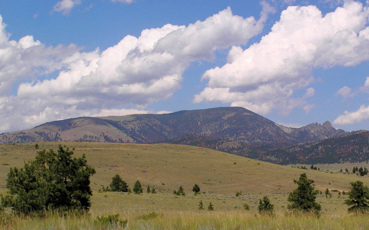
The county’s defining feature is its position within the Continental Divide, which provides both a physical barrier and a climatic buffer. The Elkhorn Mountains and the Big Belt Mountains form a ring of defensible high ground around the Helena Valley, offering natural chokepoints and observation points. This topography makes the area inherently harder to access for large-scale disruptions, while also supporting a robust watershed. The Missouri River headwaters and the Prickly Pear Creek system provide reliable surface water, a critical advantage over drier regions to the east. The county’s elevation—Helena sits at roughly 4,000 feet—reduces the risk of flooding common in lower-lying areas, and its inland position shields it from coastal storm surges and tsunami threats. For a relocator, this means a baseline of geographic security that few other regions in the lower 48 can match.
Risks, exposures, and proximity to fallout-relevant landmarks
While Lewis and Clark County is not a primary target zone, it sits within a broader regional risk envelope that demands attention. The most significant man-made threat is the Malmstrom Air Force Base complex near Great Falls, roughly 80 miles northeast of Helena. Malmstrom is a key node in the U.S. nuclear triad, housing Minuteman III ICBM silos and associated command facilities. A direct strike on Malmstrom or its dispersed silos would generate significant fallout, though prevailing westerly winds would likely carry contamination eastward, sparing Helena’s core valley. The Yellowstone Caldera supervolcano, located about 200 miles south, is a low-probability but high-consequence risk; ashfall from a major eruption could disrupt agriculture and air quality for months. Natural hazards are more immediate: wildfire is the primary seasonal threat, with the 2017 Helena-Lewis and Clark National Forest fires and the 2021 Mullan Fire near Lincoln demonstrating the potential for rapid spread in dry summers. Earthquake risk is moderate, with the Intermountain Seismic Belt running through the region, but major events are rare. The county’s distance from major industrial complexes—no refineries, no nuclear power plants, no major ports—means that chemical or radiological accidents common in more industrialized areas are not a primary concern.
Practical resilience for a relocator: food, water, energy, and defensibility
For a family or individual serious about self-sufficiency, Lewis and Clark County offers a strong foundation. Water is the standout asset: the county’s numerous creeks, springs, and the Missouri River provide year-round surface water, and groundwater is generally accessible via wells in the valley floors. The Helena Valley Irrigation District supports local agriculture, and many rural properties have existing water rights. Food production is viable but requires effort; the growing season is short (roughly 100-120 frost-free days), but cold-hardy crops like potatoes, carrots, and grains do well. The county has a small but active farming community, with farmers’ markets in Helena and East Helena providing local produce during summer months. For long-term food security, establishing a greenhouse or root cellar is advisable. Energy infrastructure is mixed: the county is served by NorthWestern Energy, which relies on a mix of hydroelectric, coal, and natural gas. The Hauser Dam and Holter Dam on the Missouri River provide local hydroelectric capacity, which is more resilient than grid-dependent sources. Solar potential is good, with over 200 sunny days per year, though winter snow cover can reduce output. Wood heating is common and practical, given the surrounding national forest. Defensibility is where the county truly shines: the mountainous terrain creates natural chokepoints, and many rural properties are sited on hillsides or in valleys with limited access points. The Helena Valley itself is a broad, open basin, but the surrounding foothills offer numerous defensible homestead sites. The county’s low population density—roughly 70,000 people across 3,500 square miles—means that social friction and resource competition are minimal compared to urban areas. For a relocator, the key trade-off is isolation versus access: you can be 30 minutes from Helena’s hospitals and grocery stores while living on a 40-acre parcel with a well and solar panels.
The overall strategic picture for Lewis and Clark County is one of balanced resilience. It avoids the extreme risks of coastal or industrial zones while offering a realistic path to self-sufficiency for those willing to invest in infrastructure and adapt to a cold, dry climate. The proximity to Malmstrom AFB is a real but manageable risk, mitigated by prevailing wind patterns and the county’s distance from the silo fields. The wildfire threat is the most immediate concern, but it can be mitigated through defensible space, fire-resistant construction, and a well-stocked emergency kit. For the conservative-leaning relocator who values preparedness, community, and access to public lands, this county represents a solid, middle-ground option—not the most remote or the most fortified, but one where a determined family can build a genuinely resilient life without the extreme trade-offs of Alaska or the desert Southwest. The county’s existing infrastructure, from the St. Peter’s Health hospital system to the Helena Regional Airport, provides a safety net that pure wilderness locations lack. In short, Lewis and Clark County is a strategic choice for those who want to be prepared without being paranoid, and who understand that true resilience is built through practical, incremental steps rather than dramatic escape.

* Values derived from national, state, county, city and local statistics and may differ in a specific area. Last updated: 2026-07-07T11:54:24.000Z
Narrative content on this page is AI-generated and may contain mistakes. Verify any details that matter before acting on them.
ReloMaps may earn a commission from affiliate links at no extra cost to you.

