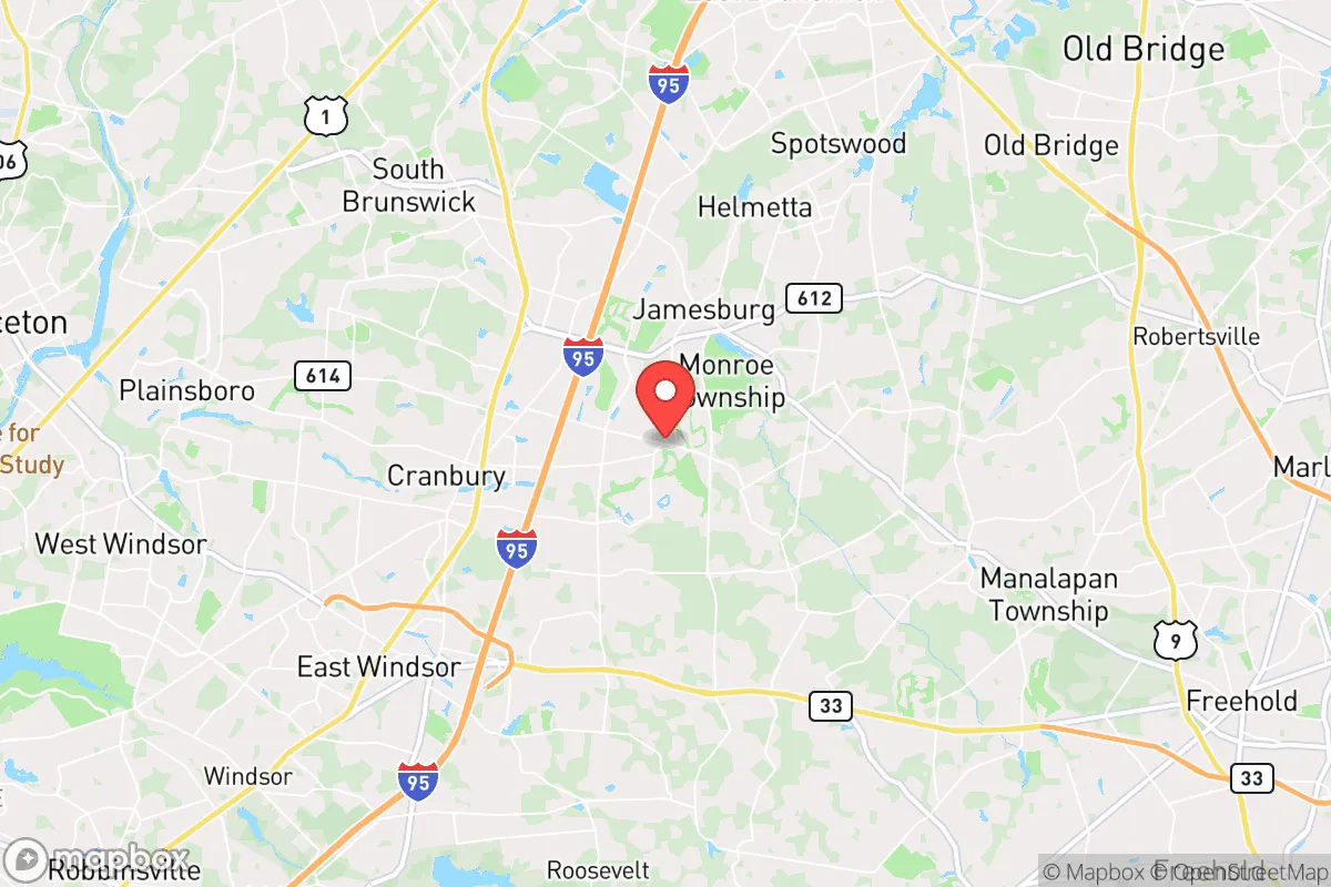
Strategic Assessment of Monroe Township, NJ
High tactical risk. This location is likely close to major population centers, strategic targets, or sits in a high-disaster corridor. A retreat property and careful exit planning is required.
What does the Strategic Assessment tell us?
Our Strategic Assessment grades tactical survivability of an area. Major population centers, military targets, fallout zones, natural disasters, and border exposure all drive risk — lower exposure means a more defensible position in a crisis.
This is heavily inspired by Joel Skousen's Strategic Relocation book. Highly recommended you checkout the book ($)What does this tell us?
Our Strategic Assessment grades tactical survivability of an area. Major population centers, military targets, fallout zones, natural disasters, and border exposure all drive risk — lower exposure means a more defensible position in a crisis.
This is heavily inspired by Joel Skousen's Strategic Relocation book. Highly recommended you checkout the book ($)Strategic Pillars

Key Distances
Regional Safe Places
Below is our recommended "safe zones" in New Jersey and the surrounding area based on our strategic heuristics. For most people, it's unrealistic to live in a “safe zone” full-time due to work, family or other personal reasons. They tend to be more rural. However, many of these areas are perfect for second homes and retreat properties that double as a vacation home or even a short-term rental.
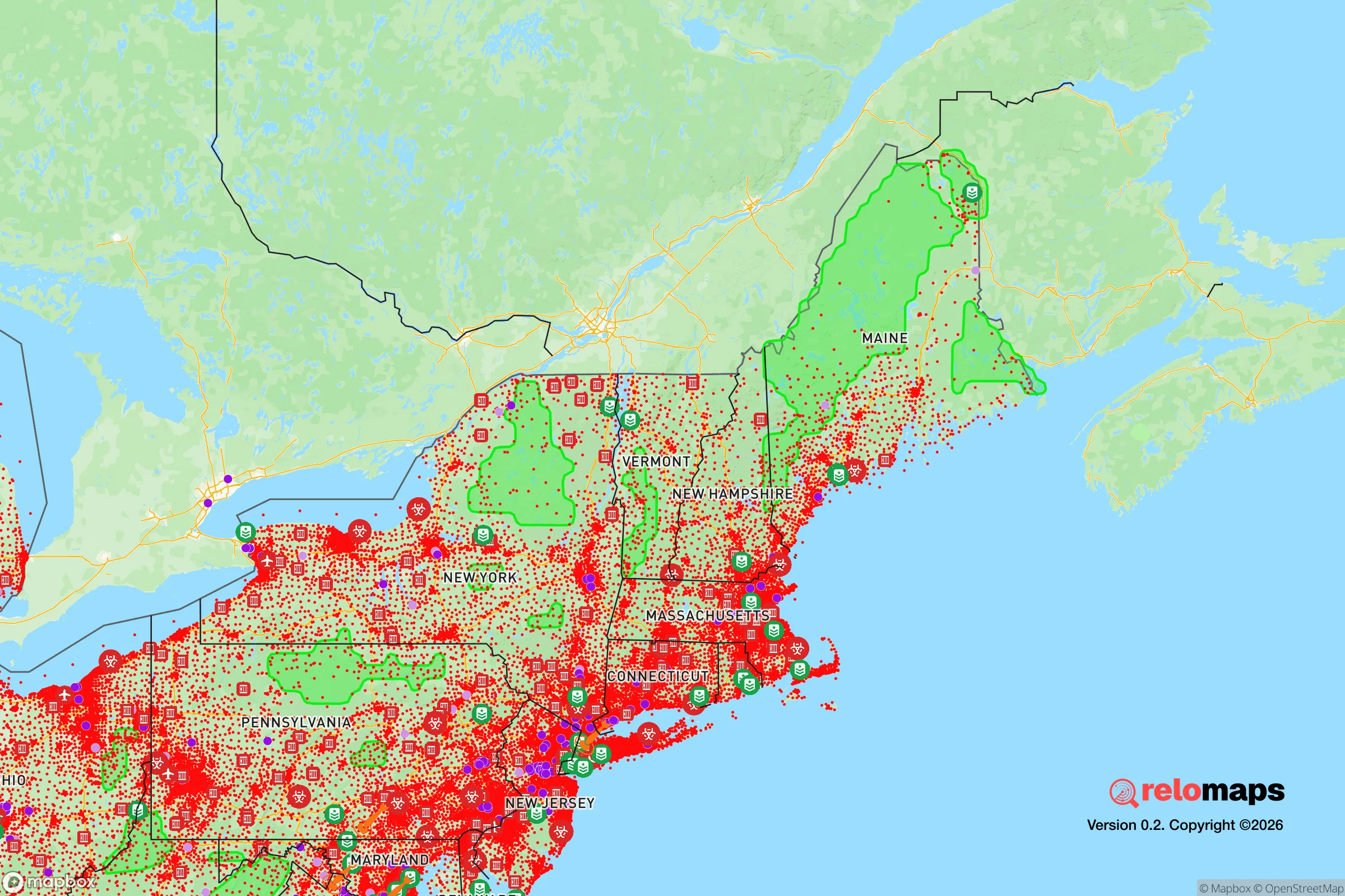
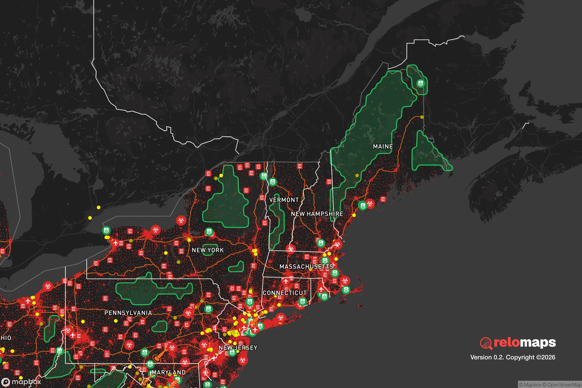


Important Note: For informational purposes only. This does not mean nothing bad ever happens in the green zones. Please use common sense. This is based on public data and modeled with AI. We tried to take a conservative approach but mistakes happen. We update this regularly as new information becomes available.
Solar Generator Recommendations
Backup power matters more here than in safer locations. We've picked three solar generators across budgets and capacity tiers — start with the budget unit if you only need a few essentials, or step up if you want to run a fridge and HVAC for days at a time.

Jackery Portable Power Station Explorer 300
Budget OptionPower on the Go: Weighing only 11 lbs, it's convenient to set up and store with book-sized foldable solar panels

BLUETTI Portable Power Station AC180
Designed for both indoor and outdoor scenarios, AC180 is highly capable as it has a robost capacity and continuous output power.

EF ECOFLOW DELTA Pro Ultra Power Station
Upgraded PickEcoFlow DELTA Pro Ultra is a whole-home energy system designed to grow with your family. Integrated with the Smart Home Panel 2, it scales to meet your evolving energy needs — keeping your home powered, intelligent, and secure through every stage of life.
We earn a commission, at no additional cost to you.
Strategic Assessment Analysis
Monroe Township, New Jersey, occupies a strategic position in central Middlesex County that offers a mixed resilience profile for relocators weighing disaster readiness and self-sufficiency. Its location roughly 40 miles southwest of New York City and 50 miles northeast of Philadelphia places it within the dense Northeast Corridor, but its rural and suburban character—particularly in the township's southern and western sections—provides meaningful buffers against the immediate fallout of a major urban disruption. The area's access to major highways (the New Jersey Turnpike, Route 32, and Route 130) and proximity to the Raritan River and surrounding farmland give it a logistical advantage for both evacuation and supply chain continuity, though those same arteries can become choke points during a crisis.
Geographic position and natural advantages for disaster readiness
Monroe Township sits on the Inner Coastal Plain of New Jersey, a region characterized by relatively flat terrain, well-drained soils, and a temperate climate that avoids the most extreme weather patterns seen elsewhere in the country. The township's elevation averages around 100 feet above sea level, which significantly reduces flood risk compared to communities directly along the Raritan River or the Atlantic coast. The area is not in a designated floodplain for the most part, though low-lying sections near tributaries of the Raritan—such as Manalapan Brook and Matchaponix Brook—can experience localized flooding during heavy rain events. Hurricane Sandy in 2012 caused minimal damage in Monroe Township relative to coastal communities, with most impacts limited to power outages and downed trees, a pattern that holds for most nor'easters and tropical storms. The region's clay and loam soils support agriculture, and the township still contains active farms and nurseries, which is a meaningful asset for long-term food security. The climate supports a growing season of roughly 180 days, allowing for diversified crop production from spring through fall. Monroe Township is not in a designated earthquake zone, has no active fault lines, and experiences tornadoes only rarely—the last significant tornado to strike Middlesex County was an EF-1 in 2009 that caused minor damage. The area's natural hazard profile is dominated by winter storms, occasional heat waves, and the threat of inland flooding from prolonged rainfall, none of which pose existential risks to a prepared household.
Risks, exposures, and proximity to fallout-relevant landmarks
The most significant vulnerability for Monroe Township in a disaster scenario is its position within the broader New York metropolitan region. The township lies approximately 35 miles from the nearest point of New York City (Staten Island) and about 45 miles from Manhattan, placing it within the zone that would experience severe secondary effects from a major urban catastrophe—whether a terrorist attack, a nuclear incident, or a cascading infrastructure failure. The nearby Raritan River corridor hosts several industrial facilities, including chemical storage and processing plants in the Raritan Center business park in neighboring Edison, as well as the Port Reading oil terminal and the Phillips 66 Bayway Refinery in Linden, roughly 20 miles north. A major accident or intentional strike at any of these sites could produce toxic plumes or fires that would affect Monroe Township depending on wind direction. The township is also within 25 miles of the Salem-Hope Creek nuclear generating stations in Lower Alloways Creek (Salem County) and roughly 40 miles from the Indian Point Energy Center in Buchanan, New York, though Indian Point ceased operations in 2021 and is in decommissioning. The Salem plants remain operational, and Monroe Township falls within the 50-mile ingestion pathway zone for those reactors, meaning that a major release could require protective actions related to food and water supplies. On the positive side, the township is not directly downwind of any major military installation or strategic target, and its relatively low population density (about 1,200 people per square mile in the developed areas, with large tracts of open space) reduces the likelihood of being a primary target. The biggest man-made risk is likely a transportation accident on the New Jersey Turnpike or the nearby Conrail freight lines, which carry hazardous materials through the region daily.
Practical resilience for a relocator: food, water, energy, and defensibility
For a relocator focused on self-sufficiency, Monroe Township offers a workable but not exceptional baseline. The township has multiple active farms and farm stands, including the well-known Alstede Farms in neighboring Chesterfield and local operations like Giamarese Farm & Orchard in East Brunswick, which provide direct access to fresh produce and the potential for bulk purchasing or community-supported agriculture (CSA) shares. The soil quality in the area supports home gardening, and many suburban lots have sufficient yard space for raised beds or small orchards. Water availability is a stronger asset: Monroe Township is served by the Middlesex Water Company and several municipal wells, but the underlying Potomac-Raritan-Magothy aquifer system is one of the most productive in the state. Private wells are common in the more rural sections of the township, and the water table sits at a depth of roughly 20 to 50 feet, making hand-pump or solar-powered well retrofits feasible for a determined household. The area's annual rainfall of about 45 inches is well-distributed throughout the year, so rainwater catchment systems can supplement household water needs during extended dry spells. Energy resilience is more challenging. The local grid is operated by PSE&G, which has a mixed record on outage restoration—during Hurricane Sandy, some areas of Middlesex County were without power for over a week. Solar panel adoption is growing in the township, and net metering is available, but the area's tree cover means that rooftop solar may be less efficient than in open terrain. Natural gas is widely available, which is an advantage for heating and cooking during a power outage if the gas grid remains intact. For defensibility, Monroe Township's layout is a double-edged sword. The developed sections are typical suburban sprawl with cul-de-sacs and winding roads that can be easily blocked or monitored, but the township's size (roughly 42 square miles) and the presence of large open spaces—including the 1,200-acre Monroe Township Recreation Center and the adjacent Thompson Park—mean that a determined household could find relatively secluded positions. The township's police department is well-funded and maintains a visible presence, but the response time to outlying areas during a widespread event could stretch to 15-20 minutes, making personal security preparations important.
Overall, Monroe Township presents a moderate-to-favorable strategic picture for a relocator who values proximity to urban resources but wants to avoid the highest-risk zones. Its natural hazard profile is mild, its water and soil resources are solid, and its distance from the most likely targets in the Northeast provides a meaningful buffer. The main trade-offs are the area's dependence on regional infrastructure that could be strained during a crisis, the presence of industrial hazards within a 20-mile radius, and the suburban development pattern that limits true off-grid potential. For a household that is willing to invest in well water, solar backup, and food storage, Monroe Township offers a defensible position with good long-term sustainability—but it is not a retreat location in the wilderness sense. It is a place where preparedness can be practiced within a functioning community, which for many relocators is the most realistic and sustainable approach to resilience.

* Values derived from national, state, county, city and local statistics and may differ in a specific area. Last updated: 2026-11-13T05:53:07.000Z
Narrative content on this page is AI-generated and may contain mistakes. Verify any details that matter before acting on them.
ReloMaps may earn a commission from affiliate links at no extra cost to you.

