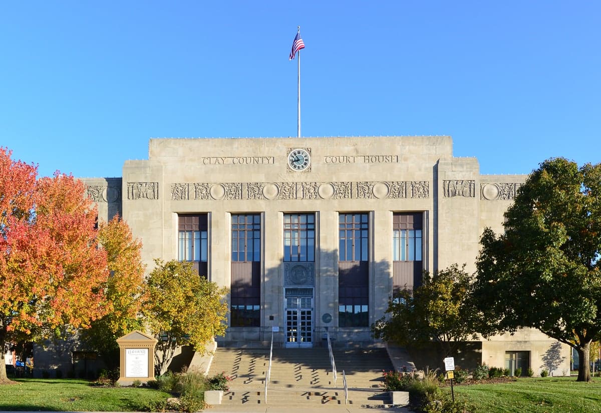
Photo: Wikipedia
Demographics of Clay County
Affluence Level in Clay County
A middle-class area roughly in line with national averages across income, home values, education, and employment.
People of Clay County
Clay County, Missouri, today is a predominantly white, suburban-leaning area of over 255,000 residents, characterized by a strong sense of local identity rooted in its history as a borderland between North and South. With a foreign-born population of just 2.0%, it remains one of the less diverse counties in the Kansas City metro, though its Hispanic (7.7%) and Black (6.6%) communities are growing. The county’s distinctive identity is shaped by its blend of historic river towns, modern suburbs, and a population that is 36% college-educated, reflecting a mix of long-established families and newer commuters drawn to its schools and relative affordability.
Settlement & growth (pre-1960)
Before American settlement, the area now known as Clay County was part of the ancestral and hunting grounds of the Osage Nation, who controlled much of present-day western Missouri. The Osage were forcibly removed through a series of treaties in the early 1800s, opening the land to Euro-American settlers. The county was officially organized in 1822, named after Kentucky statesman Henry Clay, and its earliest white settlers were largely of Scots-Irish and English stock, migrating from the Upper South states of Kentucky, Tennessee, and Virginia. These families were drawn by the promise of fertile bottomland along the Missouri River and the opportunity to establish small farms.
The county’s first major settlement was Liberty, founded in 1822 and serving as the county seat. Liberty quickly became a commercial and educational hub, home to William Jewell College (founded 1849), which attracted a professional class. A second wave of settlement followed the Platte Purchase in 1837, which added land north of the Missouri River and spurred the founding of Excelsior Springs, a town that grew around mineral springs and became a health resort in the late 19th century. The county’s location on the Missouri River also made it a key point on the Santa Fe Trail, with Kearney (originally Centerville) serving as a staging post. This trade route brought a transient population of merchants and teamsters, though few settled permanently.
The Civil War deeply divided Clay County, as it was a border county with strong Southern sympathies. Many residents fought for the Confederacy, and the area saw guerrilla warfare, including the 1864 Centralia Massacre. After the war, the county’s economy shifted from slave-based hemp and tobacco farming to general agriculture and, increasingly, small-scale manufacturing. A notable group of German immigrants arrived in the 1870s and 1880s, settling in and around North Kansas City, which was incorporated in 1912. These Germans worked in the growing railroad and river industries, and their descendants remain a visible cultural presence in the city’s older neighborhoods.
The 20th century brought suburbanization. The construction of the Chicago, Burlington and Quincy Railroad and later the automobile made Clay County a bedroom community for Kansas City. Gladstone, incorporated in 1959, was one of the first planned suburbs, attracting middle-class white families fleeing the city. By 1960, the county’s population had grown to roughly 87,000, still overwhelmingly white and native-born, with a small Black population concentrated in Liberty and a few rural pockets.
Modern era (post-1965)
The 1965 Hart-Cellar Act had a minimal direct impact on Clay County, as the area did not become a primary destination for post-1965 immigration. Instead, the county’s demographic changes since 1965 have been driven overwhelmingly by domestic migration from other parts of the United States. The most significant shift has been the continued suburbanization of the Kansas City metro, with families moving north from Kansas City proper and from other Midwestern states. Smithville, a small town on the county’s northern edge, saw rapid growth after the completion of Interstate 35, transforming from a farming community into a commuter suburb. Similarly, Kearney has grown from a village of 1,000 in 1970 to over 10,000 today, driven by affordable housing and the expansion of the Clay County School District.
The county’s Hispanic population, now 7.7%, began to grow noticeably in the 1990s, largely through domestic migration from the southwestern U.S. and Mexico. These families have concentrated in North Kansas City and Gladstone, where they work in construction, manufacturing, and service industries. The Black population, at 6.6%, has also grown, primarily through migration from Kansas City’s urban core to suburbs like Liberty and Gladstone, seeking better schools and lower crime rates. East and Southeast Asian communities (1.9%) are small but present, with families of Vietnamese and Korean descent settling in Liberty and Kearney, often drawn by professional opportunities in healthcare and engineering. The Indian-subcontinent population (0.6%) is even smaller, with most families living in Gladstone and working in tech or medical fields in the broader Kansas City area.
Suburbanization has been the dominant force. The county’s population more than doubled between 1970 and 2020, with most growth occurring in unincorporated areas that were later annexed by cities like Gladstone and Liberty. This growth has been almost entirely white and native-born, reinforcing the county’s demographic character even as the Kansas City metro has become more diverse overall.
The future
Clay County is projected to continue growing, though at a slower pace than the fast-growing suburbs of Johnson County, Kansas. The county’s population is expected to reach roughly 280,000 by 2035, driven by continued domestic migration from the Midwest and, to a lesser extent, from coastal states. The county is becoming slightly more diverse, with the Hispanic and Black shares each expected to rise by 1-2 percentage points over the next decade. However, the foreign-born share is likely to remain below 3%, as the county lacks the established immigrant networks and employment hubs that attract newcomers to other parts of the metro.
New residential development is concentrating in the northern and eastern parts of the county, particularly around Smithville and Kearney, where land is cheaper and new subdivisions are being built. These areas are attracting younger families, many of whom are priced out of Johnson County. The county’s cultural identity is evolving from a rural-agricultural past to a suburban-present, with a growing emphasis on schools, parks, and local events like the Clay County Fair. The political character remains reliably conservative, though the growing suburbs are showing signs of becoming more politically competitive.
For someone moving in now, Clay County offers a stable, family-oriented environment with good schools and a relatively low cost of living. It is becoming more suburban and slightly more diverse, but it remains a place where the population is overwhelmingly native-born and where the pace of change is gradual. The county’s future is one of steady, moderate growth, with its identity rooted in its history as a borderland community that has become a comfortable, middle-class suburb of Kansas City.

* Values derived from national, state, county, city and local statistics and may differ in a specific area. Last updated: 2026-07-14T11:12:26.000Z
Narrative content on this page is AI-generated and may contain mistakes. Verify any details that matter before acting on them.
ReloMaps may earn a commission from affiliate links at no extra cost to you.

