Photo: Wikipedia
Strategic Assessment of Christian County
Workable tactical position. Some exposure to population density or targets, but generally defensible in a crisis.
What does the Strategic Assessment tell us?
Our Strategic Assessment grades tactical survivability of an area. Major population centers, military targets, fallout zones, natural disasters, and border exposure all drive risk — lower exposure means a more defensible position in a crisis.
This is heavily inspired by Joel Skousen's Strategic Relocation book. Highly recommended you checkout the book ($)What does this tell us?
Our Strategic Assessment grades tactical survivability of an area. Major population centers, military targets, fallout zones, natural disasters, and border exposure all drive risk — lower exposure means a more defensible position in a crisis.
This is heavily inspired by Joel Skousen's Strategic Relocation book. Highly recommended you checkout the book ($)Strategic Pillars

Key Distances
Strategic Assessment Analysis
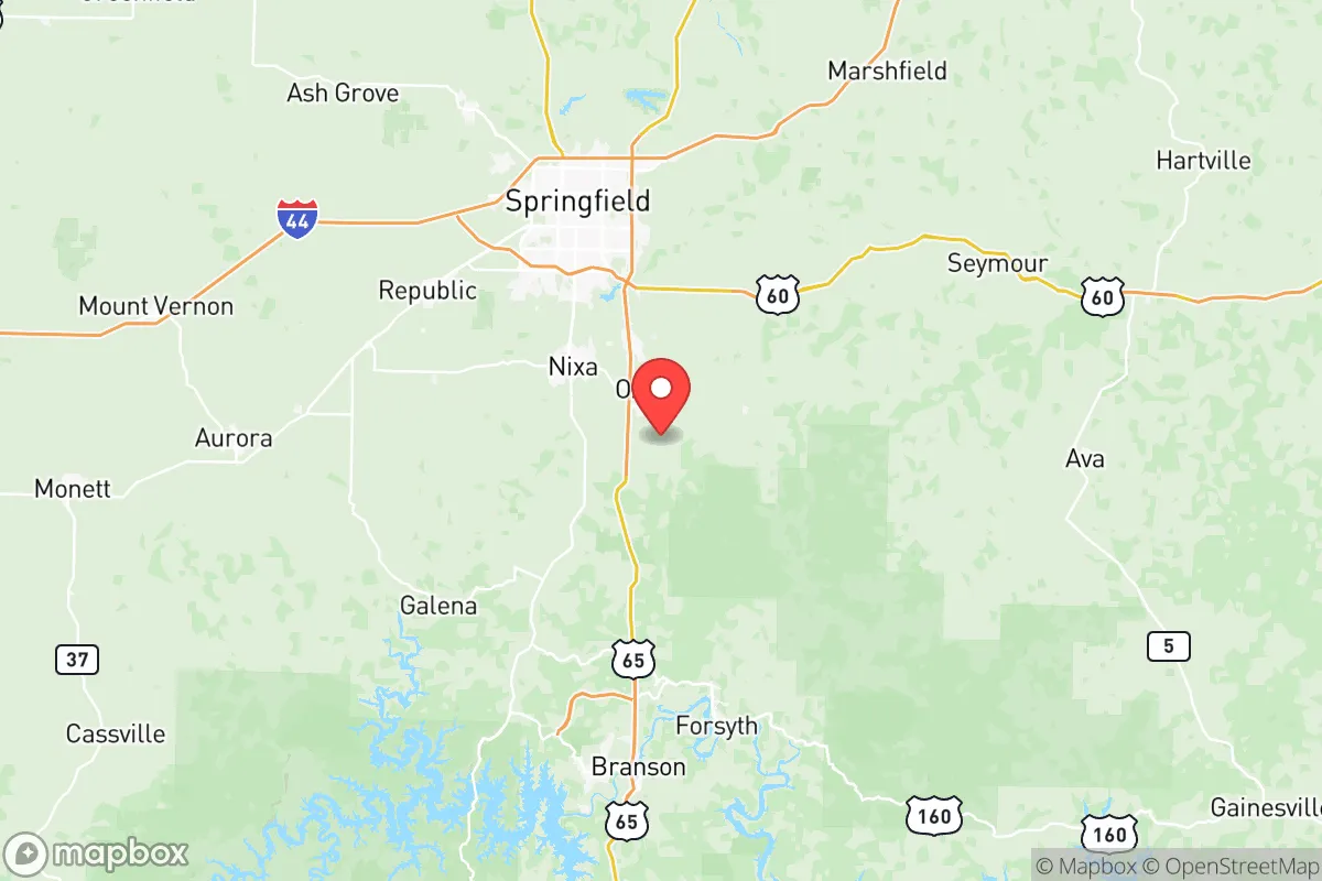
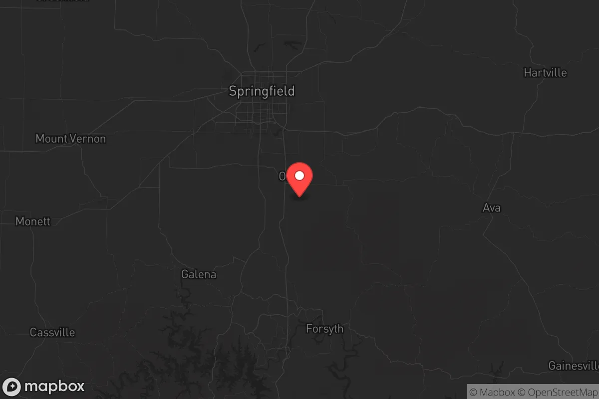
Christian County, Missouri, offers a compelling strategic position for those prioritizing resilience and long-term stability, blending rural self-sufficiency with access to regional resources. Located in the southwestern part of the state, the county sits roughly 30 miles north of the Arkansas border and about 200 miles from the major population centers of St. Louis and Kansas City, providing a buffer from the immediate fallout of urban unrest or infrastructure collapse. The county seat, Ozark, and the larger city of Nixa anchor a population of roughly 90,000, giving the area enough economic activity to support essential services without the density that becomes a liability during crises. The region’s topography—rolling hills, limestone bluffs, and abundant waterways—offers natural defensibility and resource access that make it a serious candidate for a relocation strategy focused on preparedness.
Geographic position and natural advantages for long-term stability
Christian County sits within the Ozark Plateau, a region known for its rugged terrain, dense forests, and extensive cave systems—features that provide both concealment and microclimate stability. The county is bisected by the Finley Creek and James River watersheds, which feed into Table Rock Lake and Bull Shoals Lake to the south, creating a reliable surface water network that is less prone to drought than the Great Plains. Elevation ranges from 1,000 to 1,500 feet, reducing flood risk compared to low-lying river towns, and the limestone bedrock offers natural filtration for groundwater wells. The area’s position in the central time zone and away from major fault lines (the New Madrid Seismic Zone is about 200 miles east) minimizes earthquake risk, though tornadoes remain a seasonal concern. For a relocator, the key advantage is that Christian County is not a choke point—no major interstate runs through it (I-44 skirts the northern edge near Springfield), meaning it avoids the traffic and supply chain vulnerabilities of a corridor like I-35 or I-70. The nearest military installation of note is Fort Leonard Wood, about 90 miles northeast, which is a training base for engineers and chemical corps—relevant for understanding regional military traffic but not a primary fallout target.
Risks, exposures, and proximity to fallout-relevant landmarks
No location is immune to risk, and Christian County has its share of exposures that a strategic relocator must weigh. The most immediate concern is proximity to Springfield, Missouri’s third-largest city, located just 10 miles north of the county line. Springfield is home to a major medical center (Mercy Hospital), a regional airport, and a rail hub for BNSF and Union Pacific—all of which could become targets or points of congestion during a national emergency. The city’s population of 170,000 means that a collapse in services there would send refugees south into Christian County, particularly along Highway 65, the main north-south artery through Ozark and Nixa. Additionally, the county lies within 150 miles of the Arkansas Nuclear One plant in Russellville, Arkansas, a pressurized water reactor that, while not a likely direct target, could pose a fallout risk if compromised. On the positive side, there are no major refineries, chemical plants, or military bases within the county itself, and the nearest major interstate (I-44) is far enough to avoid the chaos of a mass evacuation from St. Louis or Tulsa. The real risk here is not a direct strike but the secondary effects of a crisis—influx of displaced populations, supply chain disruptions, and the potential for civil unrest spilling over from Springfield. A prepper’s strategy should focus on hardening the southern and eastern approaches to the county, where rural roads and forested terrain offer natural barriers.
Practical resilience for a relocator: food, water, energy, and defensibility
For a single individual or family looking to establish a sustainable homestead, Christian County offers a strong baseline for self-sufficiency. Water is the first priority, and the county’s position over the Ozark Aquifer means that private wells are common and reliable, with depths typically ranging from 100 to 300 feet. Surface water from the James River and Finley Creek is accessible but requires filtration due to agricultural runoff and recreational use. The growing season runs from April to October, with average rainfall of 45 inches per year—enough for dryland farming of corn, beans, and squash, though supplemental irrigation from ponds or cisterns is wise. Soil quality varies: the river bottoms are fertile loam, while the hillsides are thin and rocky, better suited for pasture or orchards. For energy, the county is served by Ozarks Electric Cooperative, which offers net metering for solar panels, and the region’s average of 200 sunny days per year makes photovoltaic systems viable. Wood heating is practical given the abundant oak and hickory forests, and propane delivery is common in rural areas. Defensibility is where Christian County shines: the terrain of steep hollows, ridge lines, and creek crossings creates natural chokepoints, and the low population density (about 120 people per square mile outside of Ozark and Nixa) means that a well-chosen property on a dead-end road or at the end of a gravel lane offers significant privacy. The county has a strong hunting culture, with deer and turkey populations that can supplement food stores, and the Mark Twain National Forest (about 30 miles east) provides a public land buffer for foraging and emergency retreat. The main practical weakness is the lack of a robust local manufacturing base—most goods come from Springfield or via I-44—so stockpiling ammunition, medical supplies, and spare parts for vehicles and generators is essential.
The overall strategic picture for Christian County is one of balanced risk and reward. It is not a remote bunker location like the Idaho panhandle or the Montana Rockies, but it offers a realistic middle ground for someone who wants to stay within a day’s drive of regional medical care and supply chains while maintaining a defensible, self-sufficient property. The county’s conservative lean—historically voting Republican by wide margins—aligns with a culture of self-reliance, low taxes, and minimal zoning, which makes it easier to build a homestead, keep livestock, or store supplies without bureaucratic interference. The proximity to Springfield is a double-edged sword: it provides access to hospitals and hardware stores in normal times, but it becomes a liability during a crisis. The smart play is to locate in the southern half of the county, near Highlandville or Sparta, where the terrain is rougher and the distance from Springfield is greatest. For a relocator with a prepper mindset, Christian County is a solid B+ option—not perfect, but workable, with enough natural resources and geographic isolation to ride out most scenarios short of a full societal collapse. The key is to move before the next wave of urban flight drives up land prices, which are already climbing as people from St. Louis and Kansas City discover the Ozarks. Act now, and you can secure a position that gives you time, water, and space to think.
* Values derived from national, state, county, city and local statistics and may differ in a specific area. Last updated: 2026-05-28T04:29:32.000Z
Narrative content on this page is AI-generated and may contain mistakes. Verify any details that matter before acting on them.
ReloMaps may earn a commission from affiliate links at no extra cost to you.