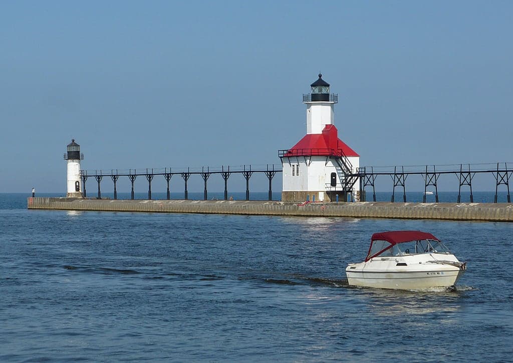
Photo: Wikipedia
Strategic Assessment of Berrien County
Meaningful friction. Expect exposure to either population pressure, blast zones, or natural disaster risk. Consider buying a retreat property.
What does the Strategic Assessment tell us?
Our Strategic Assessment grades tactical survivability of an area. Major population centers, military targets, fallout zones, natural disasters, and border exposure all drive risk — lower exposure means a more defensible position in a crisis.
This is heavily inspired by Joel Skousen's Strategic Relocation book. Highly recommended you checkout the book ($)What does this tell us?
Our Strategic Assessment grades tactical survivability of an area. Major population centers, military targets, fallout zones, natural disasters, and border exposure all drive risk — lower exposure means a more defensible position in a crisis.
This is heavily inspired by Joel Skousen's Strategic Relocation book. Highly recommended you checkout the book ($)Strategic Pillars

Key Distances
Strategic Assessment Analysis
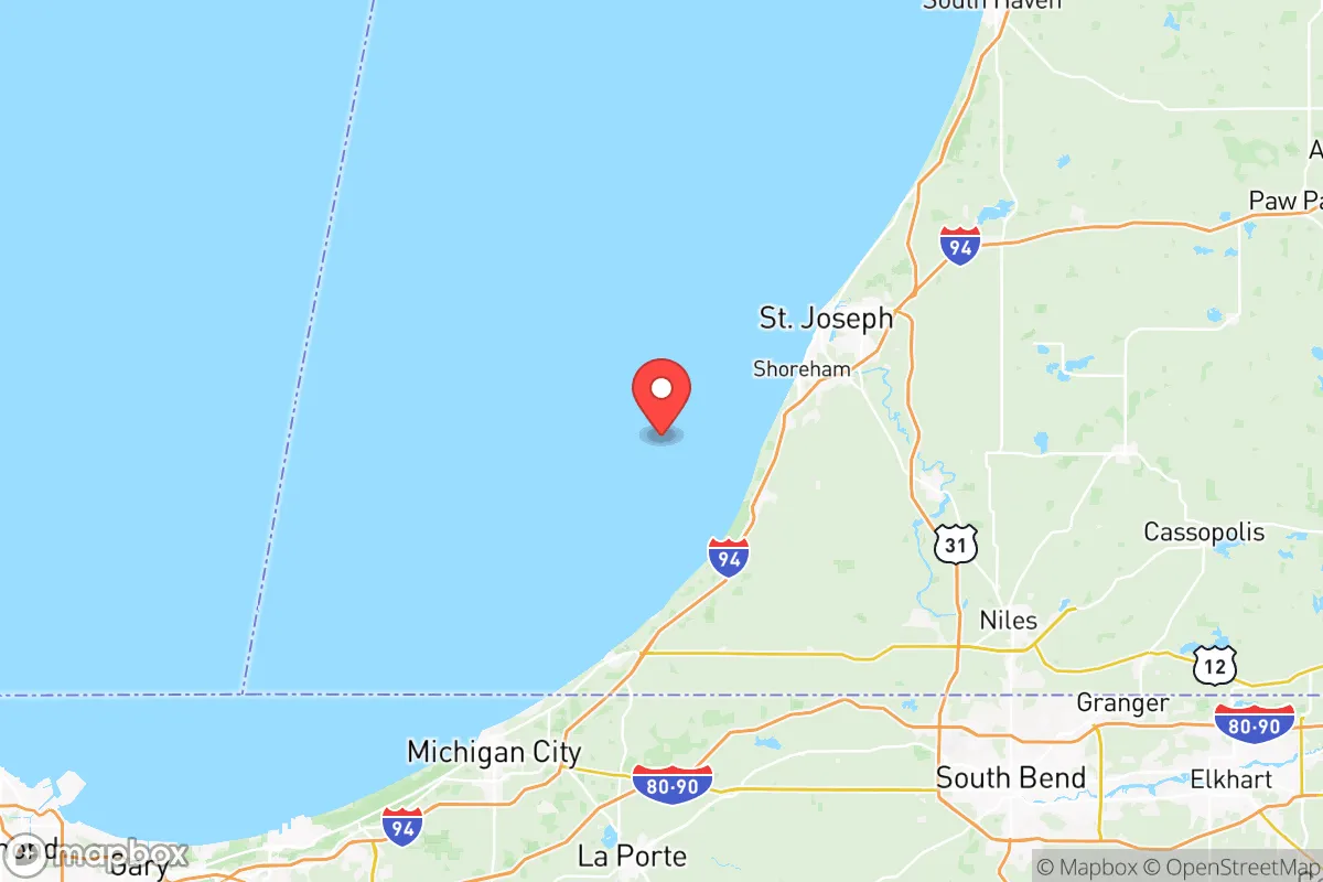
Berrien County, Michigan, occupies a strategic position in the southwestern corner of the state, offering a mix of geographic insulation and practical resilience that appeals to relocators prioritizing disaster readiness and self-sufficiency. Its location along the Lake Michigan shoreline provides a natural buffer against large-scale population displacement, while its distance from major metropolitan centers like Chicago (roughly 90 miles east) and Detroit (roughly 170 miles east) reduces exposure to the immediate fallout of urban-centric crises. The county's agricultural base, access to freshwater, and relatively low population density (around 153,000 residents spread across 580 square miles) create a foundation for a more self-reliant lifestyle, though proximity to certain industrial and infrastructure targets warrants careful consideration.
Geographic position and natural advantages for self-sufficiency
Berrien County's most significant asset is its direct access to Lake Michigan, the sixth-largest freshwater lake in the world, providing an essentially unlimited water source for households with proper filtration or catchment systems. The county sits within the Michigan Fruit Belt, a region known for its fertile glacial soils and moderate microclimate moderated by the lake, which extends growing seasons by several weeks compared to inland areas. This makes small-scale agriculture, orchards, and market gardening viable for families seeking food independence. The terrain is gently rolling, with elevations ranging from 580 to 1,000 feet above sea level, offering natural drainage and reducing flood risk compared to flatter inland areas. Key towns like St. Joseph, Benton Harbor, and Niles serve as population centers, but the county remains predominantly rural, with large tracts of forested land in the eastern and southern portions near the Indiana border. The Paw Paw River and St. Joseph River watersheds provide additional surface water sources and riparian corridors for wildlife and foraging. For a relocator, this geography supports a decentralized, low-profile lifestyle with ample space for gardens, rainwater collection, and off-grid energy systems like solar or small wind, though the region's cloud cover in winter months reduces solar efficiency compared to the Southwest.
Risks, exposures, and proximity to fallout-relevant landmarks
While Berrien County offers natural buffers, it is not immune to risks tied to its regional infrastructure. The most prominent concern is the Donald C. Cook Nuclear Plant, located in Bridgman along the Lake Michigan shoreline, approximately 12 miles north of St. Joseph. This two-unit pressurized water reactor generates over 2,000 megawatts and represents a potential target for both accidental release and deliberate disruption. The plant's 10-mile emergency planning zone covers much of northern Berrien County, including the towns of Bridgman, Stevensville, and parts of St. Joseph. Additionally, the county lies within 50 miles of the Indiana Dunes National Park area, which hosts multiple oil refineries and industrial facilities along the Lake Michigan shoreline near Michigan City and Gary, Indiana. These include the BP Whiting Refinery (roughly 40 miles southwest), one of the largest in the Midwest, processing 440,000 barrels per day. The South Bend International Airport (30 miles east) and the Chicago O'Hare and Midway air traffic corridors (90 miles west) introduce moderate risk from air traffic incidents or secondary fallout from a Chicago-area event. Tornado risk is moderate, with the county averaging 2-3 tornado warnings per year, typically EF0-EF2 strength. Winter storms can produce lake-effect snow accumulations of 60-80 inches annually in the northern part of the county, which can disrupt road access for days at a time. For a relocator, the nuclear plant and refinery proximity are the most significant man-made risks, though the prevailing westerly winds tend to carry airborne contaminants away from the county's populated areas and over Lake Michigan.
Practical resilience for a relocator: food, water, energy, and defensibility
Berrien County scores well on practical resilience metrics for a Midwestern location. Food security is a standout: the county is part of Michigan's leading agricultural region, producing apples, blueberries, grapes, peaches, and vegetables in volume. The Benton Harbor Farmers Market is one of the largest in the state, and the county has a strong network of u-pick farms, CSAs, and local food processors. For those seeking to grow their own, the USDA hardiness zone is 6a (average minimum temperatures -10 to -5°F), supporting a wide range of perennial crops. Water availability is excellent: Lake Michigan provides an inexhaustible surface water source, while groundwater is abundant and generally high-quality, with most wells producing 10-30 gallons per minute at depths of 50-150 feet. The county's municipal water systems draw from Lake Michigan, but rural properties rely on private wells, which require periodic testing for agricultural runoff and industrial contaminants. Energy resilience is mixed: the grid is served by Indiana Michigan Power (AEP) and several rural electric cooperatives, with average outage durations of 2-4 hours per year in normal conditions. Solar potential is moderate (4.0-4.5 peak sun hours per day in summer, dropping to 1.5-2.0 in winter), making battery backup or generator integration advisable for off-grid setups. Wood heating is viable given the county's 40% forest cover, with ample hardwood species like oak, maple, and hickory available for sustainable harvest. Defensibility is favorable: the county's rural character, with long sightlines, dispersed population, and limited choke points (the St. Joseph River crossings and I-94 corridor are the main access routes), makes it easier to monitor and control access to a property compared to denser suburban areas. The Berrien County Sheriff's Office maintains a visible presence, but response times in remote areas can exceed 20 minutes, reinforcing the need for personal security planning.
Overall, Berrien County presents a balanced strategic picture for the disaster-conscious relocator. Its strengths lie in abundant freshwater, productive agricultural land, and a low-density layout that supports self-sufficiency and privacy. The primary trade-offs are the proximity to the Donald C. Cook Nuclear Plant and the industrial corridor along southern Lake Michigan, which introduce a non-zero risk of man-made incidents that could affect the county's northern and western areas. For a family or individual willing to locate in the southern or eastern portions of the county—away from the nuclear plant's 10-mile zone and closer to the agricultural interior—the risk profile improves significantly. The county's location at the intersection of I-94, I-196, and US-31 provides reasonable access to regional medical centers in South Bend and Kalamazoo (both 30-40 minutes away) while maintaining enough distance from major urban centers to avoid the worst of a metropolitan crisis. For the relocator who values a quiet, resource-rich environment with manageable risks and strong natural defenses, Berrien County deserves serious consideration as a long-term base of operations.

* Values derived from national, state, county, city and local statistics and may differ in a specific area. Last updated: 2026-10-25T21:42:46.000Z
Narrative content on this page is AI-generated and may contain mistakes. Verify any details that matter before acting on them.
ReloMaps may earn a commission from affiliate links at no extra cost to you.

