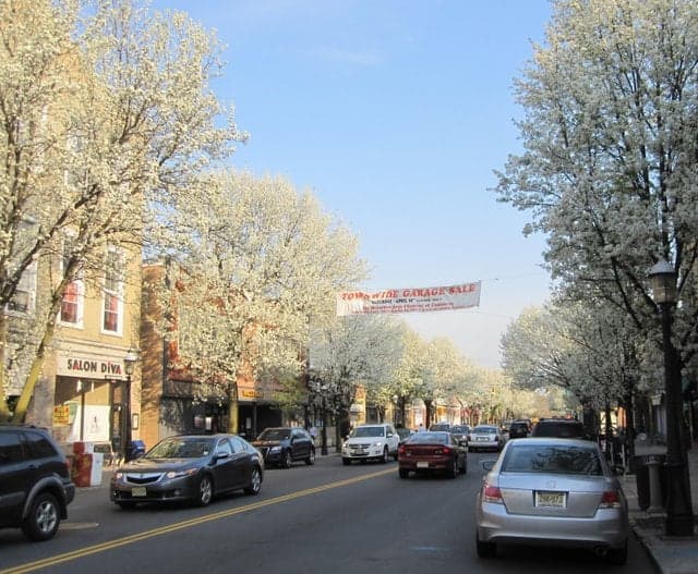
Photo: Wikipedia
Strategic Assessment of Metuchen, NJ
High tactical risk. This location is likely close to major population centers, strategic targets, or sits in a high-disaster corridor. A retreat property and careful exit planning is required.
What does the Strategic Assessment tell us?
Our Strategic Assessment grades tactical survivability of an area. Major population centers, military targets, fallout zones, natural disasters, and border exposure all drive risk — lower exposure means a more defensible position in a crisis.
This is heavily inspired by Joel Skousen's Strategic Relocation book. Highly recommended you checkout the book ($)What does this tell us?
Our Strategic Assessment grades tactical survivability of an area. Major population centers, military targets, fallout zones, natural disasters, and border exposure all drive risk — lower exposure means a more defensible position in a crisis.
This is heavily inspired by Joel Skousen's Strategic Relocation book. Highly recommended you checkout the book ($)Strategic Pillars

Key Distances
Regional Safe Places
Below is our recommended "safe zones" in New Jersey and the surrounding area based on our strategic heuristics. For most people, it's unrealistic to live in a “safe zone” full-time due to work, family or other personal reasons. They tend to be more rural. However, many of these areas are perfect for second homes and retreat properties that double as a vacation home or even a short-term rental.
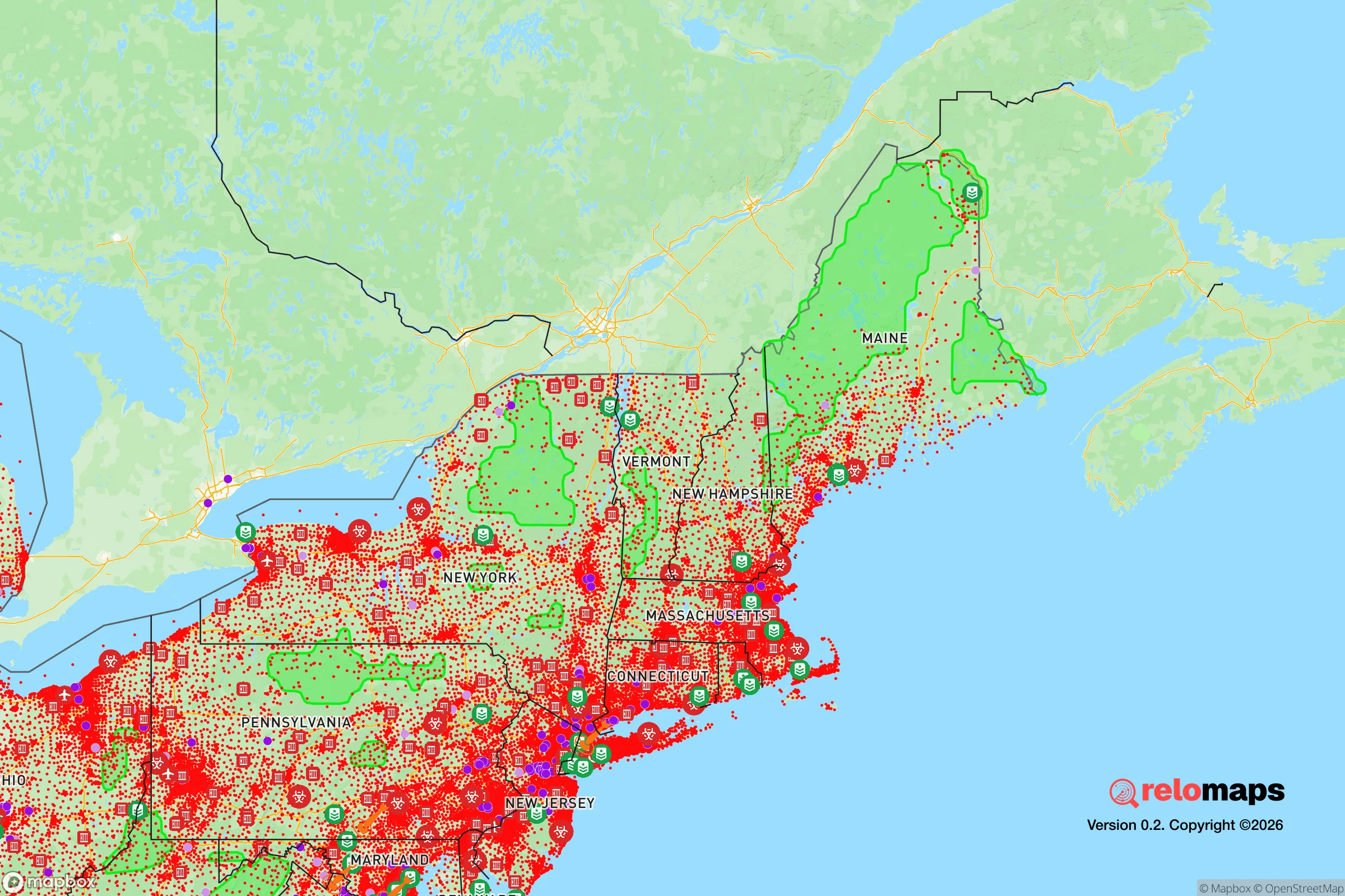
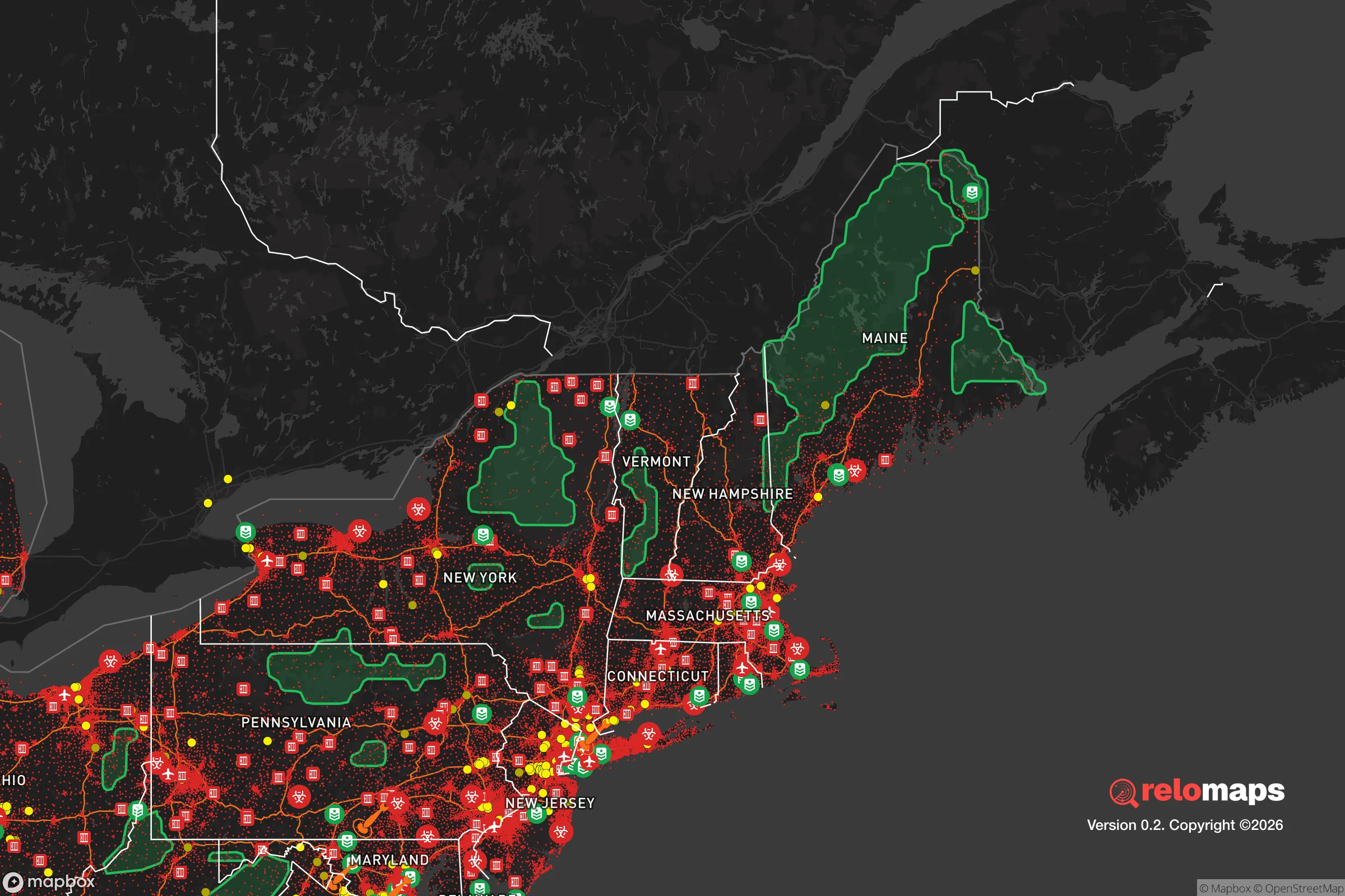


Important Note: For informational purposes only. This does not mean nothing bad ever happens in the green zones. Please use common sense. This is based on public data and modeled with AI. We tried to take a conservative approach but mistakes happen. We update this regularly as new information becomes available.
Solar Generator Recommendations
Backup power matters more here than in safer locations. We've picked three solar generators across budgets and capacity tiers — start with the budget unit if you only need a few essentials, or step up if you want to run a fridge and HVAC for days at a time.

Jackery Portable Power Station Explorer 300
Budget OptionPower on the Go: Weighing only 11 lbs, it's convenient to set up and store with book-sized foldable solar panels

BLUETTI Portable Power Station AC180
Designed for both indoor and outdoor scenarios, AC180 is highly capable as it has a robost capacity and continuous output power.

EF ECOFLOW DELTA Pro Ultra Power Station
Upgraded PickEcoFlow DELTA Pro Ultra is a whole-home energy system designed to grow with your family. Integrated with the Smart Home Panel 2, it scales to meet your evolving energy needs — keeping your home powered, intelligent, and secure through every stage of life.
We earn a commission, at no additional cost to you.
Strategic Assessment Analysis
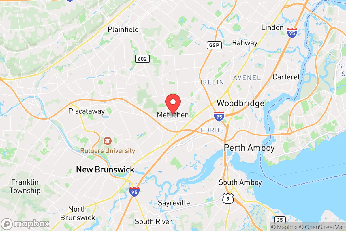
Metuchen, New Jersey, presents a mixed strategic picture for the relocation-minded reader focused on resilience and self-sufficiency. While its location in central Middlesex County offers some geographic advantages, its proximity to major metropolitan corridors and critical infrastructure introduces significant vulnerabilities that a serious preparedness-minded individual must weigh. The borough’s compact, walkable layout and established community networks provide a baseline of social resilience, but its dependence on regional supply chains and exposure to dense population centers nearby demand a clear-eyed assessment of both natural and man-made risks.
Geographic position and natural advantages for long-term stability
Metuchen sits on the Raritan Valley Line, roughly 30 miles southwest of New York City, placing it within the densely populated Northeast Corridor but not directly in the blast radius of a major urban target. The area’s topography is relatively flat, with elevations around 100 feet above sea level, which reduces risks from landslides or flash flooding compared to more mountainous regions. The borough is situated near the Raritan River and several smaller tributaries, providing a natural water source, though this also introduces floodplain exposure in low-lying sections. The surrounding Middlesex County landscape is a mix of suburban development and preserved farmland, particularly to the south and west, offering some buffer against urban sprawl. Metuchen’s position on the Atlantic Coastal Plain means it avoids the seismic risks of the western U.S., and its inland location reduces direct hurricane storm surge threats, though tropical storm remnants can still bring heavy rain and wind. The area’s temperate climate supports a growing season of roughly 180 days, which is adequate for small-scale vegetable gardening and fruit cultivation, a key consideration for those planning long-term food security. The presence of the nearby Pine Barrens, a vast forested region about 40 miles southeast, provides a potential retreat zone with abundant natural resources, though access would require a vehicle and pre-planned routes.
Risk exposure and proximity to fallout-relevant infrastructure
The most significant strategic liability for Metuchen is its proximity to high-value targets in the New York metropolitan area and the Philadelphia region. The borough lies within the fallout plume potential of any nuclear event targeting Manhattan, Newark, or the Port of Elizabeth, with prevailing westerly winds carrying contamination eastward over central New Jersey. Metuchen is also within 10 miles of the ExxonMobil Bayway Refinery in Linden, one of the largest oil refineries on the East Coast, which represents a major industrial accident and potential secondary target risk. The borough is bisected by the Northeast Corridor rail line and is near Interstates 287 and 95, making it a chokepoint for evacuation and supply routes that could become congested or targeted during a crisis. The area’s dense suburban population—over 14,000 residents in just 1.8 square miles—means that any large-scale disaster would strain local resources quickly, with limited room for on-site food production or water storage. Flooding from the Raritan River and its tributaries is a recurring natural hazard, with the National Flood Insurance Program mapping several zones within Metuchen as high-risk, particularly near the Metuchen Golf and Country Club and along the borough’s southern edge. The region also faces periodic nor’easters and winter storms that can knock out power for days, exposing the area’s reliance on an aging electrical grid. For the preparedness-minded relocator, these factors mean that Metuchen’s resilience is heavily dependent on pre-positioned supplies and a clear evacuation plan, rather than inherent geographic protection.
Practical resilience for daily life: food, water, energy, and defensibility
Metuchen’s practical resilience for a relocator is a study in contrasts. The borough has a robust local food scene with several grocery stores, farmers’ markets, and specialty shops within walking distance of most homes, but this convenience masks a vulnerability: the area relies almost entirely on just-in-time delivery from regional distribution centers. A prolonged supply chain disruption would empty shelves within 72 hours, as seen during the early pandemic panic buying. For water, Metuchen is served by the Middlesex Water Company, which draws from the Raritan River and groundwater wells, but the system lacks redundant backup power for pumps, meaning a multi-day blackout would cut water pressure. Residents should plan for at least two weeks of stored water per person, ideally more. Energy infrastructure is similarly fragile: the borough’s overhead power lines are susceptible to tree damage during storms, and while PSE&G has invested in grid hardening, outages lasting 24–48 hours remain common after major weather events. Solar panels with battery storage are a viable option for homeowners, though the area’s tree canopy can limit rooftop solar yield. Defensibility is the weakest category: Metuchen’s dense, interconnected street grid and lack of natural barriers make it difficult to secure a perimeter in a prolonged crisis. The borough’s police force is small—around 25 officers—and would be overwhelmed in a widespread emergency. However, the community’s strong social fabric, with active neighborhood associations and a well-used public library and community center, provides a foundation for mutual aid and information sharing. For the relocator, the best strategy is to treat Metuchen as a base for normal life with a low-key preparedness posture, not as a bug-out location. A well-stocked pantry, a reliable vehicle with a full tank, and a pre-planned route to a rural retreat in western New Jersey or Pennsylvania are essential complements to any residence here.
The overall strategic picture for Metuchen is one of calculated trade-offs. Its central location offers excellent access to employment, healthcare, and education, but that same connectivity makes it a secondary risk zone for both natural and man-made disasters. The borough’s small size and dense layout limit its capacity for self-sufficiency, but its engaged community and proximity to preserved open space provide some offsetting advantages. For the relocator who values preparedness without sacrificing urban amenities, Metuchen can work—provided they invest in home resilience measures, maintain a low profile, and have a clear plan for evacuation or sheltering in place. It is not a fortress, but it is a livable, strategically aware choice for those who understand the risks and prepare accordingly.

* Values derived from national, state, county, city and local statistics and may differ in a specific area. Last updated: 2026-11-13T05:34:26.000Z
Narrative content on this page is AI-generated and may contain mistakes. Verify any details that matter before acting on them.
ReloMaps may earn a commission from affiliate links at no extra cost to you.

