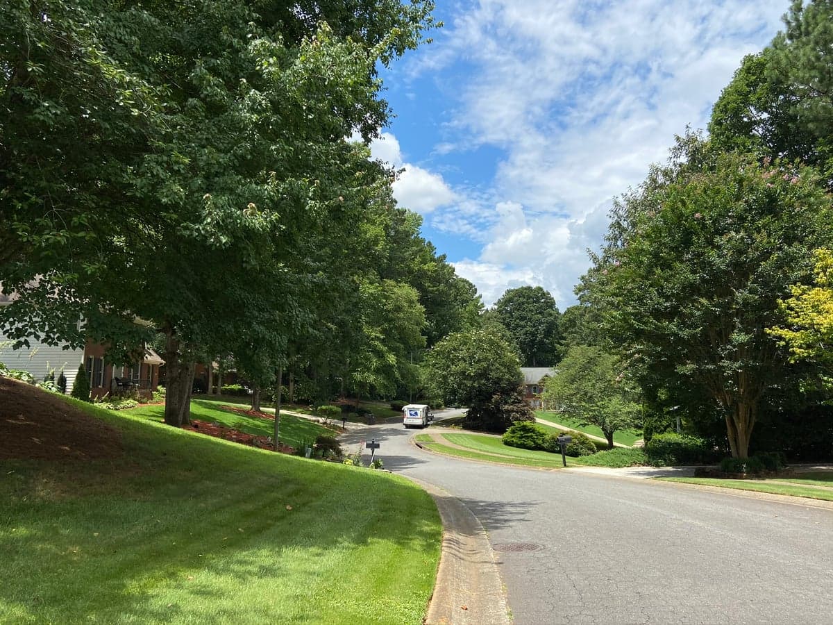
Photo: Wikipedia
Strategic Assessment of Mableton, GA
Multiple tactical vulnerabilities. Population density, target proximity, or disaster risk are likely compounding. A retreat property and exit planning is required.
What does the Strategic Assessment tell us?
Our Strategic Assessment grades tactical survivability of an area. Major population centers, military targets, fallout zones, natural disasters, and border exposure all drive risk — lower exposure means a more defensible position in a crisis.
This is heavily inspired by Joel Skousen's Strategic Relocation book. Highly recommended you checkout the book ($)What does this tell us?
Our Strategic Assessment grades tactical survivability of an area. Major population centers, military targets, fallout zones, natural disasters, and border exposure all drive risk — lower exposure means a more defensible position in a crisis.
This is heavily inspired by Joel Skousen's Strategic Relocation book. Highly recommended you checkout the book ($)Strategic Pillars

Key Distances
Regional Safe Places
Below is our recommended "safe zones" in Georgia and the surrounding area based on our strategic heuristics. For most people, it's unrealistic to live in a “safe zone” full-time due to work, family or other personal reasons. They tend to be more rural. However, many of these areas are perfect for second homes and retreat properties that double as a vacation home or even a short-term rental.
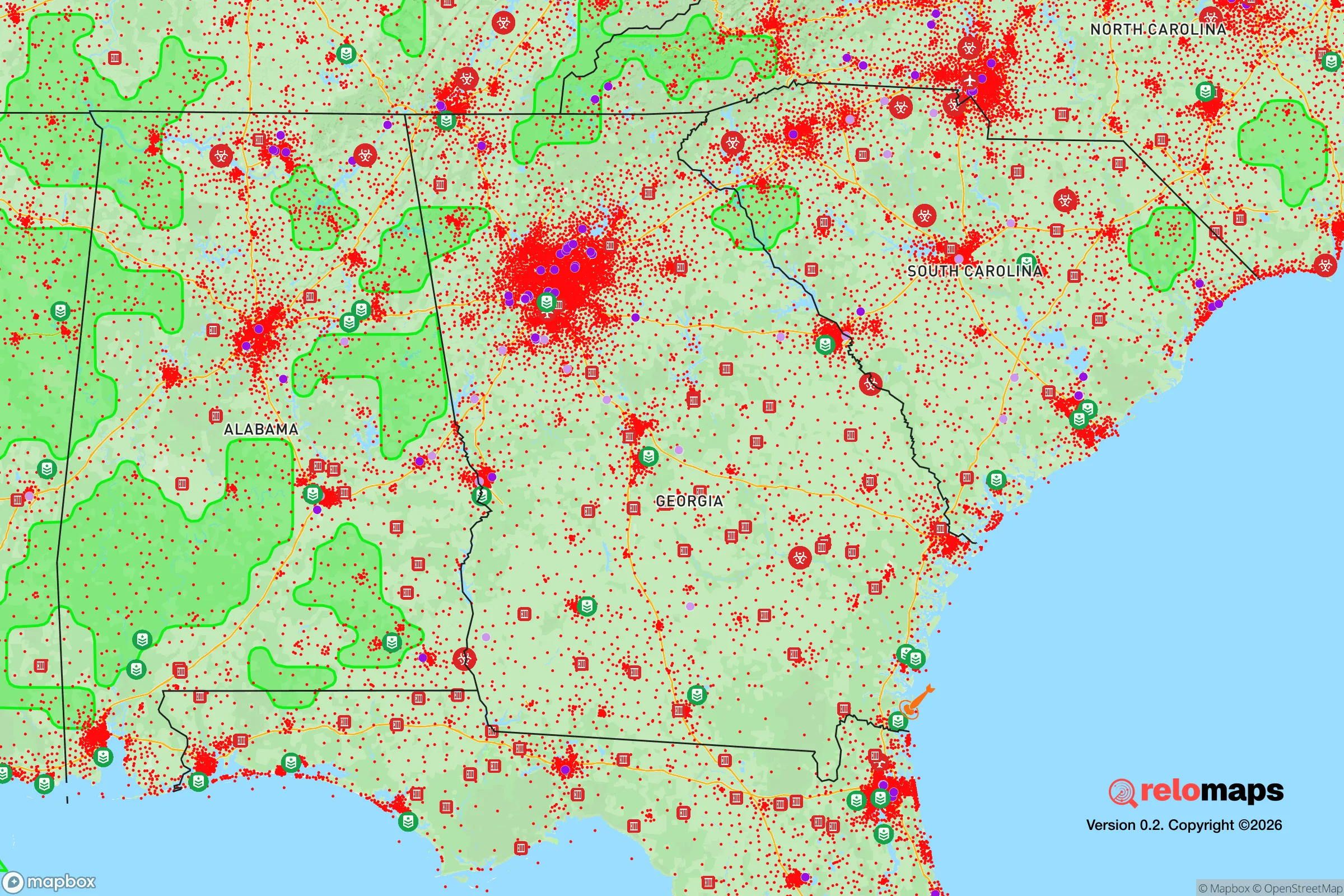
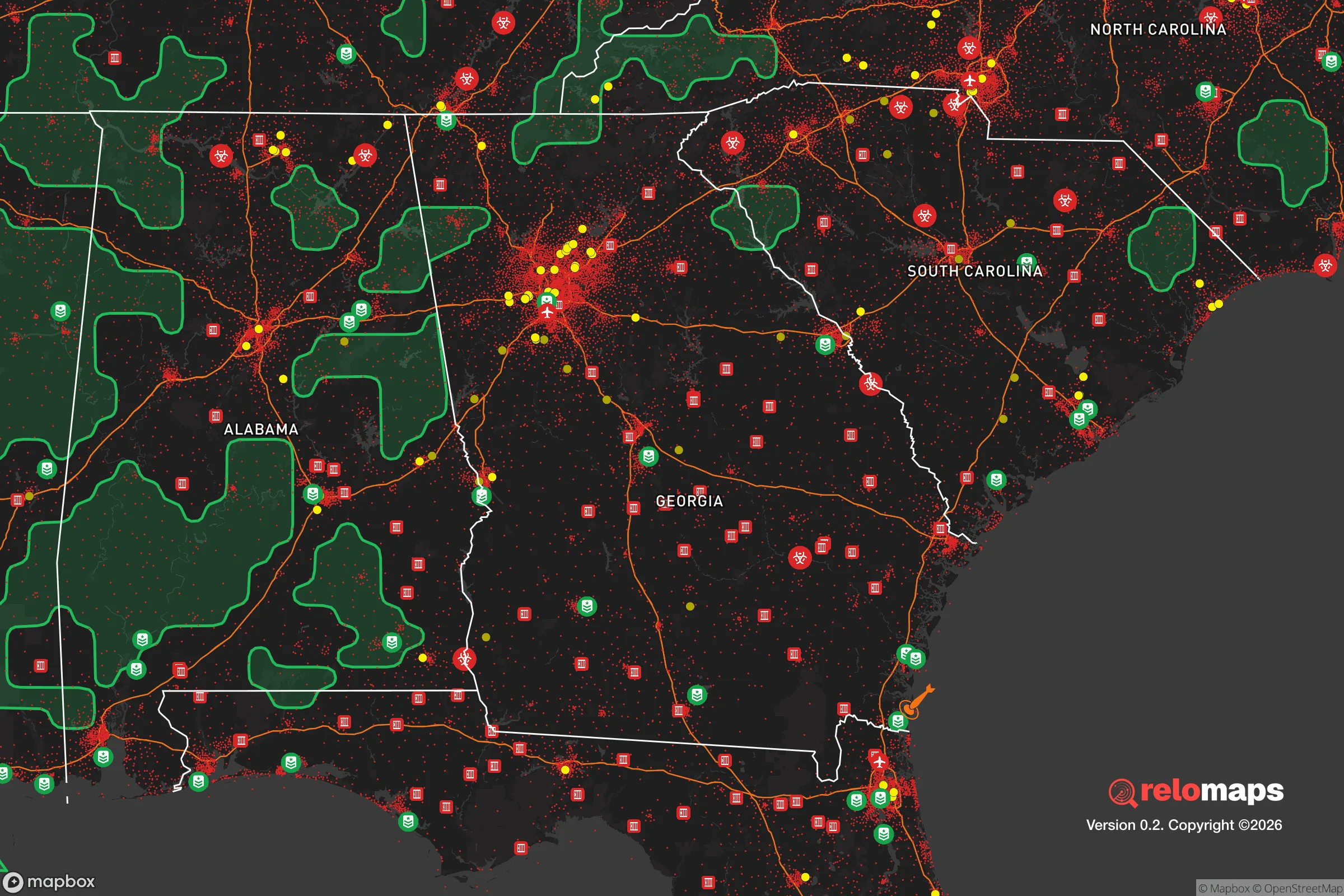


Important Note: For informational purposes only. This does not mean nothing bad ever happens in the green zones. Please use common sense. This is based on public data and modeled with AI. We tried to take a conservative approach but mistakes happen. We update this regularly as new information becomes available.
Solar Generator Recommendations
Backup power matters more here than in safer locations. We've picked three solar generators across budgets and capacity tiers — start with the budget unit if you only need a few essentials, or step up if you want to run a fridge and HVAC for days at a time.

Jackery Portable Power Station Explorer 300
Budget OptionPower on the Go: Weighing only 11 lbs, it's convenient to set up and store with book-sized foldable solar panels

BLUETTI Portable Power Station AC180
Designed for both indoor and outdoor scenarios, AC180 is highly capable as it has a robost capacity and continuous output power.

EF ECOFLOW DELTA Pro Ultra Power Station
Upgraded PickEcoFlow DELTA Pro Ultra is a whole-home energy system designed to grow with your family. Integrated with the Smart Home Panel 2, it scales to meet your evolving energy needs — keeping your home powered, intelligent, and secure through every stage of life.
We earn a commission, at no additional cost to you.
Strategic Assessment Analysis
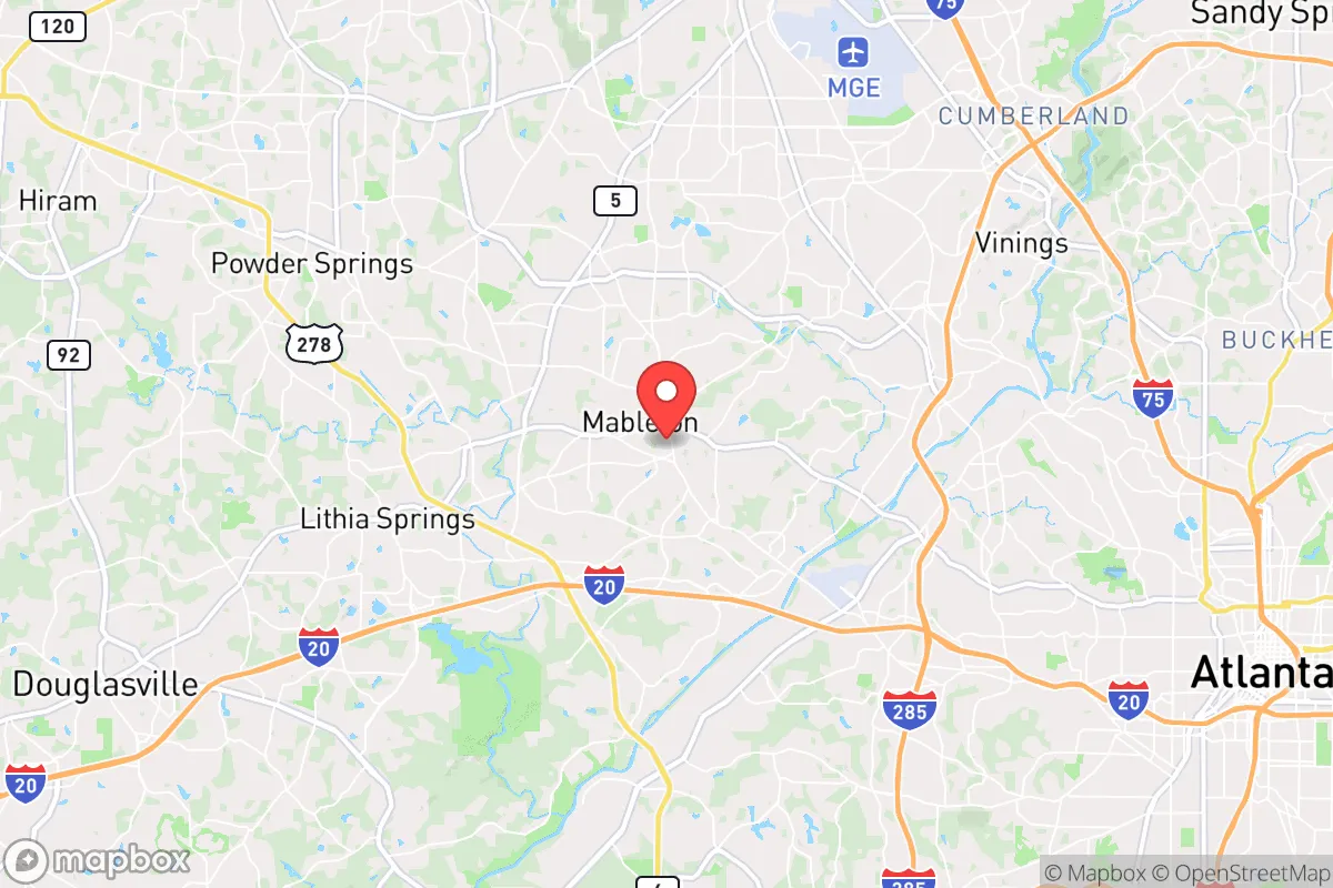
Mableton, Georgia, offers a strategic blend of proximity to Atlanta’s economic engine and a semi-rural buffer that appeals to relocation-minded individuals and families prioritizing resilience and self-sufficiency. Located roughly 15 miles west of downtown Atlanta in Cobb County, Mableton sits on the edge of the metro area’s suburban sprawl, providing access to urban resources while maintaining a lower-density, more defensible footprint. Its position along the Chattahoochee River and near key transportation corridors like I-285 and I-20 gives residents both a natural barrier and logistical flexibility, but the same geography introduces specific vulnerabilities that a serious disaster-readiness assessment must weigh.
Geographic position and natural advantages for self-sufficiency
Mableton’s location in the Piedmont region of north Georgia provides a moderate climate with four distinct seasons, reducing the risk of extreme weather events common in coastal or plains states. The area sits at an elevation of roughly 1,000 feet above sea level, which mitigates flood risks from the nearby Chattahoochee River—though low-lying neighborhoods near the river and its tributaries, such as Nickajack Creek, should be evaluated individually. The surrounding terrain is gently rolling, with mixed hardwood forests and clay-based soils that support small-scale agriculture, gardening, and rainwater catchment. Cobb County’s water supply is robust, drawing from the Chattahoochee and the Allatoona Lake reservoir system, but Mableton’s reliance on municipal water means a private well or cistern is a prudent addition for long-term self-sufficiency. The area’s tree cover provides natural insulation and some concealment, but also presents a wildfire risk during dry spells—a factor that has become more relevant with Georgia’s increasing drought frequency. For a relocator, the key natural advantage is the ability to carve out a semi-rural lifestyle within a short drive of Atlanta’s hospitals, supply chains, and employment hubs, without being fully exposed to the city’s density.
Risks, exposures, and proximity to fallout-relevant landmarks
Mableton’s primary risk profile stems from its proximity to Atlanta, a major population center and potential target for both natural cascading failures and man-made disruptions. The area lies within 20 miles of Hartsfield-Jackson Atlanta International Airport, one of the world’s busiest, which could become a chokepoint or evacuation bottleneck during a crisis. Additionally, the nearby I-285 corridor and the CSX rail lines that run through Cobb County are critical logistics arteries; a disruption—whether from a cyberattack, infrastructure failure, or severe weather—could quickly strain local supplies of fuel, food, and medical goods. Cobb County is also home to the Lockheed Martin facility in Marietta (roughly 10 miles north), a defense contractor that could be a secondary target in a geopolitical conflict. On the natural hazard side, the region experiences occasional tornadoes (Cobb County averages 2-3 per year), severe thunderstorms, and ice storms that can knock out power for days. The 2021 Atlanta ice storm left over 300,000 without power, and Mableton’s tree-lined streets are particularly vulnerable to falling limbs. Flooding is localized but real in areas near the Chattahoochee floodplain; the 2009 floods caused significant damage in parts of Cobb County. For a relocator, the takeaway is that Mableton is not a remote bunker—it’s a suburban buffer zone where situational awareness and a solid preparedness plan (backup power, water storage, multiple evacuation routes) are essential.
Practical resilience for a relocator: food, water, energy, and defensibility
For a family or individual serious about self-sufficiency, Mableton offers a mixed bag. Food resilience is moderate: the area has several farmers’ markets (including the Mableton Farmers Market and nearby Austell market), and the clay soil can support raised-bed gardening with amendments, but the growing season is limited to roughly April through October. Local grocery options include a Publix and a Walmart, but supply chain disruptions could hit these stores quickly—stockpiling non-perishables and building relationships with local growers is advisable. Water resilience is a stronger point: the Chattahoochee River is a reliable surface water source, but access is limited to public parks and boat ramps, not private riverfront property. A well is feasible on larger lots (many homes in Mableton sit on 0.5–2 acres), and rainwater harvesting is legal in Georgia with no state-level restrictions, though Cobb County may have HOA or permitting nuances. Energy resilience is a weak spot: the grid is aging and prone to outages during storms, but solar adoption is growing, and many homes have natural gas hookups that can power generators or stoves during blackouts. Cobb County’s emergency services are well-funded (the county has a Class 1 ISO fire rating in many areas), but response times in the more rural parts of Mableton can stretch to 10–15 minutes. Defensibility is a trade-off: the area’s winding roads and tree cover provide some natural chokepoints, but the lack of a single, defensible perimeter means a relocator should prioritize a home with a clear sightline to the street, a fenced yard, and a basement or storm shelter. The community itself is a mix of long-term residents and new arrivals, with a growing interest in homesteading and prepping—local Facebook groups and the Cobb County Emergency Management Agency offer resources for building neighborhood-level resilience.
The overall strategic picture for Mableton is one of calculated compromise. It is not a remote retreat, nor is it a high-risk urban core. For a relocator with a slightly conservative leaning who values both access to Atlanta’s economy and a buffer from its vulnerabilities, Mableton provides a workable middle ground—provided they invest in the infrastructure that the area lacks: backup power, water storage, and a network of trusted neighbors. The proximity to the Chattahoochee and the region’s moderate climate are genuine assets, but the risks from Atlanta’s shadow (traffic, supply chain fragility, potential targeting) are real and should not be dismissed. A family willing to harden their home, build local connections, and maintain a low profile will find Mableton a defensible, livable base for the long haul—just not a fortress.

* Values derived from national, state, county, city and local statistics and may differ in a specific area. Last updated: 2026-08-22T15:29:38.000Z
Narrative content on this page is AI-generated and may contain mistakes. Verify any details that matter before acting on them.
ReloMaps may earn a commission from affiliate links at no extra cost to you.

