
Photo: Wikipedia
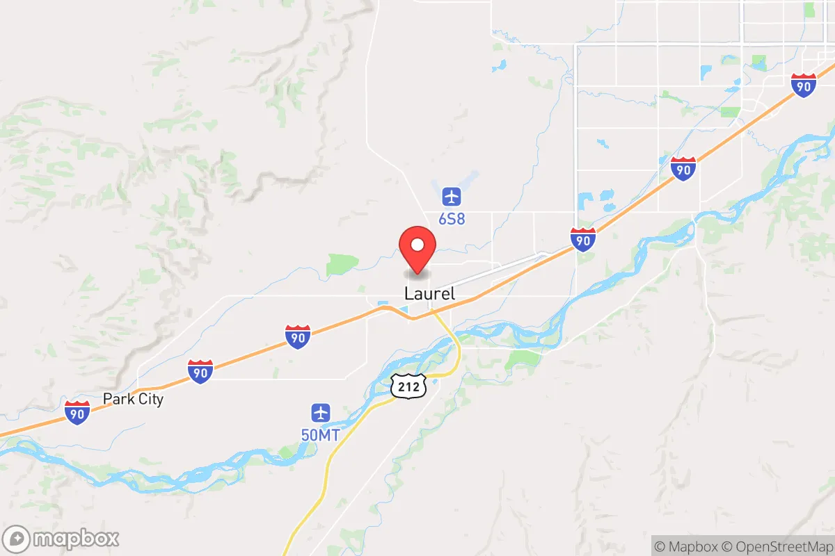
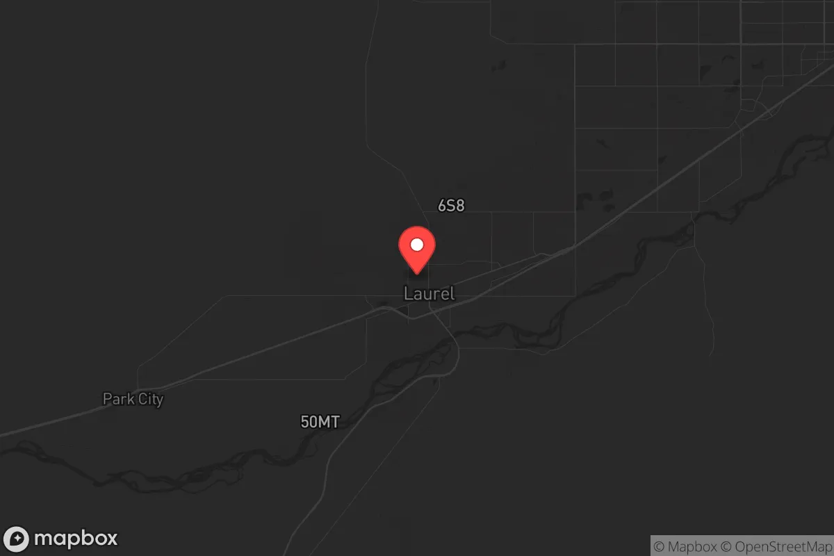
Strategic Assessment of Laurel, MT
Workable tactical position. Some exposure to population density or targets, but generally defensible in a crisis.
What does the Strategic Assessment tell us?
Our Strategic Assessment grades tactical survivability of an area. Major population centers, military targets, fallout zones, natural disasters, and border exposure all drive risk — lower exposure means a more defensible position in a crisis.
This is heavily inspired by Joel Skousen's Strategic Relocation book. Highly recommended you checkout the book ($)What does this tell us?
Our Strategic Assessment grades tactical survivability of an area. Major population centers, military targets, fallout zones, natural disasters, and border exposure all drive risk — lower exposure means a more defensible position in a crisis.
This is heavily inspired by Joel Skousen's Strategic Relocation book. Highly recommended you checkout the book ($)Strategic Pillars

Key Distances
Regional Safe Places
Below is our recommended "safe zones" in Montana and the surrounding area based on our strategic heuristics. For most people, it's unrealistic to live in a “safe zone” full-time due to work, family or other personal reasons. They tend to be more rural. However, many of these areas are perfect for second homes and retreat properties that double as a vacation home or even a short-term rental.

Important Note: For informational purposes only. This does not mean nothing bad ever happens in the green zones. Please use common sense. This is based on public data and modeled with AI. We tried to take a conservative approach but mistakes happen. We update this regularly as new information becomes available.
Solar Generator Recommendations
Backup power matters more here than in safer locations. We've picked three solar generators across budgets and capacity tiers — start with the budget unit if you only need a few essentials, or step up if you want to run a fridge and HVAC for days at a time.

Jackery Portable Power Station Explorer 300
Budget OptionPower on the Go: Weighing only 11 lbs, it's convenient to set up and store with book-sized foldable solar panels

BLUETTI Portable Power Station AC180
Designed for both indoor and outdoor scenarios, AC180 is highly capable as it has a robost capacity and continuous output power.

EF ECOFLOW DELTA Pro Ultra Power Station
Upgraded PickEcoFlow DELTA Pro Ultra is a whole-home energy system designed to grow with your family. Integrated with the Smart Home Panel 2, it scales to meet your evolving energy needs — keeping your home powered, intelligent, and secure through every stage of life.
We earn a commission, at no additional cost to you.
Strategic Assessment Analysis
Laurel, Montana, positioned at the intersection of I-90 and the Yellowstone River, offers a strategic blend of agricultural self-sufficiency and relative isolation from major population centers that makes it a serious contender for those prioritizing long-term resilience. With a population hovering around 7,500, this railroad town sits 15 miles west of Billings—close enough for supply runs but far enough to avoid the immediate chaos of a metropolitan collapse. The area’s elevation (3,300 feet) and semi-arid climate reduce flood and wildfire risks compared to other parts of the West, while the Yellowstone River provides a reliable water source that doesn’t depend on fragile municipal infrastructure. For a relocator thinking in terms of decades, not election cycles, Laurel’s combination of hard infrastructure (rail, interstate, river) and low population density makes it a practical base for weathering the storms ahead.
Geographic position and natural advantages for long-term security
Laurel’s location is its primary strategic asset. It sits in the Yellowstone Valley, a natural corridor that funnels resources and movement but is also defensible—flanked by the Beartooth Mountains to the south and the Bull Mountains to the north. The Yellowstone River runs through town, offering a year-round surface water source that doesn’t require deep wells or complex pumping systems. The surrounding soil is fertile enough for small-scale agriculture, and the growing season (roughly 120 days) supports cold-hardy crops like potatoes, carrots, and grains. The area’s low humidity and consistent winds reduce the spread of airborne contaminants, a factor often overlooked in prepper planning. The interstate (I-90) provides a direct route to Billings for medical care or supplies, but the town’s layout—with multiple secondary roads and rail access—means you’re not funneled into a single choke point. For a single individual or family, this means you can establish a home base that’s connected but not dependent on a single lifeline.
Risks, exposures, and proximity to fallout-relevant landmarks
No location is perfect, and Laurel has specific vulnerabilities that demand attention. The most immediate concern is the Yellowstone River itself—while a water source is a plus, the river is prone to ice jams and spring flooding, particularly in the low-lying areas near the railroad tracks. The 2022 flood event (which damaged parts of nearby Red Lodge) was a reminder that even semi-arid regions can see catastrophic water events. More critically, Laurel sits 15 miles from Billings, a city of 110,000 that hosts a major medical center, an oil refinery (the ExxonMobil Billings Refinery), and a rail hub. In a mass casualty event or civil unrest scenario, Billings could become a source of refugees, resource competition, or secondary hazards (refinery fires, chemical releases). The refinery is roughly 20 miles northwest of Laurel, meaning prevailing winds (typically from the west) would carry any plume away from the town in most weather patterns—but not all. Additionally, the rail lines through Laurel carry hazardous materials (crude oil, propane, ammonia), and a derailment near the town center could be catastrophic. For the prepper mindset, these risks are manageable with proper planning: avoid low-lying flood zones, maintain a 30-mile buffer from Billings for daily activities, and have a wind-direction monitoring plan for industrial incidents.
Practical resilience for a relocator: food, water, energy, and defensibility
Laurel’s practical resilience hinges on its existing infrastructure and the ability to go off-grid without starting from scratch. Water is the strongest asset: the Yellowstone River is a Class I water source, and while municipal treatment is available, a simple sand filter and UV system can make river water potable. The town’s water table is shallow (20-40 feet in most areas), so a hand pump or solar-powered well is a realistic backup. For food, the surrounding county (Yellowstone County) has active agricultural operations—cattle ranches, hay fields, and some grain production—meaning local food networks exist even if grocery stores fail. The Laurel Farmers Market (summer months) and local CSAs provide direct access to producers. Energy resilience is moderate: the area has good solar exposure (over 200 sunny days per year), and wind is consistent enough for small turbines. However, Montana’s net metering laws are favorable, so grid-tied solar with battery backup is the most practical setup. Natural gas is available in town, but for long-term independence, wood heat is the fallback—the surrounding national forests (Custer Gallatin) provide fuel, but you’ll need a permit and a chainsaw. Defensibility is where Laurel shines: the town is compact, with a grid street pattern that’s easy to monitor, and the surrounding rural areas offer properties with clear sightlines and limited access points. The nearest military installation is Malmstrom Air Force Base (250 miles west), which is far enough to avoid being a target but close enough to provide a sense of regional stability. For a single individual, a small acreage (5-10 acres) within 10 miles of town offers the best balance of community access and operational security.
The overall strategic picture for Laurel is one of cautious optimism for the prepared relocator. It’s not a bug-out location in the wilderness—it’s a working town with real infrastructure, real risks, and real opportunities. The proximity to Billings is a double-edged sword: it provides medical care, supplies, and a labor market, but it also introduces the chaos of a mid-sized city in crisis. For the conservative prepper who values community, self-reliance, and a low profile, Laurel offers a middle path—close enough to civilization to function, far enough to survive its collapse. The key is to treat it as a base, not a fortress: build relationships with local ranchers, stockpile for 90 days (not 90 years), and maintain a vehicle capable of navigating winter roads. In a worst-case scenario, Laurel’s rail and river access become escape routes to the mountains or the Dakotas, but in a best-case scenario, it’s a place where you can live a normal life while being ready for the abnormal. That’s the kind of strategic depth that makes a relocation worth the effort.
* Values derived from national, state, county, city and local statistics and may differ in a specific area. Last updated: 2026-04-30T07:50:24.000Z
Narrative content on this page is AI-generated and may contain mistakes. Verify any details that matter before acting on them.
ReloMaps may earn a commission from affiliate links at no extra cost to you.