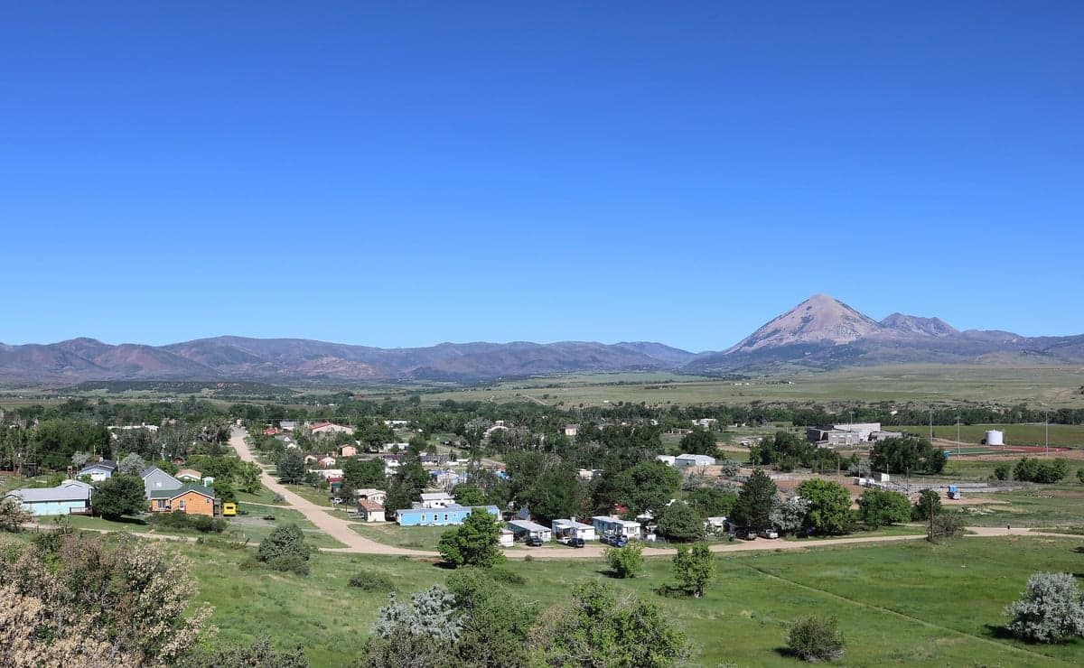
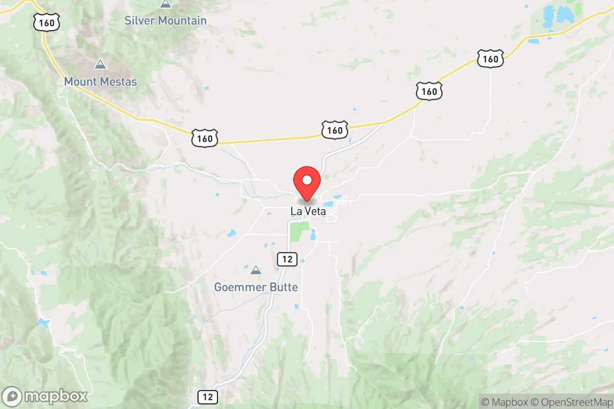
Photo: Wikipedia
Strategic Assessment of La Veta, CO
Strong survivability profile. Good buffer from population centers, with manageable environmental and tactical risks.
What does the Strategic Assessment tell us?
Our Strategic Assessment grades tactical survivability of an area. Major population centers, military targets, fallout zones, natural disasters, and border exposure all drive risk — lower exposure means a more defensible position in a crisis.
This is heavily inspired by Joel Skousen's Strategic Relocation book. Highly recommended you checkout the book ($)What does this tell us?
Our Strategic Assessment grades tactical survivability of an area. Major population centers, military targets, fallout zones, natural disasters, and border exposure all drive risk — lower exposure means a more defensible position in a crisis.
This is heavily inspired by Joel Skousen's Strategic Relocation book. Highly recommended you checkout the book ($)Strategic Pillars

Key Distances
Regional Safe Places
Below is our recommended "safe zones" in Colorado and the surrounding area based on our strategic heuristics. For most people, it's unrealistic to live in a “safe zone” full-time due to work, family or other personal reasons. They tend to be more rural. However, many of these areas are perfect for second homes and retreat properties that double as a vacation home or even a short-term rental.
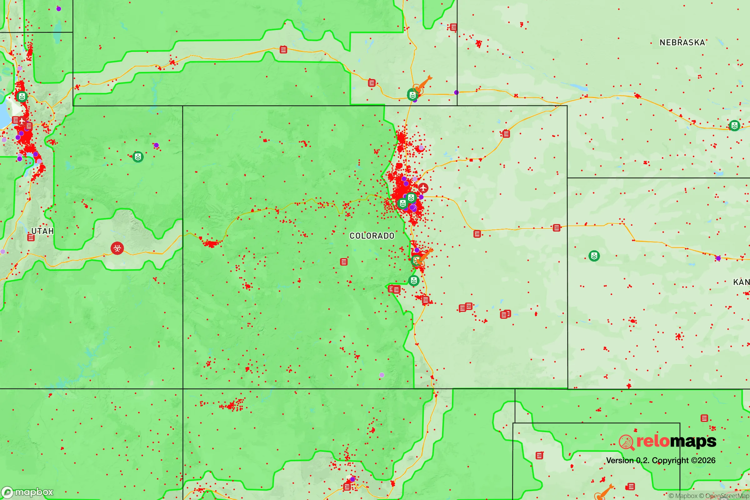
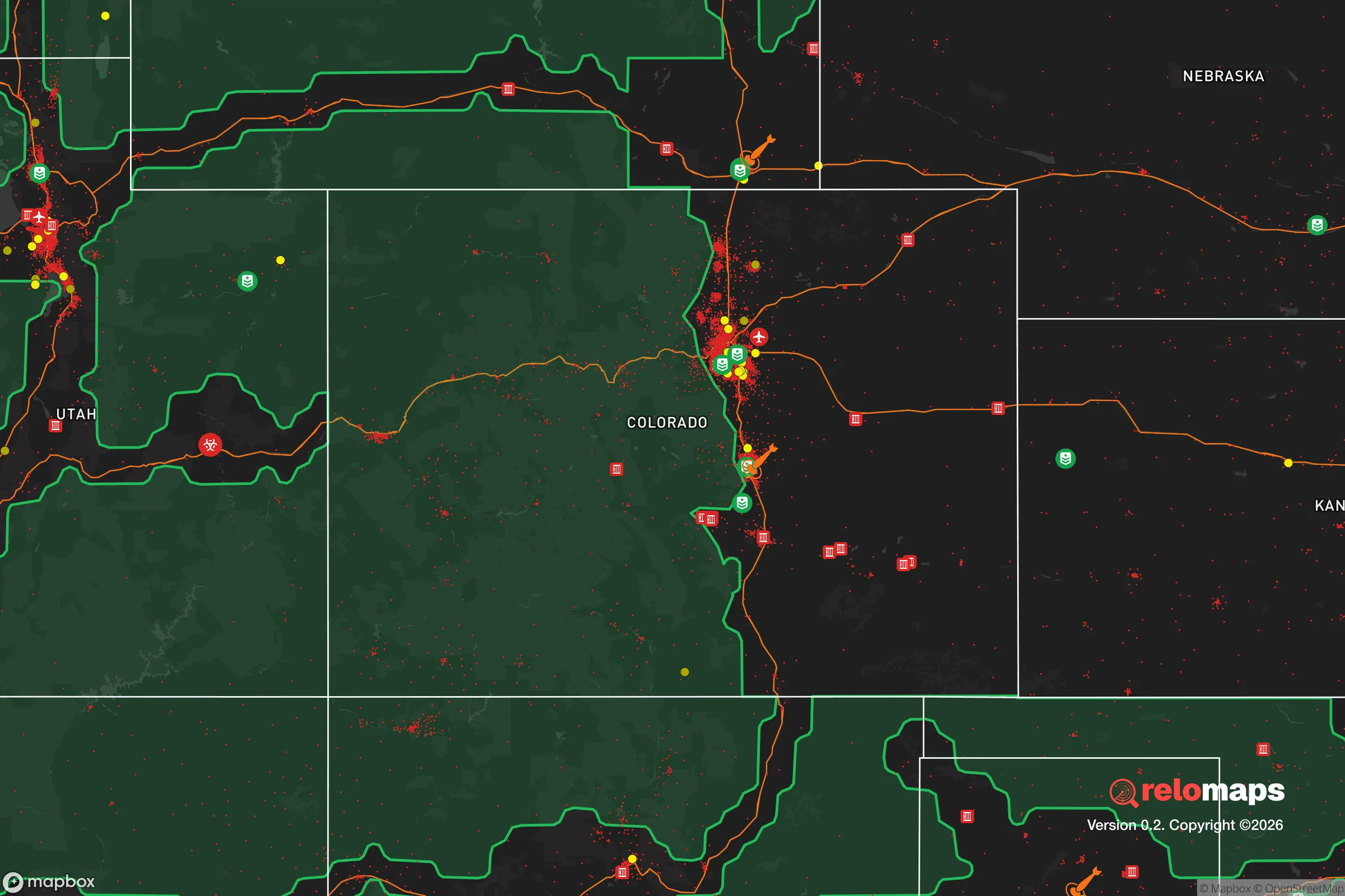


Important Note: For informational purposes only. This does not mean nothing bad ever happens in the green zones. Please use common sense. This is based on public data and modeled with AI. We tried to take a conservative approach but mistakes happen. We update this regularly as new information becomes available.
Solar Generator Recommendations
Backup power matters more here than in safer locations. We've picked three solar generators across budgets and capacity tiers — start with the budget unit if you only need a few essentials, or step up if you want to run a fridge and HVAC for days at a time.

Jackery Portable Power Station Explorer 300
Budget OptionPower on the Go: Weighing only 11 lbs, it's convenient to set up and store with book-sized foldable solar panels

BLUETTI Portable Power Station AC180
Designed for both indoor and outdoor scenarios, AC180 is highly capable as it has a robost capacity and continuous output power.

EF ECOFLOW DELTA Pro Ultra Power Station
Upgraded PickEcoFlow DELTA Pro Ultra is a whole-home energy system designed to grow with your family. Integrated with the Smart Home Panel 2, it scales to meet your evolving energy needs — keeping your home powered, intelligent, and secure through every stage of life.
We earn a commission, at no additional cost to you.
Strategic Assessment Analysis
La Veta sits in a genuinely strong position for a relocator thinking about resilience, combining high-altitude seclusion with practical access to the supplies and services you actually need. The town anchors the Cuchara Valley at roughly 7,000 feet, tucked against the eastern flank of the Sangre de Cristo range, and that geography does a lot of the defensive work for you. It is far enough from the Front Range urban corridor — about a three-hour drive to Colorado Springs and nearly four to Denver — that you are outside the immediate blast-and-fallout zones of major population centers, yet close enough that a full resupply run is a day trip, not an expedition.
Geographic position and natural defensive advantages
The Cuchara Valley is a natural funnel, and La Veta sits at its mouth, which cuts both ways. The Sangre de Cristo mountains rise sharply to the west and southwest, creating a formidable natural barrier between the town and the San Luis Valley. That range, with peaks pushing past 13,000 feet, is a serious obstacle for anyone approaching from that direction, and it also blocks a good deal of winter weather. To the east, the terrain opens onto the high plains, giving you a long sightline toward the Interstate 25 corridor and the towns of Walsenburg and Trinidad. The Spanish Peaks — two distinctive laccoliths just south of town — are a landmark you can navigate by from miles away, which is more useful than it sounds in a grid-down scenario.
Elevation is your first real asset. At 7,000 feet, La Veta is above the inversion layers that trap smoke and particulates in the lower valleys, and it is high enough that most flood risks are limited to the immediate creek drainages rather than the town itself. The climate is semi-arid, with roughly 15 inches of annual precipitation, which means you are not dealing with the mold, rot, and structural decay issues that plague wetter mountain towns. Winters are real — expect 60 to 80 inches of snow — but the town sits on the leeward side of the range, so you get less accumulation than Wolf Creek Pass or even nearby Cuchara, which sits 1,000 feet higher and gets hammered.
The valley floor gives you something rare in Colorado mountain towns: actual arable land. The Cuchara River runs through town, and the surrounding meadows have been farmed and ranched for over a century. That is not a trivial detail for a resilience assessment. It means the local soil is proven, the growing season is long enough for cold-hardy crops, and there is existing irrigation infrastructure you can learn from or tap into.
Risks, exposures, and proximity to fallout-relevant landmarks
No location is risk-free, and La Veta has its own set of exposures you should weigh honestly. The most significant is wildfire. The valley is surrounded by piñon-juniper and ponderosa pine stands, and the last two decades have seen several major fires in the broader region, including the 2018 Spring Fire, which burned over 108,000 acres just south of town and forced evacuations in the Cuchara area. La Veta itself has not taken a direct hit, but the fuel load is there, and the town's primary evacuation route — Highway 12 through the valley — is a two-lane road that can bottleneck quickly. You should have a personal evacuation plan that does not depend on that single artery.
On the man-made risk side, the picture is more favorable than most of Colorado. The nearest significant military installation is Fort Carson, near Colorado Springs, roughly 150 miles north — well outside any realistic fallout plume from a conventional or limited nuclear exchange targeting that facility. The same logic applies to the Front Range's other strategic assets: Schriever Space Force Base, Peterson SFB, and the U.S. Air Force Academy are all clustered around Colorado Springs, and Buckley SFB is near Denver. La Veta is far enough from all of them that you are not in the immediate blast zone, and prevailing westerly winds would carry any fallout east, away from the valley. The San Luis Valley to the west is home to some sensitive infrastructure — including the Great Sand Dunes and various research facilities — but nothing that makes it a likely first-strike target.
The more realistic man-made risks are mundane: a derailment on the Union Pacific line that runs through Walsenburg, a hazardous materials spill on I-25, or a prolonged power outage from a winter storm. Huerfano County has a population of roughly 6,800, which means emergency services are thin. The hospital in Walsenburg is a critical-access facility, and the nearest trauma center is in Pueblo, about 75 minutes away. For a serious medical emergency, you are relying on air evacuation or a long ground transport. That is a fact you should internalize before committing to the area.
Practical resilience for a relocator: food, water, energy, and defensibility
Water is the strongest card La Veta holds. The town's municipal supply comes from the Cuchara River and several high-mountain reservoirs, and the system is gravity-fed from storage above the valley floor — meaning it keeps flowing even without power. For a household, a 1,500-gallon cistern with a simple filtration setup would give you months of drinking water, and the shallow groundwater table in the valley means a well is a realistic option on most parcels. The river itself runs year-round, fed by snowmelt, and while it is not potable without treatment, it is a reliable surface source that most Colorado mountain towns simply do not have.
Food security is above average for the region. Huerfano County has an active agricultural community — cattle ranching, hay production, and a growing number of small market farms — and the La Veta Farmers Market runs through the summer. For a relocator serious about self-sufficiency, the valley's growing season (roughly 100 frost-free days) supports potatoes, root vegetables, cold-hardy greens, and greenhouse production. The local soil is volcanic in origin, well-draining, and fertile where it has been worked. You will not grow citrus, but you can produce a meaningful portion of your own calories within two or three seasons.
Energy is the weakest link. The grid here is rural and exposed, and winter storms routinely cause outages measured in days, not hours. Solar is viable — the valley gets over 300 days of sun annually — but you need battery storage and a backup generator for the deep winter weeks when panels are snow-covered. Propane is the pragmatic choice for heating and cooking; it is delivered locally, and a 500-gallon tank will carry a well-insulated home through a hard winter. Firewood is abundant and cheap, and a wood stove is not a luxury here; it is the difference between a rough week and a dangerous one when the power goes out in January.
Defensibility is a mixed picture. The town itself is compact and walkable, with a classic mountain-town layout where most homes are within a few blocks of the main street. That density is an advantage for community cohesion — neighbors know each other, and the town has a strong volunteer fire department and an active community association. But it also means you are not going to hold a perimeter around a single property. The better play is to buy a few acres on the valley floor or the lower slopes, where you have sightlines, a defensible driveway, and space between you and the nearest neighbor. The terrain rewards someone who thinks in terms of fields of fire and approach routes, but it punishes the unprepared — the valley is a funnel, and if you are at the bottom of it, you are also at the bottom of the drainage.
The overall strategic picture for La Veta is genuinely strong for a resilience-minded relocator, with the caveat that it rewards preparation over improvisation. You have water, arable land, a defensible valley position, and distance from the Front Range's strategic targets — but you also have wildfire risk, thin medical infrastructure, and a rural grid that will test you every winter. For a single individual or a family willing to put in the work on water storage, backup power, and a serious food-production plan, this is one of the better-balanced mountain towns in southern Colorado. It is not a bunker, and it is not a prepper fantasy; it is a real community with real infrastructure, sitting in a position that gives you options when things go wrong. That is the best you can ask for anywhere.

* Values derived from national, state, county, city and local statistics and may differ in a specific area. Last updated: 2026-09-05T17:18:36.000Z
Narrative content on this page is AI-generated and may contain mistakes. Verify any details that matter before acting on them.
ReloMaps may earn a commission from affiliate links at no extra cost to you.

