Photo: Wikipedia
Strategic Assessment of Barren County
Workable tactical position. Some exposure to population density or targets, but generally defensible in a crisis.
What does the Strategic Assessment tell us?
Our Strategic Assessment grades tactical survivability of an area. Major population centers, military targets, fallout zones, natural disasters, and border exposure all drive risk — lower exposure means a more defensible position in a crisis.
This is heavily inspired by Joel Skousen's Strategic Relocation book. Highly recommended you checkout the book ($)What does this tell us?
Our Strategic Assessment grades tactical survivability of an area. Major population centers, military targets, fallout zones, natural disasters, and border exposure all drive risk — lower exposure means a more defensible position in a crisis.
This is heavily inspired by Joel Skousen's Strategic Relocation book. Highly recommended you checkout the book ($)Strategic Pillars

Key Distances
Strategic Assessment Analysis
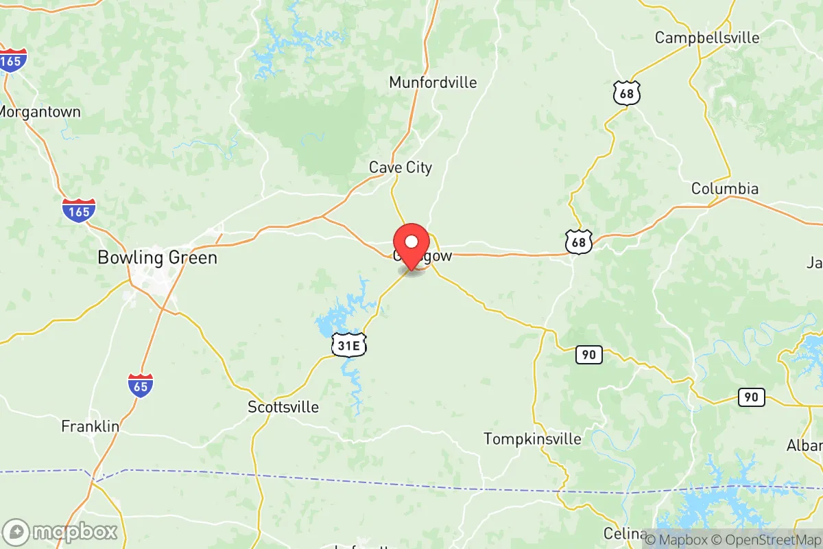
Barren County, Kentucky, offers a compelling strategic profile for relocators prioritizing resilience and self-sufficiency, balancing a central location with a notably low exposure to major man-made and natural threats. Anchored by the city of Glasgow, the county sits at the intersection of I-65 and the Cumberland Parkway, providing efficient access to regional resources without the vulnerabilities of a major metropolitan hub. Its position in the south-central part of the state places it roughly 90 miles from both Louisville and Nashville, far enough to avoid fallout from those urban centers while remaining within a practical distance for supply runs or specialized medical care. The area’s rolling hills, limestone geology, and agricultural base create a foundation for long-term sustainability that is rare in more developed regions of the eastern United States.
Geographic position and natural advantages for long-term security
Barren County’s geography is its primary strategic asset. The county sits atop the Mississippian Plateau, characterized by karst topography with numerous caves, springs, and sinkholes that provide natural water filtration and potential shelter options. The Barren River, which flows through the county and forms Barren River Lake to the east, offers a reliable surface water source that is less prone to contamination than rivers running through industrial corridors. The lake itself, managed by the U.S. Army Corps of Engineers, provides a significant reservoir for drought mitigation and recreational water access. The terrain is gently rolling rather than mountainous, which means the area avoids the wildfire risks common in the West and the floodplain hazards of the Mississippi Delta. Soils in the region are predominantly silt loams over limestone, supporting pasture and row crops like corn, soybeans, and tobacco—a practical advantage for anyone considering small-scale agriculture. The county’s position in USDA Hardiness Zone 6b allows for a long growing season (roughly 180 frost-free days) suitable for staple crops and orchard fruits. Unlike the coastal plains or the Ohio River floodplain, Barren County experiences minimal seismic activity and is not in a designated hurricane or tornado alley, though severe thunderstorms and occasional EF-0 to EF-1 tornadoes do occur. The nearest major fault line, the New Madrid Seismic Zone, is over 200 miles to the west, reducing the risk of catastrophic ground movement.
Risks, exposures, and proximity to fallout-relevant landmarks
For a relocator concerned with man-made threats, Barren County’s profile is favorable but not without considerations. The county has no nuclear power plants, major oil refineries, or chemical manufacturing facilities within its borders. The nearest significant industrial target is the Bowling Green assembly plant (GM) and its associated logistics hubs, located about 30 miles north—a potential secondary target in a conflict scenario, but far enough to avoid direct blast effects. The Fort Knox military installation, which includes the U.S. Army Armor School and the U.S. Bullion Depository, lies roughly 60 miles northwest. While Fort Knox is a high-value strategic asset, its distance and the prevailing wind patterns (generally west to east) mean Barren County is unlikely to receive fallout from a strike on that facility. The Blue Grass Army Depot near Richmond, Kentucky, which stores chemical munitions, is about 100 miles east-northeast—again, outside the immediate danger zone. The county’s primary risk comes from its position along I-65, a major north-south logistics corridor connecting the Great Lakes to the Gulf Coast. In a national emergency, this highway could become a chokepoint for military and refugee movements, potentially straining local resources. However, the county’s secondary road network—including US-68, KY-90, and numerous state highways—offers alternative routes that bypass Glasgow’s downtown. The Glasgow Municipal Airport is a general aviation facility with a single 5,000-foot runway, capable of handling small cargo aircraft but not a target for strategic strikes. Natural disaster risks are limited to occasional ice storms, flash flooding in low-lying areas near the Barren River, and the rare tornado; the county’s emergency management agency maintains a robust siren system and has mutual aid agreements with surrounding counties.
Practical resilience for a relocator: food, water, energy, and defensibility
Barren County offers strong practical resilience for individuals and families looking to establish a self-sufficient homestead. The agricultural sector is well-developed, with over 1,200 farms covering roughly 60% of the county’s land area. The local extension office (University of Kentucky Cooperative Extension) provides resources on soil testing, crop rotation, and livestock management, and the Glasgow Farmers Market operates seasonally for those not yet producing their own food. Water availability is a standout advantage: the karst aquifer system provides abundant groundwater, and many rural properties have access to springs or shallow wells. The Glasgow Water Company and Barren River Water District serve municipal areas, but a private well with a hand pump or solar-powered pump is a realistic option for most parcels outside city limits. For off-grid energy, the region’s average solar insolation is about 4.5 peak sun hours per day—adequate for a modest photovoltaic system, though tree cover in the eastern part of the county may require clearing. Wood heating is practical given the county’s 50% forest cover (predominantly oak-hickory), and the local Amish and Mennonite communities (concentrated around the Hiseville and Eighty Eight areas) provide a network of skilled craftsmen for off-grid construction and repair. Defensibility is moderate: the terrain offers good visibility from elevated ridgelines, and the many sinkholes and cave entrances provide natural concealment for storage or shelter. However, the county’s relatively dense rural population (about 44,000 residents, with roughly 15,000 in Glasgow) means that a complete retreat from society is difficult; the best approach is to integrate into a small, like-minded community. The county has a strong tradition of volunteer fire departments and a sheriff’s office with a reputation for responsiveness, which supports community safety without reliance on distant state resources.
Overall, Barren County presents a balanced strategic picture for the resilience-minded relocator. It avoids the high-risk profiles of coastal, industrial, or border regions while offering genuine advantages in water availability, agricultural potential, and community infrastructure. The presence of the Barren River Lake and the karst aquifer system provides a buffer against drought that many inland counties lack. The main trade-offs are the moderate population density and the proximity to I-65, which could become a liability in a large-scale evacuation scenario. For a family or individual willing to invest in a well, solar panels, and a garden, the county offers a realistic path to long-term self-sufficiency without the extreme isolation of more remote locations. The local culture, shaped by a mix of agricultural traditions and a growing interest in homesteading, means that newcomers with practical skills are generally welcomed. In short, Barren County is a solid B+ choice for strategic relocation—not the most remote, but one of the most practical for building a resilient life in the American heartland.

* Values derived from national, state, county, city and local statistics and may differ in a specific area. Last updated: 2026-06-17T10:17:31.000Z
Narrative content on this page is AI-generated and may contain mistakes. Verify any details that matter before acting on them.
ReloMaps may earn a commission from affiliate links at no extra cost to you.

