
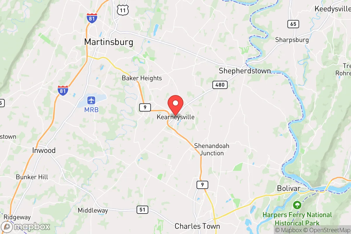
Strategic Assessment of Kearneysville, WV
Meaningful friction. Expect exposure to either population pressure, blast zones, or natural disaster risk. Consider buying a retreat property.
What does the Strategic Assessment tell us?
Our Strategic Assessment grades tactical survivability of an area. Major population centers, military targets, fallout zones, natural disasters, and border exposure all drive risk — lower exposure means a more defensible position in a crisis.
This is heavily inspired by Joel Skousen's Strategic Relocation book. Highly recommended you checkout the book ($)What does this tell us?
Our Strategic Assessment grades tactical survivability of an area. Major population centers, military targets, fallout zones, natural disasters, and border exposure all drive risk — lower exposure means a more defensible position in a crisis.
This is heavily inspired by Joel Skousen's Strategic Relocation book. Highly recommended you checkout the book ($)Strategic Pillars

Key Distances
Regional Safe Places
Below is our recommended "safe zones" in West Virginia and the surrounding area based on our strategic heuristics. For most people, it's unrealistic to live in a “safe zone” full-time due to work, family or other personal reasons. They tend to be more rural. However, many of these areas are perfect for second homes and retreat properties that double as a vacation home or even a short-term rental.




Important Note: For informational purposes only. This does not mean nothing bad ever happens in the green zones. Please use common sense. This is based on public data and modeled with AI. We tried to take a conservative approach but mistakes happen. We update this regularly as new information becomes available.
Solar Generator Recommendations
Backup power matters more here than in safer locations. We've picked three solar generators across budgets and capacity tiers — start with the budget unit if you only need a few essentials, or step up if you want to run a fridge and HVAC for days at a time.

Jackery Portable Power Station Explorer 300
Budget OptionPower on the Go: Weighing only 11 lbs, it's convenient to set up and store with book-sized foldable solar panels

BLUETTI Portable Power Station AC180
Designed for both indoor and outdoor scenarios, AC180 is highly capable as it has a robost capacity and continuous output power.

EF ECOFLOW DELTA Pro Ultra Power Station
Upgraded PickEcoFlow DELTA Pro Ultra is a whole-home energy system designed to grow with your family. Integrated with the Smart Home Panel 2, it scales to meet your evolving energy needs — keeping your home powered, intelligent, and secure through every stage of life.
We earn a commission, at no additional cost to you.
Strategic Assessment Analysis
Kearneysville, West Virginia, occupies a strategic position in the eastern Panhandle that offers a compelling balance of rural self-sufficiency potential and access to critical infrastructure, making it a noteworthy option for relocation-minded individuals and families prioritizing resilience. Situated roughly 70 miles from Washington, D.C., and 20 miles from the Baltimore-Washington metropolitan fringe, the area provides a meaningful buffer from the immediate blast and fallout zones of a major urban target while remaining close enough to leverage regional supply chains and medical networks. The town’s location within Jefferson County, nestled between the Blue Ridge Mountains to the east and the Shenandoah River to the west, creates a natural defensive pocket that has historically insulated it from the densest population corridors, offering a realistic starting point for a prepared household.
Geographic position and natural defensive advantages
Kearneysville’s topography and regional geography provide several inherent resilience benefits. The area sits in the Shenandoah Valley, a broad, fertile corridor flanked by the Blue Ridge Mountains to the southeast and the Allegheny Front to the northwest. This valley orientation offers natural wind and weather shielding from the most severe storm tracks that often sweep across the Midwest, while the surrounding ridges create a visual and physical barrier that reduces the area’s profile as a primary target. The proximity to the Potomac River and its tributaries—particularly the Shenandoah River, which runs just west of town—provides a reliable surface water source, though it also introduces floodplain considerations in low-lying sections near the river. The local elevation averages around 500 to 600 feet, which places Kearneysville above the worst of valley fog and flood risks while remaining low enough to avoid the extreme winter conditions of higher Appalachian elevations. The area’s position within the Eastern Panhandle’s “safety corridor”—a zone roughly 60 to 90 miles from D.C. that has historically seen less development pressure than closer suburbs—means that the surrounding land remains predominantly agricultural, with large tracts of open farmland and forest that could support decentralized food production and provide natural cover in a crisis scenario.
Risks, exposures, and proximity to fallout-relevant landmarks
No strategic assessment is complete without a clear-eyed look at the risks. Kearneysville’s primary vulnerability stems from its proximity to the Washington, D.C., metropolitan area, which is a high-priority target for any nuclear or electromagnetic pulse (EMP) scenario. At roughly 70 miles from the Capitol, the town sits outside the likely severe blast radius of a ground burst (typically 5–10 miles for a large-yield weapon) but well within the fallout plume zone, depending on wind direction. Prevailing winds in the region are from the west and northwest, which means that fallout from a D.C. strike would likely drift eastward, away from Kearneysville, but a shift to southerly or easterly winds could bring contamination into the Shenandoah Valley. The area is also within 30 miles of the Jefferson County Airport and the Martinsburg Air National Guard Base (Shepherd Field), which are secondary military targets that could draw conventional or tactical nuclear strikes in a broader conflict. Additionally, the nearby Doubs Mill Dam and several smaller hydroelectric facilities along the Potomac represent potential infrastructure failure points that could disrupt local power and water supplies. On the natural disaster front, the region faces moderate risks from flooding along the Shenandoah and Potomac rivers, with the 1996 and 2018 floods causing significant damage to low-lying properties. Tornado risk is low but not zero—Jefferson County averages one or two weak tornadoes per decade—and the area is seismically quiet, with no major fault lines nearby. The primary man-made risk is the I-81 corridor, which runs 10 miles west of Kearneysville and carries heavy truck traffic of hazardous materials, including propane, ammonia, and gasoline, creating a credible spill or explosion hazard along that route.
Practical resilience for a relocator: food, water, energy, and defensibility
For a household serious about self-sufficiency, Kearneysville offers a strong baseline that requires deliberate investment to reach full resilience. Water availability is the area’s strongest asset: the Shenandoah River and its tributaries provide year-round surface water, and the underlying karst geology (limestone and dolomite) supports shallow wells that typically yield 10 to 30 gallons per minute at depths of 100 to 300 feet. Most rural properties in the county rely on private wells, and the water table is generally reliable, though drought years can lower yields in shallow aquifers. The county’s public water system, which serves the town core, draws from the Potomac River and is treated at the Jefferson County Public Service District plant, but this system is vulnerable to power loss and contamination events. Food production potential is excellent: Jefferson County is one of West Virginia’s top agricultural producers, with over 600 farms covering 80,000 acres, specializing in apples, peaches, corn, soybeans, and livestock. The growing season runs roughly April through October, with an average of 170 frost-free days, and the soil in the valley is deep, well-drained loam that supports intensive gardening. Local farmers’ markets and CSAs are abundant, and the Kearneysville Farmers Market operates seasonally, providing a direct link to local food networks. Energy resilience is a mixed picture: the area is served by Potomac Edison (FirstEnergy), which relies on a mix of coal, natural gas, and nuclear power from the nearby Calvert Cliffs Nuclear Plant (100 miles east). Grid reliability is average for rural Appalachia, with outages typically lasting 2–6 hours during storms, but the region is not prone to the extended blackouts seen in coastal or mountainous areas. Solar potential is good—the area receives about 4.5 peak sun hours per day—and many rural homes already have backup generators or wood stoves. Defensibility is moderate: the open valley terrain offers limited natural chokepoints, but the surrounding ridges and forested areas provide cover for a prepared household. The town’s low population density (roughly 150 people per square mile in the rural parts) reduces competition for resources in a crisis, and the strong local hunting culture means many residents already possess firearms and outdoor skills. The Jefferson County Sheriff’s Office has a response time of 10–20 minutes in rural areas, so self-defense capability is a practical consideration rather than a paranoid one.
The overall strategic picture for Kearneysville is one of moderate-to-high baseline resilience with manageable trade-offs. Its greatest strength is its position in a fertile, water-rich valley that is far enough from major targets to avoid immediate destruction but close enough to benefit from regional infrastructure. The primary weaknesses are the proximity to secondary military targets and the I-81 hazardous materials corridor, both of which are credible but not catastrophic risks for a prepared household. For a relocator willing to invest in a private well, solar panels, and a well-stocked pantry, Kearneysville offers a realistic foundation for long-term self-sufficiency without the extreme isolation of deeper Appalachia. The area’s conservative-leaning culture, strong agricultural base, and active outdoor community align well with a preparedness mindset, and the local government’s relatively low regulatory burden (no county-wide building codes in rural zones) allows for independent infrastructure improvements. In short, Kearneysville is not a bunker—but it is a solid, defensible piece of ground for a family that wants to be ready for whatever comes next.

* Values derived from national, state, county, city and local statistics and may differ in a specific area. Last updated: 2026-07-28T20:15:12.000Z
Narrative content on this page is AI-generated and may contain mistakes. Verify any details that matter before acting on them.
ReloMaps may earn a commission from affiliate links at no extra cost to you.

