Photo: Wikipedia
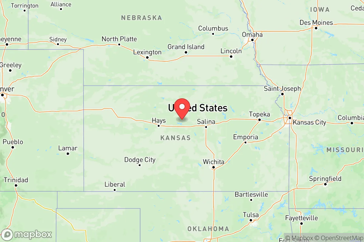
Strategic Assessment of Kansas
Strong survivability profile. Good buffer from population centers, with manageable environmental and tactical risks.
What does the Strategic Assessment tell us?
Our Strategic Assessment grades tactical survivability of an area. Major population centers, military targets, fallout zones, natural disasters, and border exposure all drive risk — lower exposure means a more defensible position in a crisis.
This is heavily inspired by Joel Skousen's Strategic Relocation book. Highly recommended you checkout the book ($)What does this tell us?
Our Strategic Assessment grades tactical survivability of an area. Major population centers, military targets, fallout zones, natural disasters, and border exposure all drive risk — lower exposure means a more defensible position in a crisis.
This is heavily inspired by Joel Skousen's Strategic Relocation book. Highly recommended you checkout the book ($)Regional Safe Places
Below is our recommended "safe zones" in Kansas and the surrounding area based on our strategic heuristics. For most people, it's unrealistic to live in a “safe zone” full-time due to work, family or other personal reasons. They tend to be more rural. However, many of these areas are perfect for second homes and retreat properties that double as a vacation home or even a short-term rental.
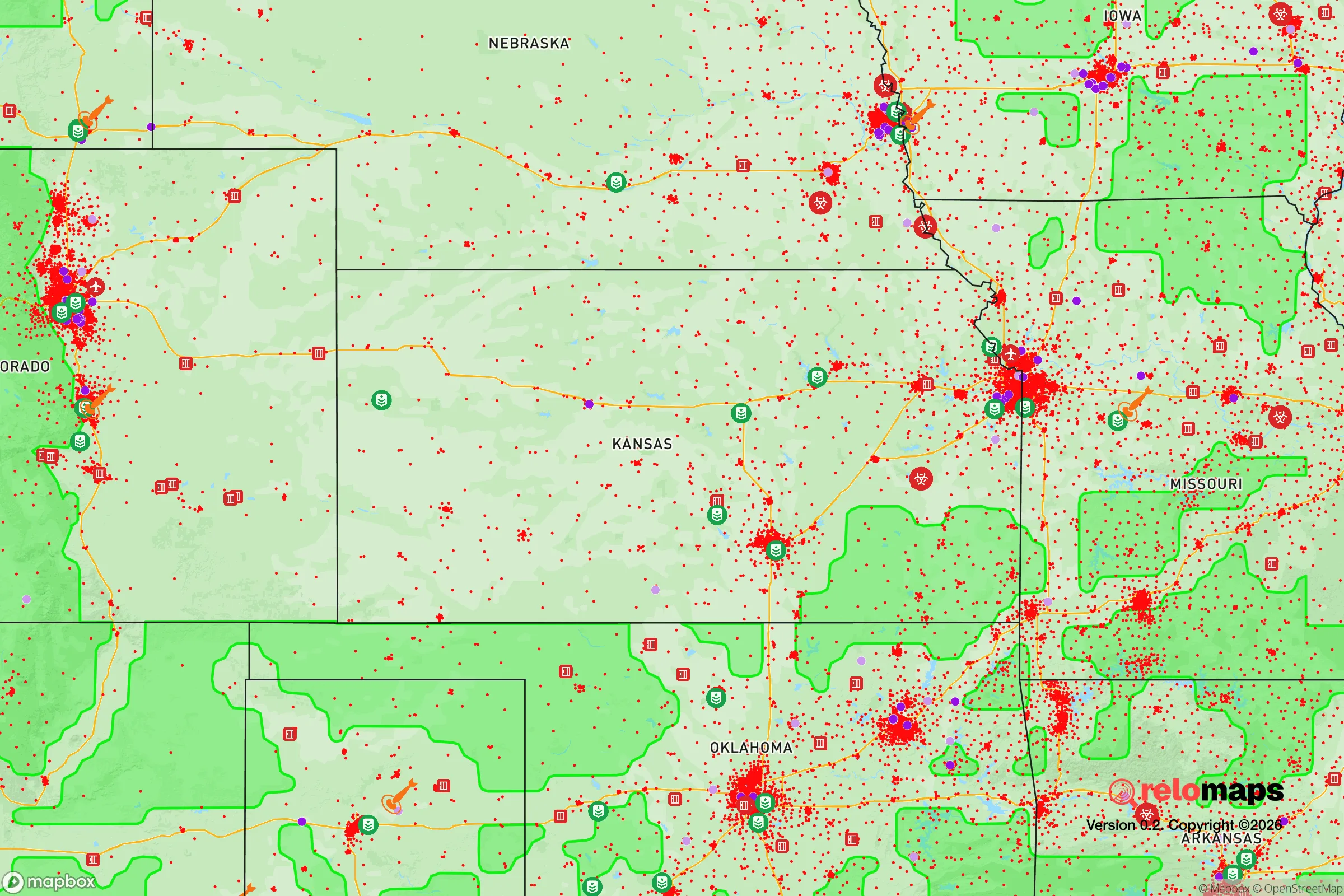
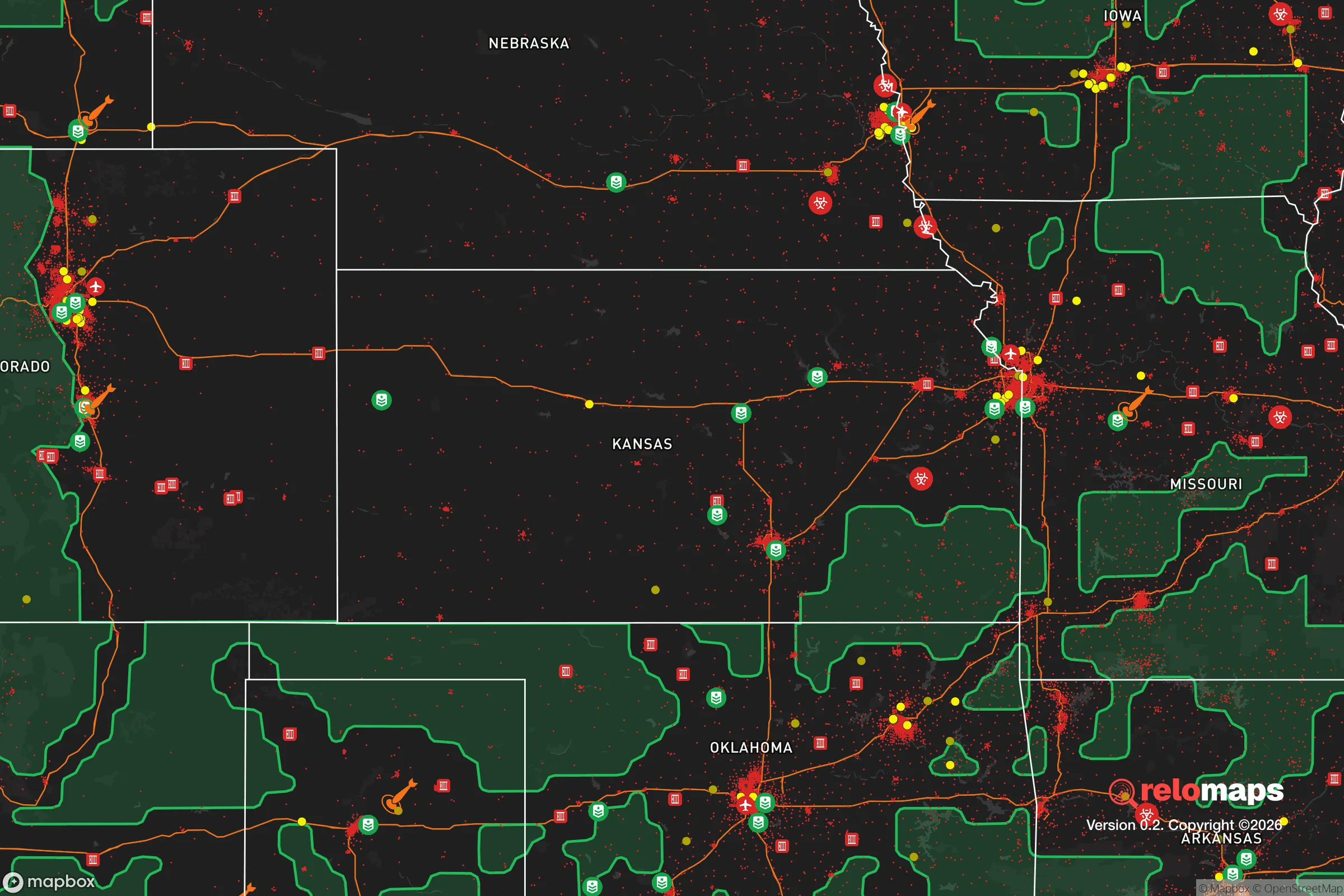
Important Note: For informational purposes only. This does not mean nothing bad ever happens in the green zones. Please use common sense. This is based on public data and modeled with AI. We tried to take a conservative approach but mistakes happen. We update this regularly as new information becomes available.
Solar Generator Recommendations
Backup power matters more here than in safer locations. We've picked three solar generators across budgets and capacity tiers — start with the budget unit if you only need a few essentials, or step up if you want to run a fridge and HVAC for days at a time.

Jackery Portable Power Station Explorer 300
Budget OptionPower on the Go: Weighing only 11 lbs, it's convenient to set up and store with book-sized foldable solar panels

BLUETTI Portable Power Station AC180
Designed for both indoor and outdoor scenarios, AC180 is highly capable as it has a robost capacity and continuous output power.

EF ECOFLOW DELTA Pro Ultra Power Station
Upgraded PickEcoFlow DELTA Pro Ultra is a whole-home energy system designed to grow with your family. Integrated with the Smart Home Panel 2, it scales to meet your evolving energy needs — keeping your home powered, intelligent, and secure through every stage of life.
We earn a commission, at no additional cost to you.
Strategic Assessment Analysis
Kansas offers a strategic relocation option for those prioritizing resilience, self-sufficiency, and distance from the most volatile coastal and urban corridors. Its central geography, low population density, and agricultural backbone provide a buffer against the cascading failures that could follow a major national crisis, whether from civil unrest, economic collapse, or a mass casualty event. The state’s real advantage lies not in hiding, but in being positioned to ride out disruptions while maintaining access to essential resources—food, water, and energy—without relying on fragile supply chains that could snap in a crisis.
Geographic position and natural advantages for long-term stability
Kansas sits in the heart of the continental United States, far from the strategic vulnerabilities of coastal ports, major military command centers, and densely packed population hubs like New York, Los Angeles, or Chicago. This central location means that a relocator in Kansas is less likely to be caught in the immediate fallout of a nuclear strike on a high-value target—such as the refineries near Houston or the naval bases in Norfolk. The state’s terrain is predominantly flat to gently rolling plains, which offers both advantages and trade-offs. On the plus side, the open landscape provides excellent visibility for security and long-range observation, a factor that matters if civil order degrades. The Ogallala Aquifer, which underlies much of western Kansas, is a critical water resource; towns like Garden City and Dodge City sit atop this massive underground reservoir, offering a reliable water source that is less vulnerable to surface contamination than rivers or reservoirs near industrial zones. The state’s agricultural output—wheat, corn, sorghum, and cattle—means that food production is local and abundant, reducing dependence on trucked-in supplies that could be disrupted by fuel shortages or road blockages.
Risks, exposures, and proximity to fallout-relevant landmarks
No location is without risk, and Kansas has its own set of exposures that a strategic relocator must weigh. The state is home to McConnell Air Force Base near Wichita, which houses tanker aircraft and is a potential target in a conflict scenario. Wichita itself, as the largest city in Kansas with a population over 390,000, is a concentration of people and infrastructure—including aircraft manufacturing plants like Spirit AeroSystems—that could become a focal point for unrest or supply chain disruption. Similarly, the Kansas City metropolitan area straddles the state line with Missouri and includes major rail yards, interstate highways, and a significant population center; being within 50 miles of this area increases exposure to fallout from a potential strike on nearby Whiteman Air Force Base in Missouri or the BNSF rail hub in Kansas City. The state’s flat terrain, while offering visibility, also means that a nuclear detonation in a neighboring state—like the missile fields of Nebraska or the refineries of Oklahoma—could carry fallout across the border, especially with prevailing westerly winds. Tornadoes are a recurring natural hazard, particularly in the central and eastern parts of the state, but these are predictable seasonal events that can be mitigated with proper shelter, unlike the cascading chaos of a societal collapse. For a relocator, the key is to avoid the I-35 corridor from Wichita to Kansas City, which concentrates population and infrastructure, and instead look to smaller towns in the western and central regions, such as Hays or Colby, where population density drops below 10 people per square mile.
Practical resilience for a relocator: food, water, energy, and defensibility
For a family or individual serious about preparedness, Kansas offers a practical foundation. Water is the first concern: the Ogallala Aquifer provides a deep, renewable source, but it is being depleted for irrigation, so a relocator should verify well depth and local water rights before purchasing land. Towns like Liberal and Ulysses in the southwest have access to this aquifer, but also face higher evaporation rates and summer heat. Rainwater catchment is viable across the state, with average annual precipitation ranging from 15 inches in the west to 40 inches in the east; a 1,000-square-foot roof can collect over 20,000 gallons per year in eastern Kansas. Food security is strong: the state produces more than 300 million bushels of wheat annually, and local farmers’ markets are common even in small towns. A relocator with a few acres can grow vegetables, raise chickens, or even keep a milk cow, with ample grazing land available. Energy is a mixed picture: natural gas is plentiful, and many rural homes use propane or heating oil, but grid reliability is a concern during severe storms. Solar panels are a practical investment, especially in western Kansas where sunlight is abundant, and wind turbines are common on larger properties. Defensibility is where Kansas falls short compared to mountainous terrain; the open plains offer little natural cover, so a relocator must rely on distance from neighbors, good fencing, and a well-stocked armory. The state’s gun laws are favorable for preparedness—constitutional carry is legal, and there are no state-level magazine bans or assault weapon restrictions—which matters if civil order breaks down. Community resilience varies: small towns like Lindsborg or Abilene have tight-knit populations that may band together, while more isolated areas require self-reliance.
The overall strategic picture for Kansas is one of trade-offs. It is not a fortress—there are no mountains to hide in, no coastline to defend, and the flat terrain makes it vulnerable to fallout from distant strikes. But for a relocator who values food security, water access, and distance from the most likely targets of a national crisis, Kansas offers a solid baseline. The key is to choose a location west of the I-135 corridor, away from Wichita and Kansas City, and to invest in water storage, solar power, and a community of like-minded neighbors. The state’s conservative culture, low crime rates in rural areas, and strong agricultural economy make it a viable option for those who want to be prepared without living off-grid in a remote wilderness. In a world where the next crisis could come from any direction, Kansas provides a central, resource-rich position from which to wait it out.
Top 10 Cities by Strategic Assessment in Kansas


* Values derived from national, state, county, city and local statistics and may differ in a specific area. Last updated: 2026-04-18T22:32:12.000Z
Narrative content on this page is AI-generated and may contain mistakes. Verify any details that matter before acting on them.
ReloMaps may earn a commission from affiliate links at no extra cost to you.