
Photo: Wikipedia
Strategic Assessment of Montgomery County
Workable tactical position. Some exposure to population density or targets, but generally defensible in a crisis.
What does the Strategic Assessment tell us?
Our Strategic Assessment grades tactical survivability of an area. Major population centers, military targets, fallout zones, natural disasters, and border exposure all drive risk — lower exposure means a more defensible position in a crisis.
This is heavily inspired by Joel Skousen's Strategic Relocation book. Highly recommended you checkout the book ($)What does this tell us?
Our Strategic Assessment grades tactical survivability of an area. Major population centers, military targets, fallout zones, natural disasters, and border exposure all drive risk — lower exposure means a more defensible position in a crisis.
This is heavily inspired by Joel Skousen's Strategic Relocation book. Highly recommended you checkout the book ($)Strategic Pillars

Key Distances
Strategic Assessment Analysis
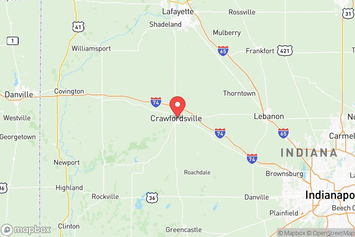
Montgomery County, Indiana, offers a compelling strategic position for relocators prioritizing disaster readiness and self-sufficiency, balancing rural resilience with access to critical infrastructure. Its location roughly 40 miles northwest of Indianapolis places it outside the immediate blast and fallout zones of a major metropolitan target, while still providing reasonable proximity to supply chains and medical care. The county seat, Crawfordsville, anchors a region of roughly 38,000 residents, with a landscape of farmland, woodlands, and the Sugar Creek watershed that supports a quieter, more defensible lifestyle. For those evaluating long-term security, Montgomery County presents a moderate-risk, high-resilience profile that rewards preparation without demanding extreme isolation.
Geographic position and natural advantages for disaster preparedness
Montgomery County sits in west-central Indiana, a region defined by glacial till plains and rolling hills that offer natural drainage and limited flood risk compared to areas near the Wabash River or Ohio River floodplains. The county's highest point, near the town of New Market, reaches about 850 feet above sea level, providing modest elevation advantages for line-of-sight communications and reduced vulnerability to storm surge or tsunami—irrelevant here but a sign of overall topographic stability. The Sugar Creek, a tributary of the Wabash, runs through the southern part of the county, offering a reliable surface water source for those who plan for off-grid water collection or well drilling. The area's clay-loam soils support productive agriculture, with corn, soybeans, and hay as staple crops, meaning local food production is feasible for smallholders. The county's position away from major fault lines, hurricane zones, and wildfire corridors (Indiana averages fewer than 200 wildfire acres annually) means natural disaster risk is largely limited to severe thunderstorms, tornadoes, and occasional winter ice storms—events that are manageable with basic preparation like a generator and storm shelter.
Risks, exposures, and proximity to fallout-relevant landmarks
The primary strategic risk for Montgomery County is its proximity to Indianapolis, a metropolitan area of over 2 million people that would be a high-priority target in a major conflict. The 40-mile distance places Crawfordsville outside the most severe blast and thermal effects of a ground burst on the city center, but fallout patterns depend heavily on wind direction. In a worst-case scenario with prevailing westerlies, radioactive debris from an Indianapolis strike could drift over the county within hours, making indoor shelter and potassium iodide stockpiles prudent. Additionally, the county lies about 60 miles southwest of the Grissom Air Reserve Base in Miami County, a potential secondary target, and roughly 90 miles northwest of the Newport Chemical Depot in Vermillion County, which still stores some chemical agents. On the positive side, Montgomery County has no major refineries, nuclear power plants (the nearest is the Cook Nuclear Plant in Bridgman, Michigan, over 100 miles away), or high-value industrial complexes that would make it a direct target. The county's own infrastructure—including the Crawfordsville Municipal Airport and a CSX rail line running through town—is modest enough to avoid strategic significance but useful for resupply. The presence of the Wabash River to the west and Interstate 74 to the south provides evacuation routes, though these same corridors could become choke points during a mass exodus from Indianapolis.
Practical resilience for a relocator: food, water, energy, and defensibility
For a relocator focused on self-sufficiency, Montgomery County offers several practical advantages. The agricultural base means local food sources are accessible: the county has over 1,200 farms, with Crawfordsville hosting a weekly farmers market from May to October, and nearby towns like Ladoga and New Ross have small-scale producers of meat, eggs, and produce. Water availability is strong—the Sugar Creek aquifer provides reliable groundwater, and most rural properties can support a drilled well at depths of 50 to 150 feet, with yields averaging 10 to 20 gallons per minute. The county's electric grid is served by Duke Energy Indiana, with a mix of coal, natural gas, and renewables, but rural areas experience fewer outages than urban centers; still, a backup generator or solar array with battery storage is wise given occasional ice storms that can knock out power for days. Defensibility is moderate: the county's open farmland offers long sightlines but limited natural cover, while the wooded areas along Sugar Creek and the Shades State Park provide better concealment for a retreat property. The county's population density of about 70 people per square mile means neighbors are close enough for mutual aid but far enough to avoid crowding. The Crawfordsville Police Department and Montgomery County Sheriff's Office maintain a visible presence, with response times in rural areas typically under 15 minutes, though during a widespread emergency, self-reliance becomes critical. For those seeking a community of like-minded preparers, the county has a small but active network of homesteaders and preppers, with local gun shops and outdoor retailers supporting a culture of self-defense and hunting.
The overall strategic picture for Montgomery County is one of balanced risk and reward. It avoids the extreme vulnerabilities of coastal or metropolitan areas while retaining access to the resources of the Indianapolis region. The county's agricultural capacity, water availability, and moderate population density make it a viable location for a family or individual serious about disaster readiness, provided they invest in fallout sheltering, backup power, and food storage. The proximity to Indianapolis is a double-edged sword—it offers supply chains and medical access in normal times but introduces fallout risk in a crisis. For a relocator who values a quiet, rural lifestyle with a realistic preparedness plan, Montgomery County represents a solid middle-ground option in Indiana's strategic landscape, neither a fortress nor a target, but a place where thoughtful preparation can yield genuine security.

* Values derived from national, state, county, city and local statistics and may differ in a specific area. Last updated: 2026-08-14T16:38:23.000Z
Narrative content on this page is AI-generated and may contain mistakes. Verify any details that matter before acting on them.
ReloMaps may earn a commission from affiliate links at no extra cost to you.

