Photo: Wikipedia
Strategic Assessment of Valley County
Strong survivability profile. Good buffer from population centers, with manageable environmental and tactical risks.
What does the Strategic Assessment tell us?
Our Strategic Assessment grades tactical survivability of an area. Major population centers, military targets, fallout zones, natural disasters, and border exposure all drive risk — lower exposure means a more defensible position in a crisis.
This is heavily inspired by Joel Skousen's Strategic Relocation book. Highly recommended you checkout the book ($)What does this tell us?
Our Strategic Assessment grades tactical survivability of an area. Major population centers, military targets, fallout zones, natural disasters, and border exposure all drive risk — lower exposure means a more defensible position in a crisis.
This is heavily inspired by Joel Skousen's Strategic Relocation book. Highly recommended you checkout the book ($)Strategic Pillars

Key Distances
Strategic Assessment Analysis
Valley County, Idaho, offers a strategic relocation option for those prioritizing resilience, self-sufficiency, and distance from major metropolitan vulnerabilities. Its position in west-central Idaho, anchored by the communities of McCall, Cascade, Donnelly, and Yellow Pine, provides a blend of remote mountain terrain, abundant natural resources, and a small but established population base that has weathered economic shifts and natural events alike. For a conservative-leaning reader assessing long-term preparedness, the county presents a compelling mix of geographic insulation and practical livability, though it is not without its own distinct risk profile.
Geographic position and natural advantages for long-term security
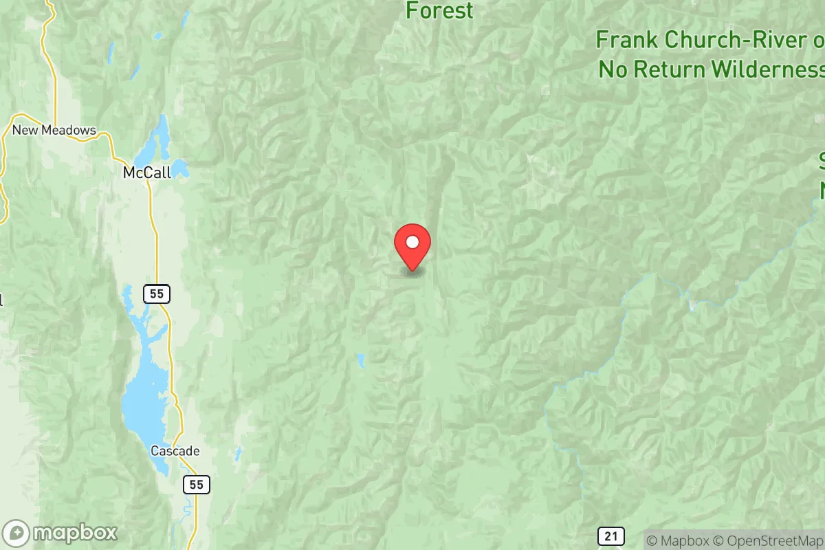
Valley County's primary strategic asset is its location within the Salmon River Mountains and the Payette National Forest, placing it far from the dense population corridors of the Intermountain West. The county seat, Cascade, sits at roughly 4,800 feet elevation, while McCall, the largest town, rests on the southern shore of Payette Lake at about 5,000 feet. This elevation provides a natural buffer against many lowland hazards and ensures a cooler climate that reduces wildfire risk compared to lower-elevation parts of the region. The surrounding national forest land—over 2.3 million acres of Payette National Forest alone—creates a vast, sparsely populated buffer zone. The nearest major population center, Boise, is roughly 100 miles south via Highway 55, a distance that places Valley County well outside any plausible suburban sprawl or immediate crisis zone. The county's terrain, characterized by steep canyons, high plateaus, and dense conifer forests, offers numerous natural choke points and defensible positions for those with property in more remote areas like Yellow Pine or the Secesh River drainage. Water resources are abundant: Payette Lake, Cascade Reservoir, and the North Fork of the Payette River provide surface water that is less contested than in drier parts of the West. For a relocator thinking in decades rather than years, the county's low population density—roughly 11 people per square mile—means less competition for resources during disruptions.
Risks, exposures, and proximity to fallout-relevant landmarks
No strategic assessment is complete without an honest accounting of vulnerabilities. Valley County's primary natural risk is wildfire, a reality of the Northern Rockies ecosystem. The 2021 Boundary Fire and the 2024 Wolf Creek Fire both burned within the county, demonstrating that large fires can threaten communities, particularly in the wildland-urban interface around McCall and Cascade. However, the county's fire-adapted forests and active Forest Service management reduce the likelihood of catastrophic, city-level conflagrations seen in California. Seismic risk is moderate; the county lies near the northern edge of the Basin and Range province, but no major fault lines run directly through it. The more significant risk for the resilience-minded relocator is man-made: Valley County is approximately 200 miles from the Idaho National Laboratory (INL) near Idaho Falls, a major nuclear research and waste storage facility. While this distance provides substantial safety from any direct incident, prevailing westerly winds mean that a worst-case scenario at INL could theoretically affect eastern portions of the county. More practically, the county is roughly 250 miles from the Hanford Site in Washington, a decommissioned nuclear production facility with ongoing contamination issues. Neither poses an immediate threat, but they are relevant for a reader conducting a thorough risk assessment. There are no major military bases, refineries, or ports within 150 miles, which is a net positive for those seeking to avoid collateral risks associated with strategic targets. The closest military installation of note is Mountain Home Air Force Base, about 130 miles south, well outside any plausible ground-zero radius.
Practical resilience for a relocator: food, water, energy, and defensibility
For a family or individual serious about self-sufficiency, Valley County offers strong fundamentals. Water is the county's clearest advantage: Payette Lake and Cascade Reservoir are large, reliable surface water sources, and groundwater is accessible via wells in most valley-bottom areas. The growing season is short—typically 90 to 110 days—limiting large-scale agriculture, but small gardens, greenhouses, and cold-hardy crops like potatoes, carrots, and kale are viable. The county's cattle ranching heritage, particularly in the Long Valley area between Cascade and McCall, means local meat production is established, and relationships with ranchers can be built over time. For energy, the county benefits from Idaho Power's hydroelectric grid, which is more stable than many regional grids, but off-grid solar is practical given the area's 200+ sunny days per year. Wood heating is common and culturally accepted, with ample fuel from national forest thinning projects. Defensibility is high: the county's road network is limited, with Highway 55 as the primary north-south artery, and many secondary roads are seasonal or unpaved. Remote properties in areas like the Stibnite Mining District or the East Fork of the South Fork of the Salmon River offer near-total isolation. The local population skews older and more conservative, with a strong tradition of hunting, fishing, and firearms ownership—factors that contribute to a community that is likely to organize effectively during emergencies. McCall's hospital, while small, is well-regarded for a rural facility, and the county's emergency services are coordinated through Valley County Dispatch. For a relocator, the practical takeaway is that the county supports a self-reliant lifestyle without requiring extreme off-grid measures; most necessities can be produced or procured locally with reasonable effort.
The overall strategic picture for Valley County is one of balanced resilience. It avoids the extreme isolation of Alaska or the high desert of Nevada while offering genuine distance from the vulnerabilities of the Front Range or the Pacific Coast. The county's combination of abundant water, low population density, defensible terrain, and a culturally aligned population makes it a strong candidate for a conservative-leaning relocator who values preparedness without wanting to live in a bunker. The trade-offs are real: a short growing season, wildfire risk, and a limited local economy that requires either remote work, retirement savings, or a willingness to engage in seasonal industries like tourism or timber. For the reader who can accept those constraints, Valley County represents one of the more strategically sound relocation options in the lower 48 states for long-term resilience and self-sufficiency.

* Values derived from national, state, county, city and local statistics and may differ in a specific area. Last updated: 2026-06-21T22:38:26.000Z
Narrative content on this page is AI-generated and may contain mistakes. Verify any details that matter before acting on them.
ReloMaps may earn a commission from affiliate links at no extra cost to you.

