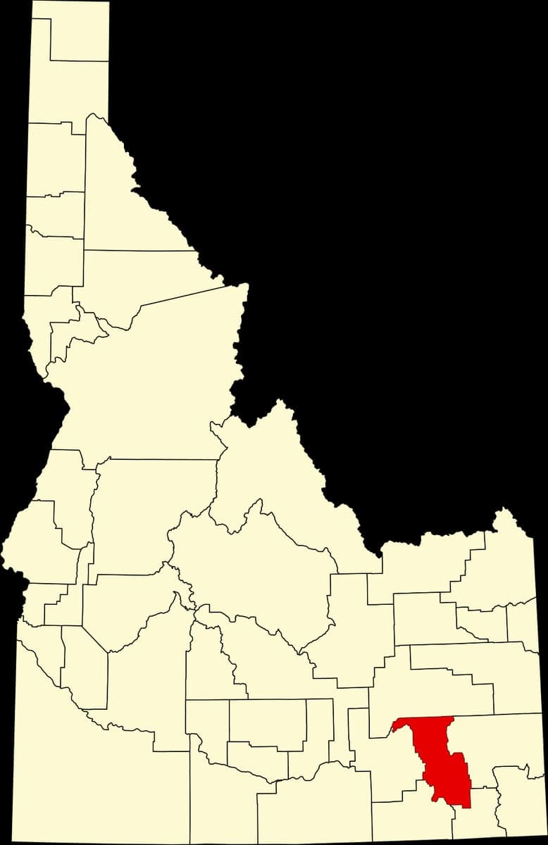
Photo: Wikipedia
Strategic Assessment of Bannock County
Strong survivability profile. Good buffer from population centers, with manageable environmental and tactical risks.
What does the Strategic Assessment tell us?
Our Strategic Assessment grades tactical survivability of an area. Major population centers, military targets, fallout zones, natural disasters, and border exposure all drive risk — lower exposure means a more defensible position in a crisis.
This is heavily inspired by Joel Skousen's Strategic Relocation book. Highly recommended you checkout the book ($)What does this tell us?
Our Strategic Assessment grades tactical survivability of an area. Major population centers, military targets, fallout zones, natural disasters, and border exposure all drive risk — lower exposure means a more defensible position in a crisis.
This is heavily inspired by Joel Skousen's Strategic Relocation book. Highly recommended you checkout the book ($)Strategic Pillars

Key Distances
Strategic Assessment Analysis
Bannock County, anchored by Pocatello and Chubbuck, offers a strategic relocation option for those prioritizing resilience and self-sufficiency, combining a robust local economy with a geographic position that buffers against many of the risks found in larger metropolitan corridors. Its location along the I-15 corridor provides access to regional resources while maintaining a comfortable distance from the highest-density population centers and their associated vulnerabilities. For a single individual or family weighing disaster readiness, the county presents a balanced profile of natural advantages and manageable exposures, making it a credible choice for a long-term, prepared lifestyle.
Geographic position and natural advantages for long-term security
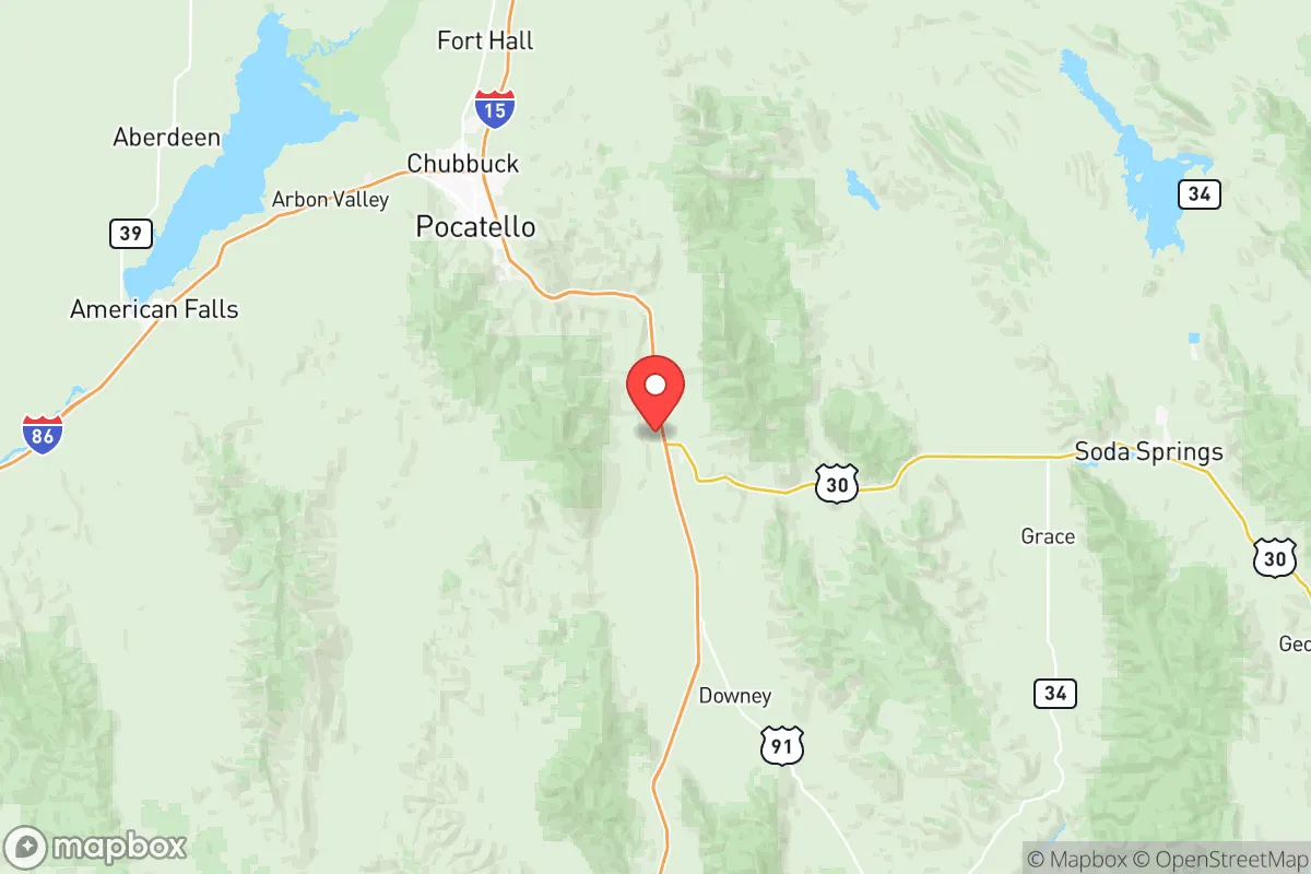
Bannock County sits in the southeastern corner of Idaho, a region defined by the Portneuf Valley and the surrounding Bannock Range and Pocatello Mountains. This topography provides a natural layer of defensibility: the valley is flanked by elevated terrain, offering both vantage points and chokepoints that would complicate any large-scale movement into the area. The county’s elevation—Pocatello sits at roughly 4,460 feet—means a cooler, drier climate than much of the Intermountain West, reducing risks from extreme heat, wildfire spread, and many vector-borne diseases. The proximity to the Snake River Plain to the west and the Caribou-Targhee National Forest to the east gives residents access to vast public lands for hunting, foraging, and potential relocation if needed. Critically, the county is over 150 miles from the Wasatch Front (Salt Lake City–Ogden), a major population and industrial corridor, and over 200 miles from the Boise metro area. This distance from primary targets—military installations like Hill Air Force Base, refineries along the Wasatch Front, and major transportation hubs—reduces the likelihood of direct fallout exposure from a man-made event. The nearest significant military target is the Idaho National Laboratory (INL) about 90 miles northwest, but prevailing winds and the county’s position in a separate valley system offer some dispersion advantage.
Risks, exposures, and proximity to fallout-relevant landmarks
While Bannock County’s distance from major cities is a strength, it is not immune to risks. The most significant man-made exposure comes from the Idaho National Laboratory (INL) near Idaho Falls, a 890-square-mile complex housing nuclear research reactors and spent fuel storage. A major incident at INL could send a plume across the eastern Snake River Plain, and while Bannock County is downwind only under specific meteorological conditions, it remains within a 100-mile radius of a high-consequence facility. Additionally, the Pocatello Regional Airport and the adjacent Pocatello Rail Yard—a major Union Pacific classification yard—are moderate-value targets, though neither is likely to be a primary strike objective. The county also sits near the Pocatello Valley and the Portneuf River, which can experience flash flooding during heavy spring runoff or rain-on-snow events, particularly in lower-lying neighborhoods near the river corridor. Wildfire risk is moderate but growing; the 2020 Sharp Fire burned over 10,000 acres in the county, and the wildland-urban interface around Inkom and Downey is increasingly exposed. Earthquake risk is low compared to the Wasatch Front, but the Pocatello Valley has experienced small seismic events, and the region is not seismically inert. On balance, the county’s risk profile is dominated by natural hazards (flood, fire) rather than man-made ones, which is favorable for a relocator seeking to avoid the fallout dangers of coastal or major industrial zones.
Practical resilience for a relocator: food, water, energy, and defensibility
For someone serious about self-sufficiency, Bannock County offers a strong baseline. Water availability is a key advantage: the Portneuf River runs through Pocatello and Chubbuck, and the Snake River Plain aquifer underlies much of the county, providing reliable groundwater for wells. Many rural properties outside city limits have existing wells, and the county’s water rights framework is well-established. Food production is viable: the Pocatello Valley and surrounding benchlands support dryland and irrigated farming, with local producers growing hay, alfalfa, and small grains. The Portneuf Valley Farmers Market in Pocatello is a hub for local produce, and the county’s agricultural extension office offers resources for home gardening and small-scale livestock. Energy resilience is solid: the area is served by Idaho Power, which draws from a mix of hydroelectric (Snake River dams), natural gas, and wind. The grid is generally reliable, but the county’s elevation and exposure to winter storms mean occasional outages. Solar potential is good—the region averages over 200 sunny days per year—and off-grid setups are feasible on larger parcels. Defensibility is where the county shines: the valley’s natural funnel shape, with the mountains to the east and the Portneuf Gap to the south, creates a natural defensive perimeter. The Bannock County Sheriff’s Office and local law enforcement are well-regarded, and the community’s culture of hunting and outdoor skills means a higher-than-average baseline of preparedness among residents. The Pocatello Army Depot (now a commercial and industrial park) is a historical landmark but no longer a major military asset, reducing its target value. For a relocator, the key practical steps would be securing a property with a well and south-facing solar exposure, establishing a garden and food storage, and building connections with local preparedness groups like the Bannock County Preparedness Network.
The overall strategic picture for Bannock County is one of moderate-to-high resilience with manageable trade-offs. Its geographic isolation from major population centers and military targets is a genuine asset, and its natural resources—water, arable land, defensible terrain—provide a solid foundation for a self-sufficient lifestyle. The primary risks are natural (flood, fire) and the moderate proximity to INL, but these are well-understood and can be mitigated with proper site selection and planning. For a conservative-leaning individual or family seeking a location that balances economic opportunity (Pocatello’s healthcare, education, and manufacturing sectors are stable) with disaster readiness, Bannock County ranks favorably against many alternatives in the Intermountain West. It is not a remote bunker location, but it is a practical, livable community where a prepared household can thrive without the extreme isolation or resource scarcity of more remote areas. The county’s real strength lies in its combination of community infrastructure and natural buffers—a rare balance that makes it a serious contender for anyone prioritizing long-term security.

* Values derived from national, state, county, city and local statistics and may differ in a specific area. Last updated: 2026-06-16T02:12:18.000Z
Narrative content on this page is AI-generated and may contain mistakes. Verify any details that matter before acting on them.
ReloMaps may earn a commission from affiliate links at no extra cost to you.

