Photo: Wikipedia
Strategic Assessment of Hubert, NC
Multiple tactical vulnerabilities. Population density, target proximity, or disaster risk are likely compounding. A retreat property and exit planning is required.
What does the Strategic Assessment tell us?
Our Strategic Assessment grades tactical survivability of an area. Major population centers, military targets, fallout zones, natural disasters, and border exposure all drive risk — lower exposure means a more defensible position in a crisis.
This is heavily inspired by Joel Skousen's Strategic Relocation book. Highly recommended you checkout the book ($)What does this tell us?
Our Strategic Assessment grades tactical survivability of an area. Major population centers, military targets, fallout zones, natural disasters, and border exposure all drive risk — lower exposure means a more defensible position in a crisis.
This is heavily inspired by Joel Skousen's Strategic Relocation book. Highly recommended you checkout the book ($)Strategic Pillars

Key Distances
Regional Safe Places
Below is our recommended "safe zones" in North Carolina and the surrounding area based on our strategic heuristics. For most people, it's unrealistic to live in a “safe zone” full-time due to work, family or other personal reasons. They tend to be more rural. However, many of these areas are perfect for second homes and retreat properties that double as a vacation home or even a short-term rental.

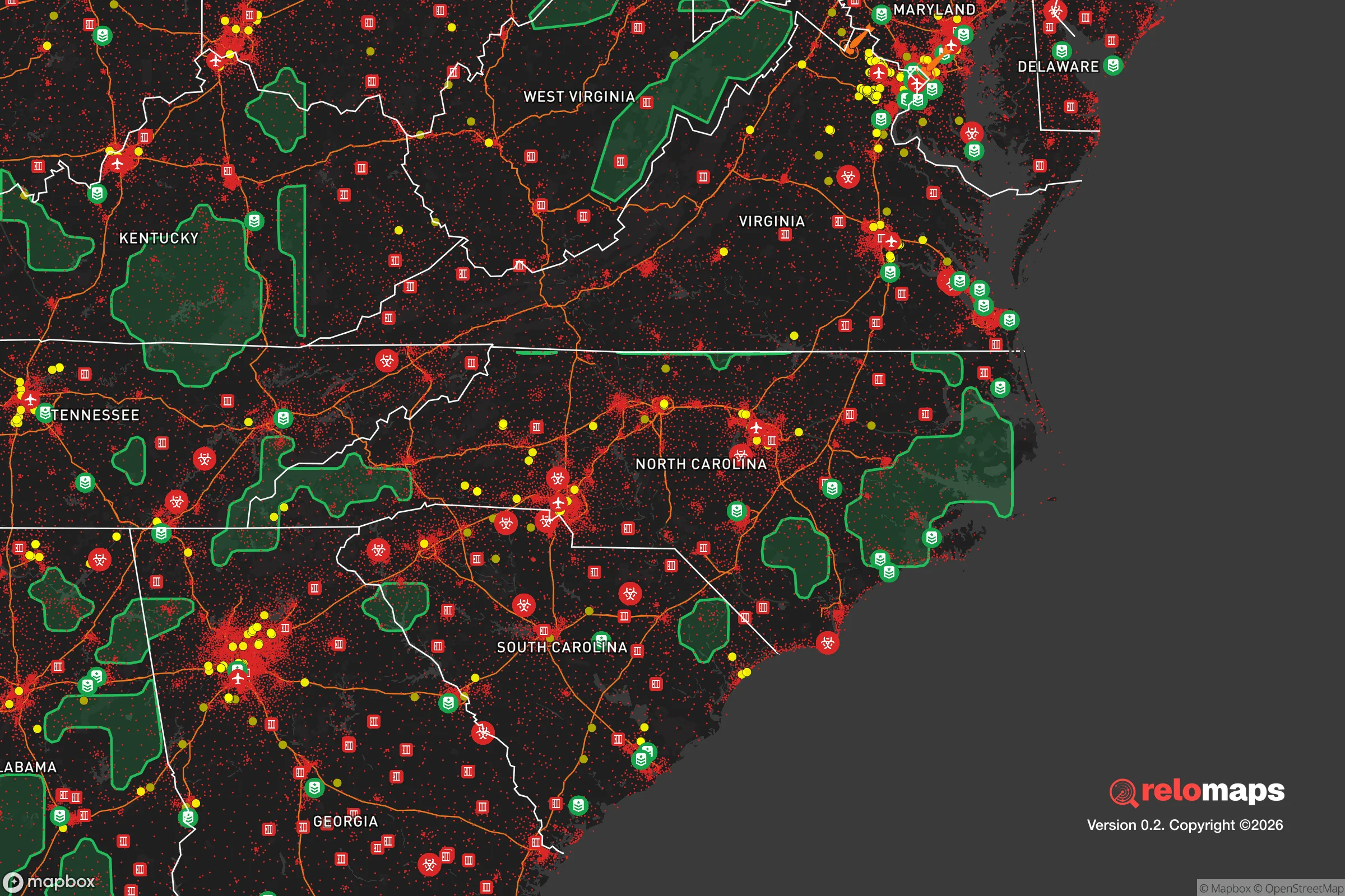


Important Note: For informational purposes only. This does not mean nothing bad ever happens in the green zones. Please use common sense. This is based on public data and modeled with AI. We tried to take a conservative approach but mistakes happen. We update this regularly as new information becomes available.
Solar Generator Recommendations
Backup power matters more here than in safer locations. We've picked three solar generators across budgets and capacity tiers — start with the budget unit if you only need a few essentials, or step up if you want to run a fridge and HVAC for days at a time.

Jackery Portable Power Station Explorer 300
Budget OptionPower on the Go: Weighing only 11 lbs, it's convenient to set up and store with book-sized foldable solar panels

BLUETTI Portable Power Station AC180
Designed for both indoor and outdoor scenarios, AC180 is highly capable as it has a robost capacity and continuous output power.

EF ECOFLOW DELTA Pro Ultra Power Station
Upgraded PickEcoFlow DELTA Pro Ultra is a whole-home energy system designed to grow with your family. Integrated with the Smart Home Panel 2, it scales to meet your evolving energy needs — keeping your home powered, intelligent, and secure through every stage of life.
We earn a commission, at no additional cost to you.
Strategic Assessment Analysis
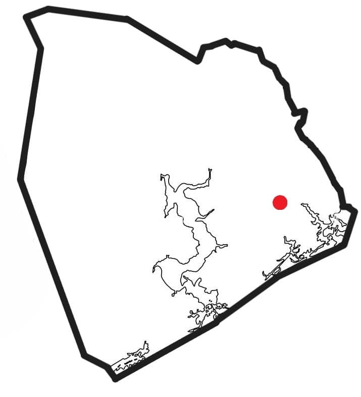
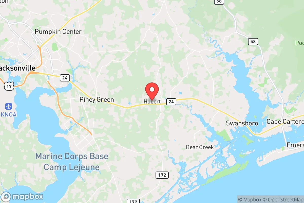
Hubert, North Carolina, offers a compelling balance of coastal access and inland buffer that makes it a noteworthy option for relocators prioritizing resilience and self-sufficiency. Situated in Onslow County, roughly 12 miles north of Camp Lejeune and 15 miles from the Atlantic coast, Hubert sits far enough from major metropolitan targets like Raleigh (120 miles) and Wilmington (50 miles) to reduce exposure to cascading urban failure scenarios, yet close enough to supply chains and medical infrastructure for practical daily living. The area's low population density—around 4,500 residents spread across a rural-suburban mix—combined with its position along the Intracoastal Waterway and proximity to the Croatan National Forest, gives it a strategic foothold for those thinking seriously about disaster readiness and long-term self-sufficiency.
Geographic position and natural advantages for self-sufficiency
Hubert's location provides several structural advantages for a resilience-minded household. The town sits on a relatively elevated coastal plain, with average elevations around 20–30 feet above sea level, which reduces flood risk compared to direct oceanfront communities like Emerald Isle or Swansboro. The surrounding landscape is dominated by pine forests, wetlands, and agricultural fields, offering ample space for private gardens, rainwater catchment, and small-scale livestock operations. The nearby Croatan National Forest—over 160,000 acres of public land—provides a buffer zone to the north and west, limiting suburban sprawl and preserving natural resources like timber, game, and wild edibles. For water security, the area's high water table and numerous creeks, including the New River and White Oak River, make well drilling a viable option for off-grid properties, though prospective relocators should verify local well permits and aquifer depth. The moderate climate, with an average of 215 sunny days per year and a growing season of roughly 220 days, supports year-round food production, a critical factor for anyone aiming to reduce dependence on grocery supply chains.
Risks, exposures, and proximity to fallout-relevant landmarks
No strategic assessment is complete without acknowledging the area's vulnerabilities. Hubert's primary natural risk is hurricane and tropical storm impact, given its 15-mile proximity to the coast. The region has experienced direct hits from Hurricanes Florence (2018) and Dorian (2019), both of which caused widespread power outages, flooding, and supply chain disruptions lasting weeks in some rural areas. Storm surge is less of a concern at Hubert's elevation, but wind damage and tree falls are real hazards—properties should be evaluated for roof anchoring, window protection, and generator readiness. On the man-made risk side, the most significant exposure is Camp Lejeune, located just south of Hubert. While the base is a major economic driver, it also represents a potential target in a conflict scenario, and its daily operations include live-fire training, ordnance handling, and helicopter traffic that generate noise and occasional road closures. Additionally, the nearby Marine Corps Air Station at Cherry Point (30 miles north) and the port at Morehead City (20 miles east) add to the region's strategic value, which could be a double-edged sword in a national emergency. For relocators concerned about fallout from a major urban or military event, Hubert's distance from Raleigh (130 miles) and Charlotte (200 miles) provides meaningful separation, though it is not remote enough to be considered a true bug-out location. The area's population is also growing steadily—Onslow County saw a 12% increase between 2010 and 2020—which means that in a crisis, local resources could be strained by evacuees from Jacksonville (10 miles south) and coastal communities.
Practical resilience for a relocator: food, water, energy, and defensibility
For a relocator serious about self-sufficiency, Hubert offers a mixed but workable picture. Food security is achievable: the area has several year-round farmers' markets, including the Jacksonville Farmers Market and the Swansboro Farmers Market, and the sandy loam soil is suitable for raised-bed gardening, fruit trees (figs, persimmons, blueberries), and poultry. Local hunting for deer and wild hog is permitted in season on public and private land, and fishing in the New River and nearby sounds provides a reliable protein source. Water security is a strong point—most rural properties rely on private wells, and the water table is generally shallow (20–50 feet), making hand-pump or solar-powered well systems feasible. Municipal water is available in denser subdivisions but is vulnerable to power outages, so a backup plan is essential. Energy resilience is where Hubert falls short for many relocators. The local grid, served by Duke Energy Progress, is prone to outages during storms, and solar adoption is still low compared to western North Carolina. Net metering policies are favorable, but upfront costs for a solar-plus-battery system can run $15,000–$25,000 for a typical home. Propane and wood heating are common backups, and many residents own generators. Defensibility is moderate: the area's rural character means properties are often spaced out with natural tree cover, providing privacy and some tactical advantage, but the lack of natural choke points (mountains, rivers, or steep terrain) means a determined threat could approach from multiple directions. Community cohesion is a real asset here—Hubert has a strong military and veteran presence, which tends to foster neighborly watchfulness and practical skills like first aid, mechanical repair, and firearms proficiency. The local sheriff's office (Onslow County) is well-funded and responsive, but response times in the most rural pockets can exceed 20 minutes.
Overall, Hubert presents a viable option for the resilience-minded relocator who wants coastal access without the extreme exposure of beachfront living, and who values a community with built-in practical skills and a low-key, self-reliant culture. It is not a remote fortress—it is a working-class coastal town with real hurricane risk, military proximity, and growing population pressure. But for a single individual or family willing to invest in well water, solar backup, and storm hardening, Hubert offers a defensible, resource-rich base that balances everyday convenience with genuine disaster readiness. The key is to buy with elevation, test the well, and get to know the neighbors before the storm hits.

* Values derived from national, state, county, city and local statistics and may differ in a specific area. Last updated: 2026-10-09T16:10:28.000Z
Narrative content on this page is AI-generated and may contain mistakes. Verify any details that matter before acting on them.
ReloMaps may earn a commission from affiliate links at no extra cost to you.

