Photo: Wikipedia
Strategic Assessment of Hammondsport, NY
Meaningful friction. Expect exposure to either population pressure, blast zones, or natural disaster risk. Consider buying a retreat property.
What does the Strategic Assessment tell us?
Our Strategic Assessment grades tactical survivability of an area. Major population centers, military targets, fallout zones, natural disasters, and border exposure all drive risk — lower exposure means a more defensible position in a crisis.
This is heavily inspired by Joel Skousen's Strategic Relocation book. Highly recommended you checkout the book ($)What does this tell us?
Our Strategic Assessment grades tactical survivability of an area. Major population centers, military targets, fallout zones, natural disasters, and border exposure all drive risk — lower exposure means a more defensible position in a crisis.
This is heavily inspired by Joel Skousen's Strategic Relocation book. Highly recommended you checkout the book ($)Strategic Pillars

Key Distances
Regional Safe Places
Below is our recommended "safe zones" in New York and the surrounding area based on our strategic heuristics. For most people, it's unrealistic to live in a “safe zone” full-time due to work, family or other personal reasons. They tend to be more rural. However, many of these areas are perfect for second homes and retreat properties that double as a vacation home or even a short-term rental.
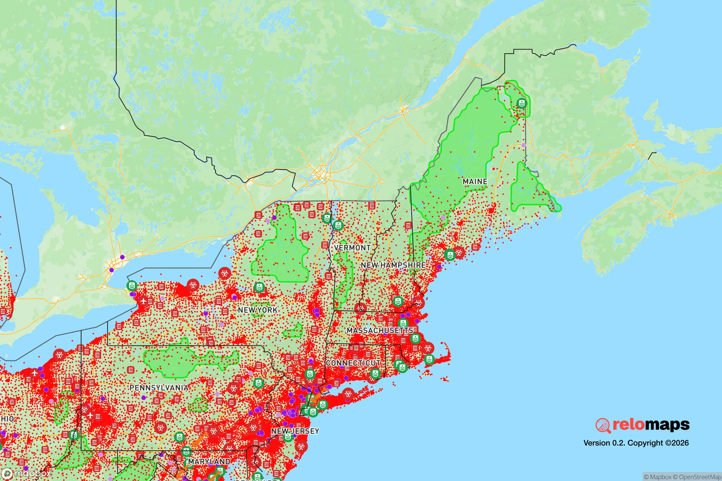
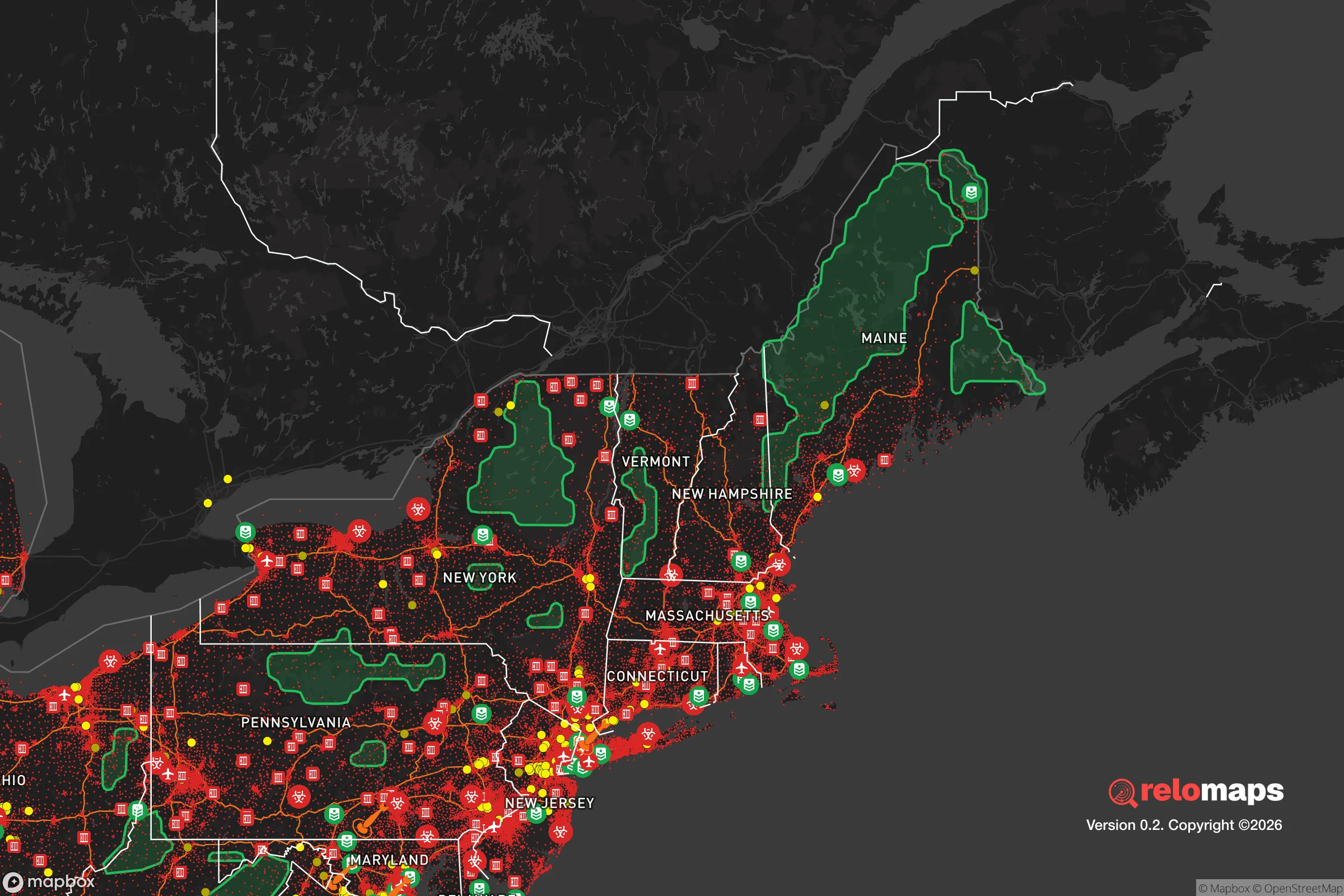


Important Note: For informational purposes only. This does not mean nothing bad ever happens in the green zones. Please use common sense. This is based on public data and modeled with AI. We tried to take a conservative approach but mistakes happen. We update this regularly as new information becomes available.
Solar Generator Recommendations
Backup power matters more here than in safer locations. We've picked three solar generators across budgets and capacity tiers — start with the budget unit if you only need a few essentials, or step up if you want to run a fridge and HVAC for days at a time.
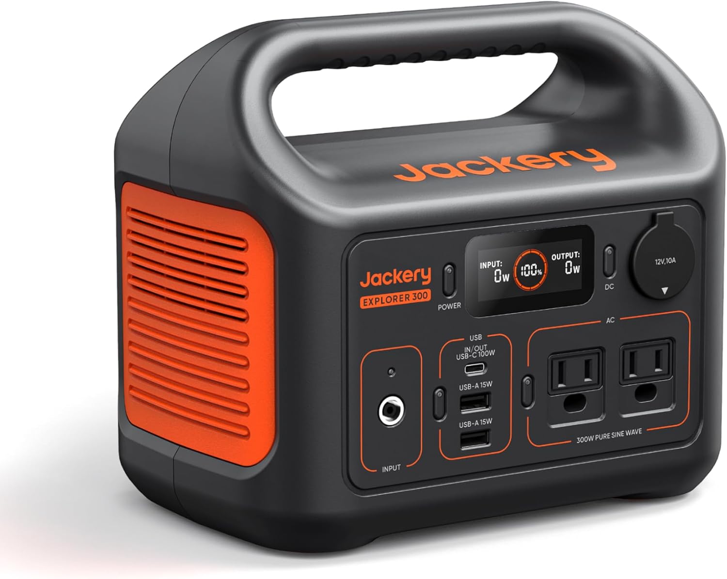
Jackery Portable Power Station Explorer 300
Budget OptionPower on the Go: Weighing only 11 lbs, it's convenient to set up and store with book-sized foldable solar panels

BLUETTI Portable Power Station AC180
Designed for both indoor and outdoor scenarios, AC180 is highly capable as it has a robost capacity and continuous output power.

EF ECOFLOW DELTA Pro Ultra Power Station
Upgraded PickEcoFlow DELTA Pro Ultra is a whole-home energy system designed to grow with your family. Integrated with the Smart Home Panel 2, it scales to meet your evolving energy needs — keeping your home powered, intelligent, and secure through every stage of life.
We earn a commission, at no additional cost to you.
Strategic Assessment Analysis
Where Hammondsport sits and why the geography matters
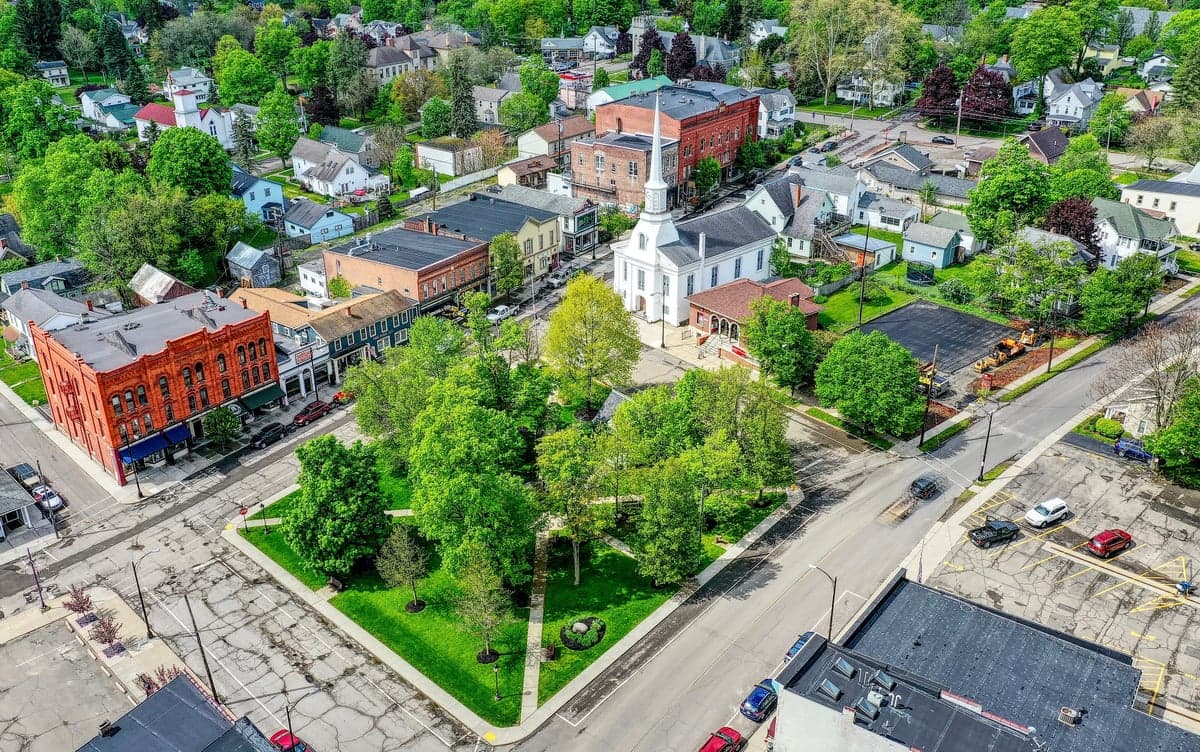
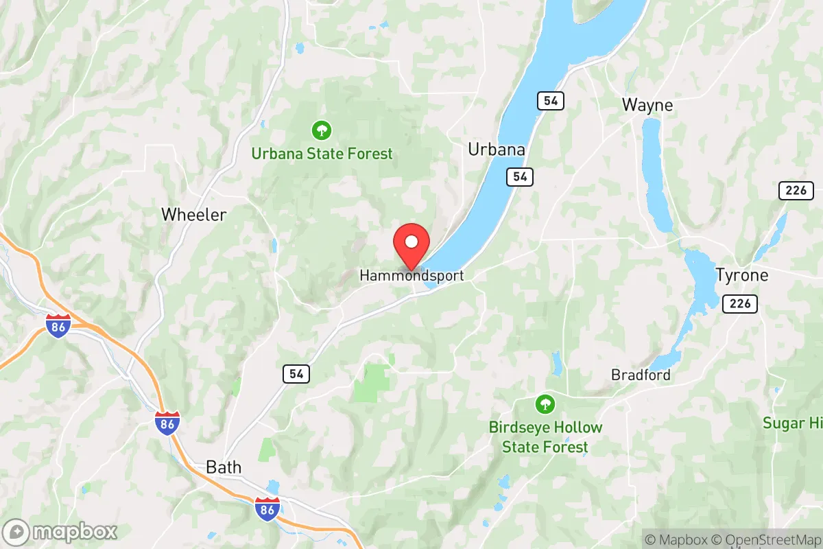
Hammondsport is in the town of Urbana, Steuben County, on the south end of Keuka Lake — the "Crooked Lake" — about 15 minutes from Bath (the county seat), 30–40 minutes from Corning, and roughly an hour from Rochester and Ithaca. The village occupies a narrow valley floor where the lake meets the surrounding hills, with the Pleasant Valley and Urbana uplands rising on either side. That bowl-and-ridge topography is a genuine asset: it channels weather, water, and movement, and it means the village is not sitting on a flat floodplain or an open transportation corridor. Keuka Lake itself is a deep, cold, spring-fed glacial lake — a substantial freshwater reserve that does not depend on a single pumped municipal well. The surrounding countryside is active agricultural land: the Keuka Lake wine trail, Concord and Niagara grape vineyards, dairy farms, and mixed woodlots. Steuben County is one of New York's more rural counties, with population density well under 100 people per square mile outside the Bath–Corning corridor. For a family thinking about food and water independence, that matters more than almost any other single factor.
Risks, exposures, and distance from fallout-relevant landmarks
The realistic risks here are ordinary and local, not catastrophic and strategic. The Finger Lakes region sees severe thunderstorms, ice storms, and occasional flash flooding in the steep-sided valleys; winter lake-effect snow is heavy but manageable, and the village's main road access (State Routes 54 and 54A) can be cut briefly by downed trees or ice. The bigger structural exposure is economic and infrastructural rather than physical: Steuben County's population has been declining for decades, the Corning-area glass and manufacturing base has thinned, and rural hospitals and services have consolidated toward Corning and Bath. On the man-made side, Hammondsport is reassuringly far from the things that matter in a fallout scenario. The nearest major nuclear plant is Nine Mile Point on Lake Ontario near Oswego, roughly 100 miles north-northeast — well outside any plausible acute fallout footprint for a release there, and upwind of the prevailing westerlies in most weather. The big Northeast population centers and their strike-value targets (New York City, the Albany corridor, the Buffalo–Niagara industrial belt) are 4–6 hours away. There is no major military installation, no large dam immediately upstream, and no significant chemical or refining complex in the immediate area. The trade-off is that remoteness cuts both ways: emergency services are volunteer-staffed and thin, the nearest Level II trauma care is in Corning or Rochester, and a serious regional event would leave the village largely on its own for days.
Practical resilience for a relocator: food, water, energy, defensibility
On the practical checklist, Hammondsport scores well above average for a village its size. Water is the strongest card: Keuka Lake plus numerous springs and wells mean household water independence is achievable, and the village water system draws on high-quality sources rather than a distant aqueduct. Food is the second: the surrounding townships are working farmland, with U-pick orchards, dairy, and vegetable growers within a short drive, and enough tillable acreage on the uplands that a household with a few acres can realistically produce a meaningful share of its own food. Energy is mixed — the grid is rural and storm-exposed, propane and wood heat are common and practical, and south-facing hillsides make solar viable, but there is no natural gas mains service in much of the area and winter heating depends on stored fuel. Defensibility is favorable in the sense that matters: low population density, a single main road in and out of the village core, and a surrounding population that is older, established, and not transient. The realistic threat is not mass influx but isolation — you should assume you are your own first responder, and plan for a week or more of self-sufficiency after an ice storm or regional outage.
The bottom line on Hammondsport as a preparedness location
Hammondsport is a solid, unglamorous choice for someone who wants distance from dense population and strike-value targets without giving up a functioning village, clean water, and working farmland. It is not a fortress — the winters are real, the economy is thin, and services are limited — but its geography, water, and agricultural base give it a resilience profile that most small towns in the Northeast cannot match. If your priority is a low-profile, self-sufficient base with genuine freshwater and food capacity and no reason to be on anyone's map, Hammondsport belongs on the short list; if you need proximity to major medical, employment, or urban amenities, the trade-offs will bite.

* Values derived from national, state, county, city and local statistics and may differ in a specific area. Last updated: 2026-11-03T03:23:03.000Z
Narrative content on this page is AI-generated and may contain mistakes. Verify any details that matter before acting on them.
ReloMaps may earn a commission from affiliate links at no extra cost to you.

