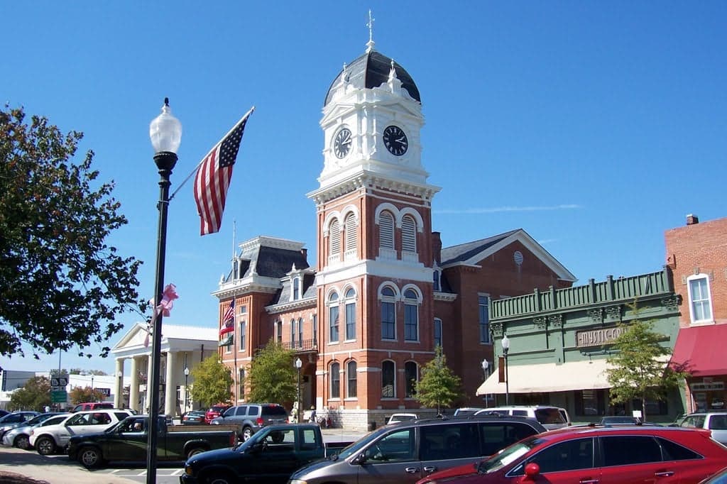
Photo: Wikipedia
Strategic Assessment of Newton County
Workable tactical position. Some exposure to population density or targets, but generally defensible in a crisis.
What does the Strategic Assessment tell us?
Our Strategic Assessment grades tactical survivability of an area. Major population centers, military targets, fallout zones, natural disasters, and border exposure all drive risk — lower exposure means a more defensible position in a crisis.
This is heavily inspired by Joel Skousen's Strategic Relocation book. Highly recommended you checkout the book ($)What does this tell us?
Our Strategic Assessment grades tactical survivability of an area. Major population centers, military targets, fallout zones, natural disasters, and border exposure all drive risk — lower exposure means a more defensible position in a crisis.
This is heavily inspired by Joel Skousen's Strategic Relocation book. Highly recommended you checkout the book ($)Strategic Pillars

Key Distances
Strategic Assessment Analysis
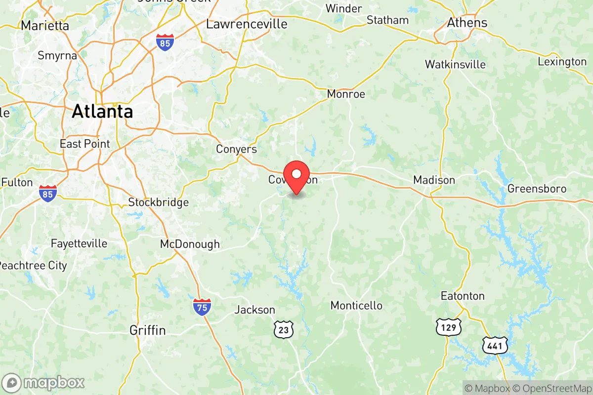
Newton County, Georgia, offers a compelling mix of strategic depth and practical livability for those prioritizing resilience and self-sufficiency, sitting roughly 35 miles east of Atlanta’s urban core while remaining firmly anchored in a rural, resource-rich landscape. The county’s position along the Alcovy River and its proximity to the Georgia Piedmont’s rolling hills provide natural buffers against both coastal storm surges and the densest population corridors, making it a viable relocation target for families and individuals who want access to regional infrastructure without being in the blast zone of a major metropolitan target. With a population hovering around 115,000 and a land area of 279 square miles, Newton County offers enough space for small-scale homesteading while still maintaining a functional tax base and local government services.
Geographic position and natural advantages for long-term stability
Newton County sits in the heart of Georgia’s Piedmont region, a zone characterized by gently rolling terrain, clay-based soils, and abundant hardwood forests that provide both timber resources and natural cover. The county is bisected by Interstate 20, which runs east-west and connects directly to Atlanta, but the majority of its landmass remains rural, with the towns of Covington (the county seat), Oxford, and Porterdale serving as population centers. The Alcovy River and its tributaries, including the South River, flow through the county, offering surface water sources that are less prone to contamination than the alluvial aquifers found in coastal Georgia. The area’s elevation—averaging around 800 feet above sea level—provides a natural advantage against flooding, storm surge, and sea-level rise, while the clay soils, though challenging for gardening, offer excellent water retention and can be amended for food production. The county’s position also places it within a two-hour drive of the Fort Moore (formerly Fort Benning) military installation to the south, a potential source of logistical support and community resilience networks, though this proximity also carries its own risk calculus.
Risk exposures and proximity to fallout-relevant landmarks
While Newton County avoids the direct blast radius of Atlanta’s urban core, it is not immune to the cascading effects of a major metropolitan disruption. The county lies approximately 35 miles east of Hartsfield-Jackson Atlanta International Airport, one of the busiest airports in the world and a high-value target in any conflict scenario. Additionally, the county is within 50 miles of the Plant Vogtle nuclear power plant near Waynesboro, Georgia, which, while not an immediate fallout risk in a conventional attack, represents a potential radiological hazard in the event of a strike or sabotage. The county’s own industrial base is modest, with major employers including Parker Hannifin (aerospace components) and General Mills (food processing), both of which are low-priority targets but could face secondary disruptions from supply chain failures. The Georgia State Route 20 corridor, which runs through Covington, is a major freight route connecting to I-20 and I-75, making it a potential chokepoint for evacuation or resupply during a crisis. On the natural disaster front, the county is at low risk for hurricanes (given its inland position) and moderate risk for tornadoes, with the Piedmont region experiencing an average of 10-15 tornado warnings per year. Wildfire risk is low due to the area’s humidity and forest management practices, though drought conditions can elevate that risk in dry summers.
Practical resilience for relocators: food, water, energy, and defensibility
For a relocator focused on self-sufficiency, Newton County offers several practical advantages. The county’s agricultural heritage is still visible, with numerous small farms and Newton County Farmers Market in Covington providing local food sources. The clay soils, while requiring amendment with organic matter, can support vegetable gardens, fruit trees, and small livestock, and the county’s zoning codes in unincorporated areas are generally permissive of backyard chickens, goats, and even larger animals on parcels of two acres or more. Water access is a strong point: the Alcovy River and its tributaries provide surface water, and the county’s groundwater is generally potable with basic filtration, though well drilling is recommended for those on larger parcels. The Newton County Water and Sewerage Authority serves the more densely populated areas, but rural properties often rely on private wells, which offer a degree of independence from municipal systems. Energy resilience is more mixed: the county is served by Georgia Power, a subsidiary of Southern Company, which relies heavily on natural gas and nuclear (Plant Vogtle), making the grid vulnerable to both fuel supply disruptions and cyberattacks. Solar potential is moderate—the region averages about 215 sunny days per year—and off-grid solar installations are feasible for those willing to invest in battery storage. Defensibility is a nuanced factor: the county’s rolling terrain and forested areas provide natural cover and chokepoints, but the I-20 corridor also makes it accessible to outsiders. The towns of Oxford and Porterdale, with their smaller populations and limited road access, offer more defensible positions than Covington’s more developed core. The Newton County Sheriff’s Office maintains a visible presence, with response times in rural areas averaging 15-20 minutes, which is reasonable for a semi-rural county but not a substitute for personal security measures.
The overall strategic picture for Newton County is one of moderate resilience with clear trade-offs. Its geographic position offers a solid buffer from Atlanta’s immediate blast radius while still providing access to the region’s medical, logistical, and economic resources during normal times. The county’s natural advantages—elevation, surface water, and agricultural potential—make it a viable location for a self-sufficient homestead, particularly for those willing to invest in well drilling, soil amendment, and off-grid energy. However, the proximity to high-value targets like Hartsfield-Jackson and Plant Vogtle, combined with the vulnerability of the I-20 corridor, means that a relocator should plan for both short-term evacuation and long-term isolation scenarios. For a family or individual who values a balance between rural self-sufficiency and access to urban infrastructure, Newton County represents a solid middle-ground option—not the most hardened location in Georgia, but far from the most exposed. The key is to choose a property in the less densely populated northern or eastern parts of the county, away from the I-20 corridor, and to build redundancy into water, food, and energy systems from day one.

* Values derived from national, state, county, city and local statistics and may differ in a specific area. Last updated: 2026-09-07T07:15:40.000Z
Narrative content on this page is AI-generated and may contain mistakes. Verify any details that matter before acting on them.
ReloMaps may earn a commission from affiliate links at no extra cost to you.

