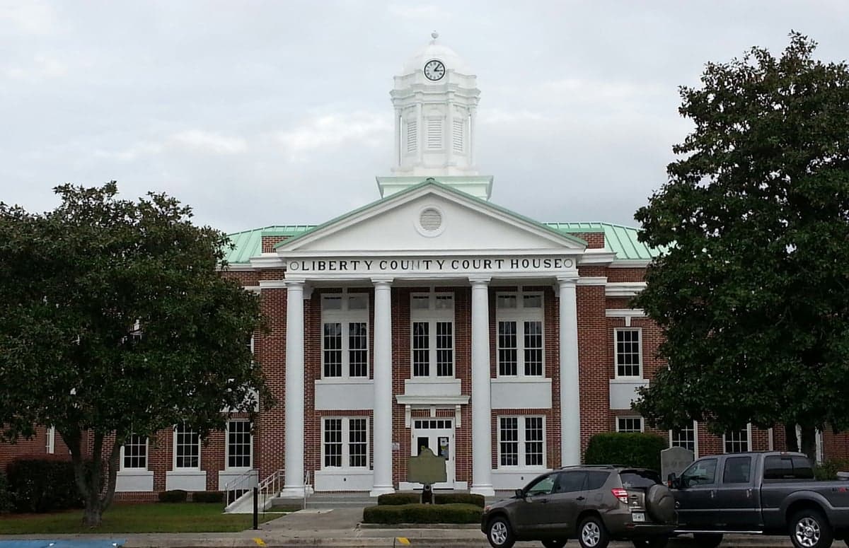
Photo: Wikipedia
Strategic Assessment of Liberty County
Meaningful friction. Expect exposure to either population pressure, blast zones, or natural disaster risk. Consider buying a retreat property.
What does the Strategic Assessment tell us?
Our Strategic Assessment grades tactical survivability of an area. Major population centers, military targets, fallout zones, natural disasters, and border exposure all drive risk — lower exposure means a more defensible position in a crisis.
This is heavily inspired by Joel Skousen's Strategic Relocation book. Highly recommended you checkout the book ($)What does this tell us?
Our Strategic Assessment grades tactical survivability of an area. Major population centers, military targets, fallout zones, natural disasters, and border exposure all drive risk — lower exposure means a more defensible position in a crisis.
This is heavily inspired by Joel Skousen's Strategic Relocation book. Highly recommended you checkout the book ($)Strategic Pillars

Key Distances
Strategic Assessment Analysis
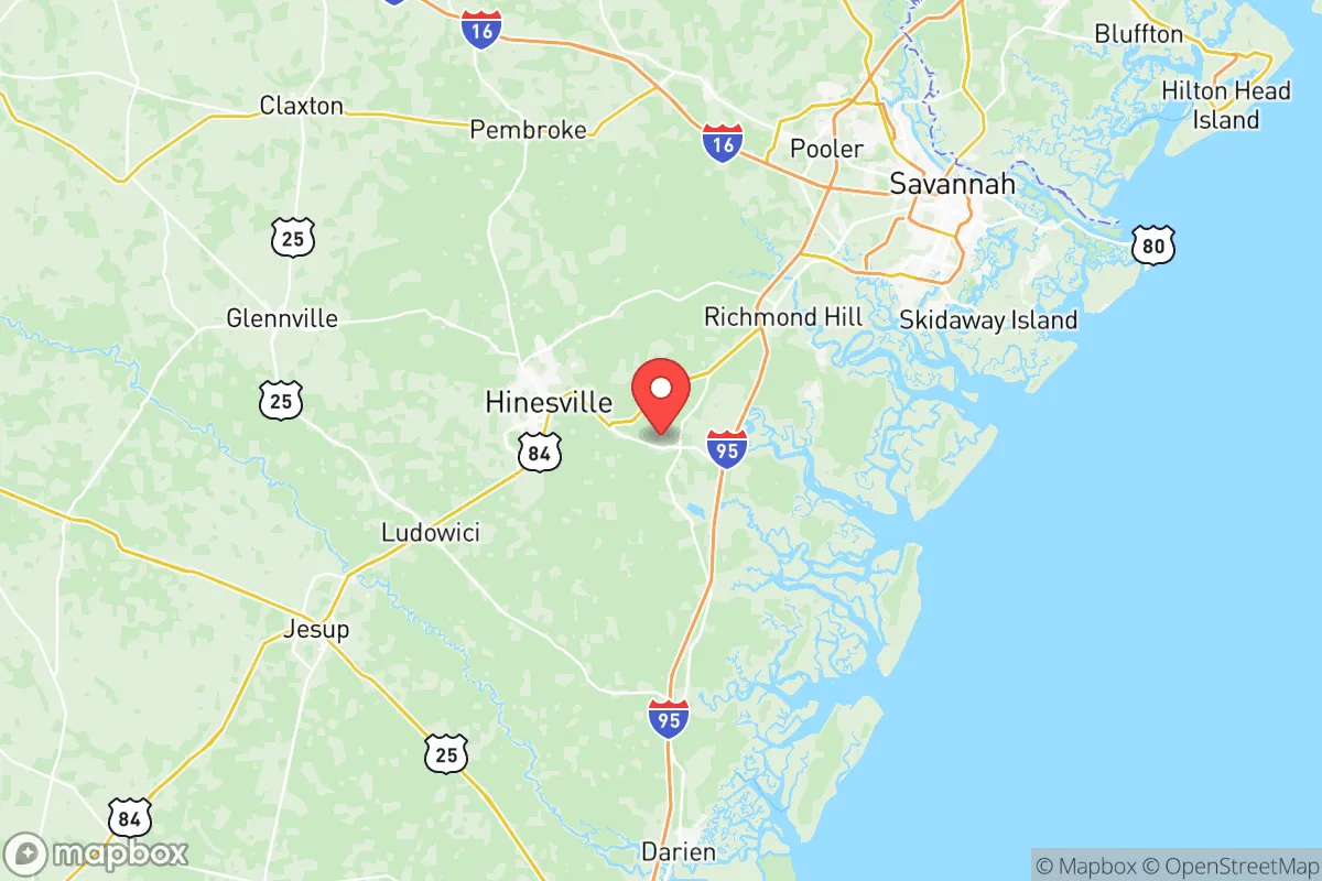
Liberty County, Georgia, offers a strategic balance of coastal access and inland buffer that appeals to relocation-minded readers prioritizing resilience and self-sufficiency. Located roughly 40 miles southwest of Savannah and 30 miles inland from the Atlantic, the county avoids the direct storm surge exposure of barrier islands while retaining proximity to major logistics hubs. Its position along Interstate 95 and U.S. Highway 84 places it within a two-hour drive of Jacksonville, Florida, and three hours from Atlanta, making it a viable option for those who want rural space without complete isolation. The county seat, Hinesville, anchors the area with a population of roughly 35,000, while smaller communities like Midway, Riceboro, and Flemington offer lower-density alternatives.
Geographic position and natural advantages for long-term stability
Liberty County sits on the Georgia Coastal Plain, a region characterized by flat terrain, abundant groundwater, and a temperate climate that supports year-round agriculture. The county is bisected by the Canochee River and the North Newport River, both of which drain into the Atlantic via the Medway River and St. Catherines Sound. These waterways provide natural water sources and potential irrigation capacity, though they are not navigable for large vessels, which limits industrial traffic. The area's elevation averages 20 to 40 feet above sea level, with some inland ridges reaching 60 feet—enough to avoid the worst of tidal flooding but not immune to heavy rain events. The county's 520 square miles include extensive pine forests, wetlands, and agricultural land, offering natural resources for timber, hunting, and small-scale farming. The Fort Stewart military reservation, which occupies roughly 280,000 acres across Liberty and adjacent counties, acts as a de facto green buffer, limiting suburban sprawl and preserving large tracts of undeveloped land. This military presence also means the area has robust infrastructure, including a regional airport (MidCoast Regional Airport at Wright Army Airfield) and maintained road networks that serve both military and civilian needs.
Risk exposure: natural hazards and proximity to fallout-relevant landmarks
Liberty County's primary natural risk is hurricane-related flooding, given its location within 30 miles of the coast. While the county avoids direct storm surge in most Category 1-2 events, heavy rainfall from tropical systems can overwhelm local drainage, particularly in low-lying areas near the coast. The 2016 Hurricane Matthew and 2017 Hurricane Irma both caused significant flooding in Hinesville and along the coastal highways, with some rural roads impassable for days. The county's flat topography means water moves slowly, increasing the risk of prolonged standing water. Tornado risk is moderate, with occasional spin-up storms during hurricane landfalls, but the area is not in the traditional Dixie Alley corridor. Wildfire risk is low due to the wet climate, though prescribed burns on Fort Stewart can occasionally drift smoke into populated areas.
From a man-made risk perspective, Liberty County's proximity to Savannah's port and industrial corridor is a double-edged sword. The Port of Savannah, located 40 miles north, is one of the busiest container ports on the East Coast, handling over 5 million TEUs annually. This concentration of shipping, rail, and chemical storage creates a potential target for disruption or attack. The Elba Island LNG terminal, located near Savannah, and the Kinder Morgan Savannah terminal for petroleum products add to the industrial risk profile. Additionally, the Fort Stewart military base itself, while a stabilizing economic force, is a high-value strategic asset that could be a target in a conflict scenario. The base houses the 3rd Infantry Division and includes ammunition storage, aircraft hangars, and fuel depots. While the base's security is robust, its presence means the area could face secondary effects from any large-scale disruption, such as road closures or resource diversion. The Brunswick, Georgia, port (about 50 miles south) and the Kings Bay Naval Submarine Base (60 miles south) add further strategic density to the region. For a relocator concerned about fallout from industrial accidents or targeted infrastructure attacks, Liberty County's inland position offers some buffer, but the concentration of military and port assets within a 60-mile radius is a factor to weigh.
Practical resilience for relocators: food, water, energy, and defensibility
Liberty County's practical resilience is mixed but generally favorable for a self-sufficiency-minded household. Water access is a strong point: the county sits atop the Floridan Aquifer, one of the most productive groundwater systems in the Southeast. Private wells are common in rural areas, with typical depths of 100-300 feet yielding reliable, clean water. The county's public water system, managed by the Liberty County Water and Sewer Authority, draws from both surface water (the Canochee River) and groundwater, but a private well offers independence from municipal treatment. Food production is viable, with the county's agricultural extension service supporting small-scale farming, poultry, and livestock. The growing season runs from March to November, and the sandy loam soils are suitable for vegetables, melons, and citrus. Local farmers' markets in Hinesville and Midway provide fresh produce, but the area is not a major agricultural exporter—most food is trucked in from larger distribution centers in Savannah and Atlanta. For a relocator aiming for food security, establishing a garden and sourcing local meat from farms in neighboring Long County or McIntosh County would be necessary.
Energy resilience is adequate but not exceptional. The county is served by Georgia Power, which relies on a mix of natural gas, nuclear (Plant Vogtle, 80 miles west), and coal. Power outages during hurricanes are common, with restoration times ranging from 24 hours to several days in rural areas. Solar potential is good, with the region averaging 5.2 peak sun hours per day, and many rural homes have space for ground-mounted panels. Battery storage and backup generators are recommended for anyone serious about off-grid capability. Defensibility is a mixed picture: the county's flat, open terrain offers limited natural cover, but the extensive pine forests and wetlands provide some concealment for rural properties. The presence of Fort Stewart means a large, armed population and a culture of firearms ownership, which aligns with a self-defense mindset. However, the county's proximity to I-95 and major highways means that any large-scale evacuation or crisis could bring transient populations through the area. The county's law enforcement presence is adequate, with the Liberty County Sheriff's Office and Hinesville Police Department, but rural areas are lightly patrolled. For a relocator, choosing a property with good visibility, a defensible perimeter, and access to multiple egress routes (not just the main highways) is advisable.
Overall, Liberty County offers a solid but not exceptional resilience profile for a relocation-minded reader. Its strengths are reliable groundwater, a long growing season, and a buffer from direct coastal hazards. Its weaknesses are the concentration of military and port assets within a 60-mile radius, moderate hurricane flood risk, and dependence on external food supply chains. For a family or individual willing to invest in a private well, solar power, and a garden, the county provides a viable base for a self-sufficient lifestyle. The presence of Fort Stewart adds a layer of economic stability and community preparedness, but it also introduces a strategic risk that should be weighed against the area's natural advantages. Liberty County is not a remote survivalist retreat, but it is a defensible, resource-rich location for someone who wants to be within striking distance of coastal amenities while maintaining a degree of separation from the highest-risk zones.

* Values derived from national, state, county, city and local statistics and may differ in a specific area. Last updated: 2026-07-17T10:32:41.000Z
Narrative content on this page is AI-generated and may contain mistakes. Verify any details that matter before acting on them.
ReloMaps may earn a commission from affiliate links at no extra cost to you.

