
Photo: Wikipedia
Strategic Assessment of Hall County
Workable tactical position. Some exposure to population density or targets, but generally defensible in a crisis.
What does the Strategic Assessment tell us?
Our Strategic Assessment grades tactical survivability of an area. Major population centers, military targets, fallout zones, natural disasters, and border exposure all drive risk — lower exposure means a more defensible position in a crisis.
This is heavily inspired by Joel Skousen's Strategic Relocation book. Highly recommended you checkout the book ($)What does this tell us?
Our Strategic Assessment grades tactical survivability of an area. Major population centers, military targets, fallout zones, natural disasters, and border exposure all drive risk — lower exposure means a more defensible position in a crisis.
This is heavily inspired by Joel Skousen's Strategic Relocation book. Highly recommended you checkout the book ($)Strategic Pillars

Key Distances
Strategic Assessment Analysis
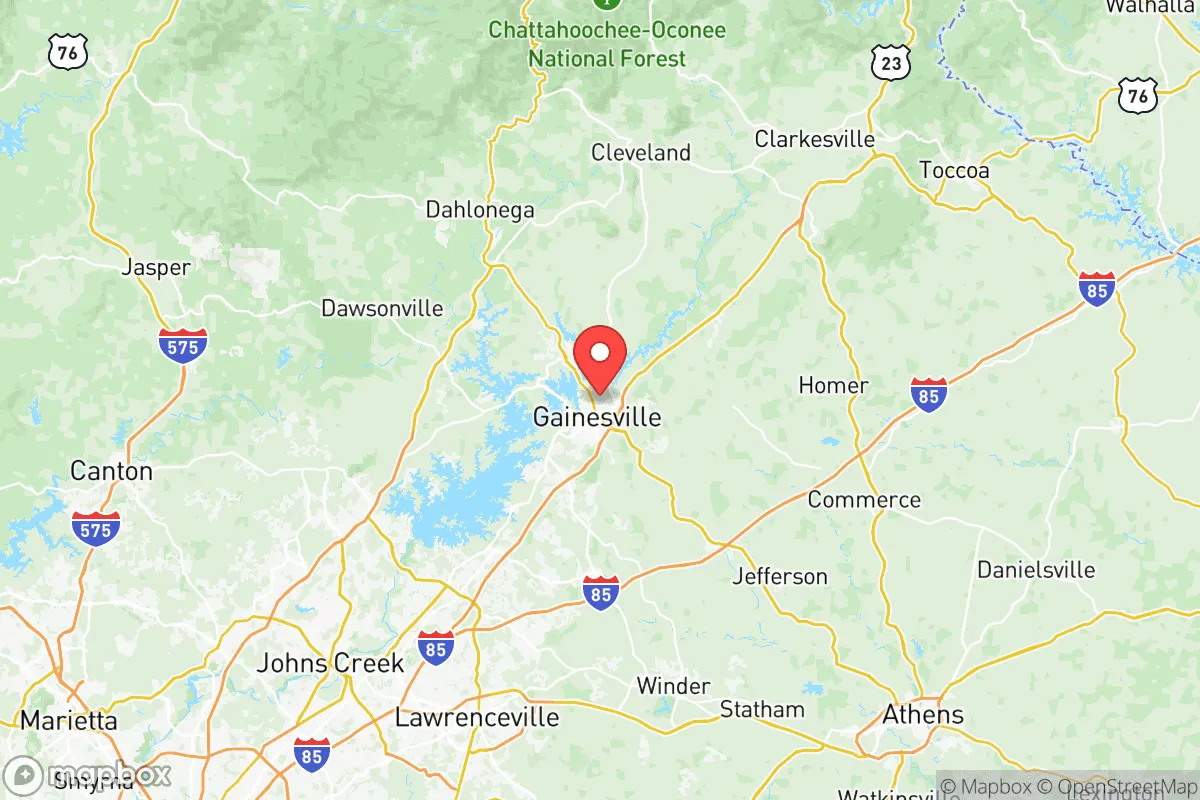
Hall County, Georgia, anchored by the city of Gainesville, presents a compelling strategic profile for relocators prioritizing resilience and self-sufficiency, balancing robust economic stability with a geographic position that offers meaningful separation from major metropolitan vulnerabilities. The county sits roughly 50 miles northeast of Atlanta, placing it far enough from the core urban zone to avoid the worst fallout scenarios associated with a major city, yet close enough to access critical supply chains and medical infrastructure. Its location along the foothills of the Blue Ridge Mountains and the shores of Lake Lanier provides natural defensive terrain and a reliable freshwater reservoir, making it a serious contender for those evaluating long-term preparedness in the Southeast.
Geographic position and natural defensive advantages in Hall County
Hall County's geography is defined by its position in the Piedmont region, where rolling hills and granite outcroppings create natural chokepoints and defensible terrain, a distinct advantage over the flat, exposed landscapes of coastal Georgia or the Atlanta metro sprawl. The county is bisected by the Chattahoochee River, which feeds the massive Lake Lanier — a 38,000-acre reservoir managed by the U.S. Army Corps of Engineers that serves as the primary water source for much of north Georgia. For a relocator, this means access to a reliable, large-volume freshwater supply that is less susceptible to drought than smaller municipal systems. The terrain itself, with elevations ranging from roughly 1,000 to 2,000 feet, offers natural line-of-sight advantages and reduces the risk of flooding compared to low-lying areas downstream. Specific communities like Flowery Branch and Oakwood sit on higher ground near the lake's edge, while Clermont and Lula in the northern part of the county are nestled into steeper, more secluded terrain that could offer additional privacy and defensibility in a crisis scenario.
Risks, exposures, and proximity to fallout-relevant landmarks
While Hall County avoids the direct blast and fallout risks of a major metropolitan target like Atlanta, it is not without exposure. The county lies within the general fallout plume zone for a ground burst targeting Dobbins Air Reserve Base in Marietta (roughly 40 miles southwest) or Fort Moore (formerly Fort Benning) near Columbus, though prevailing wind patterns in north Georgia typically carry fallout northeast, away from Hall County. More immediately, the county contains its own potential secondary targets: the Gainesville Industrial Park houses several chemical and food processing facilities, and the Georgia Power Plant Hammond coal-fired plant on Lake Lanier could be a point of concern for contamination or grid disruption. Natural disaster risks are moderate — the area sees occasional tornadoes (typically EF-1 or EF-2 strength) and ice storms that can knock out power for days, as seen in the 2014 winter storm that left parts of Gainesville without electricity for nearly a week. Wildfire risk is low due to the region's humidity and forest composition, but the interface between suburban development and wooded areas in places like Murrayville creates some exposure during dry spells. The proximity to Interstate 985 and U.S. Route 129 is a double-edged sword: these roads provide evacuation routes north toward the mountains or south toward Atlanta, but they also serve as potential chokepoints during a mass evacuation event.
Practical resilience for a relocator: food, water, energy, and defensibility
For someone serious about self-sufficiency, Hall County offers a strong baseline. The agricultural sector is active, with Hall County being one of Georgia's top poultry-producing counties — the presence of major processors like Fieldale Farms and Mar-Jac Poultry means local food production is industrial-scale, not just hobby farming. Smaller-scale operations in the northern parts of the county, particularly around Lula and Clermont, support farmers' markets and CSAs that could be leveraged for local food security. Water access is the standout advantage: Lake Lanier provides a nearly inexhaustible surface water source, and the county's groundwater aquifers in the Piedmont region are generally reliable for private wells, especially in areas with deeper bedrock fractures. Energy resilience is more mixed. The local grid is served by Georgia Power and Jackson EMC, both of which have improved tree-trimming and infrastructure hardening since the 2014 ice storm, but the area remains vulnerable to extended outages from winter weather or cyberattacks on the broader Southeast grid. Solar potential is moderate — the region gets about 215 sunny days per year, below the national average, but sufficient for supplemental generation with battery storage. Defensibility is aided by the terrain: the northern part of the county, with its winding roads and forested hills, offers natural cover and limited approach vectors for any potential threat, while the more suburban areas around Gainesville and Flowery Branch are harder to secure due to density and multiple access points.
The overall strategic picture for Hall County is one of balanced resilience: it avoids the worst-case risks of a primary target zone while offering genuine practical advantages in water access, local food production, and defensible terrain. The county's growth — Gainesville's population has increased by roughly 15% since 2020 — brings both economic opportunity and increased density, which could strain resources in a prolonged crisis. For a relocator who values proximity to Atlanta's medical and supply networks but wants a buffer from its vulnerabilities, Hall County represents a solid middle ground. The key trade-off is between the security of the northern, more rural areas and the convenience of the southern corridor near I-985. Those prioritizing maximum self-sufficiency should focus on properties north of Gainesville, ideally with well water and southern solar exposure, while those wanting a balance of preparedness and everyday livability will find the lake communities around Flowery Branch and Oakwood a practical choice. In a region where true isolation is rare, Hall County offers a defensible position with the resources to sustain a household through most plausible disruption scenarios.

* Values derived from national, state, county, city and local statistics and may differ in a specific area. Last updated: 2026-07-02T23:05:23.000Z
Narrative content on this page is AI-generated and may contain mistakes. Verify any details that matter before acting on them.
ReloMaps may earn a commission from affiliate links at no extra cost to you.

