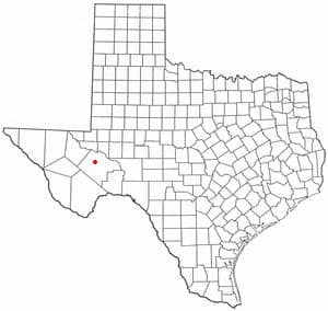
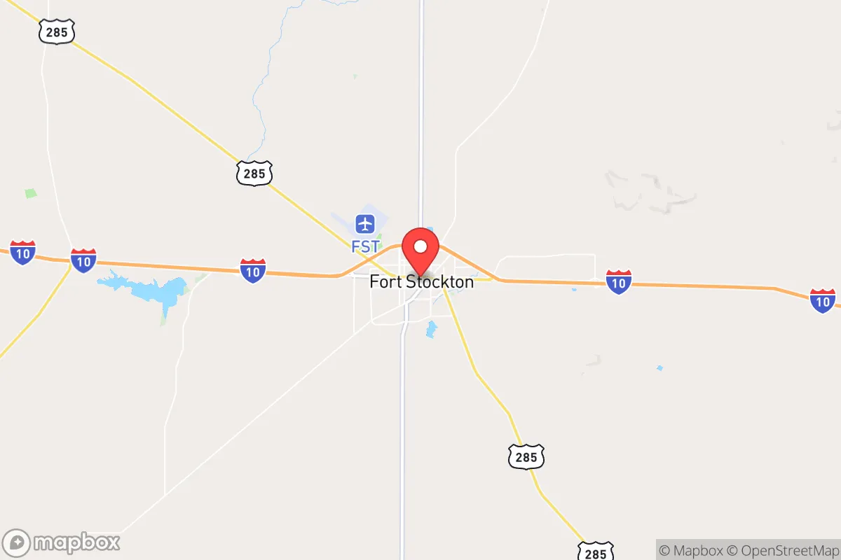
Photo: Wikipedia
Strategic Assessment of Fort Stockton, TX
Workable tactical position. Some exposure to population density or targets, but generally defensible in a crisis.
What does the Strategic Assessment tell us?
Our Strategic Assessment grades tactical survivability of an area. Major population centers, military targets, fallout zones, natural disasters, and border exposure all drive risk — lower exposure means a more defensible position in a crisis.
This is heavily inspired by Joel Skousen's Strategic Relocation book. Highly recommended you checkout the book ($)What does this tell us?
Our Strategic Assessment grades tactical survivability of an area. Major population centers, military targets, fallout zones, natural disasters, and border exposure all drive risk — lower exposure means a more defensible position in a crisis.
This is heavily inspired by Joel Skousen's Strategic Relocation book. Highly recommended you checkout the book ($)Strategic Pillars

Key Distances
Regional Safe Places
Below is our recommended "safe zones" in Texas and the surrounding area based on our strategic heuristics. For most people, it's unrealistic to live in a “safe zone” full-time due to work, family or other personal reasons. They tend to be more rural. However, many of these areas are perfect for second homes and retreat properties that double as a vacation home or even a short-term rental.

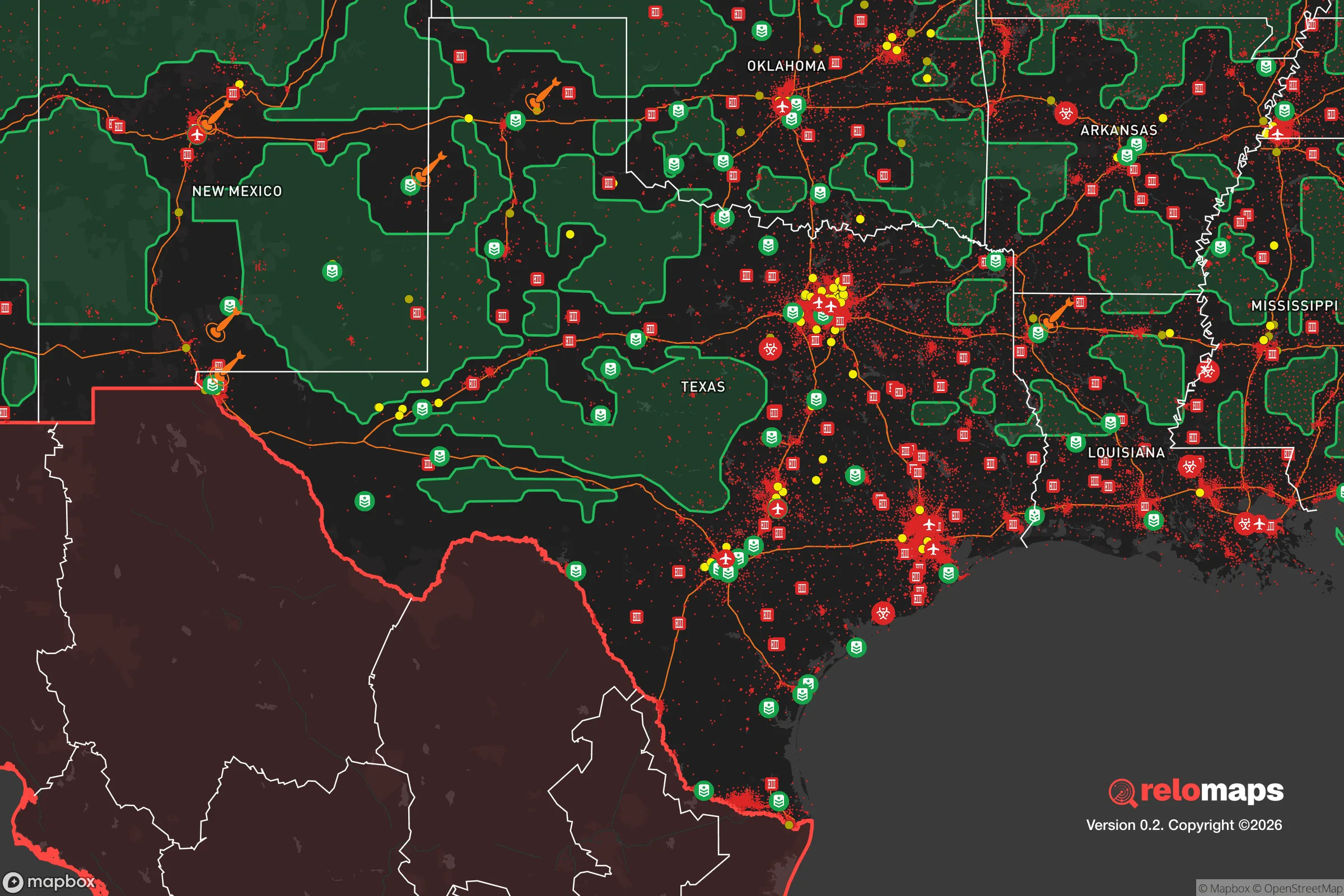


Important Note: For informational purposes only. This does not mean nothing bad ever happens in the green zones. Please use common sense. This is based on public data and modeled with AI. We tried to take a conservative approach but mistakes happen. We update this regularly as new information becomes available.
Solar Generator Recommendations
Backup power matters more here than in safer locations. We've picked three solar generators across budgets and capacity tiers — start with the budget unit if you only need a few essentials, or step up if you want to run a fridge and HVAC for days at a time.

Jackery Portable Power Station Explorer 300
Budget OptionPower on the Go: Weighing only 11 lbs, it's convenient to set up and store with book-sized foldable solar panels

BLUETTI Portable Power Station AC180
Designed for both indoor and outdoor scenarios, AC180 is highly capable as it has a robost capacity and continuous output power.

EF ECOFLOW DELTA Pro Ultra Power Station
Upgraded PickEcoFlow DELTA Pro Ultra is a whole-home energy system designed to grow with your family. Integrated with the Smart Home Panel 2, it scales to meet your evolving energy needs — keeping your home powered, intelligent, and secure through every stage of life.
We earn a commission, at no additional cost to you.
Strategic Assessment Analysis
Fort Stockton, Texas, presents a compelling case for the relocation-minded individual or family prioritizing resilience and self-sufficiency, largely due to its strategic location and inherent geographic advantages. Situated at the crossroads of I-10 and I-20 in the vast, sparsely populated Permian Basin, this community of roughly 8,500 people offers a unique blend of isolation from major metropolitan vulnerabilities and access to critical infrastructure. For those thinking seriously about disaster readiness, Fort Stockton’s position—far from the hurricane-prone Gulf Coast, the seismic risks of the West Coast, and the dense population corridors of the eastern U.S.—provides a foundational layer of security that is difficult to replicate in more central or coastal locations.
Geographic position and natural advantages for long-term stability
Fort Stockton’s most significant resilience asset is its location in the Trans-Pecos region, a high desert environment at roughly 3,000 feet elevation. This elevation places it above the floodplains that threaten much of Texas, and the arid climate—averaging only about 12 inches of rain annually—dramatically reduces risks from hurricanes, tornadoes, and widespread flooding. The area sits on the southern edge of the vast Edwards Plateau, offering hard, stable limestone bedrock that is less prone to the subsidence or liquefaction issues found in coastal or river delta regions. This geological stability is a quiet but critical advantage for long-term infrastructure integrity. Furthermore, the region’s low population density—Pecos County has about 16,000 people spread over 4,765 square miles—means that in a crisis, competition for local resources would be far less intense than in a suburban or urban setting. The sheer distance from major population centers like San Antonio (260 miles), El Paso (200 miles), and Dallas (350 miles) acts as a natural buffer against the cascading failures that can ripple through densely connected metropolitan grids.
Risks, exposures, and proximity to fallout-relevant landmarks
No location is without vulnerabilities, and Fort Stockton’s risk profile is shaped by its industrial and geographic context. The most prominent man-made risk is its position within the heart of the Permian Basin oil and gas fields. The area is dotted with well pads, pipelines, and processing facilities, and a major incident—such as a large-scale gas leak, well blowout, or pipeline rupture—could create localized air quality or fire hazards. However, these risks are generally industrial and containable, not existential or fallout-related in the nuclear sense. The nearest significant military or strategic target is likely the Fort Bliss complex near El Paso (200 miles west), which includes the William Beaumont Army Medical Center and extensive training ranges. While not a primary nuclear target, it is a potential secondary asset. More relevant for the resilience-minded relocator is the absence of major nuclear power plants, large-scale chemical storage facilities, or major military command centers within a 100-mile radius. The closest nuclear plant is the Comanche Peak plant near Glen Rose, over 300 miles east—well outside any plausible fallout zone. The primary risk from a major national emergency would be the potential for transient populations fleeing the larger cities to pass through or attempt to settle in the area, straining local supplies. Fort Stockton’s location on major east-west and north-south highways (I-10 and I-20) makes it a natural chokepoint and potential refuge for evacuees, which is a double-edged sword: it offers trade access but also potential influx pressure.
Practical resilience for a relocator: food, water, energy, and defensibility
For the individual or family focused on practical self-sufficiency, Fort Stockton offers a mixed but generally favorable picture. Water is the most critical concern. The region relies on the Edwards-Trinity aquifer system, and while the city has a robust municipal supply, the arid climate means that surface water is scarce. A relocator would need to plan for rainwater harvesting or deep well drilling if they intend to be off-grid. The Pecos River runs nearby, but its flow is highly variable and its water quality is often brackish. Energy resilience is a strong point. The Permian Basin is the nation’s premier oil and gas producing region, and natural gas is abundant and relatively cheap. Solar potential is excellent—the area averages over 260 sunny days per year—making photovoltaic systems highly viable for backup or primary power. Wind energy is also present, with several large wind farms in the region. For food, the local growing season is long (over 250 days), but the low rainfall and alkaline soils limit traditional gardening without irrigation. However, the region’s ranching heritage means that locally sourced beef, lamb, and goat are available, and the nearby Rio Grande Valley provides some produce access via trade routes. Defensibility is a nuanced advantage. The flat, open terrain offers long sightlines, which is a tactical benefit for property security, but it also provides little natural cover. The low population density means that a well-chosen property with a good well, solar array, and stored supplies could be highly defensible against casual threats. The local law enforcement presence is small but effective, and the community’s culture is generally self-reliant and armed, which aligns with a conservative-leaning audience’s values. The nearest major medical facility is in Odessa (110 miles), which is a significant vulnerability for serious emergencies, so a relocator should plan for advanced first-aid capability and telemedicine access.
Overall, Fort Stockton presents a strong strategic picture for the resilience-minded relocator who values isolation from major metropolitan risks and is willing to invest in water independence and medical preparedness. Its geographic position offers a rare combination of distance from coastal and seismic hazards, low population density, and access to abundant energy resources. The primary trade-offs are the arid climate’s demands on water planning and the distance from specialized medical care. For a family or individual looking to build a long-term, self-sufficient lifestyle in a region that is politically and culturally aligned with conservative values, Fort Stockton is a solid, defensible choice—provided you come prepared to manage the desert’s fundamental constraints. It is not a bug-out location for a weekend; it is a place to build a life with resilience baked into the geography.

* Values derived from national, state, county, city and local statistics and may differ in a specific area. Last updated: 2026-11-08T15:23:32.000Z
Narrative content on this page is AI-generated and may contain mistakes. Verify any details that matter before acting on them.
ReloMaps may earn a commission from affiliate links at no extra cost to you.

