Photo: Wikipedia
Strategic Assessment of St Johns County
Multiple tactical vulnerabilities. Population density, target proximity, or disaster risk are likely compounding. A retreat property and exit planning is required.
What does the Strategic Assessment tell us?
Our Strategic Assessment grades tactical survivability of an area. Major population centers, military targets, fallout zones, natural disasters, and border exposure all drive risk — lower exposure means a more defensible position in a crisis.
This is heavily inspired by Joel Skousen's Strategic Relocation book. Highly recommended you checkout the book ($)What does this tell us?
Our Strategic Assessment grades tactical survivability of an area. Major population centers, military targets, fallout zones, natural disasters, and border exposure all drive risk — lower exposure means a more defensible position in a crisis.
This is heavily inspired by Joel Skousen's Strategic Relocation book. Highly recommended you checkout the book ($)Strategic Pillars

Key Distances
Strategic Assessment Analysis
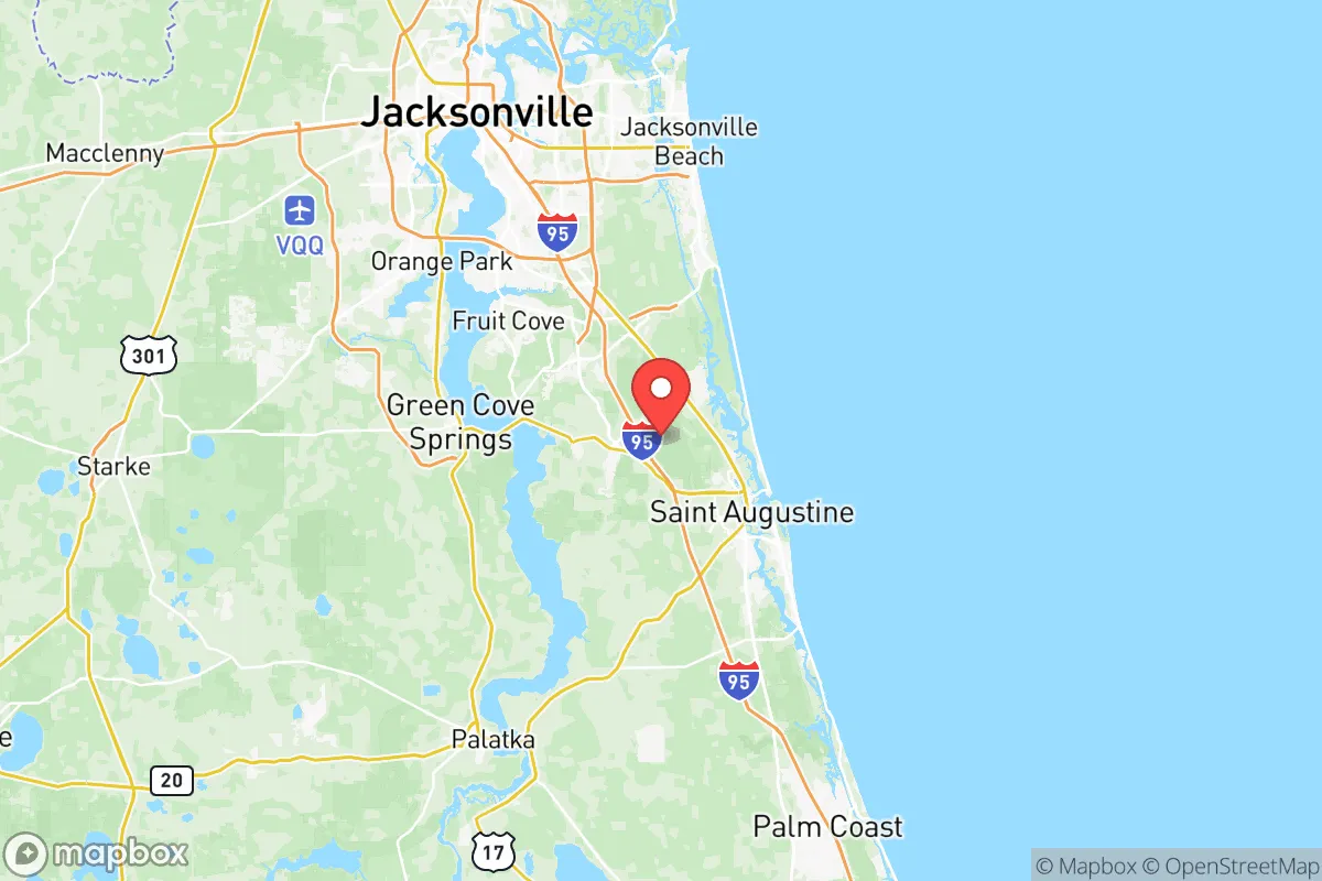
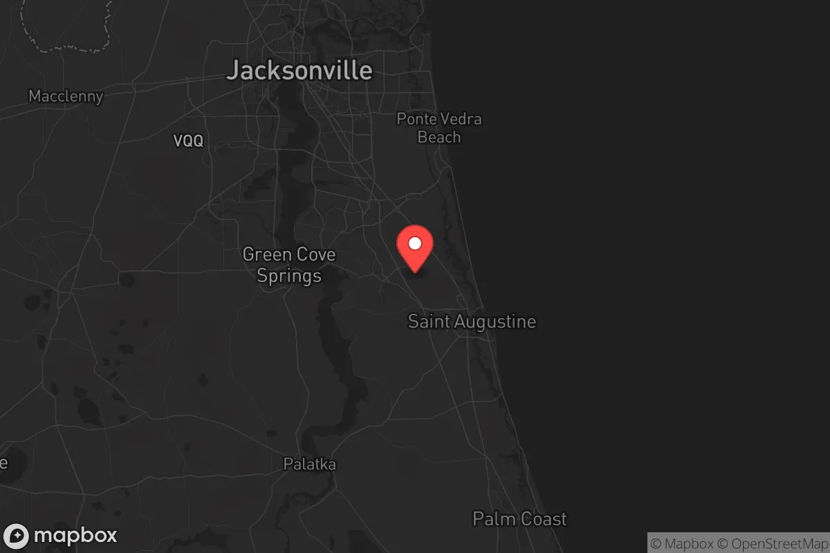
St. Johns County, Florida, offers a compelling strategic position for those prioritizing resilience and self-sufficiency in an uncertain future. Its location along the Atlantic coast, anchored by the historic city of St. Augustine and stretching south to the outskirts of Palm Coast, provides a buffer from the immediate fallout zones of major metropolitan centers while retaining access to critical infrastructure. The county’s geography—a mix of coastal barrier islands, inland waterways like the St. Johns River, and dense pine forests—creates natural chokepoints and defensible terrain that a prepper or survivalist would recognize as valuable. For a conservative-leaning relocator concerned with civic stability and disaster preparedness, this area balances proximity to resources with the ability to isolate and endure.
Geographic position and natural advantages for long-term security
St. Johns County sits in a sweet spot: far enough from Jacksonville’s urban core (about 30 miles south) to avoid the worst of a city-wide collapse or mass casualty event, yet close enough to tap into its medical and logistical hubs if needed. The county’s eastern edge is the Atlantic Ocean, offering a natural barrier against land-based threats, while the St. Johns River forms a western boundary that can be monitored and controlled. The terrain is mostly flat with sandy soils, but the dense forests around areas like Hastings and the agricultural zones near the Flagler County line provide cover and isolation. The climate is subtropical, meaning year-round growing seasons for food production—a critical advantage for long-term self-sufficiency. Unlike the hurricane-prone Gulf Coast, St. Johns County’s storms typically track north or west, reducing the frequency of direct hits, though the 2022 Hurricane Ian impacts showed that even glancing blows can cause power outages and flooding in low-lying areas like Vilano Beach and Davis Shores.
Risks, exposures, and proximity to fallout-relevant landmarks
No location is without vulnerabilities, and St. Johns County has several that a strategic relocator must weigh. The most obvious is the nuclear power plant at St. Lucie, about 100 miles south—a potential target for sabotage or accident that could render large swaths of the coast uninhabitable depending on wind patterns. Closer to home, the Mayport Naval Station in Jacksonville (home to the U.S. Navy’s Atlantic Fleet) and the Kings Bay Naval Submarine Base in Georgia (about 60 miles north) are high-value military assets that could become focal points for conflict or civil unrest. The Port of Jacksonville (JAXPORT) is a major logistics hub for fuel and container shipping; a disruption there would ripple south into St. Johns County within days. On the plus side, the county lacks the dense refinery corridors of Texas or Louisiana, and the nearest major petrochemical complex is in Tampa, over 150 miles away. The biggest natural risk is hurricane storm surge, which threatens coastal communities like Anastasia Island and Crescent Beach—any property below 10 feet elevation should be considered a secondary or temporary location, not a primary retreat. Flood zones along the St. Johns River and its tributaries (e.g., the Matanzas River) also require careful mapping before purchase.
Practical resilience for a relocator: food, water, energy, and defensibility
For a single individual or family looking to hunker down, St. Johns County offers a mix of strengths and gaps. Water is abundant: the Floridan Aquifer lies beneath the entire county, and shallow wells can be drilled in most areas outside the coastal barrier islands. The St. Johns River itself is a reliable surface water source, though it requires filtration due to agricultural runoff and brackish intrusion near the coast. Food production is viable—the county has a strong agricultural base in crops like potatoes, cabbage, and sod, with working farms around Elkton and the agricultural corridor along State Road 207. Backyard gardening is feasible year-round, and the long growing season means a family can produce a significant portion of their own calories. Energy resilience is a mixed bag: the grid is vulnerable to hurricane outages (the 2024 hurricane season saw multi-day blackouts in parts of the county), but solar adoption is growing, and many rural properties can install off-grid systems without HOA restrictions. The county’s defensibility is moderate: the barrier islands and river crossings create natural chokepoints, but the flat terrain means a determined group could move through the interior. The best strategy is to locate inland, away from major highways like I-95 and US-1, in areas like the rural stretches near the Putnam County line or the woodlands around the St. Johns River’s western banks. These zones offer isolation, access to water, and the ability to monitor approach routes.
The overall strategic picture for St. Johns County is one of calculated trade-offs. It is not a remote mountain redoubt—it is a coastal county with real exposure to hurricanes, military targets, and the ripple effects of Jacksonville’s urban problems. But for a relocator who values access to fresh water, a long growing season, and a politically conservative population (the county voted +18 points Republican in 2024), it offers a foundation that can be hardened over time. The key is to avoid the tourist-heavy zones of St. Augustine and the beach communities, and instead focus on the inland agricultural and forested areas where a family can build a self-sufficient homestead. Pair that with a well-stocked pantry, a reliable water filtration system, and a plan for evacuation to the interior (the Ocala National Forest is a 90-minute drive west), and St. Johns County becomes a viable base for weathering the storms—both literal and societal—that lie ahead.
* Values derived from national, state, county, city and local statistics and may differ in a specific area. Last updated: 2026-06-05T17:46:50.000Z
Narrative content on this page is AI-generated and may contain mistakes. Verify any details that matter before acting on them.
ReloMaps may earn a commission from affiliate links at no extra cost to you.