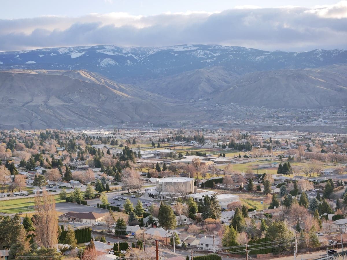
Photo: Wikipedia
Strategic Assessment of East Wenatchee, WA
Workable tactical position. Some exposure to population density or targets, but generally defensible in a crisis.
What does the Strategic Assessment tell us?
Our Strategic Assessment grades tactical survivability of an area. Major population centers, military targets, fallout zones, natural disasters, and border exposure all drive risk — lower exposure means a more defensible position in a crisis.
This is heavily inspired by Joel Skousen's Strategic Relocation book. Highly recommended you checkout the book ($)What does this tell us?
Our Strategic Assessment grades tactical survivability of an area. Major population centers, military targets, fallout zones, natural disasters, and border exposure all drive risk — lower exposure means a more defensible position in a crisis.
This is heavily inspired by Joel Skousen's Strategic Relocation book. Highly recommended you checkout the book ($)Strategic Pillars

Key Distances
Regional Safe Places
Below is our recommended "safe zones" in Washington and the surrounding area based on our strategic heuristics. For most people, it's unrealistic to live in a “safe zone” full-time due to work, family or other personal reasons. They tend to be more rural. However, many of these areas are perfect for second homes and retreat properties that double as a vacation home or even a short-term rental.
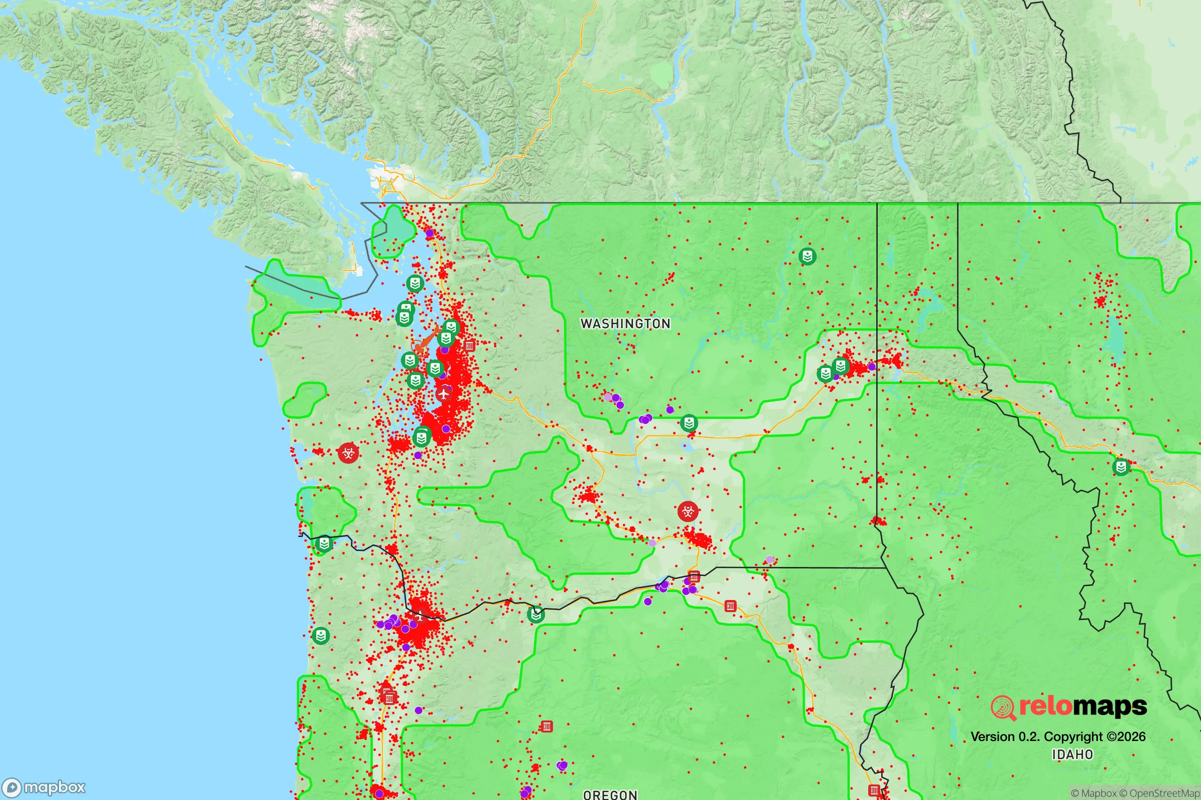
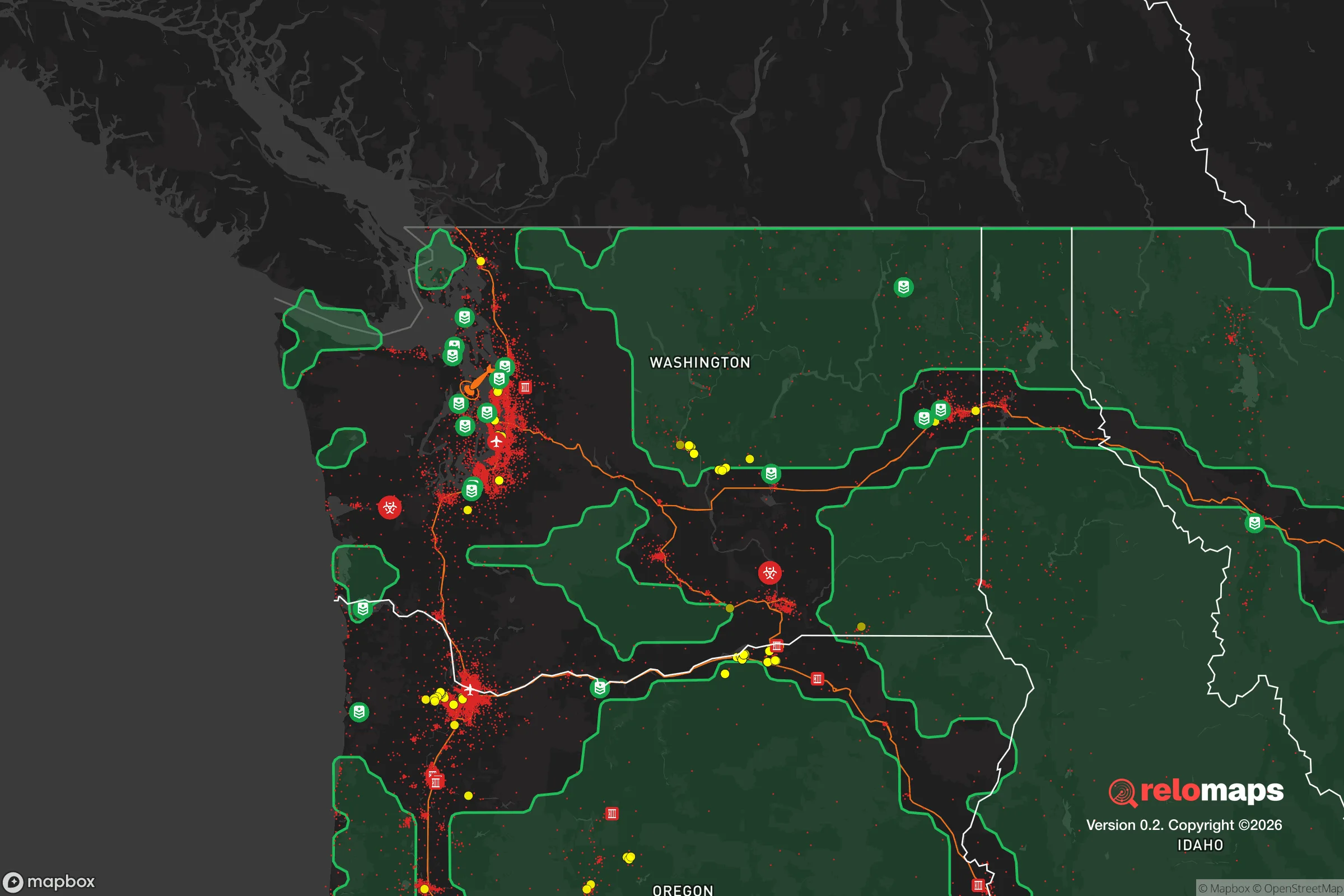


Important Note: For informational purposes only. This does not mean nothing bad ever happens in the green zones. Please use common sense. This is based on public data and modeled with AI. We tried to take a conservative approach but mistakes happen. We update this regularly as new information becomes available.
Solar Generator Recommendations
Backup power matters more here than in safer locations. We've picked three solar generators across budgets and capacity tiers — start with the budget unit if you only need a few essentials, or step up if you want to run a fridge and HVAC for days at a time.

Jackery Portable Power Station Explorer 300
Budget OptionPower on the Go: Weighing only 11 lbs, it's convenient to set up and store with book-sized foldable solar panels

BLUETTI Portable Power Station AC180
Designed for both indoor and outdoor scenarios, AC180 is highly capable as it has a robost capacity and continuous output power.

EF ECOFLOW DELTA Pro Ultra Power Station
Upgraded PickEcoFlow DELTA Pro Ultra is a whole-home energy system designed to grow with your family. Integrated with the Smart Home Panel 2, it scales to meet your evolving energy needs — keeping your home powered, intelligent, and secure through every stage of life.
We earn a commission, at no additional cost to you.
Strategic Assessment Analysis
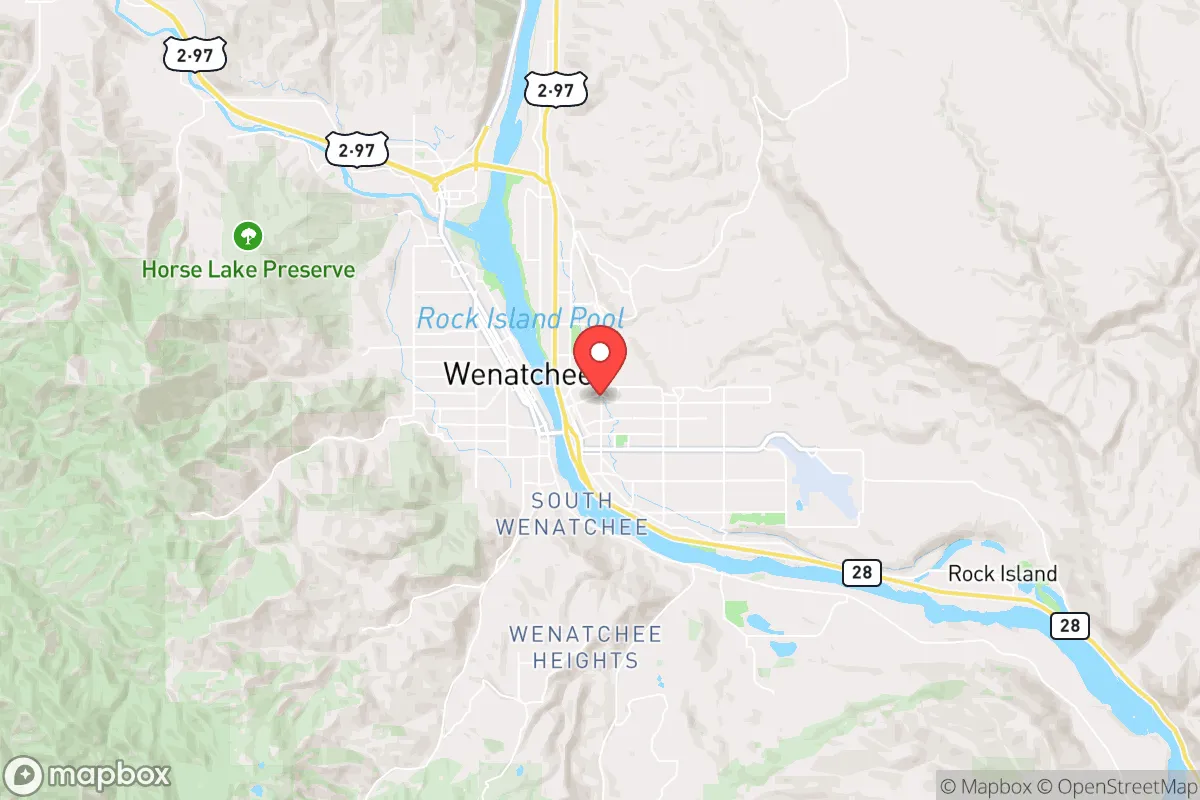
East Wenatchee, Washington, offers a compelling mix of strategic advantages and notable vulnerabilities for the disaster-conscious relocator. Its position on the Columbia River, shielded by the Cascade Range, provides a natural buffer against coastal threats while maintaining proximity to essential infrastructure. However, the area’s location near major transportation corridors and a key hydroelectric dam introduces specific risks that require careful consideration for anyone prioritizing long-term self-sufficiency and resilience.
Geographic position and natural advantages for long-term stability
East Wenatchee sits in the Columbia River Valley, on the eastern slope of the Cascade Range. This geography provides a significant natural advantage: the mountains act as a barrier against the worst of a Cascadia Subduction Zone earthquake’s shaking and any potential tsunami from the Pacific coast. The region’s semi-arid climate, averaging about 9 inches of precipitation annually, reduces risks associated with flooding and wildfire compared to western Washington. The Columbia River itself is a reliable water source, though its accessibility for individual use is regulated. The surrounding terrain—a mix of irrigated orchards, sagebrush steppe, and low hills—offers multiple egress routes via US-2, US-97, and SR-28, though these roads can become bottlenecks during an evacuation. The area’s agricultural base, particularly apple and cherry orchards, provides a local food supply that is a genuine asset for long-term resilience, though it is tied to irrigation systems dependent on power and infrastructure.
Risks, exposures, and proximity to fallout-relevant landmarks
The most significant risk for East Wenatchee is its proximity to the Rocky Reach Dam, a major hydroelectric facility on the Columbia River about 10 miles upstream. A catastrophic dam failure—whether from a seismic event, sabotage, or structural failure—would inundate large portions of the valley, including downtown East Wenatchee and its sister city Wenatchee. The inundation zone for a dam failure is well-documented and covers much of the low-lying residential and commercial areas. Additionally, the area sits near the Wenatchee Valley Mall and the regional medical center, which are potential targets for secondary effects in a crisis. The nearby BNSF Railway line, which carries freight including hazardous materials, runs along the river and presents a constant, if low-probability, risk of chemical spill or derailment. For the fallout-conscious reader, East Wenatchee is roughly 130 miles from the Hanford Site, a decommissioned nuclear production facility. While prevailing winds generally blow eastward, a major release could still affect the region depending on weather patterns. The area’s location near the Cascade Range also places it within the moderate-to-high risk zone for volcanic ashfall from Mount Rainier or Glacier Peak, which could disrupt air travel, water supplies, and agriculture for weeks.
Practical resilience for a relocator: food, water, energy, and defensibility
For the self-sufficient relocator, East Wenatchee offers a mixed picture. Water is the strongest asset: the Columbia River is a massive, reliable source, but accessing it requires legal permits and infrastructure (pumps, filtration, storage). Most residential water comes from municipal systems drawing from the river or groundwater, which are vulnerable to power outages and contamination. A private well with a hand pump or a rainwater catchment system would be a wise investment. Food resilience is high due to the local agricultural industry. The region is a major producer of apples, pears, cherries, and soft fruits. Farmers markets and u-pick operations are common, and the growing season is long enough for home gardening. However, this food supply is heavily dependent on irrigation water from the Columbia River, which is managed by the Bureau of Reclamation and could be disrupted in a prolonged crisis. Energy is a vulnerability. The area relies on the regional power grid, which is fed by hydroelectric dams. A major earthquake or dam failure would likely cause prolonged blackouts. Solar is viable given the region’s 300+ sunny days per year, but battery storage is essential for nighttime and winter use. Natural gas is available in some areas but is not a resilient backup. Defensibility is moderate. The valley floor is open and accessible, but the surrounding hills and rural areas offer more defensible positions with good sightlines and limited access points. The local population is generally self-reliant and community-oriented, with a strong hunting and outdoor culture, which can be an asset for mutual aid. However, the area’s proximity to the larger Wenatchee metro area (population ~35,000) means that in a crisis, the population could swell with refugees from the west side of the mountains, straining local resources.
The overall strategic picture for East Wenatchee is one of calculated trade-offs. It offers genuine advantages in water availability, local food production, and a climate that supports year-round habitation without extreme weather. The primary risks are man-made: dam failure, hazardous material transport, and proximity to a nuclear waste site. For the relocator who is willing to invest in off-grid water and power systems, and who chooses a home site outside the dam inundation zone, East Wenatchee can be a resilient base. It is not a remote, off-grid haven—it is a small city with the benefits and vulnerabilities that entails. The key is to treat it as a strategic location that requires active preparation, not a passive safe zone. The area’s resilience is real, but it is conditional on understanding and mitigating the specific risks that come with living in a river valley powered by dams.

* Values derived from national, state, county, city and local statistics and may differ in a specific area. Last updated: 2026-08-15T00:47:05.000Z
Narrative content on this page is AI-generated and may contain mistakes. Verify any details that matter before acting on them.
ReloMaps may earn a commission from affiliate links at no extra cost to you.

