Strategic Assessment of Dutch Island, GA
Workable tactical position. Some exposure to population density or targets, but generally defensible in a crisis.
What does the Strategic Assessment tell us?
Our Strategic Assessment grades tactical survivability of an area. Major population centers, military targets, fallout zones, natural disasters, and border exposure all drive risk — lower exposure means a more defensible position in a crisis.
This is heavily inspired by Joel Skousen's Strategic Relocation book. Highly recommended you checkout the book ($)What does this tell us?
Our Strategic Assessment grades tactical survivability of an area. Major population centers, military targets, fallout zones, natural disasters, and border exposure all drive risk — lower exposure means a more defensible position in a crisis.
This is heavily inspired by Joel Skousen's Strategic Relocation book. Highly recommended you checkout the book ($)Strategic Pillars

Key Distances
Regional Safe Places
Below is our recommended "safe zones" in Georgia and the surrounding area based on our strategic heuristics. For most people, it's unrealistic to live in a “safe zone” full-time due to work, family or other personal reasons. They tend to be more rural. However, many of these areas are perfect for second homes and retreat properties that double as a vacation home or even a short-term rental.
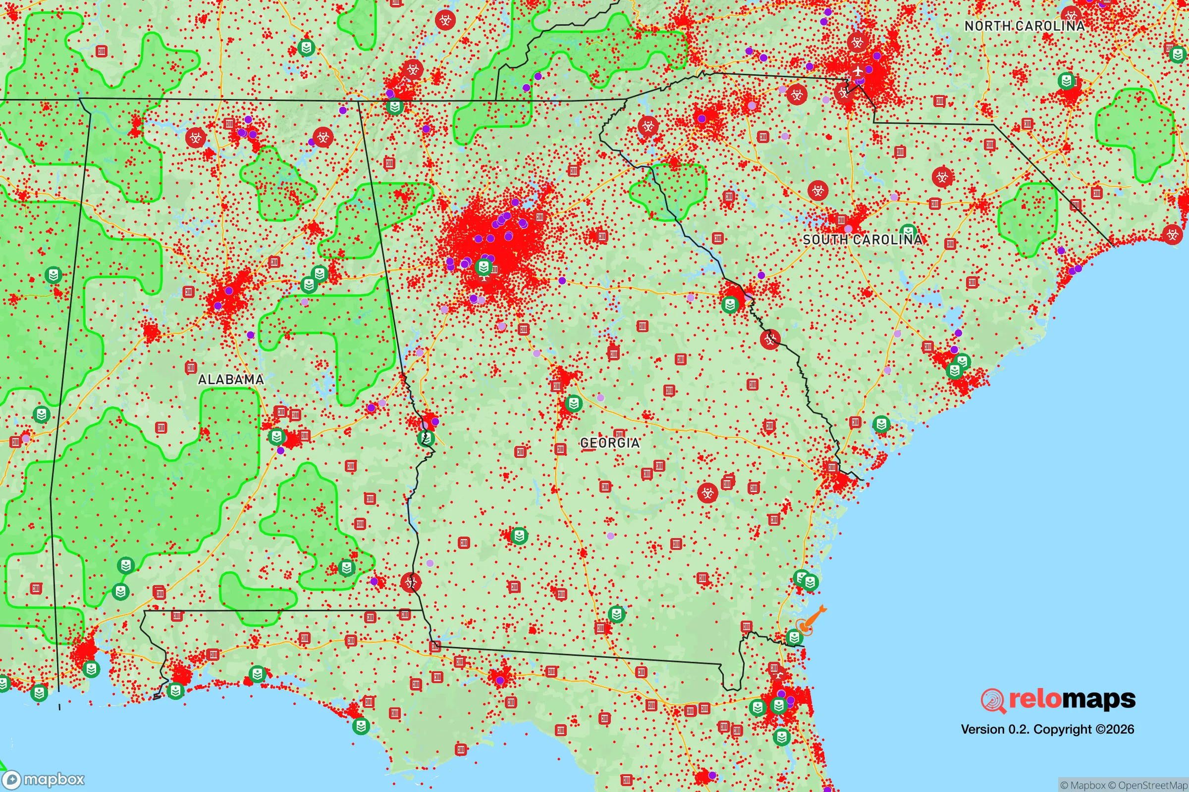
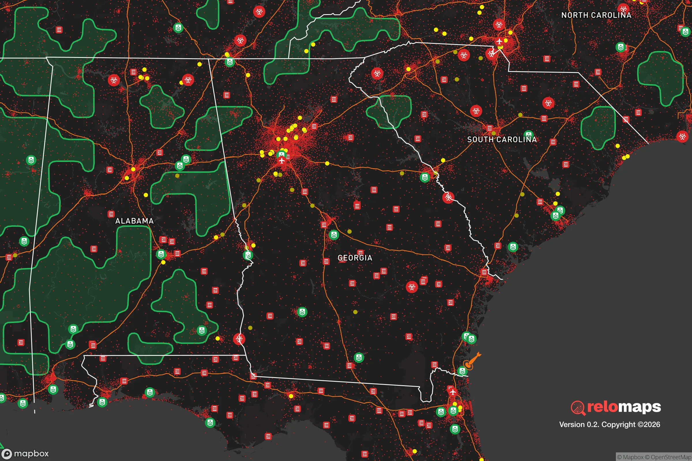


Important Note: For informational purposes only. This does not mean nothing bad ever happens in the green zones. Please use common sense. This is based on public data and modeled with AI. We tried to take a conservative approach but mistakes happen. We update this regularly as new information becomes available.
Solar Generator Recommendations
Backup power matters more here than in safer locations. We've picked three solar generators across budgets and capacity tiers — start with the budget unit if you only need a few essentials, or step up if you want to run a fridge and HVAC for days at a time.

Jackery Portable Power Station Explorer 300
Budget OptionPower on the Go: Weighing only 11 lbs, it's convenient to set up and store with book-sized foldable solar panels

BLUETTI Portable Power Station AC180
Designed for both indoor and outdoor scenarios, AC180 is highly capable as it has a robost capacity and continuous output power.

EF ECOFLOW DELTA Pro Ultra Power Station
Upgraded PickEcoFlow DELTA Pro Ultra is a whole-home energy system designed to grow with your family. Integrated with the Smart Home Panel 2, it scales to meet your evolving energy needs — keeping your home powered, intelligent, and secure through every stage of life.
We earn a commission, at no additional cost to you.
Strategic Assessment Analysis
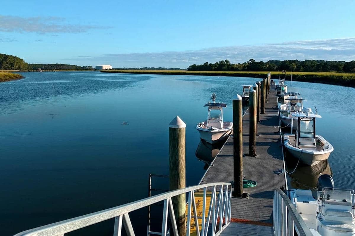
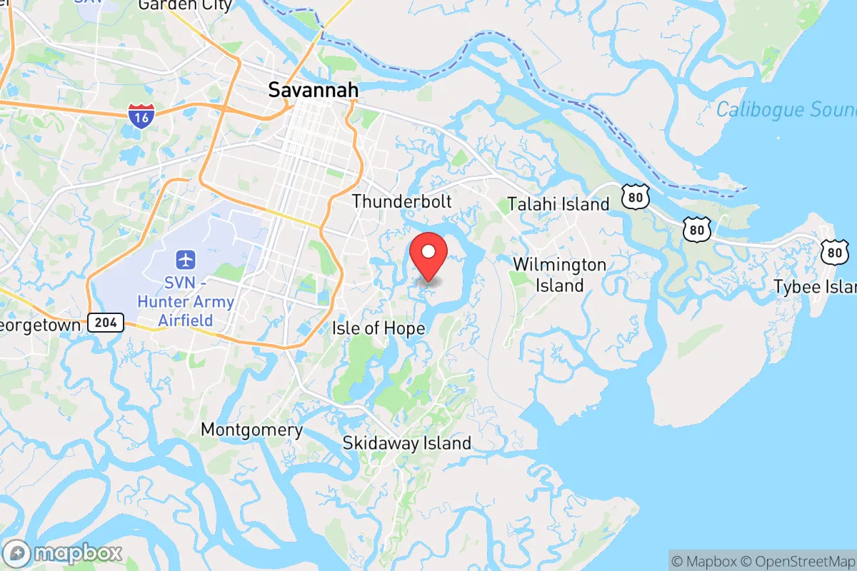
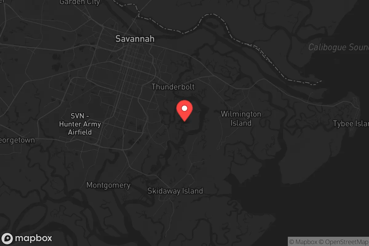
Dutch Island, Georgia, offers a surprisingly resilient position for relocators prioritizing disaster readiness and self-sufficiency, provided they understand its specific trade-offs. Located in Chatham County, roughly 15 miles southeast of downtown Savannah and just west of the Savannah River, the area benefits from a semi-rural buffer while remaining within reach of coastal resources. Its strategic value lies in moderate isolation from the densest urban zones, access to tidal creeks and marshlands, and a climate that, while humid and storm-prone, supports year-round food production. For a single individual or family thinking seriously about long-term preparedness, Dutch Island presents a viable base—but one that demands careful planning around flood exposure, supply chain dependencies, and proximity to regional infrastructure that could become a liability in a crisis.
Geographic position and natural advantages for long-term security
Dutch Island sits on a low-lying peninsula between the Little Ogeechee River and the Ogeechee River, with the Atlantic Intracoastal Waterway running just to the east. This water-rich environment provides multiple natural advantages for a resilience-minded relocator. The surrounding marshlands and tidal creeks create a natural buffer against overland approach, limiting easy access by road to a handful of routes—primarily Georgia State Route 204 (Abercorn Street Extension) and the Islands Expressway. In a grid-down or security-compromised scenario, this chokepoint geography makes Dutch Island inherently more defensible than sprawling suburban tracts. The area's elevation averages only 10 to 15 feet above sea level, but the presence of established maritime forest and salt marsh offers some storm surge attenuation. The proximity to the Ogeechee River also means fresh water access for filtration, though surface water in this region requires robust treatment due to agricultural runoff and brackish intrusion. For a relocator, the key takeaway is that Dutch Island's position offers a balance of moderate isolation from Savannah's urban core—roughly a 20-minute drive under normal conditions—while still providing access to the Port of Savannah and regional medical facilities at Memorial Health University Medical Center if needed.
Risks, exposures, and proximity to fallout-relevant landmarks
The most significant risk for Dutch Island residents is storm surge and flooding from tropical cyclones. The area falls within the Category 1–2 storm surge zone for hurricanes making landfall along the Georgia coast, and the 2024 hurricane season demonstrated that even minor storms can produce significant tidal flooding in low-lying neighborhoods. The Federal Emergency Management Agency (FEMA) designates much of Dutch Island as Zone AE (base flood elevation required), meaning flood insurance is mandatory for mortgages and strongly advisable for all property owners. Beyond natural hazards, the region's proximity to the Port of Savannah—the fourth-busiest container port in the United States—introduces man-made risk. In a major conflict or supply chain disruption, the port becomes a high-value target for cyberattack, sabotage, or conventional strike. Dutch Island lies roughly 12 miles from the port's main terminals, close enough to experience secondary effects from a detonation or industrial accident at the port's chemical storage facilities. Additionally, the Savannah River Site, a nuclear materials processing facility located about 50 miles upriver near Aiken, South Carolina, represents a distant but non-trivial fallout concern. While Dutch Island is outside the most severe plume zones for a hypothetical release, prevailing winds from the northwest could carry contamination toward the coast. For the relocator, these risks mean that a comprehensive emergency plan must account for both hurricane evacuation routes and potential radiological or industrial incidents originating from the Savannah River corridor.
Practical resilience for a relocator: food, water, energy, and defensibility
Dutch Island's practical resilience profile is mixed but workable with deliberate investment. Food production is a genuine strength: the long growing season (March through November) and sandy loam soils support home gardens, fruit trees (figs, persimmons, citrus with protection), and small livestock. The area's rural zoning allows chickens, goats, and even pigs on parcels of one acre or more, which is common in Dutch Island's subdivisions. Local farmers' markets and seafood co-ops in nearby Thunderbolt and Tybee Island provide backup sources, though these would be disrupted in a prolonged emergency. Water is the critical vulnerability. Most homes rely on municipal water from the City of Savannah's system, which draws from the Floridan Aquifer. In a power outage lasting more than 48 hours, water pressure drops and boil advisories become likely. A relocator should plan for at least two weeks of stored potable water (one gallon per person per day) plus a backup well or rainwater catchment system. The high water table (typically 5–10 feet down) makes shallow wells feasible, but permitting and installation require lead time. Energy resilience is achievable: solar irradiance in the region averages 4.5 peak sun hours per day, sufficient for a grid-tied system with battery backup. However, the tree canopy in many Dutch Island lots may require clearing for optimal panel placement. Defensibility is moderate. The road network funnels traffic through a few main arteries, which is an advantage for monitoring approach routes but a liability if evacuation becomes necessary. Neighbors tend to be a mix of long-term families and second-home owners, so community cohesion varies by subdivision. Establishing relationships with nearby property owners before a crisis is essential for mutual aid and shared security.
The overall strategic picture for Dutch Island is one of calculated viability for the serious prepper or resilience-minded relocator. It offers genuine advantages in food production, water access, and moderate isolation from Savannah's urban density, while the climate supports year-round subsistence gardening and small-scale agriculture. The trade-offs are real: hurricane and flood risk demand robust structural preparation and evacuation planning, and the proximity to the Port of Savannah and Savannah River Site introduces man-made hazards that cannot be ignored. For a family willing to invest in flood mitigation, backup water systems, and solar energy, Dutch Island provides a defensible, resource-rich base that outperforms most coastal Georgia alternatives. It is not a bug-out location for a complete societal collapse—the population density and infrastructure dependencies are too high for that—but for a relocator seeking a resilient home base within a two-hour drive of major medical and logistical resources, Dutch Island deserves serious consideration. The key is to treat it as a long-term homesteading project rather than a turnkey retreat, and to build redundancy into every critical system before the next storm or disruption arrives.

* Values derived from national, state, county, city and local statistics and may differ in a specific area. Last updated: 2026-07-14T18:17:41.000Z
Narrative content on this page is AI-generated and may contain mistakes. Verify any details that matter before acting on them.
ReloMaps may earn a commission from affiliate links at no extra cost to you.

