Photo: Wikipedia
Strategic Assessment of Derby, KS
Meaningful friction. Expect exposure to either population pressure, blast zones, or natural disaster risk. Consider buying a retreat property.
What does the Strategic Assessment tell us?
Our Strategic Assessment grades tactical survivability of an area. Major population centers, military targets, fallout zones, natural disasters, and border exposure all drive risk — lower exposure means a more defensible position in a crisis.
This is heavily inspired by Joel Skousen's Strategic Relocation book. Highly recommended you checkout the book ($)What does this tell us?
Our Strategic Assessment grades tactical survivability of an area. Major population centers, military targets, fallout zones, natural disasters, and border exposure all drive risk — lower exposure means a more defensible position in a crisis.
This is heavily inspired by Joel Skousen's Strategic Relocation book. Highly recommended you checkout the book ($)Strategic Pillars

Key Distances
Regional Safe Places
Below is our recommended "safe zones" in Kansas and the surrounding area based on our strategic heuristics. For most people, it's unrealistic to live in a “safe zone” full-time due to work, family or other personal reasons. They tend to be more rural. However, many of these areas are perfect for second homes and retreat properties that double as a vacation home or even a short-term rental.
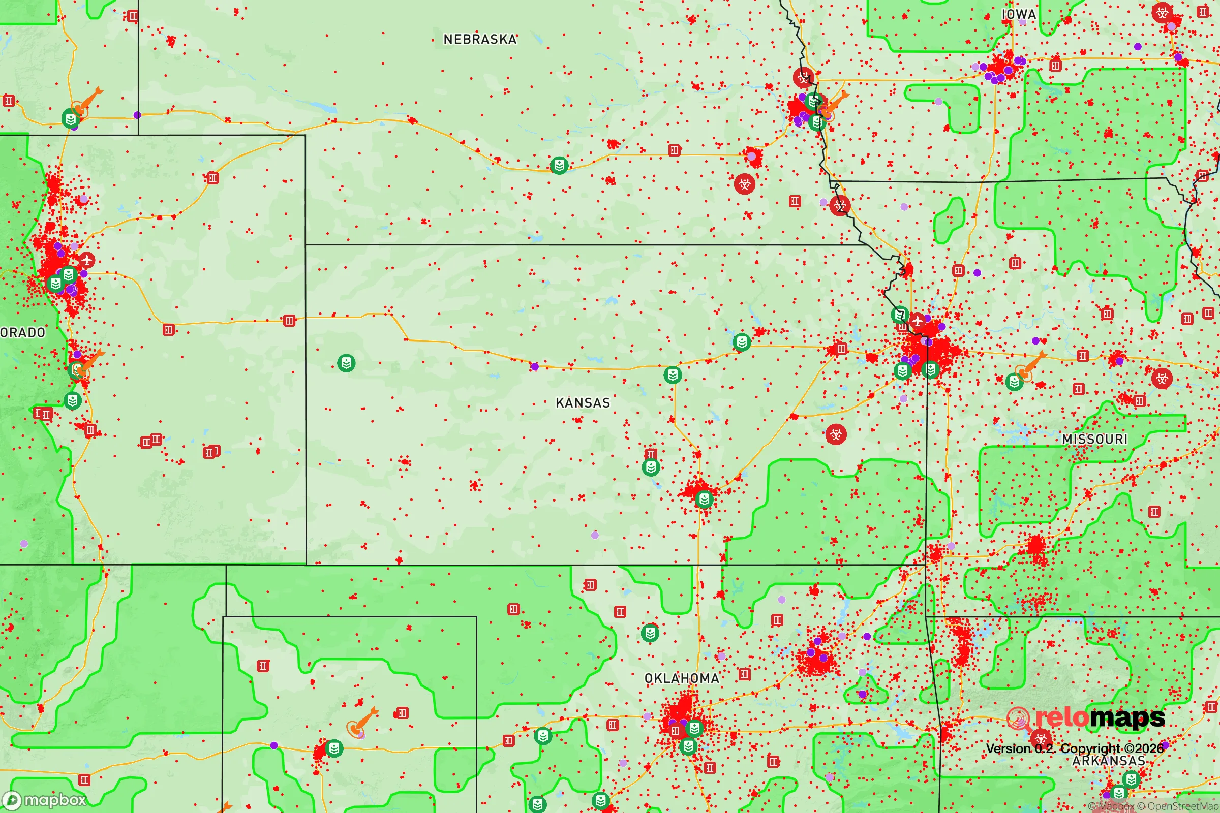
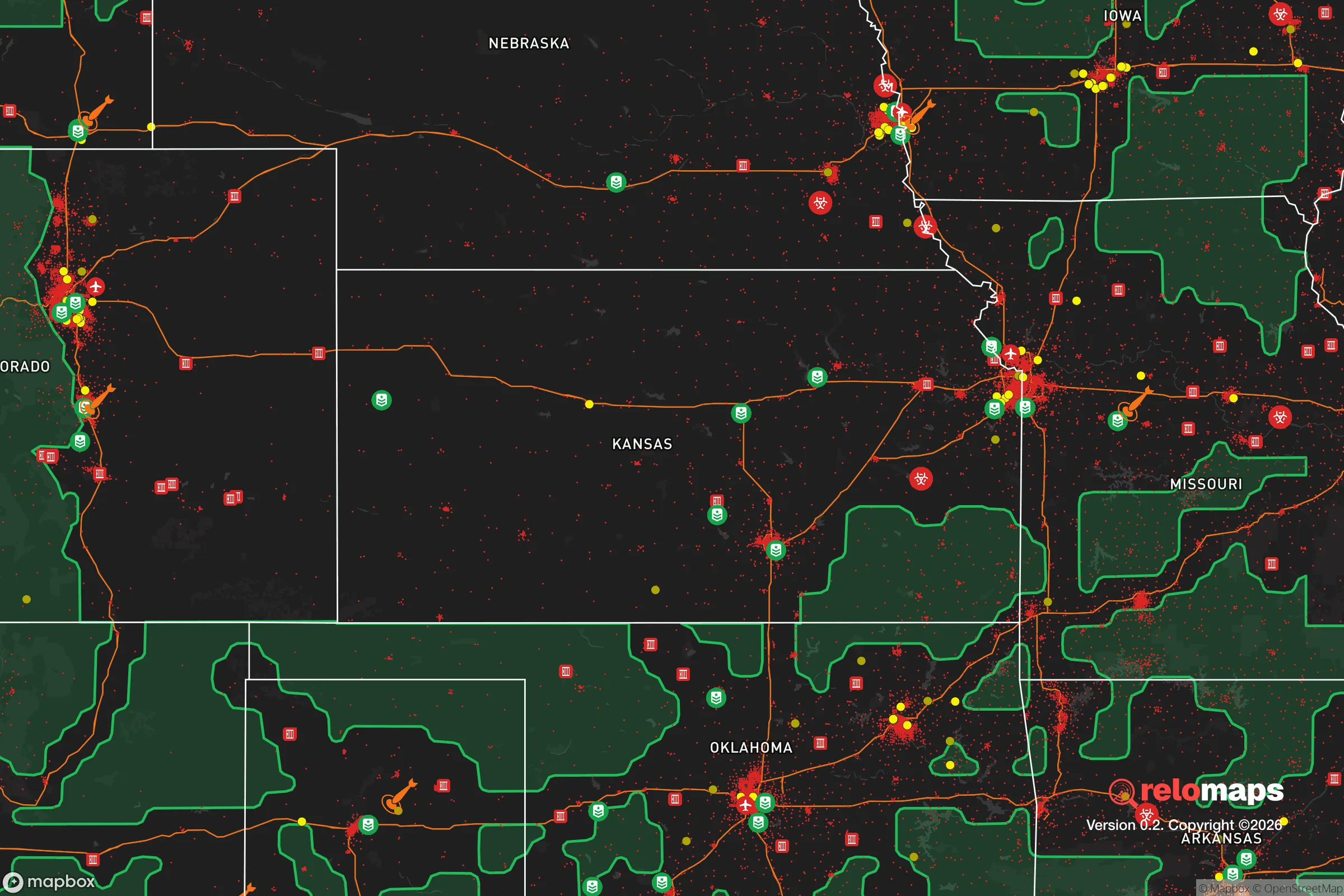
Important Note: For informational purposes only. This does not mean nothing bad ever happens in the green zones. Please use common sense. This is based on public data and modeled with AI. We tried to take a conservative approach but mistakes happen. We update this regularly as new information becomes available.
Solar Generator Recommendations
Backup power matters more here than in safer locations. We've picked three solar generators across budgets and capacity tiers — start with the budget unit if you only need a few essentials, or step up if you want to run a fridge and HVAC for days at a time.

Jackery Portable Power Station Explorer 300
Budget OptionPower on the Go: Weighing only 11 lbs, it's convenient to set up and store with book-sized foldable solar panels

BLUETTI Portable Power Station AC180
Designed for both indoor and outdoor scenarios, AC180 is highly capable as it has a robost capacity and continuous output power.

EF ECOFLOW DELTA Pro Ultra Power Station
Upgraded PickEcoFlow DELTA Pro Ultra is a whole-home energy system designed to grow with your family. Integrated with the Smart Home Panel 2, it scales to meet your evolving energy needs — keeping your home powered, intelligent, and secure through every stage of life.
We earn a commission, at no additional cost to you.
Strategic Assessment Analysis
Derby, Kansas, offers a surprisingly resilient strategic position for those prioritizing preparedness and self-reliance, sitting just south of Wichita yet maintaining a distinct small-town character that buffers it from the worst of urban collapse scenarios. Its location along the Arkansas River and within the broader Great Plains corridor provides natural advantages for food production and water access, while its distance from major military and industrial targets—relative to larger cities—reduces exposure to primary fallout zones. For a relocator thinking in terms of decades, not just years, Derby presents a workable balance between access to resources and separation from the risks that come with dense population centers.
Geographic position and natural advantages for long-term security
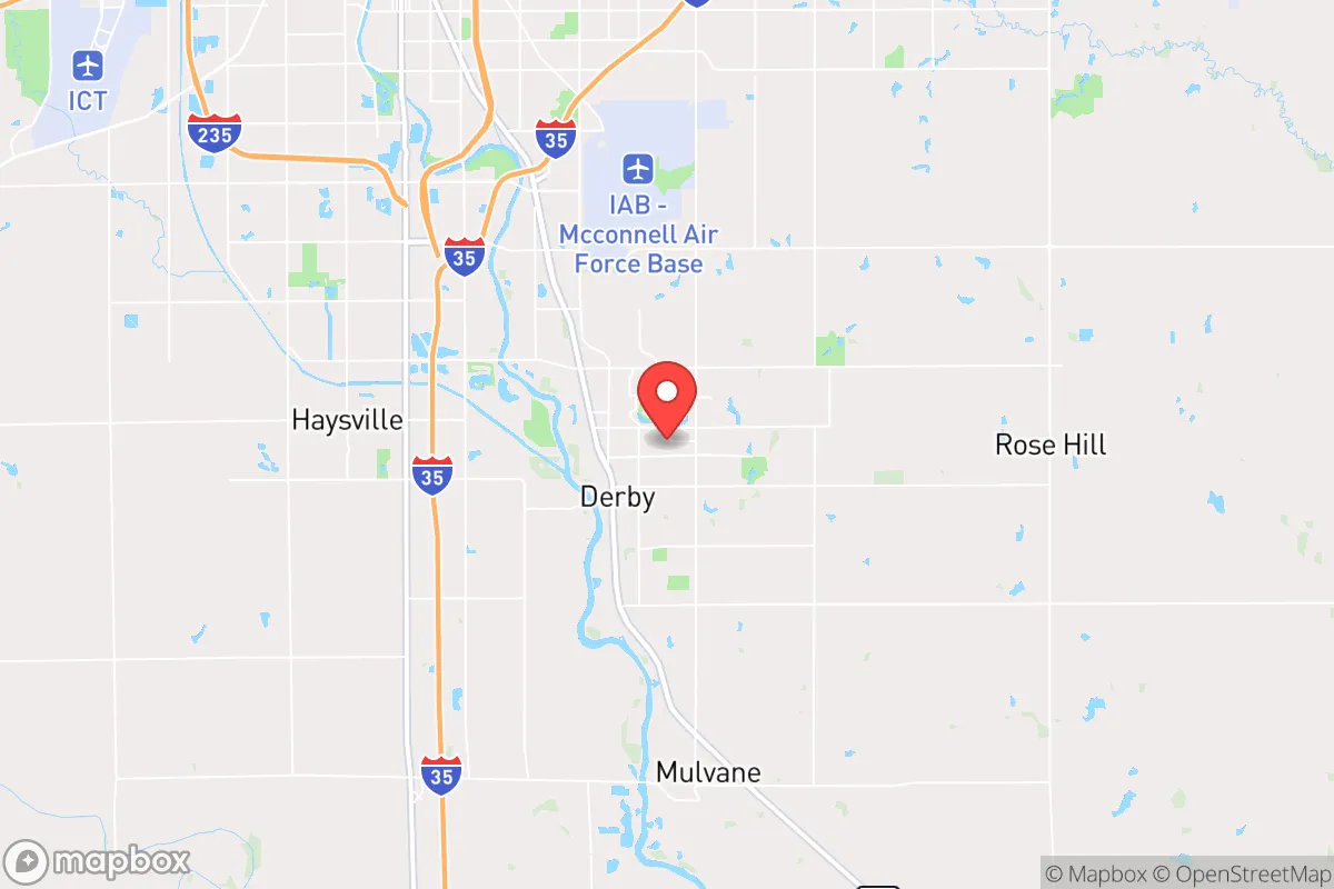
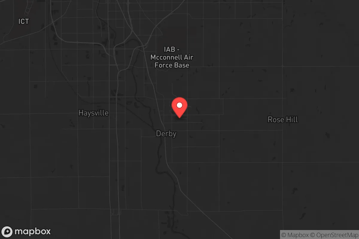
Derby sits in Sedgwick County, roughly 10 miles south of downtown Wichita, placing it on the southern edge of the region’s largest urban area. This proximity is a double-edged sword: it provides immediate access to Wichita’s medical infrastructure, supply chains, and employment—important for initial settlement—but also means that any major disruption in Wichita will ripple into Derby within hours. The Arkansas River runs through the area, offering a reliable surface water source that can be tapped for irrigation or emergency use, though it’s not pristine and would require filtration. The surrounding terrain is flat to gently rolling, with deep, fertile soils that support agriculture—a critical asset for anyone planning to grow food long-term. Derby’s elevation (roughly 1,300 feet) and inland position mean it’s far from coastal storm surge or tsunami risks, and tornadoes are the primary natural hazard, which can be mitigated with proper shelter construction. The region’s low population density relative to the East or West Coasts means that in a grid-down scenario, you’re not competing with millions for the same resources—Sedgwick County’s population density is about 400 people per square mile, compared to over 1,000 in many suburban rings of larger metros.
Risks, exposures, and proximity to fallout-relevant landmarks
The most significant strategic downside of Derby is its proximity to McConnell Air Force Base, located just 8 miles north-northeast in Wichita. McConnell is home to the 22nd Air Refueling Wing and the 931st Air Refueling Wing, operating KC-135 and KC-46 tankers—assets that would be high-priority targets in any major conflict. A direct strike on McConnell would produce a fallout plume that, depending on wind direction, could heavily contaminate Derby within hours. The prevailing winds in Kansas are from the south and southwest, meaning Derby is generally upwind of McConnell, but a shift to a north or northeast wind would put the city directly in the danger zone. Additionally, Wichita’s industrial base—including Spirit AeroSystems, which manufactures fuselages for Boeing and Airbus—represents a secondary target set. For a prepper, this means Derby’s survivability in a nuclear exchange scenario is conditional: you’d need a fallout shelter with at least 2 feet of earth cover and a plan to stay inside for 2-4 weeks post-event. Beyond military targets, the area’s risk profile includes potential civil unrest spilling over from Wichita during economic collapse or political turmoil. The city’s population of roughly 25,000 is small enough that localized violence is unlikely, but the 400,000-plus people in Wichita could create refugee flows south along I-35 and K-15, which both run through Derby. Your defensibility plan must account for securing your property against transient groups moving along these corridors, especially if Wichita’s police and National Guard resources are overwhelmed.
Practical resilience for a relocator: food, water, energy, and defensibility
Derby’s practical resilience is strong for a suburban setting, but it requires active preparation rather than passive reliance on infrastructure. The city’s water supply comes from the Wichita Water Department, which draws from the Cheney Reservoir and the Equus Beds aquifer—both are vulnerable to contamination or pump failure during a prolonged grid outage. Installing a well on your property is the single most important resilience upgrade, as the water table in Sedgwick County is generally accessible at depths of 50-150 feet, and a hand-pump or solar-powered pump can provide water without grid electricity. For food, the surrounding agricultural land is some of the most productive in the country, with corn, soybeans, and wheat as primary crops. You can supplement with a substantial garden—the growing season runs from April to October, and the soil is workable with basic tools. Local farmers’ markets and co-ops exist, but in a crisis, barter networks with rural neighbors will be more reliable than store shelves. Energy resilience is moderate: Derby is served by Evergy, which has a mixed grid of coal, natural gas, and wind, but outages during ice storms or tornadoes are common. Solar panels with battery storage are a viable investment, as Kansas averages 200 sunny days per year. For defensibility, Derby’s layout is typical of a planned suburb—curving streets, cul-de-sacs, and a few main arteries. This creates natural chokepoints at the intersections of Rock Road, 71st Street, and K-15, which you can monitor or block if needed. Your home should be on a corner lot or have a clear field of fire to the street, and you should establish a neighborhood watch or mutual-aid group with like-minded neighbors before any crisis hits. The city’s police force is small (about 40 officers), so in a widespread emergency, you cannot rely on them for protection—self-defense training and a secure armory are non-negotiable.
The overall strategic picture for Derby is one of cautious optimism for the prepared relocator. It avoids the worst vulnerabilities of major metros while retaining enough infrastructure to support a comfortable modern life during stable times. The risks from McConnell Air Force Base and Wichita’s urban spillover are real but manageable with proper planning—a fallout shelter, a well, a garden, and a community of trusted neighbors. For a conservative-leaning individual or family who values self-reliance, local control, and a slower pace of life, Derby offers a solid foundation. The key is to treat it as a base of operations, not a final fortress: maintain a bug-out location farther south or west (toward the Oklahoma panhandle or the Flint Hills) for worst-case scenarios, and invest in skills like water purification, first aid, and small-scale farming. In a world where the state of the country feels increasingly fragile, Derby provides a defensible, resource-rich anchor point—but only if you show up ready to work for it.
* Values derived from national, state, county, city and local statistics and may differ in a specific area. Last updated: 2026-05-04T02:58:37.000Z
Narrative content on this page is AI-generated and may contain mistakes. Verify any details that matter before acting on them.
ReloMaps may earn a commission from affiliate links at no extra cost to you.