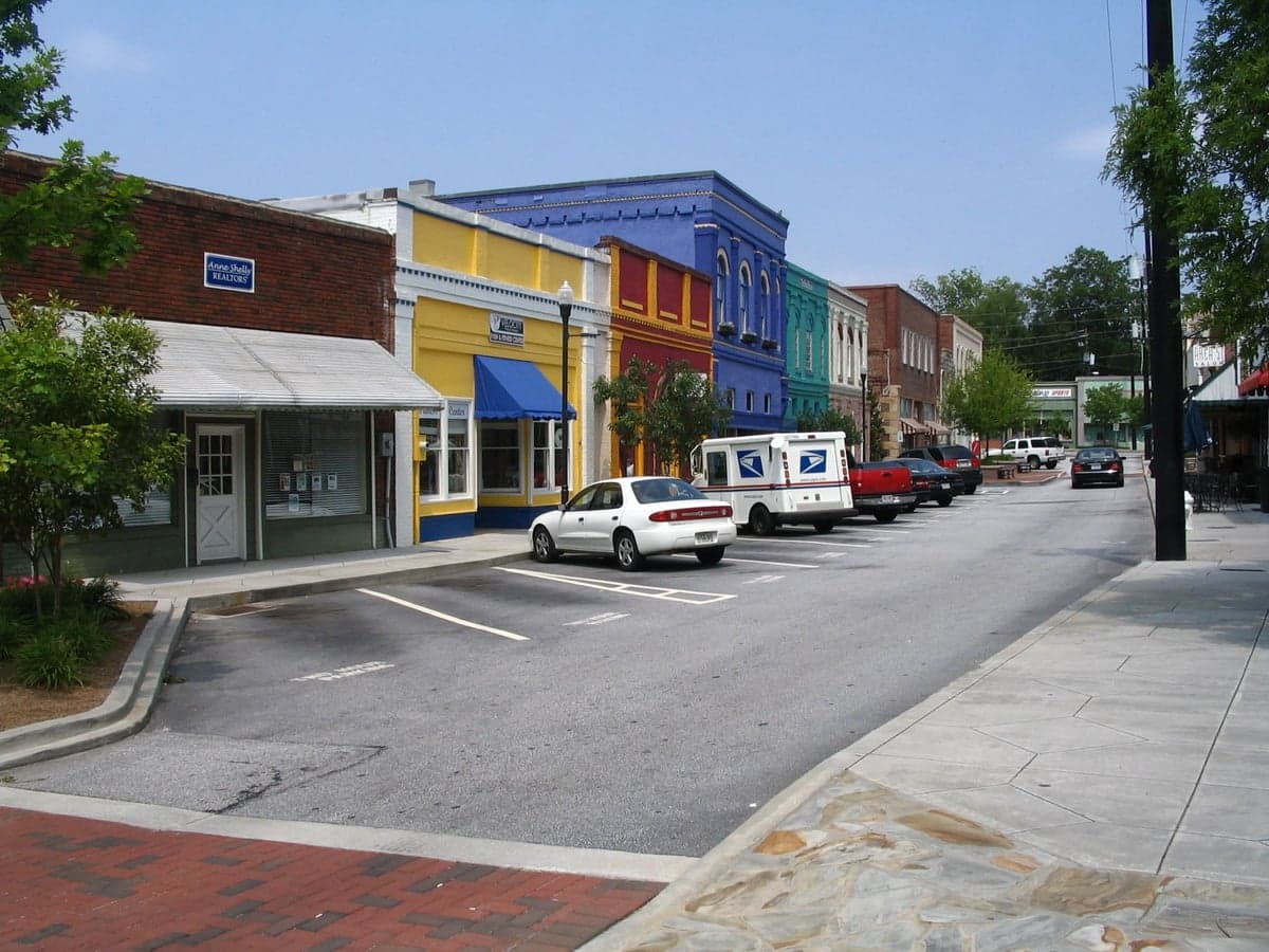
Photo: Wikipedia
Strategic Assessment of Conyers, GA
Meaningful friction. Expect exposure to either population pressure, blast zones, or natural disaster risk. Consider buying a retreat property.
What does the Strategic Assessment tell us?
Our Strategic Assessment grades tactical survivability of an area. Major population centers, military targets, fallout zones, natural disasters, and border exposure all drive risk — lower exposure means a more defensible position in a crisis.
This is heavily inspired by Joel Skousen's Strategic Relocation book. Highly recommended you checkout the book ($)What does this tell us?
Our Strategic Assessment grades tactical survivability of an area. Major population centers, military targets, fallout zones, natural disasters, and border exposure all drive risk — lower exposure means a more defensible position in a crisis.
This is heavily inspired by Joel Skousen's Strategic Relocation book. Highly recommended you checkout the book ($)Strategic Pillars

Key Distances
Regional Safe Places
Below is our recommended "safe zones" in Georgia and the surrounding area based on our strategic heuristics. For most people, it's unrealistic to live in a “safe zone” full-time due to work, family or other personal reasons. They tend to be more rural. However, many of these areas are perfect for second homes and retreat properties that double as a vacation home or even a short-term rental.
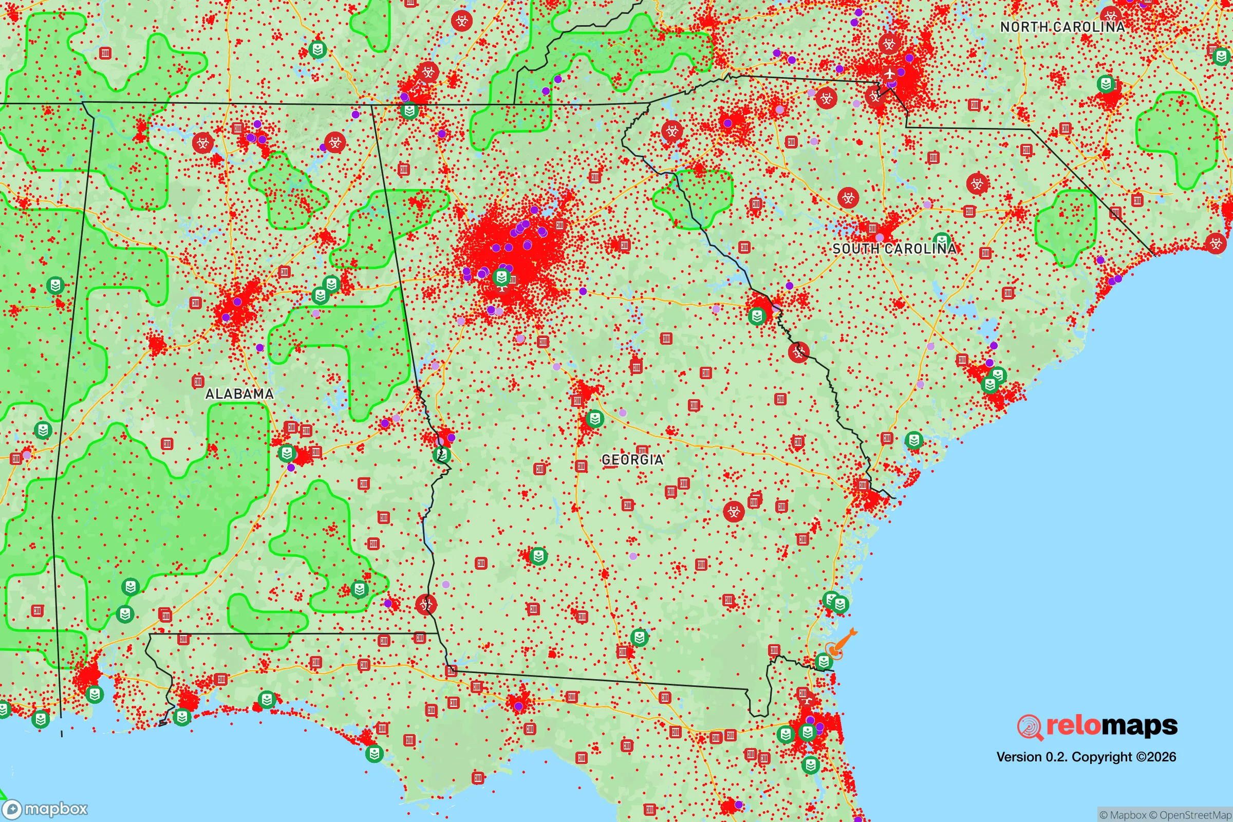
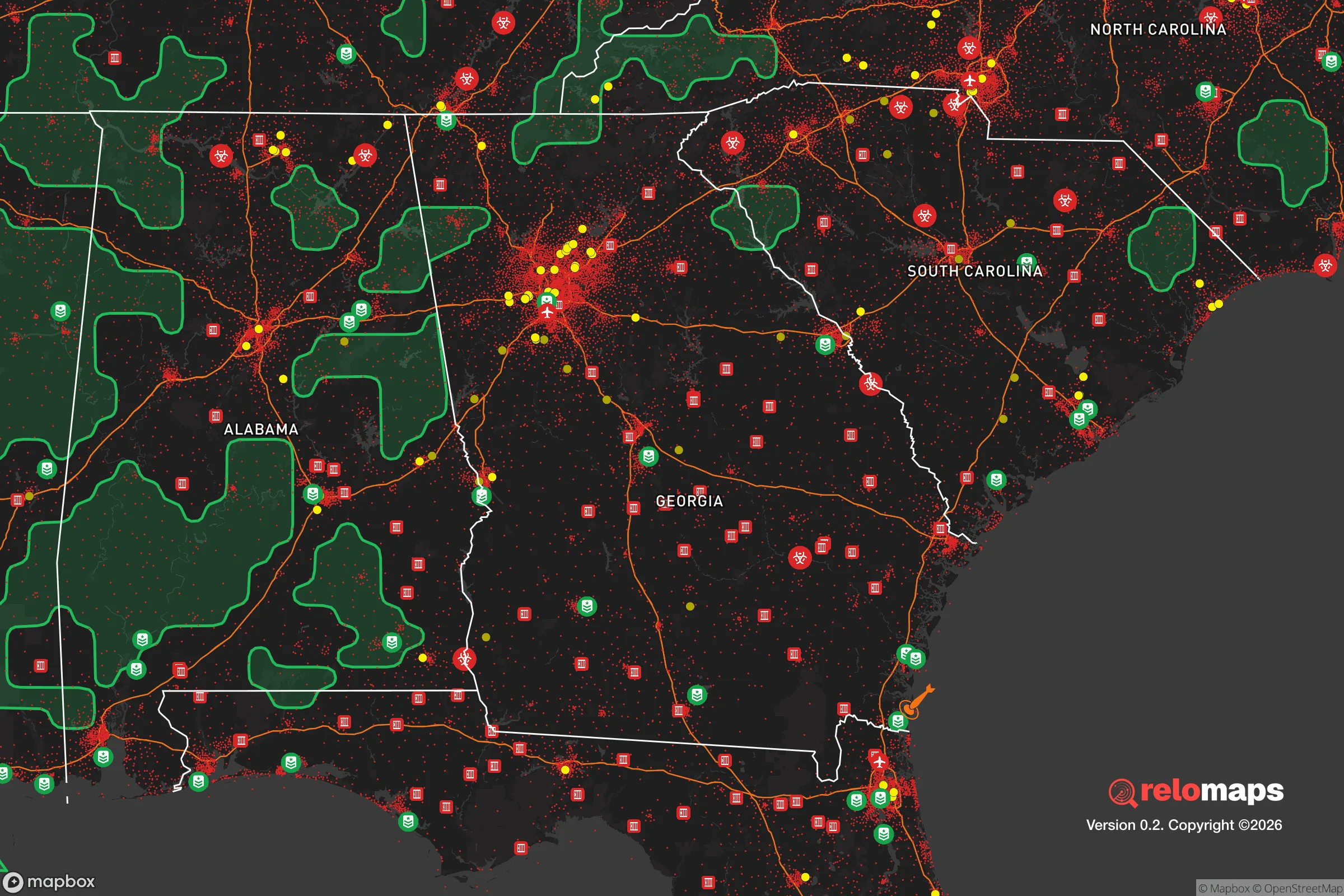


Important Note: For informational purposes only. This does not mean nothing bad ever happens in the green zones. Please use common sense. This is based on public data and modeled with AI. We tried to take a conservative approach but mistakes happen. We update this regularly as new information becomes available.
Solar Generator Recommendations
Backup power matters more here than in safer locations. We've picked three solar generators across budgets and capacity tiers — start with the budget unit if you only need a few essentials, or step up if you want to run a fridge and HVAC for days at a time.

Jackery Portable Power Station Explorer 300
Budget OptionPower on the Go: Weighing only 11 lbs, it's convenient to set up and store with book-sized foldable solar panels

BLUETTI Portable Power Station AC180
Designed for both indoor and outdoor scenarios, AC180 is highly capable as it has a robost capacity and continuous output power.

EF ECOFLOW DELTA Pro Ultra Power Station
Upgraded PickEcoFlow DELTA Pro Ultra is a whole-home energy system designed to grow with your family. Integrated with the Smart Home Panel 2, it scales to meet your evolving energy needs — keeping your home powered, intelligent, and secure through every stage of life.
We earn a commission, at no additional cost to you.
Strategic Assessment Analysis
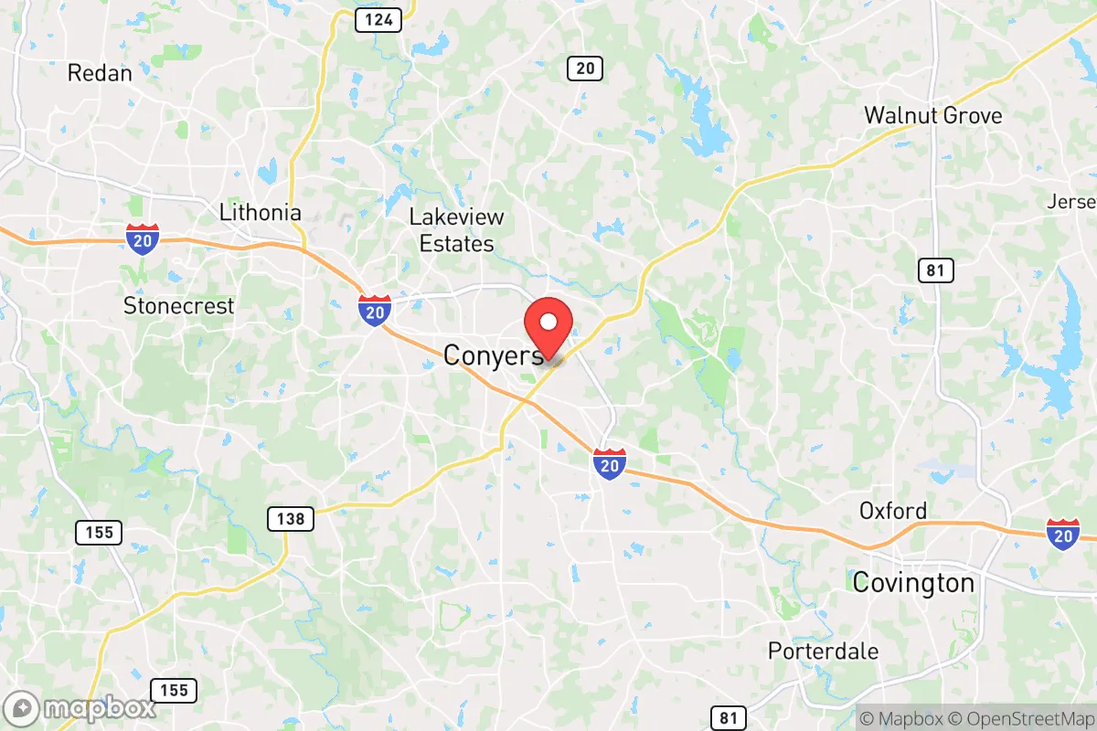
Conyers, Georgia, offers a strategic balance of rural accessibility and suburban infrastructure that makes it a serious contender for relocation-minded individuals and families who prioritize resilience. Located roughly 30 miles east of Atlanta along the I-20 corridor, Conyers sits at the edge of the metro area’s sprawl, providing a buffer from the immediate vulnerabilities of a major urban center while still retaining access to its resources. The city’s position within Rockdale County, combined with its proximity to the Georgia Piedmont’s rolling terrain and the Ocmulgee River watershed, gives it a set of geographic and logistical advantages that are worth examining closely for anyone thinking about disaster readiness and self-sufficiency.
Geographic position and natural advantages for long-term stability
Conyers occupies a transitional zone between the Atlanta metro’s dense suburban ring and the more sparsely populated counties to the east and south. This placement is significant for resilience because it places the city outside the most likely blast or fallout zones of a major metropolitan target, while still being close enough to leverage Atlanta’s medical, logistical, and economic networks in a non-crisis period. The area sits on the Piedmont plateau, characterized by gently rolling hills, clay-based soils, and a temperate climate that supports year-round agriculture. The elevation averages around 900 feet above sea level, which reduces flood risk compared to low-lying areas along the Gulf or Atlantic coasts. The nearby Ocmulgee River and its tributaries, including the South River and Yellow River, provide surface water sources that are less prone to contamination than urban reservoirs. The region’s moderate rainfall—roughly 50 inches annually—supports reliable groundwater recharge and makes rain catchment a viable option for self-sufficient households. Additionally, Conyers is situated away from major fault lines, hurricane storm surge zones, and wildfire-prone chaparral, meaning its natural hazard profile is relatively mild compared to the West Coast or Gulf states.
Risks, exposures, and proximity to fallout-relevant landmarks
The most significant risk for Conyers is its proximity to Atlanta, which is a Tier 1 target for any large-scale conflict scenario involving nuclear or EMP attacks. Conyers lies roughly 30 miles from downtown Atlanta, placing it within the moderate fallout zone for a ground burst on the city center. Depending on wind patterns, radioactive debris could reach the area within hours, though the distance provides a meaningful window for evacuation or sheltering. The I-20 corridor itself is a double-edged sword: it offers rapid egress eastward toward Augusta and the Savannah River, but it also funnels traffic and could become a choke point during a mass evacuation. The Georgia Nuclear Aircraft Laboratory (now the Dawson Forest Wildlife Management Area), located about 40 miles north near Dawsonville, is a decommissioned research site that still carries low-level contamination; while not an active threat, it’s a historical reminder of the region’s nuclear infrastructure. More immediate man-made risks include the chemical plants and rail lines along the I-20 corridor, particularly the Norfolk Southern mainline that runs through Conyers itself. A derailment or industrial accident could release hazardous materials, as seen in the 2023 Ohio train derailment, and Conyers’ position along this rail artery means residents should have a plan for sheltering in place or relocating temporarily. On the natural disaster front, the area is susceptible to severe thunderstorms, tornadoes (typically EF-0 to EF-2), and occasional ice storms, but these are manageable with standard preparedness measures like a generator and storm shelter.
Practical resilience for a relocator: food, water, energy, and defensibility
For someone serious about self-sufficiency, Conyers offers a workable foundation. The city itself has a population of roughly 17,000, with Rockdale County totaling around 93,000, which means it’s not so dense that resources would be immediately overwhelmed in a crisis. Agricultural land is still available within a 15-minute drive of downtown, with several u-pick farms, nurseries, and small-scale livestock operations that can serve as local food sources or models for homesteading. The county’s zoning allows for backyard chickens and small gardens in most residential areas, and the growing season runs from March to November, enabling two crop cycles per year for staples like tomatoes, beans, and squash. Water access is a strong point: Rockdale County draws from the Bear Creek Reservoir and the South River, and many homes in the outlying areas have private wells. For those on municipal water, the system is gravity-fed from elevated tanks, which provides some pressure even during power outages, though a hand pump or backup generator is still advisable. Energy reliability is moderate—Georgia Power’s grid is generally stable, but ice storms in 2014 and 2022 caused multi-day outages in parts of the county. Solar potential is decent, with an average of 218 sunny days per year, and net metering is available through Georgia Power, though the state’s regulatory environment is less solar-friendly than California or Texas. Defensibility is a mixed bag: Conyers’ suburban layout means most neighborhoods have multiple access points, but the historic downtown area and the surrounding rural subdivisions offer natural chokepoints and line-of-sight advantages for those who prefer a more secure perimeter. The county’s low crime rate (roughly 30% below the national average for violent crime) suggests a stable social environment, which is a soft but important factor in long-term resilience—trusted neighbors are a better asset than barbed wire.
The overall strategic picture for Conyers is one of moderate but genuine resilience, with the caveat that its proximity to Atlanta is the single greatest vulnerability. For a relocator who wants to stay within a few hours of a major job market while maintaining a buffer from urban chaos, Conyers hits a sweet spot. Its access to surface water, arable land, and a temperate climate makes it a viable location for a self-sufficient homestead, provided the owner invests in backup power, water filtration, and a fallout shelter if they’re concerned about nuclear scenarios. The city’s position along I-20 also offers a clear evacuation route east toward the Georgia coast or south toward Florida, though that same highway could become a liability during a panic. Compared to closer-in suburbs like Decatur or Stone Mountain, Conyers offers more space and lower density; compared to truly rural counties like Jasper or Putnam, it retains better access to hospitals, hardware stores, and supply chains. For the conservative-leaning family or individual who values preparedness without wanting to live off-grid entirely, Conyers is a pragmatic choice—not a fortress, but a defensible position with room to grow.

* Values derived from national, state, county, city and local statistics and may differ in a specific area. Last updated: 2026-10-16T23:56:59.000Z
Narrative content on this page is AI-generated and may contain mistakes. Verify any details that matter before acting on them.
ReloMaps may earn a commission from affiliate links at no extra cost to you.

